Off to Scotland - June 10th.
It was with mixed feelings that Colin and Johnnie set out from Liverpool on June 10th, heading north from Liverpool to Scotland. It was to be our first reunion holiday since the Ordesa way back in 2001. We were sad that Ken was laid up with a bad case of Gastro Enteritis contracted in Turkey and couldn't come as planned, but were also elated to be heading for the hills again. So we wished him a speedy recovery and set off for the highlands.
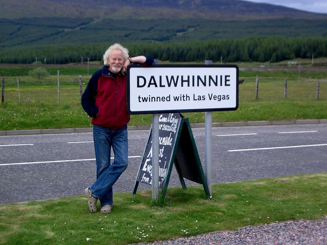
In past years we'd taken the westerly route through Glasgow alonside Loch Lomond, over Rannoch Moor and through Glen Coe. This time we decided to go for a faster trip, we couldn't wait to get there. So we headed across to the east of Scotland via Perth, around the Cairngorms to Inverness and then out west to Loch Kishorn and our overnight lodgings. On the way we passed through Dalwhinnie, famous for Malt Whiskey and not much else. The locals though seemed to think it rivaled another small town in Nevada USA as claimed in the town sign that Colin is propping up. We did ask for the gaming tables as we stopped for coffee but none were in evidence.
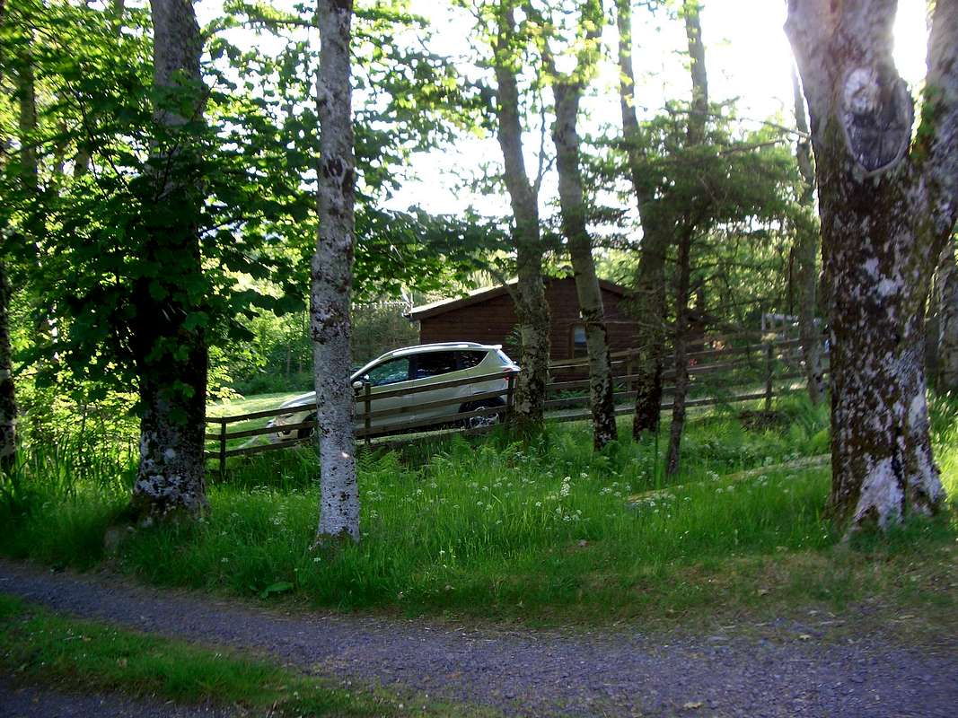
![Cabin in the woods]() Loch Kishorn cabin
Loch Kishorn cabin
![Off to Scotland]() Colin's search for roulette wheels is a failure.
Colin's search for roulette wheels is a failure.
Ken had arranged with his brother Peter to stop over in a wooden cabin that he was renting for a week's holiday with Betty his wife. They made us very welcome and having been there a few days, had already sussed out the local sights and hostelries.
After sorting our kit, Peter took us to the pub at Loch Carron and we sampled some decent ales. Later a nourishing repast provided by Betty back at the cabin preceded a music session. Peter and Colin alternated on Pete's guitar and we had a good old sing song and a few sips of malt to get into the rhythm.
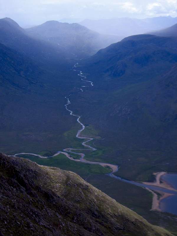
Our first hill outing - Liathach Traverse - June 11th
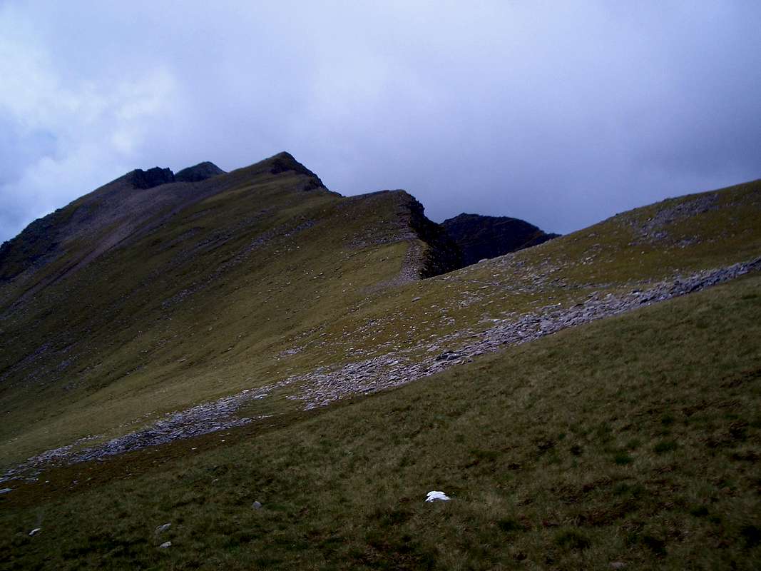
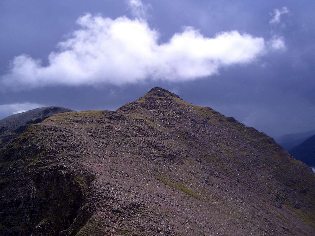
![Liathach]() The Liathach ridge
The Liathach ridge![Loch Kishorn]() Bealach na Ba across Loch Kishorn
Bealach na Ba across Loch Kishorn
An early start saw us contemplating the Bealach na Ba'(pass of the cows) across a rather gloomy Loch Kishorn. It looked set for rain, a rather inauspicious start to our summer holiday.
Nil Desperandum, cheerfully we drove off towards Torridon and parked at the campsite below the ridge (near Countryside Centre on map). We had decided to follow Poucher's (see below) advice and do the traverse from east to west.
There are two tracks that ascend from the road, the first of which is normally used in the E/W descent but this was not obvious as we strode along the tarmac.
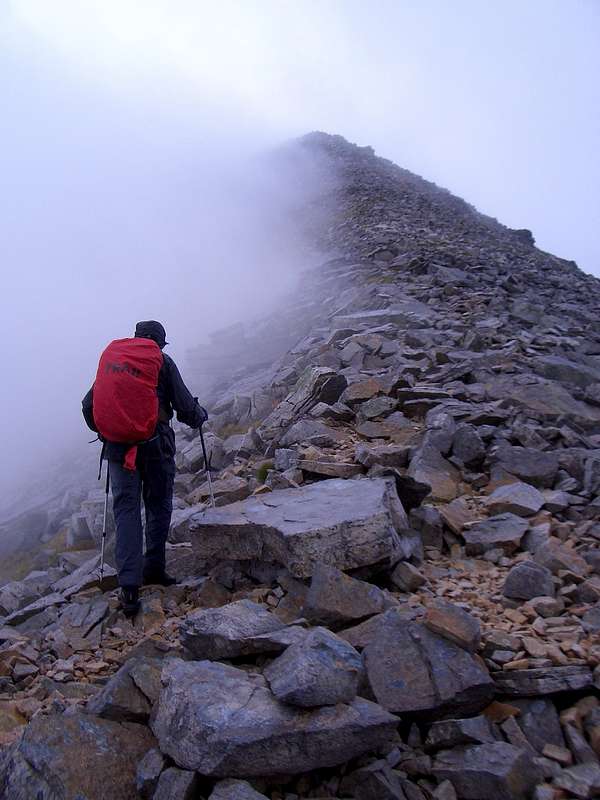
![Scotch Mist]() Colin follows the excellent path towards the bealach.
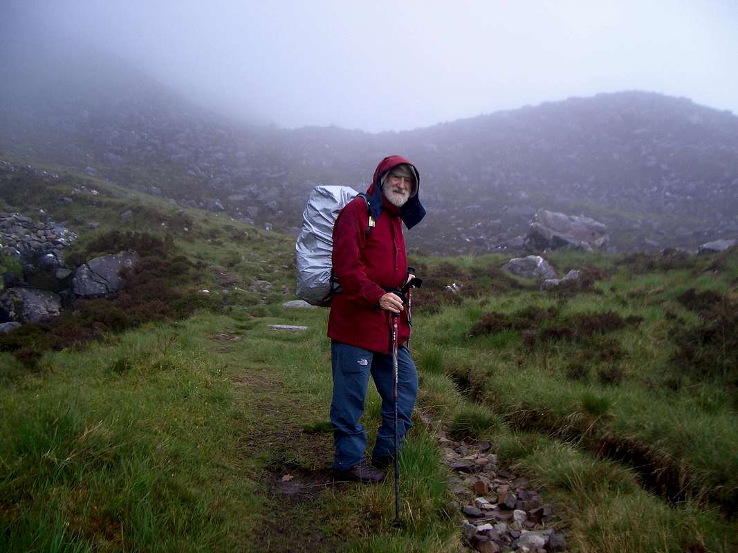
Colin follows the excellent path towards the bealach.![On the trail to Liathach]() Johnnie is fully prepared for the "Scotch mist"
Johnnie is fully prepared for the "Scotch mist"
However the track at the east end of the ridge was clearly marked and we could see it had been well maintained as we arrived there at 9:15.
![Stag at Bay?]() A young stag continues grazing unimpressed by the sight of two ancient sassenachs.
A young stag continues grazing unimpressed by the sight of two ancient sassenachs.
By the time we had climbed to the bealach, the rain was steadily falling and visibility was poor, maybe that was why we didn't spot the young stag grazing at the bealach until we were 20 feet away. It appeared unconcerned at the encounter and continued grazing whilst we scrambled onto the ridge at 11:30.
Our first objective Stuc a' Choire Dubh Bhig was invisible but the horizontal crest of the ridge only presented two possible routes, left or right, we turned right and followed the crest for less than a kilometer and arrived without difficulty on our first Scottish top for quite a few years.
![Stuc a' Choire Dhuibh Bhig - 915m.]() Colin arrives at Stuc a' Choire Dhuibh Bhig - 915m.
Colin arrives at Stuc a' Choire Dhuibh Bhig - 915m.![Sail Mhor 980m.]() Sail Mhor - 980m.
Sail Mhor - 980m.![Stob a Choire Liath Mhor - 983m.]() Stob a' Choire Liath Mhor
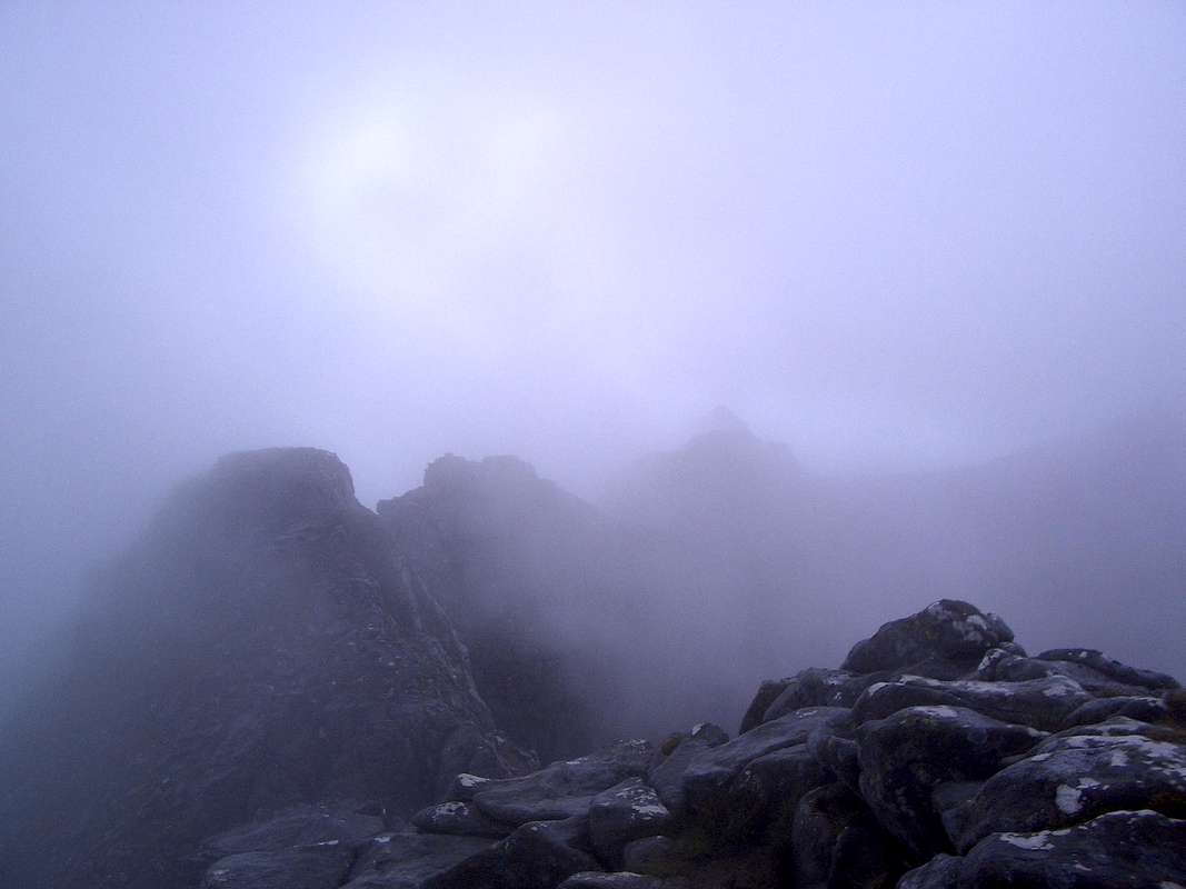
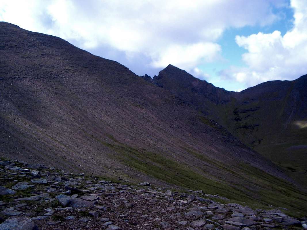
Stob a' Choire Liath Mhor![The Liathach ridge]() Cloud boiling over the Liathach ridge
Cloud boiling over the Liathach ridge
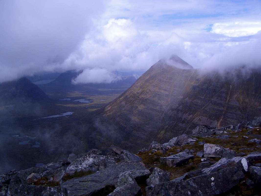
Retracing our steps we passed the bealach and continued on in the mist to Stob a' Choire Liath Mhor. Occasional breaks in the clouds allowed some stunning views of nearby mountains such as Sail Mhor to the north.
We continued on and soon reached our second top, Stob a' Choire Liath Mhor. The clouds were even thicker here but navigation was still not an issue.
After a brief foto stop we continued on along a narrow ridge where the clouds cleared on the northern side by kept pouring up from below in the south.
As we moved up on a rising line, we saw our next top Spidean a' Choire Leith Mhor ahead through the clouds.
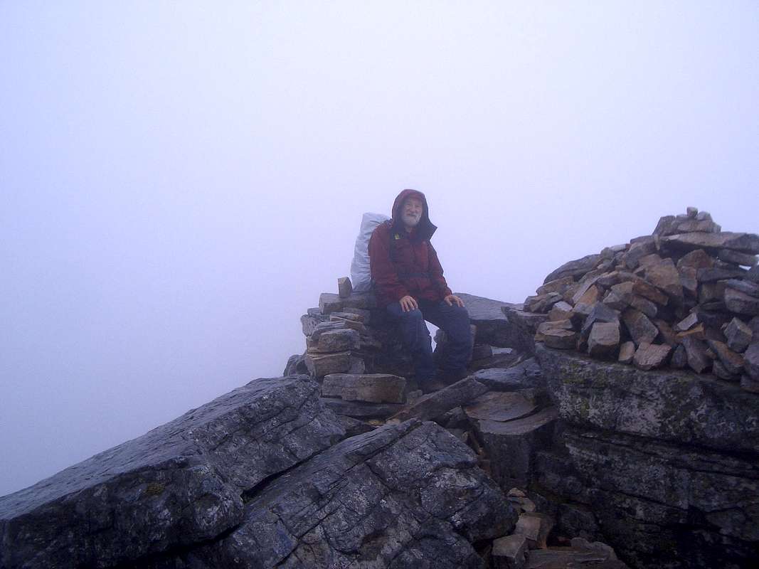
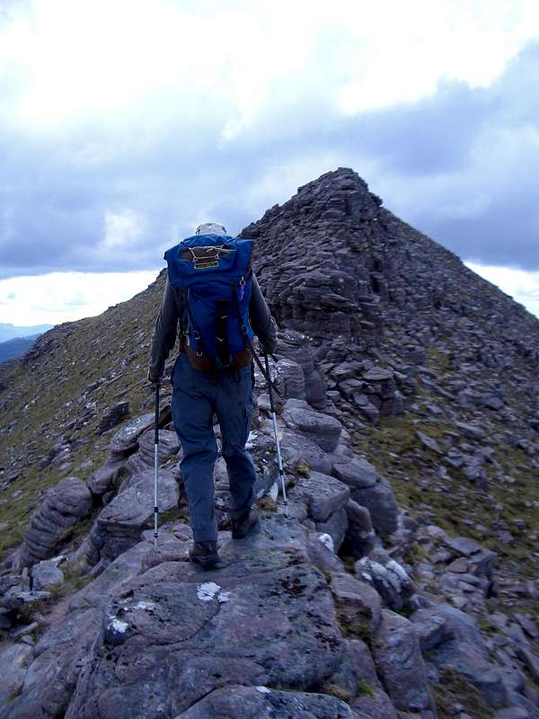
![Spidean a Coire Leith - 1055m.]() Colin ascends the ridge to our third top.
Colin ascends the ridge to our third top. We briefly stopped to shake hands on the top and take a quick look at the ordnance map before heading towards the ghostly outlines of the Pinnacles to the east. By this time we had experienced wind, rain, sleet, hail and near whiteout conditions. We were just waiting for the sun to break through to complete our set of four seasons in one day.
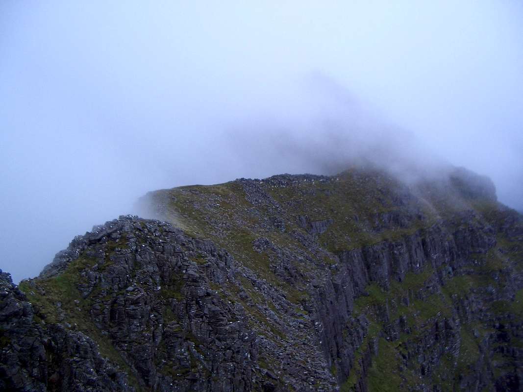
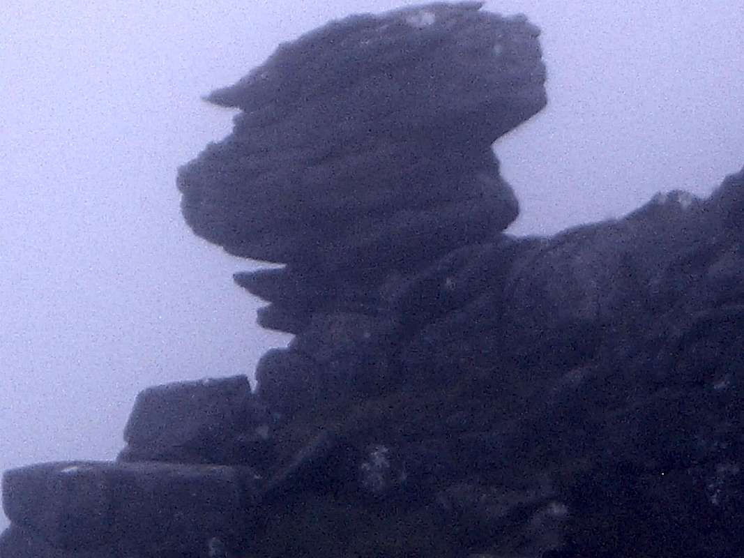
As we traversed around the pinnacles we were greatly entertained by the vertiginous path, thick mist and the strange eroded shapes of the pinnacles themselves.
![The Pinnacles]() The Pinnacles
The Pinnacles![A sudden apparition]() A curious outcrop appears from the clouds.
A curious outcrop appears from the clouds.![Liathach traverse - western end]() Colin moves up the ridge to complete the traverse.
Colin moves up the ridge to complete the traverse.
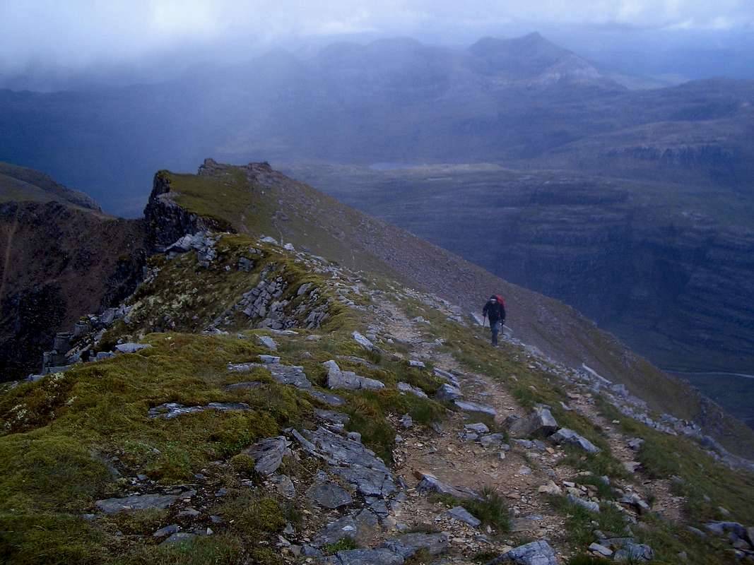
After passing the Pinnacles the weather started to improve, at last giving us good views of the valleys below and the remainder of the Liathach Ridge ahead.
The final climb to our last top was just a walk but tiring nonetheless. With the clearer weather the views of the surrounding valleys and peaks was quite breathtaking, we arrived at about 3:15pm.
![The ridge towards Mullach an Rathain]() The ridge towards Mullach an Rathain
The ridge towards Mullach an Rathain
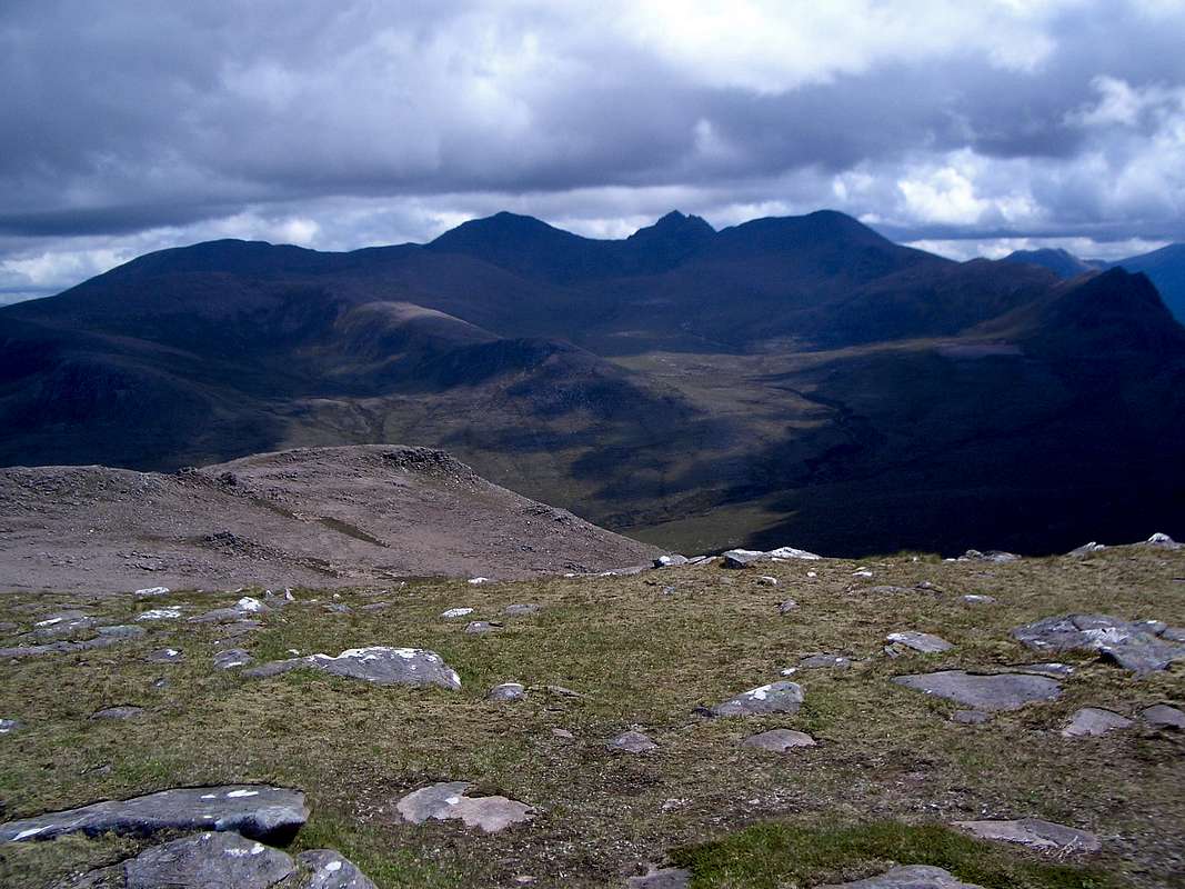
We had hoped to get a good view of the Cuillins on Skye out to the south west but due to the general cloudiness it was impossible to see that far.
The descent to the Torridon campsite was awful, nothing like the fine path at the other end of the glen. Having to watch each footstep was tiring and time consuming so it was nearly 6:30pm by the time we reached the car.
After a quick change of boots we headed back to Loch Kishorn to meet up with Peter and Betty. We told them that we should get back around 7:00pm and we were there just after.
Betty and Peter provided and excellent meal and we managed a few more sips from the bottle of malt we had bought at Inverness on the way up.
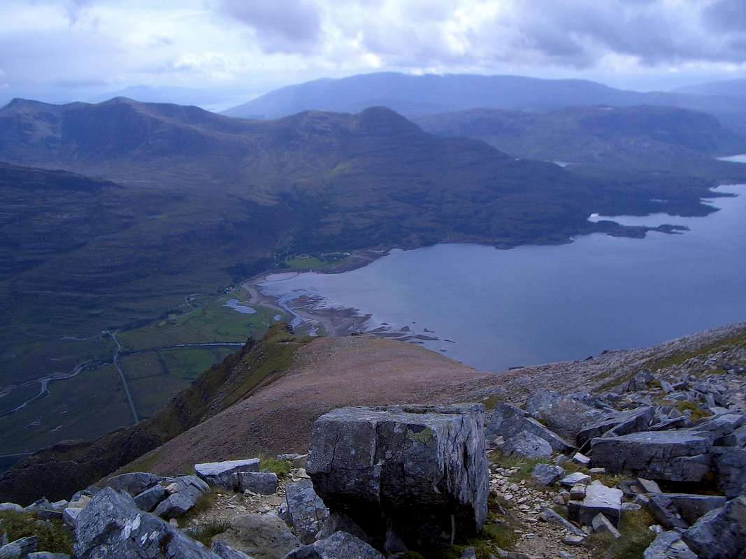
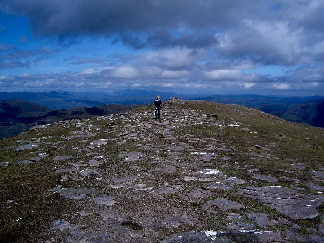
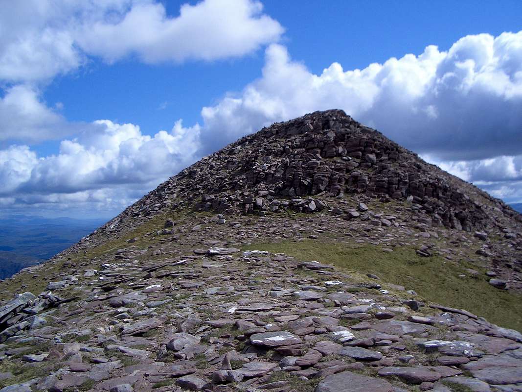
![Mullach an Rathain - 1023m.]() The view from Mullach an Rathain - 1023m.
The view from Mullach an Rathain - 1023m.Rest day at Applecross - June 12th
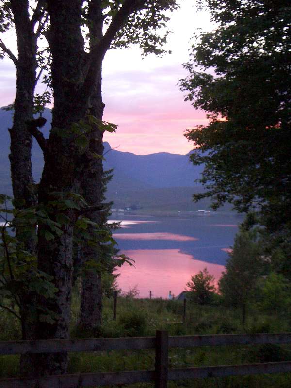
![Loch Kishorn]() Low sun over Loch Kishorn
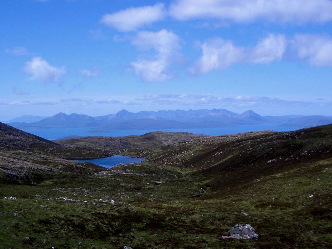
Low sun over Loch Kishorn![Skye and the Cuillins]() Skye and the Cuillins from Bealach na Ba
Skye and the Cuillins from Bealach na Ba
After our previous 12 hour day we decided to have a rest day and followed Peter and Betty's recommendation to visit Applecross.
From the cabin we could see the route to Applecross over the Bealach na Ba, at 2053 feet, allegedly the highest road crossing in the UK.
We drove up a switchback reminiscent of the Pyreneean roads and arrived at a viewing point where an engraved plate indicates locations and heights of nearby points of interest.
Although the day was a bit misty, we did get a fine view of the Cuillins on Skye not too many miles away across the water.
![The beach at Applecross]() The beach at Applecross
The beach at Applecross
We drove down from the bealach and arrived at Applecross which is just a small hamlet on the shore with an uninterrupted view of the Isle of Raasay and the Isle of Skye beyond.
We spent a pleasant few hours at Applecross, visiting a walled garden, walking on the beach and having a pub lunch.
It is a quite magical place, so remote from the everyday hustle and bustle, but really popular with visitors in spite of it's remoteness and difficult access via single track roads.
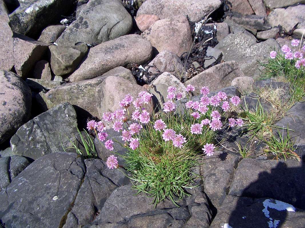
We must have walked a few miles along the beach looking for interesting stones, admiring wild flowers clinging onto rocks and generally recuperating after our previous day's efforts.
![Thrift]() Thrift on a sea shore
Thrift on a sea shore
Sadly all good things must end so we returned to the car and made our way back to Loch Kishorn where Peter and Betty had knidly offered to let us stay another night in their cabin.
Once we got back, we collected Peter and Betty and took them out to dinner at the Loch Carron pub to thank them for both the fine repast of the previous night and also for being so hospitable in providing the excellent accommodation.
As we parked up at the pub, Colin had to make a 'phone call home so we left him in the car. We got our beers and were enjoying a first sip when a total stranger tapped me on the shoulder and suggested that I should go out to my car. Apparently he had spotted a strange person jumping up and down in the car, gibbering at passers by, trying to attract attention.
Obviously many people ignored him as he probably appeared deranged but this kind soul took pity on him and listened to his mimed tale of how he got locked inside a car with all its indicators flashing.
As it turned out, by instinct I had locked the car with the remote key, trapping him inside.
Still, as I had given him my spare key which he had managed to leave in his other trousers back at the cabin, not a lot of sympathy was forthcoming. Still, the rest of us had a good laugh and the evening just got better and better.
After an excellent meal and more beer we returned to the cabin for another music session. Colin had Peter and Betty in pleats with his rendition of that old rugby club favourite "We're off to see the wild west show" Betty was particularly amused by the verse about the Fukawe tribe.
Heading further north - June 13th
An early start saw us packing our gear along with Peter and Betty who were also leaving that day. There was absolutely no wind and the midges were ferocious. All plans were thrown to the winds as we chucked our gear into the cars and high-tailed it away. Later we found out that we had left our bacon and eggs in the cabin's fridge as we departed in haste.
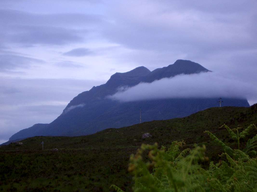
It was a fine drive up the west coast, back through Torridon and past Liathach again and we stopped a while to admire our earlier route in the much clearer air.
![Liathach from the upper glen]() Liathach
Liathach
We drove up the Glen and past the equally impressive massive of Beinn Eighe (993m.) and through it's associated National Nature Reserve.
We would have loved to stop there but our schedule was tight and An Teallach beckoned us onwards.
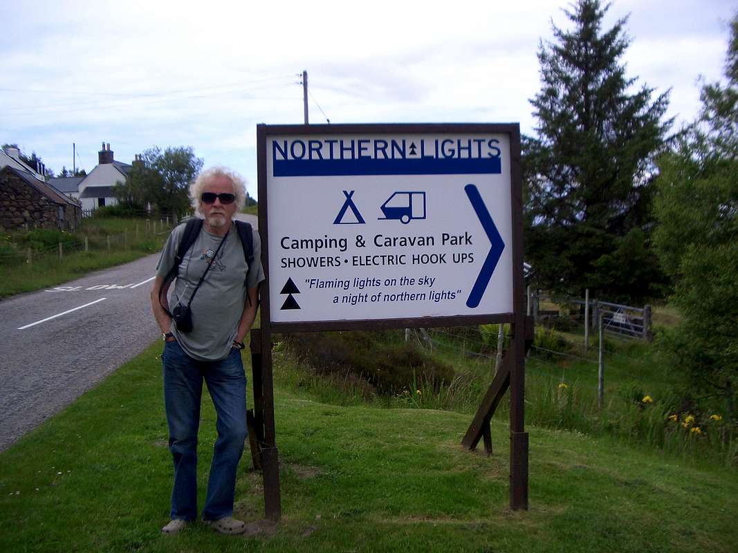
We stopped at Gairloch for coffee on the way but the possible naval presence was absent so we carried on up through the peninsulas until we arrived at Little Loch Broom and our proposed campsite at Badcaul.
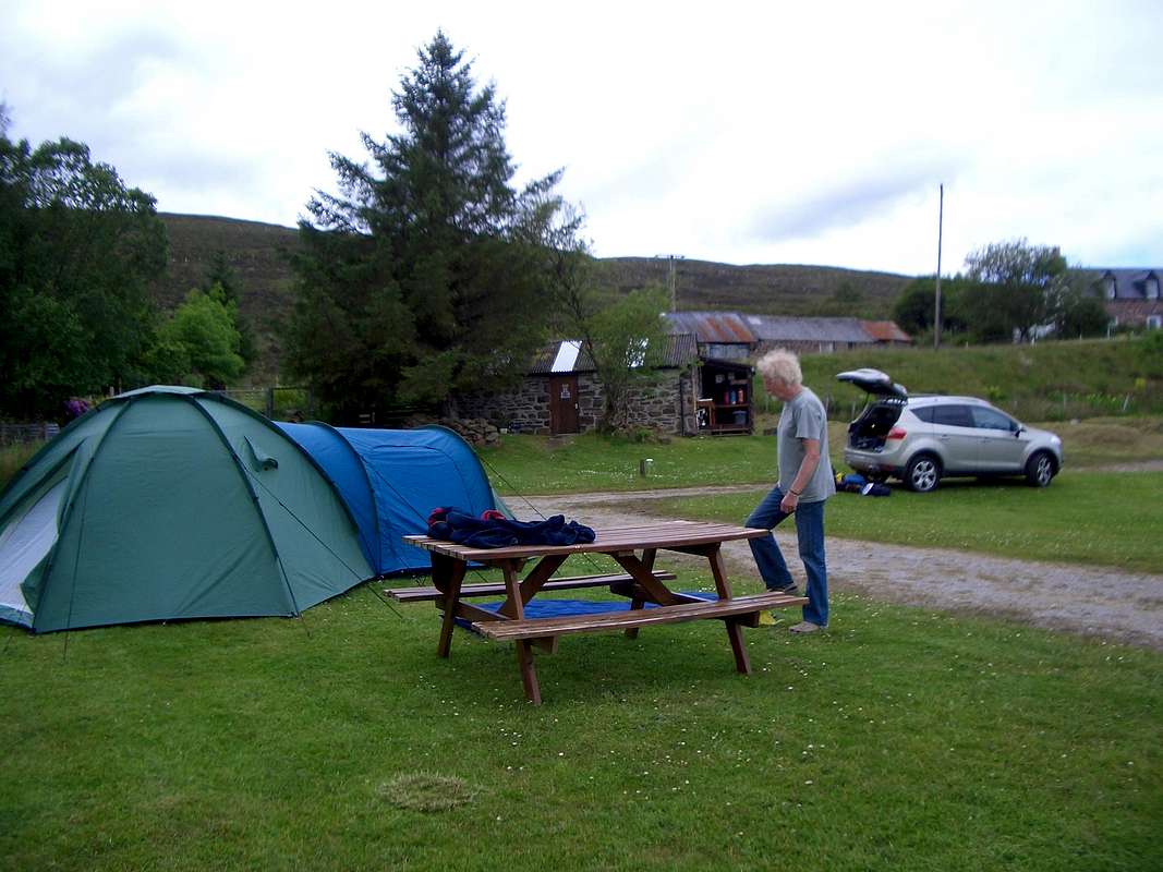
![Setting up camp]() Setting up camp at Badcaul on the shores of Loch Broom.
Setting up camp at Badcaul on the shores of Loch Broom.![The Northern Lights campsite at Badcaul.]() The Nothern Lights campsite - Little Loch Broom.
The Nothern Lights campsite - Little Loch Broom.
The Northern Lights campsite was situated close to the shores of the Loch and views were excellent.
As soon as we had the tent up and the air beds pumped we followed the advice of the campsite owners Michael, Ethel and Chris and walked up to the local shop at Durnamuck for supplies. Unfortunately once we got to the shop we were told that the previous night campers had had a barbeque and that all the beer was sold out. Slightly disgruntled we settled for a few cans of Lager (shudder) and walked back to the tent.
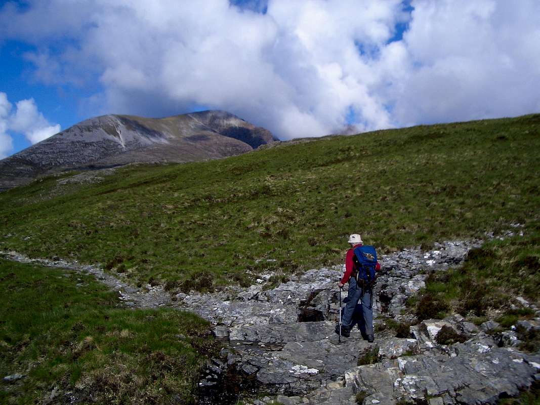
After our evening meal we decided to do a recce for the next day's walk and we drove down the glen, past Dundonnell to find the landrover trail at Corrie Hallie.
After parking in the layby, we walked up the steadily climbing trail through Gleann Chorachain for about 2Km until we reached a ford and a footbridge over the small allt from where we could see the trail continuing towards our objective for the next day: Sail Liath.
Colin seemed a bit weary as we walked back down to the road but Johnnie came up with a 'cunning plan'. Instead of doing the An Teallach traverse in one day, we could split it into two to reduce the effort required. I also suggested that we went to the Dundonnell Hotel and let someone else cook our dinner that night.
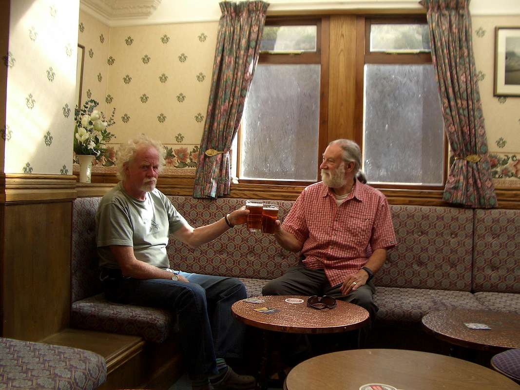
![Cheers matey]() Colin and Johnnie toast our arrival at Little Loch Broom.
Colin and Johnnie toast our arrival at Little Loch Broom.
In spite of his weariness, Colin perked up immediately and grasped my suggestion with enthusiasm. We had a tasty & nourishing meal in the pub washed down by a couple of locally brewed "Crofter's ale" and retired to bed relaxed.
An Teallach - Part 1 - June 14th
![An Teallach]() An Teallach
An Teallach
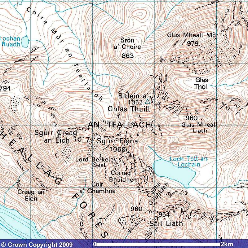
An Teallach is the name of a group of mountains that form one of the most spectacular ridges in Scotland. The traverse of these is a major undertaking requiring experience, confidence and a strong pair of legs.
My cunning plan to split the traverse into roughly two equal parts seemed a good idea at the time and as it turned out we did what we planned over two days instead of one very long one so although hatched in haste it wasn't too bad a plan.
One of the main reasons for this cunning plan was that we didn't like the idea of having to walk 5Km along a tarmac road dodging traffic from Corrie Hallie to Auchtascailt after a long day on the hills.
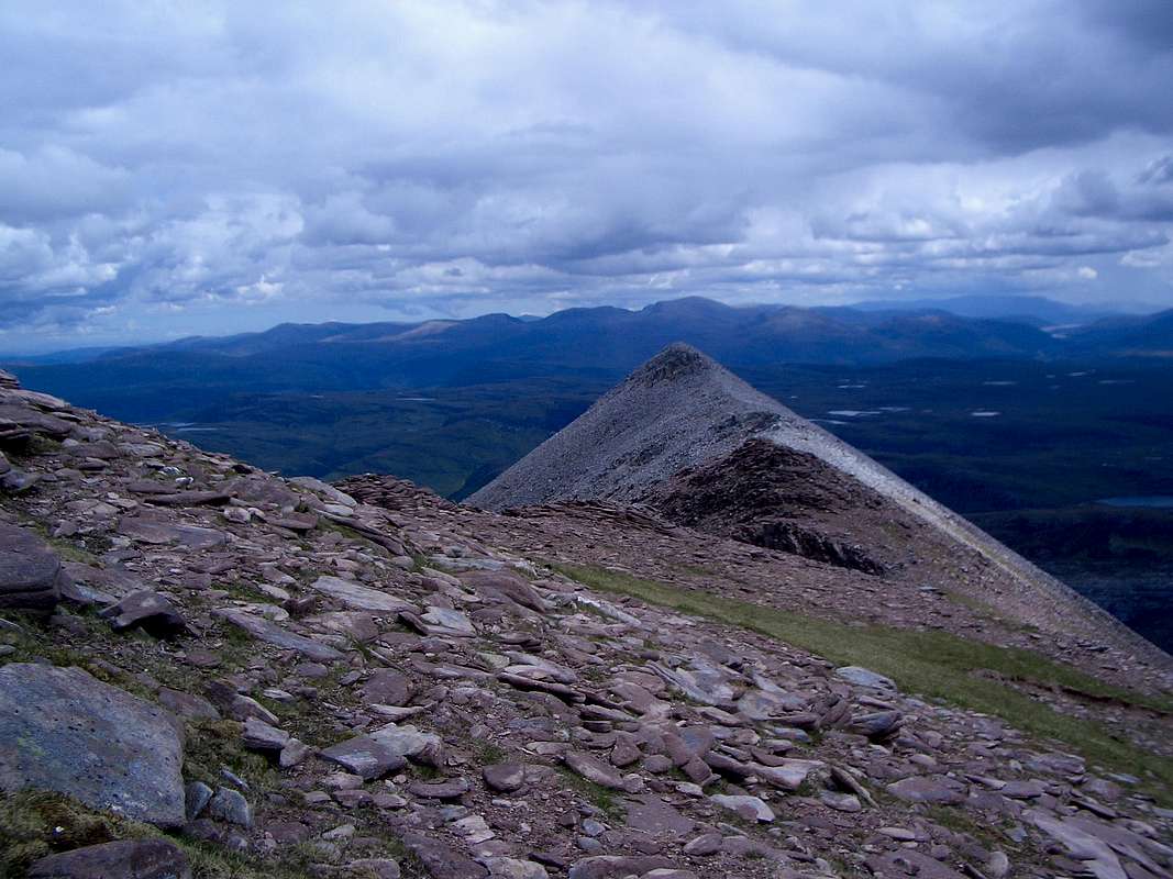
![Sail Liath - 954m.]() Colin begins his ascent of Sail Liath 954m.
Colin begins his ascent of Sail Liath 954m.![Sail Liath summit - 954m.]() Johnnie on Sail Liath summit with the impressive tops of the An Teallach ridge behind.
Johnnie on Sail Liath summit with the impressive tops of the An Teallach ridge behind.
So after a nourishing breakfast, we drove down to the roadside layby at Corrie Hallie and headed off up the track at 8:30. The going was steady after the footbridge that we had reached the day before and the scenery soon changed from dense woodland to open moors. We reckoned from the ordnance map that it was about 7Km from the car park to the top of Sail Liath and about 900m. of ascent. We arrived at Sail Liath our first summit of the day at 11:35 and the surrounding views were excellent, a far cry from our previous day on Liathach. The upper slope of the mountain being covered in pale coloured boulders. The smooth summit plateau contrasting dramatically with the tops of the peaks ahead of us.
At least we could see the challenges in advance.
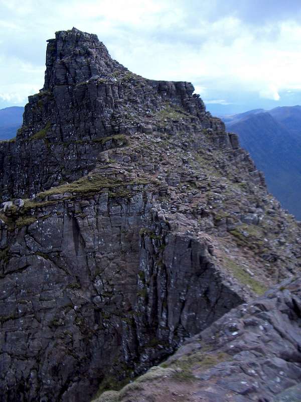
![Stob Cadha Gobhlach - 960m.]() Stob Cadha Gobhlach
Stob Cadha GobhlachThe next top along the ridge Stob Cadha Gobhlach 960m. was more of a scramble but the rocks were delightful, the perfect friction of the old red sandstone making the ascent easy and we arrived on the summit at 12:27pm.
![Loch Tall an Lochan]() An airy bealach looking down to Toll an Lochan
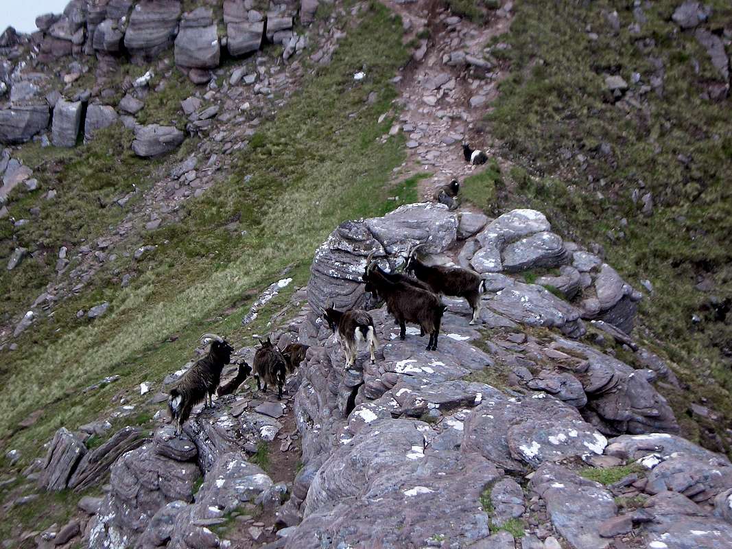
An airy bealach looking down to Toll an Lochan ![Locals on the trail]() Local residents
Local residents
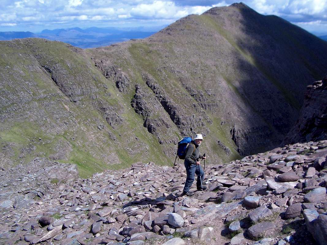
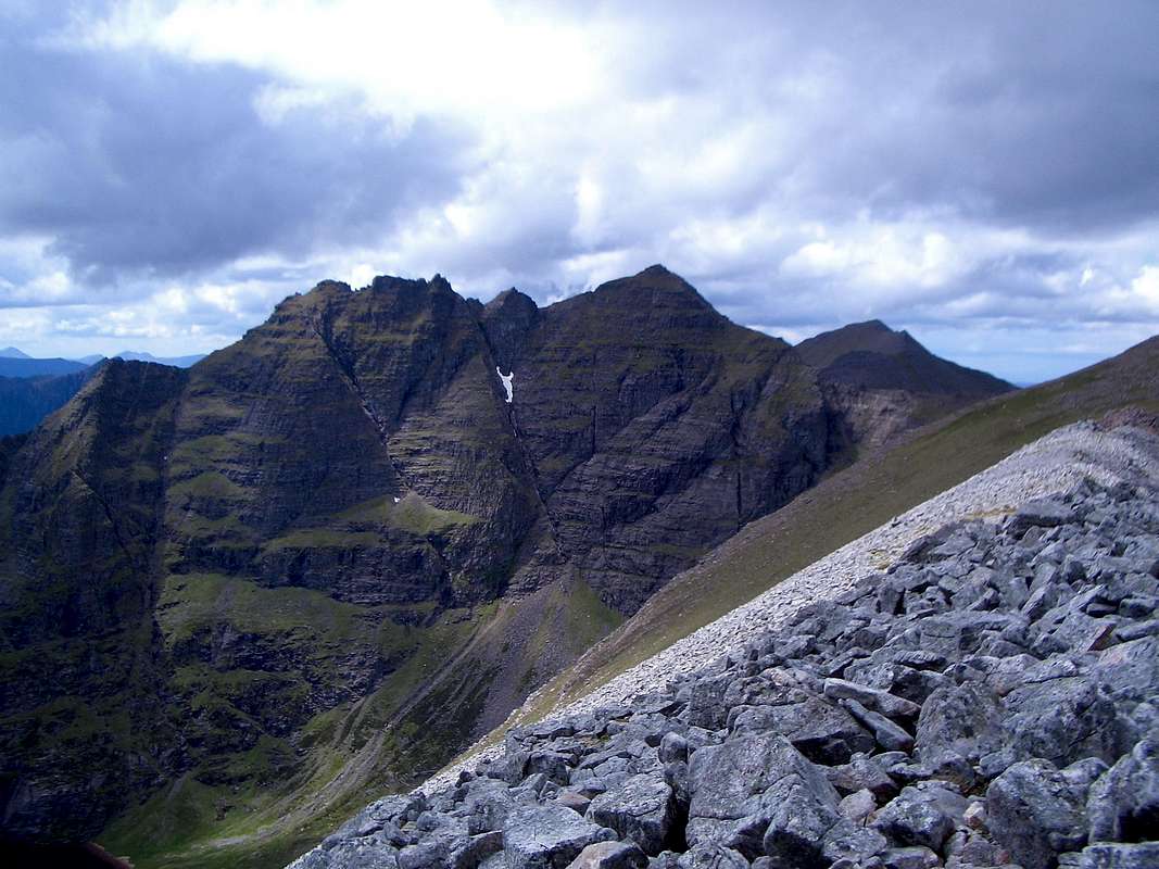
After this top, things got a bit more complicated, we passed an interesting bealach with a stunning view down to a small lochan and ascended the steep south side of Corrag Bhuide, but as we reached higher, the slopes turned into walls and the way ahead was none too clear.
Following a quick conflab, we decided to follow a goat track along the western edge of the summit cliff and along a crest towards Sgurr Fiona.
The feral goats made way for us as we strolled along the track.
Further on the track we looked for a break in the cliffs but without success and so we carried on past Corrag Bhuide, past Lord Berkeley's Seat and on to Sgurr Fiona 1060m arriving there at 2:26pm.
The panoramic views from Fiona were excellent and this was to be our highest point of the day and the place where we had planned to turn around and retrace our steps back down.
![Sgurr Fiona summit - 1060m.]() Johnnie and Colin celebrate the high point of the day - Sgurr Fiona 1060m.
Johnnie and Colin celebrate the high point of the day - Sgurr Fiona 1060m.![Sail Mhor from Sgurr Fiona]() Sail Mhor from Sgurr Fiona
Sail Mhor from Sgurr Fiona![Gleann na Muice]() Gleanne na Muice from Sgurr Fiona.
Gleanne na Muice from Sgurr Fiona.
We stayed a while on Fiona admiring the panoramic views, had a spot of lunch and then descended the ridge overlooking a sheer drop to the lochan we had spied earlier.
![Loch Toll an Lochan]() Toll an Lochan.
Toll an Lochan.
The lochan was a gleaming mirror in the sunshine and it reminded me of a lyric in Paul Simon's great tune 'Graceland'
"
shining like a National Guitar"
![Lord Berkeley s Seat - 1030m.]() Lord Berkeley's Seat
Lord Berkeley's Seat
On the way down we thought we could see a feasible line up to the top of Lord Berkeley's Seat 1030m.
We dropped our sacs and started up a line of bulging rocks.
This proved to be an easy scramble and we soon arrived at one of the most airy spots imaginable overhanging a 1500ft drop to the lochan at 3:05pm.
![Corrag Bhuide - 1049m.]() Colin on our last top of the day - Corrag Bhuide - 1049m.
Colin on our last top of the day - Corrag Bhuide - 1049m.
After admiring the precipitous view for a few minutes, we dropped down, retrieved our sacs and headed off back down the goat track.
As we approached Corrag Bhuide from the other direction, an ascent line appeared that looked a lot more feasible than anything on our upward journey, so dropping the sacs again we scrambled up bulging sandstone and onto the top at 3:22pm.
We had a debate about the rest of the descent and didn't fancy reversing Sail Liath as we thought it would be a loose slog down the boulders below the summit.
![Descent gulley]() Descent gulley
Descent gulley
We had spotted a potential descent gulley at a bealach on the way up so we agreed to head for this and 'have a look'. It looked a "goer" so we started on down at 4:07pm. On reflection, this may not have been the most sensible decision but we stuck with it. (later on as we crossed a quartzite reef Colin was heard muttering something like "*!*!!** never again").
It took quite a while to descend as we had to watch out for twisted ankles but we eventually got to the shores of the lochan. We could see an unmistakable quartzite reef just beyond the end of the lochan (under the rainbow in the image below). So we reckoned that if we crossed that feature we would see the path to Sail Liath that we had used in the morning.
![Toll an Lochan]() The path beside the lochan was not well marked.
The path beside the lochan was not well marked.
It was quite a tiring journey, through the heather, scrambling over the reef and crossing the moor until the path appeared.
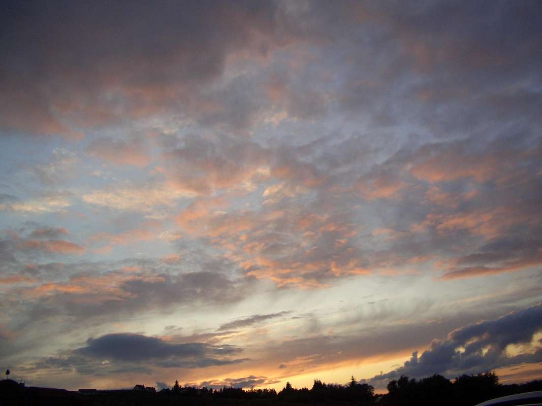
![Sunset at Little Loch Broom]() Sunset at Little Loch Broom
Sunset at Little Loch Broom
We trudged slowly down to collect the car, very tired after a strenuous day, arriving there at just before 8:00pm, virtually 12 hours since we departed. The beers in the Dundonnell Hotel tasted great and soon refreshed us. We went back to the campsite and cooked up a massive stew for dinner.
We sat outside the tent eating our food and gazing wonderingly at the vast amount of evening light considering it was nearly 10:00pm.
Rest day 2 - Sail Mhor - June 15th
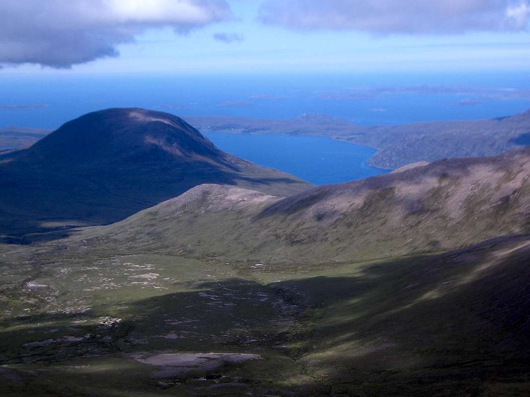
![Sail Mhor - 767m.]() Sail Mhor from near our campsite at Little Loch Broom
Sail Mhor from near our campsite at Little Loch Broom
We seemed to quickly strike up a friendly relationship with the owners of the campsite and they were soon offering us advice on easy walks around the area.
After our 12 hour day on An Teallach we though we owed ourselves an easy one the following morning, so we had a leisurely start including a large all-day breakfast fry-up (eggs, bacon, beans, tomatoes, black pudding and bread & butter). We devoured this lot whilst contemplating our objective - Sail Mhor (767m.) just a short distance from the campsite.
We were assured by the campsite owners that it was an easy outing and so we didn't set off until 11:30 and trudged along deer paths to gain height across the heather and to reach a rocky shoulder that lead onto the massive dome of Sail Mhor itself not too far ahead. On our way through the heather we came across small orchids in bloom providing bright splashes of colour amongst the rather dull browns and greens.
![Orchid - genus unknown]() Orchid of unknown genus
Orchid of unknown genus
The rocky shoulder was fairly easy going and with generally level dry ground. However, we did have to cross over some dried up peat bogs that would have been much more difficult if the weather recently hadn't been unseasonably dry.
Once we reached the main bulk of the dome, route finding became somewhat more difficult and after a short debate we decided to follow a rising traverse line towards the eastern side of the dome.
Although we couldn't see it at the time this track lead along the top of a vertical cliff with a few hundred feet of sheer drop.
![Sail Mhor summit - 767m.]() Colin reaching the summit of Sail Mhor - 767m.
Colin reaching the summit of Sail Mhor - 767m.
After a while it looked as though the ground above laid back somewhat so we decided to stop traversing and head directly up towards the summit.
We fought our way up steep grass and heather, arriving on the summit dome a short distance from the highest point. The top was utterly flat and totally devoid of any identifying features, apart from a small cairn.
We spent a short time admiring the view of An Teallach, a few miles away to the south.
![An Teallach from Sail Mhor]() An Teallach from Sail Mhor
An Teallach from Sail Mhor
We soon descended and admired the way that the path had skirted across the top of a big cliff without being obvious.
Arriving back at the campsite at 5:30pm we got cracking immediately and cooked up another big stew for dinner, then finished off the evening with a couple of beers and a malt whiskey down at the Dundonnell Hotel.
We struck up a conversation with a Alan, Scottish munro bagger in the bar and he was mine of information about the local area and many of the other locations in Scotland.
An Teallach - part 2 - June 16th
Although we thought that the second part of my cunning plan would result in an easier day than the first part, we knew we did have to ascend Bidean a Ghlas Thuill - 1062m. the highest top on An Teallach (albeit only 2 metres higher than Sgurr Fiona) so we decided an earlier start was required.
We devoured our second 'all-day-breakfast at 6:30 and were down at the car park near the Dundonnell Hotel by 7:00. Unfortunately, Johnnie discovered he had forgotten his telescopic poles, so abandoning Colin in the layby he wizzed back to the campsite to retrieve them.
We finally set off up the stalker path at 7:15 to get to a high bealach below Glas Mheall Mhor.
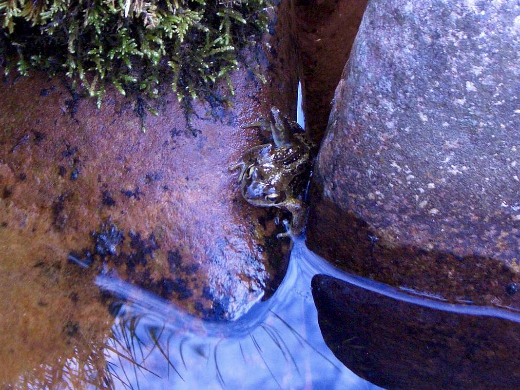
![A common frog]() Froggy hiding from the sassenachs
Froggy hiding from the sassenachs
Although the ground was very dry we did see quite a few amphibians on the trail.
On the way we crossed a small allt and disturbed a common frog apparently sun bathing but he soon hopped into the river and tried to hide behind some small boulders.
Johnnie had his camera at the ready though so he did not escape international recognition.
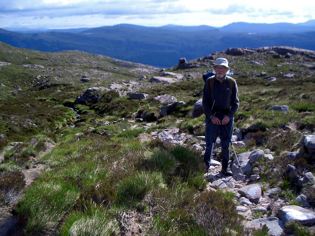
![The stalker path]() Colin takes a rest from the steady climb up the stalker path.
Colin takes a rest from the steady climb up the stalker path.The stalker path was a pleasant ascent of around 5 km. distance and 850 metres of climbing and we took it steady, arriving at the grassy plateau before too long.
Directly ahead we could see the imposing spire of Sgurr Fiona and to our left, the slopes of Bidean a' Ghlas Thuill, but before we tackled either of these we had to make a start on Glas Mheall Mhor - 979m.
![At the bealach]() At the bealach below Glas Mheall Mhor with Sgurr Fiona ahead.
At the bealach below Glas Mheall Mhor with Sgurr Fiona ahead.
So we turned left and headed up a boulder field towards the apparent summit of Glas Mheall Mor, but as we got higher we found that this was a false summit and we had to climb higher.
![Glas Mheall Mor - 979m.]() Glas Mheall Mor
Glas Mheall Mor
Once again we found that there was another false summit, so on we went again. It reminded me of the ascent of Elidir Fawr in Snowdonia, up the old slate tips from Nant Peris.
After a third false summit we finally arrived on the beautiful red sandstone top at 11:12 and we could see the whole panorama of the An Teallach massive. It is a truly inspiring view, there cannot be many better sights in all of the Scottish mountains.
![Approaching the top of AnTeallach]() Colin approaches our highest point of the week - Bidean a' Ghlas Thuill with the bulk of Glas Mheall Mhor behind.
Colin approaches our highest point of the week - Bidean a' Ghlas Thuill with the bulk of Glas Mheall Mhor behind.
The ridge of Bidean although quite steep was comprised mainly of large flatish sandstone boulders making the walk up very straightforward.
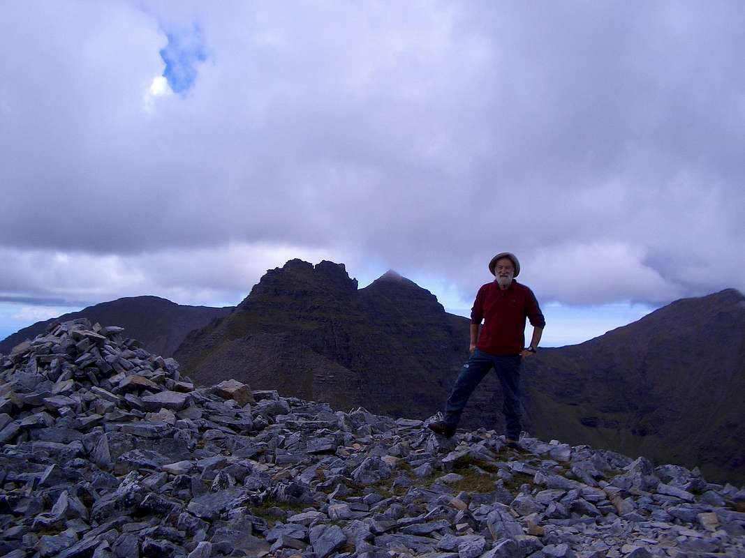
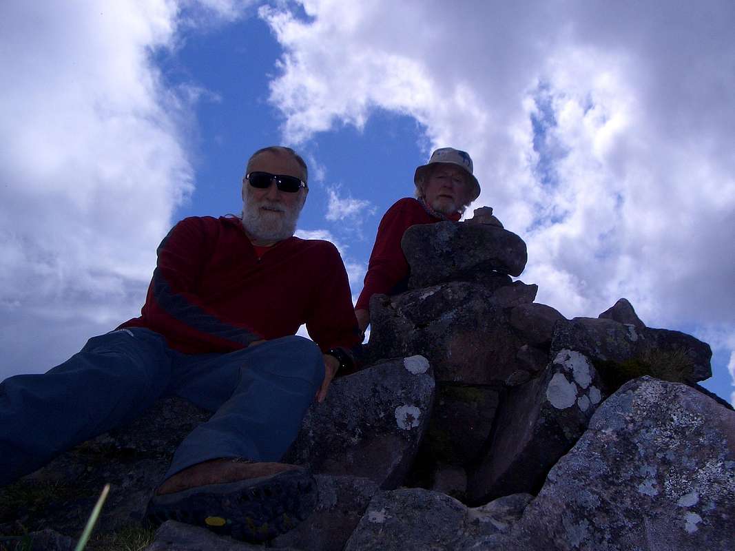
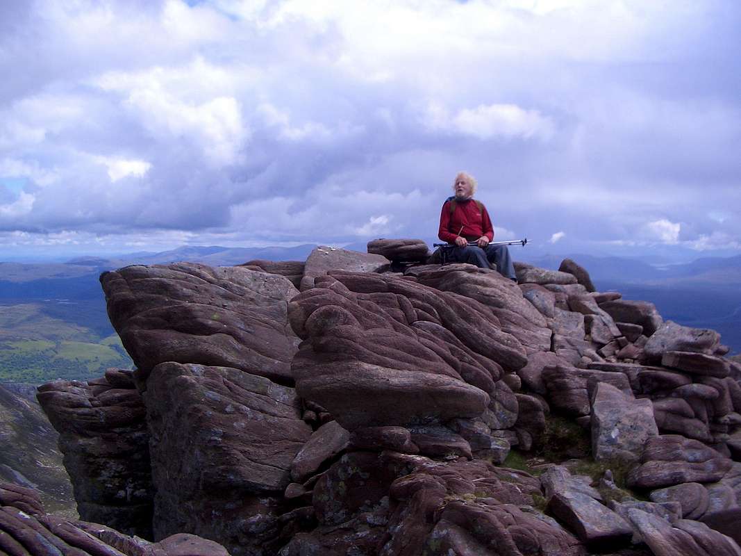
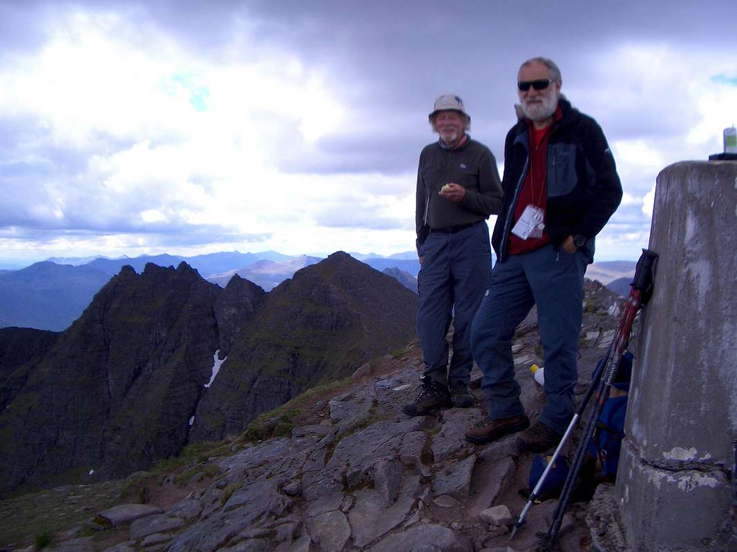
We arrived on top of Bidean at 12:20pm and sat down to eat our lunch. As we were eating our cheese & pickle sandwiches and enjoying the view, our friend Alan from the previous evening appeared on the summit attired sartorially in a fine pair of tweed breeks. He had arrived many hours before us and had been over to Fiona.
![Bidean a Ghlas Thuill - 1062m.]() Colin and Johnnie enjoy the high point of their Scottish holiday - Bidean a' Ghlas Thuill - 1062m.
Colin and Johnnie enjoy the high point of their Scottish holiday - Bidean a' Ghlas Thuill - 1062m.
Alan kindly offered to take a commemorative foto for us and we asked him if we could do the same but he said that his foto collection was becoming too large and he was thinking about reducing it.
Another two mountaineers appeared then, they were a couple that were staying on the same campsite as us. A few minutes later a lone climber turned up making it six people on top. Considering the very few others that we had seen during the week, this represented a considerable crowd.
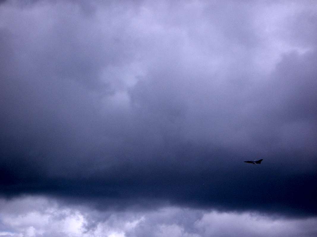
![Flying salute]() Flying salute
Flying salute
As we were chatting with Alan we noticed some fighter aircraft out to the west doing their dogfight training. After a while one flew across to our position (it looked like a tornado or a Eurofighter but I'm no expert) The pilot saw us admiring his plane and gave us a wing waggle as he went past. Looking around we saw the strange two-tone ridge of Glas Mheall Liath to the east and we decided to do that top next. We left our sacs on top of Bidean and descended past some scary drops to gain the traverse line. It was strange how the rock suddenly changed colour on the ridge from red to white in a very sharp dividing line.
![Glas Mheall Liath - 960m.]() Glas Mheall Liath - 960m.
Glas Mheall Liath - 960m.
We reached Glas Mhell Liath at 1:30 and Colin found he had a signal on his mobile 'phone so took the opportunity to call home. We then soon left and headed back to Bidean to collect our sacs.
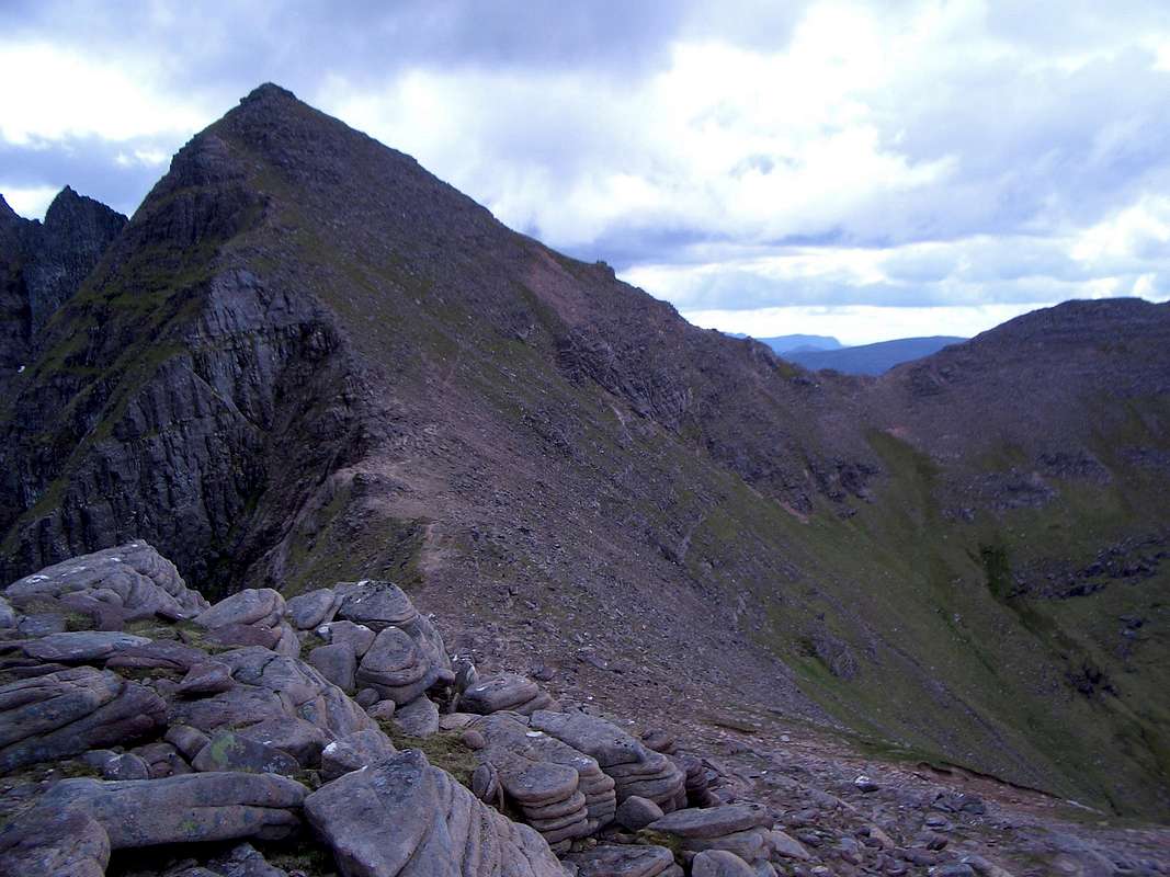
On top again we admired the ridge that we had ascended two days previously and then agreed to follow a traverse line across Sgurr Fiona to reach a bealach and travel onwards along a ridge to Sgurr Creag an Eich which was to be our last top of the week.
![An Teallach ridge]() An Teallach - southern part.
An Teallach - southern part.![Sgurr Fiona - 1060m.]() The slopes of Sgurr Fiona beckon.
The slopes of Sgurr Fiona beckon.![Sgurr Creag an Eich - 1017m.]() The ridge of Sgurr Creag an Eich - 1017m.
The ridge of Sgurr Creag an Eich - 1017m.
From a distance, the traverse line looked pretty loose and appeared to cross some scary drops but on arrival it was not too bad and we soon arrived at the bealach.
A kilometer away lay the summit of Sgurr Creag an Eich and to reach it all we had to do was to follow a gently rising sharp edged ridge line.
We arrived at our last top at 3:57pm and it was with some sadness that we dropped down into the valley below and up the other side to reach the bealach below Glas Mheall Mor again at 5:10pm.
Casting a lingering look back at the magnificent circle of peaks we headed down the stalker path back to Dundonnell, arriving at the car tired but satisfied with our efforts at 7:12pm, 12 hours after we had left.
We decided to treat ourselves to a celebration meal and a few beers at the Dundonnell Hotel before driving back to the campsite for our last night in Scotland.
Information for location and camping
The Scottish highlands have some brilliant areas for mountaineers of all levels of skill and provide a challenge at any season of the year.
The two areas described in this report are in our opinion among the best.
Descriptions of the routes we took can also be found in the excellent book mentioned earlier:
The Scottish Peaks - by W.A. Poucher - published by Constable - ISBN 0 09 471120 8
Another fine reference book is:
100 Best Routes on Scottish Mountains by Ralph Storer - published by Sphere - ISBN 978-0-7515-1890-0
Other guidebooks can be obtained from the Scottish Mountaineering Club.
NAVIGATION
Navigation in these two areas is fairly straightforward due to the sharp-edged nature of the ridges climbed. More navigational details can be found in the following Ordnance Maps:
Scotland Tour 12 - 1:500,000 scale - ISBN 978-0-319-24536-1
Torridon 433 - Beinn Eighe & Liathach - 1: 25,000 scale - ISBN 978-0-319-23968-1
An Teallach & Slioch 435 - 1: 25,000 scale - ISBN 978-0-319-23970-4
CAMPSITES:
Torridon - free site with toilets - map ref: NG - 905 558
An Teallach - Northern Lights - chargeable site with hot water and showers - map ref: NG - 023 914
REFRESHMENTS:
Rockvilla Hotel - Loch Carron - Map ref: NG 401 910
Dundonnell Hotel - Little Loch Broom - Map ref: NG 089 881
Applecross Inn - Applecross - Map ref: NG 712 445
External links
http://www.applecross.uk.com/inn/


Comments
Post a Comment