We arrived back at our car just before 4:00pm and thought that a cool pint would reward our efforts of climbing up nearly 1000 metres and covering over 10 steep kilometres but the hotel bar was closed. (We later found out that they didn’t open until 6:00pm – Que lastima.)
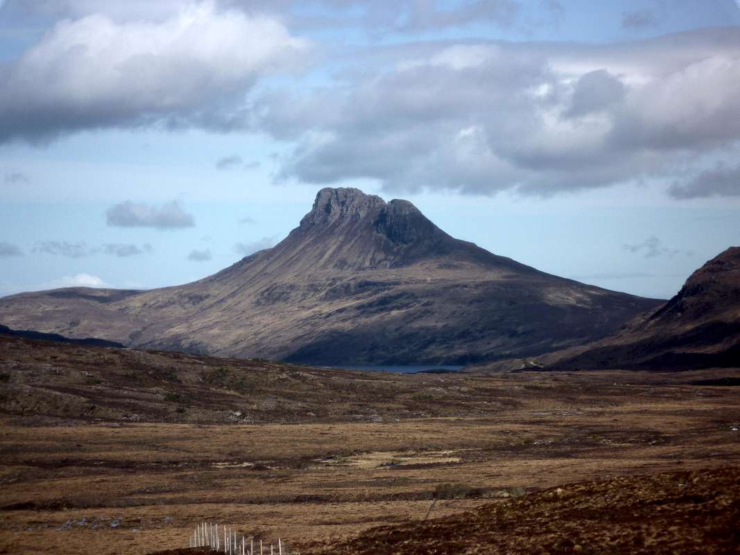
Talking to Dave and some of his other guests at the hostel the previous evening, we heard that they had been on a visit to Stac Polly (alt. Stac Pollaidh) with Dave acting as the guide and whilst we had been blasted by the elements on An Teallach, they had been sunning themselves on Stac Polly.
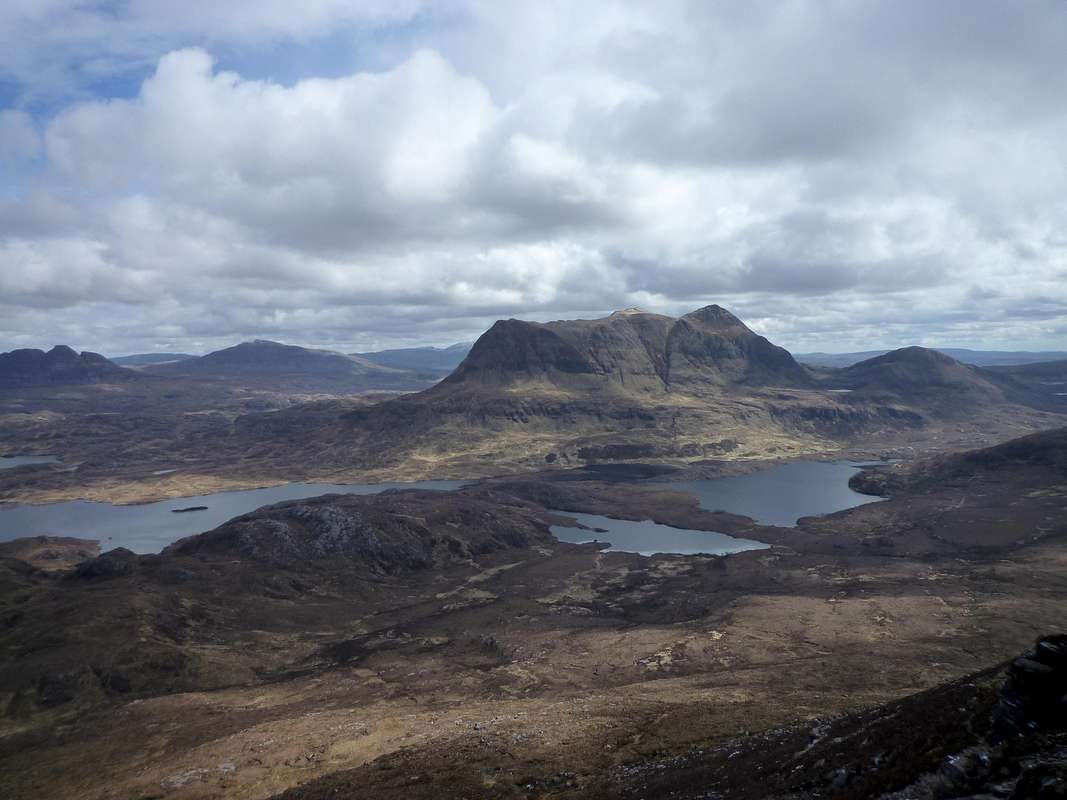
Get in there we thought, let’s have it, so off we drove in the same direction passing Ullapool and heading further north again. We glimpsed Stac Polly from the road and stopped to admire it’s proud prominence, thrusting steeply up out of the moors like some sort of prehistoric monster.
Leaving the main A 835 road we drove down a single track road with passing places until we reached a car park under the hill. This hill is obviously more of a tourist trap than the surrounding peaks due to it’s easy access and low height (612 metres). A notice board at the car park gave information about the geology and affects of erosion on the area.
It also recommended a circular route devised to alleviate further erosion and this we took passing around the hill to the north side before ascending to it’s central bealach.
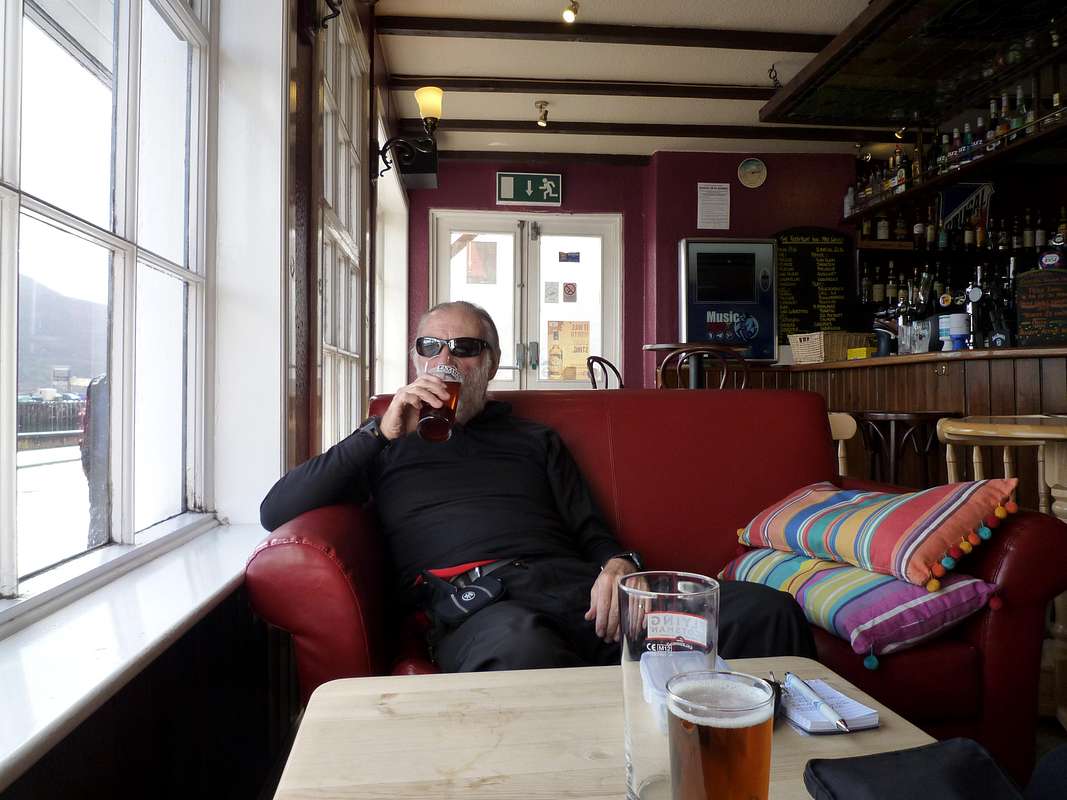
On the way back we stopped in Ullapool for refreshments and tried another hostelry called
The Ferry Boat Inn directly on the promenade. They served a reasonable ale which we supped in a leisurely manner whilst admiring a sailing crew tacking across the Loch from the comfort of our leather armchairs.
![Ferry Boat Inn - Ullapool]() Johnnie samples the ale at the quayside inn.
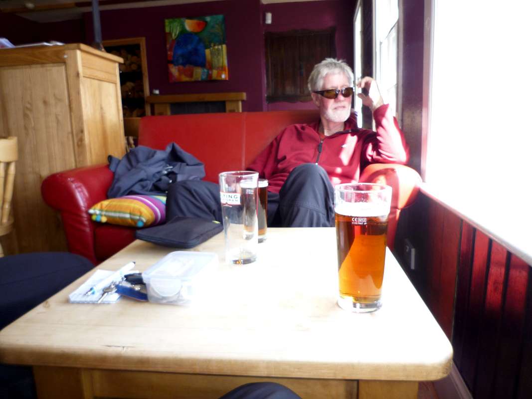
Johnnie samples the ale at the quayside inn.![Refreshments in Ullapool]() Ken chills out with a pint of local ale.
Ken chills out with a pint of local ale.Day 5 - May 17th - An Teallach again
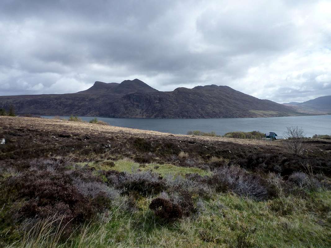
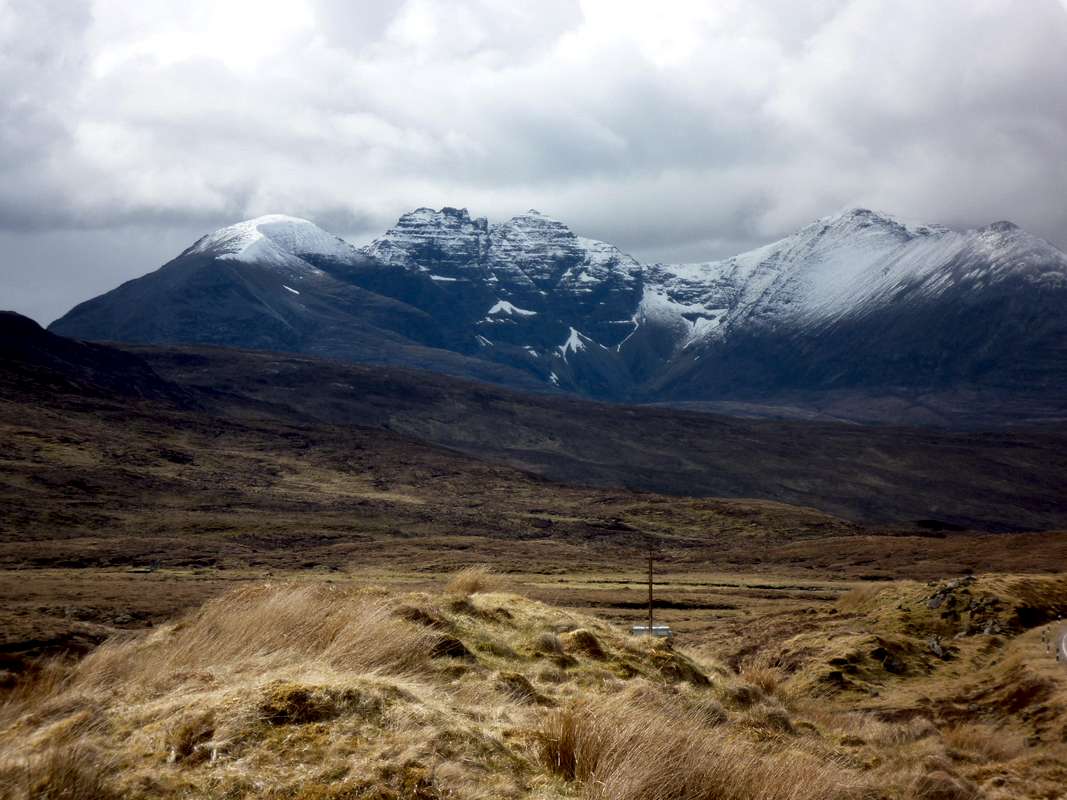
![Return to An Teallach]() The impressive ridge of An Teallach seen across the moors from the A832 road south of Dundonnell
The impressive ridge of An Teallach seen across the moors from the A832 road south of DundonnellWith the prospect of the best weather window of our week’s stay, we decided to head for An Teallach again.
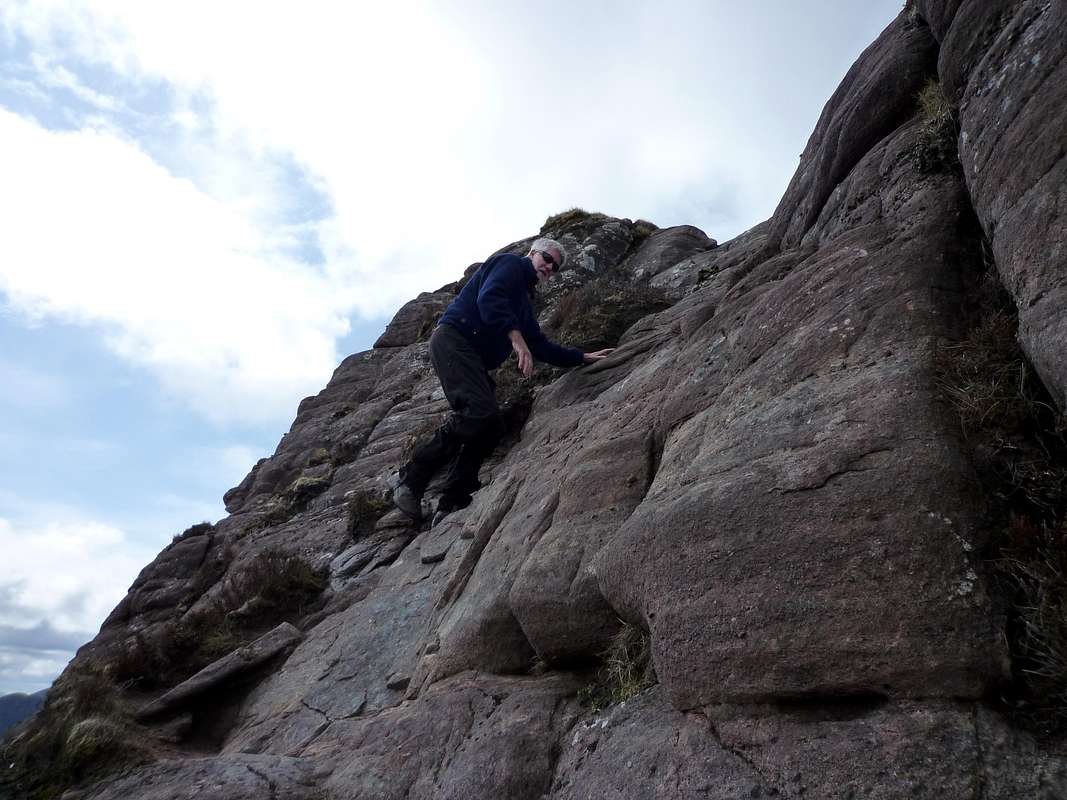
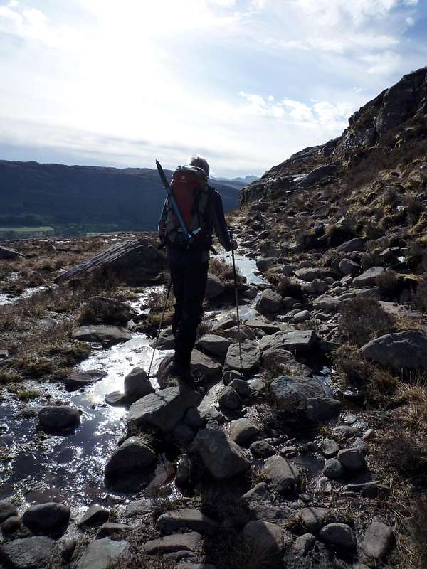
We were soon trudging along the familiar Stalker path heading up towards the plateau where we had been on May 15th. This time the weather was fine and we arrived at the marker cairn in good style Just before 11 am.
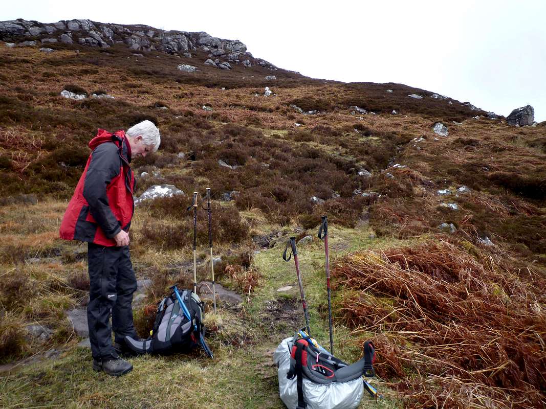
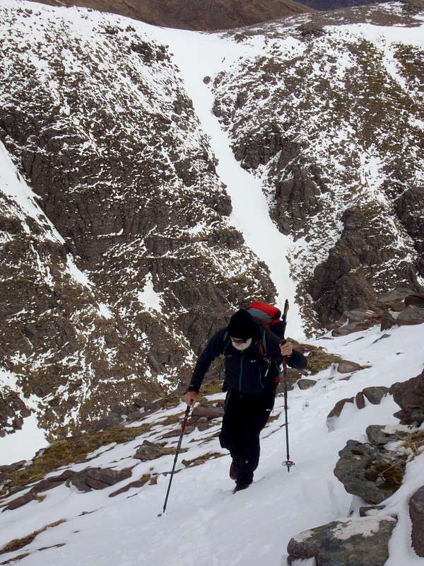
![The stalker path again]() Ken heads up the trail to An Teallach
Ken heads up the trail to An Teallach![Some routefinding required]() The stalker path becomes somewhat indistinct in an area of rocky slabs.
The stalker path becomes somewhat indistinct in an area of rocky slabs.
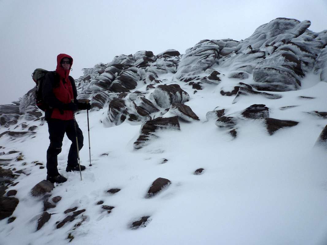
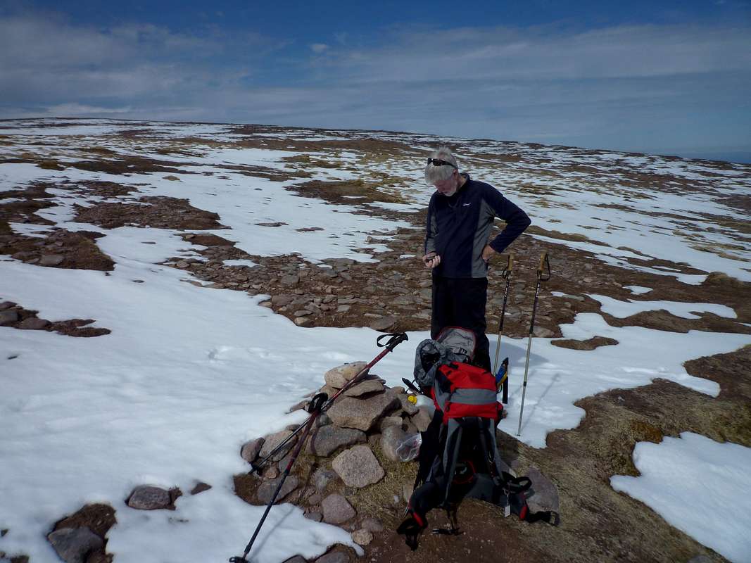
![Ken enjoys the fresh snow]() Ken checks his GPS at the marker cairn at the top of the approach gully.
Ken checks his GPS at the marker cairn at the top of the approach gully.
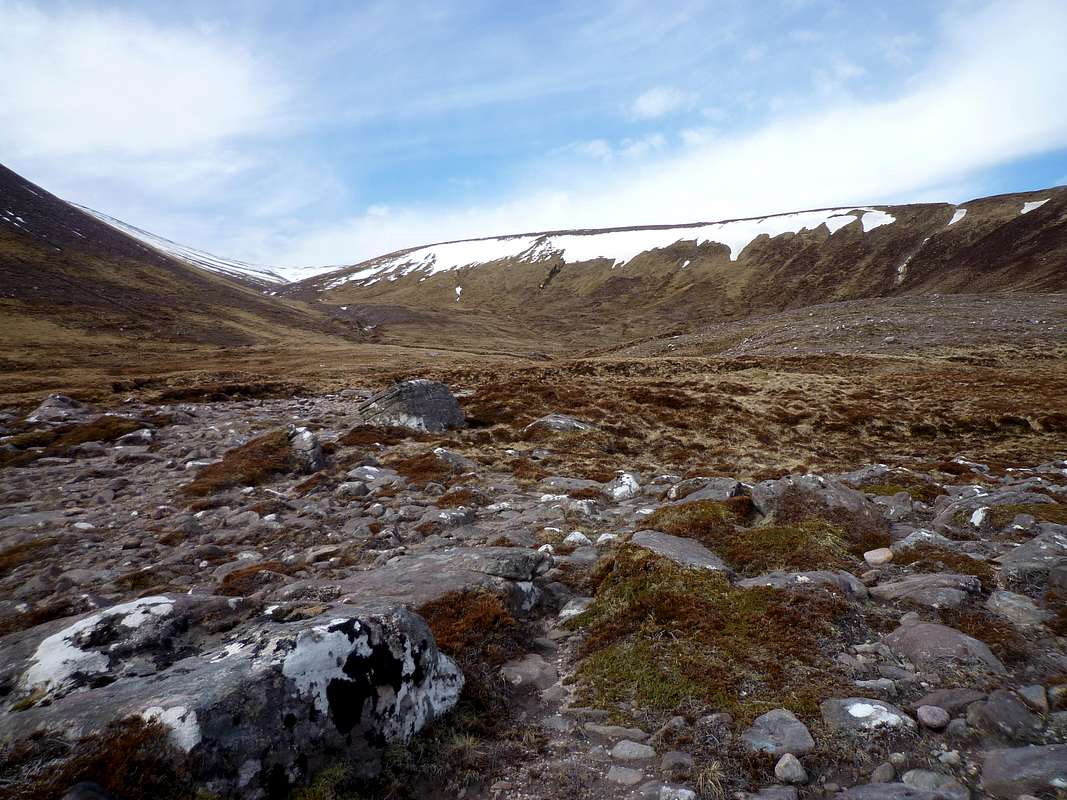
Unlike our previous visit, our way was clear, so after a quick check on Johnnie's map and Ken's GPS we soon arrived at a bealach below the summit ridge.
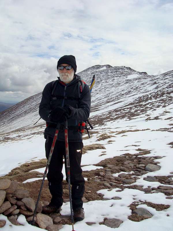
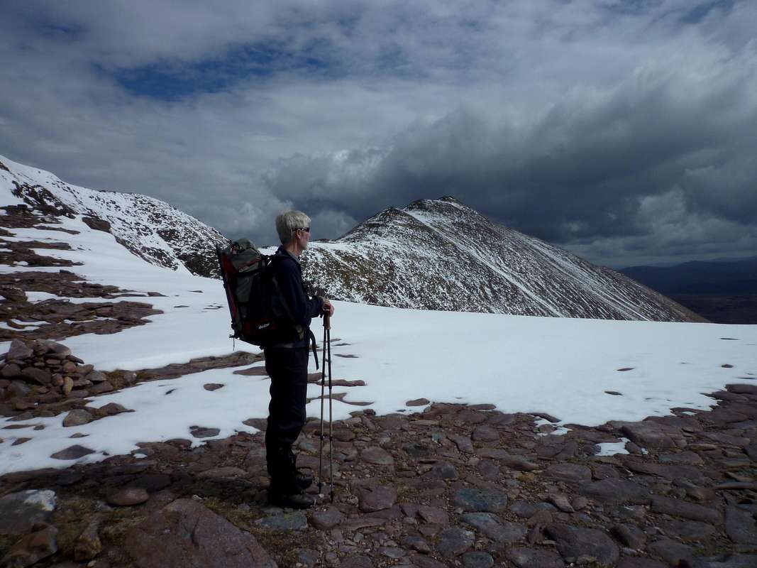
![The bealach below Bidean a' Glas Thuille]() Ken admires the view across An Teallach.The ridge and summit of his first top Glas Mheall Mor from a previous days ascent is over to his left side.
Ken admires the view across An Teallach.The ridge and summit of his first top Glas Mheall Mor from a previous days ascent is over to his left side.
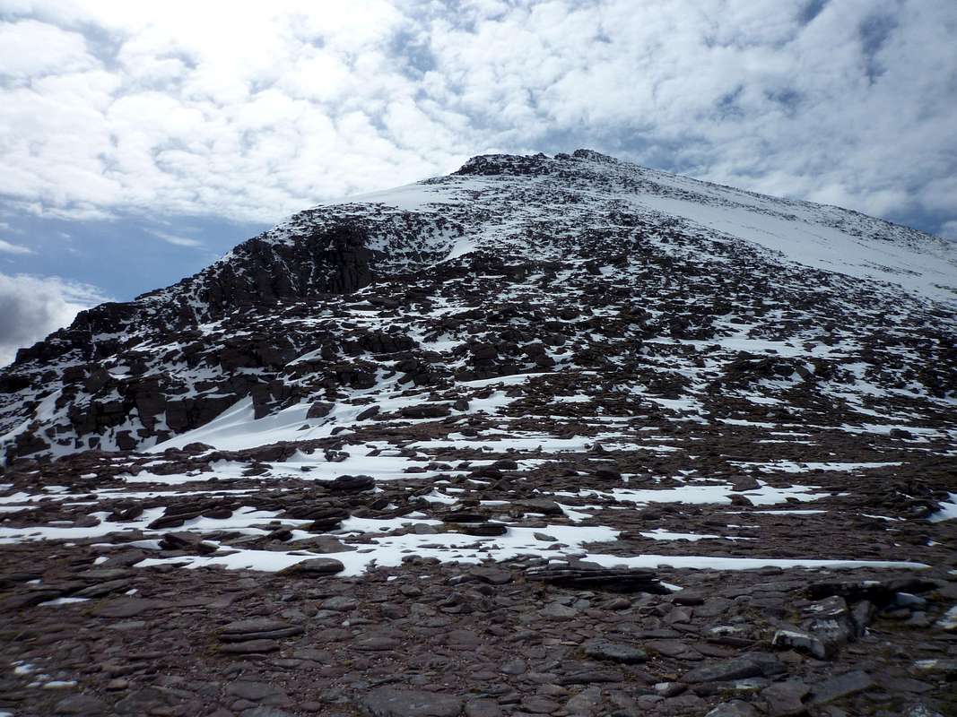
![The way to the summit]() 150 metres above lies the summit of Bidean a' Ghlas Thuill.
150 metres above lies the summit of Bidean a' Ghlas Thuill.
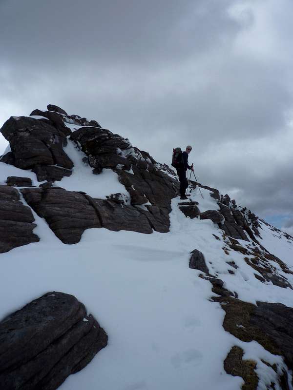
Ahead the final one hundred and fifty metres rose steeply and were covered by a good layer of fresh snow.
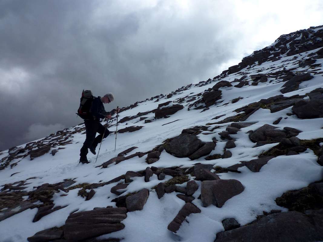
![Heading to Bidean]() Ken kicks steps up the crispy snow towards the summit.
Ken kicks steps up the crispy snow towards the summit.We decided against donning crampons although we were carrying them as well as our axes. The snow conditions were good so Ken led the way, kicking steps where necessary or hopping from boulder to boulder.
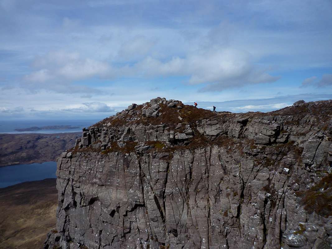
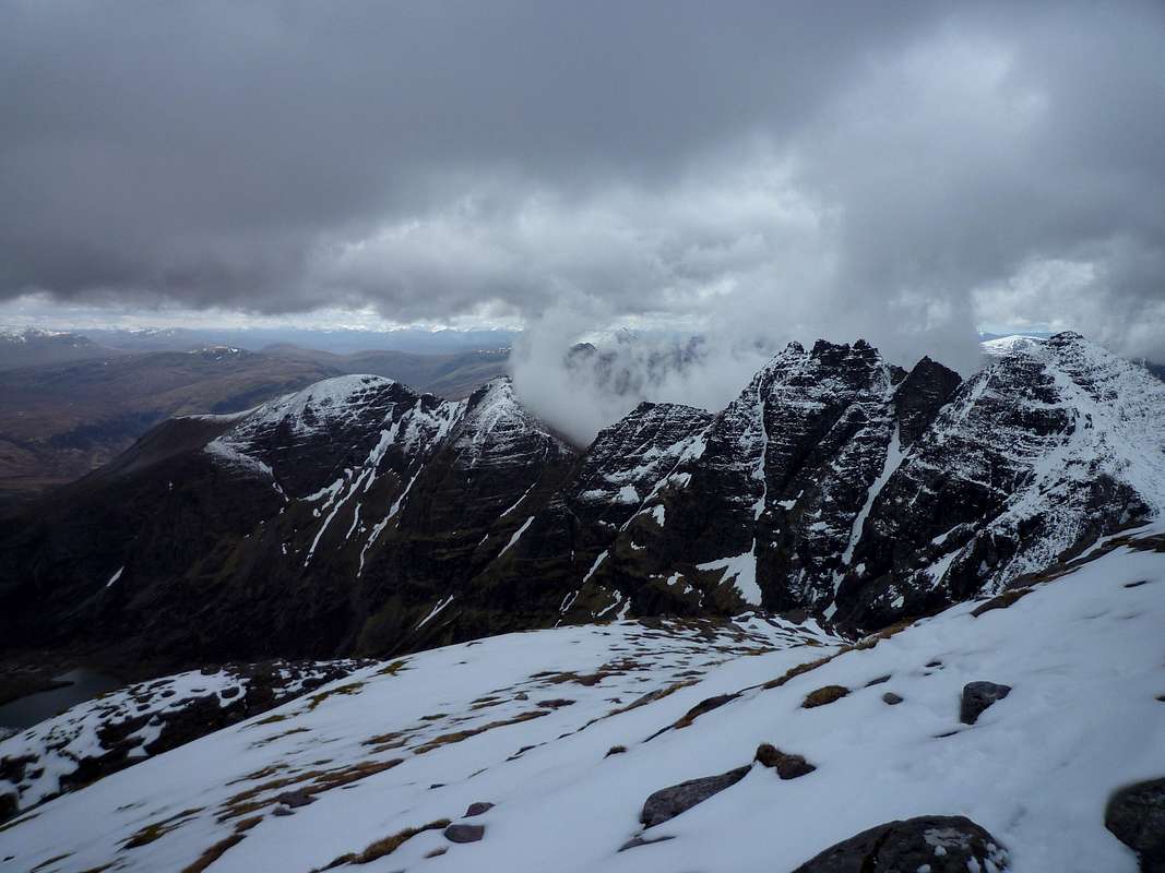
We were ascending along the edge of the ridge and soon saw the inspiring sight of the An Teallach ridge extending from Sgurr Fiona to Sail Liath.
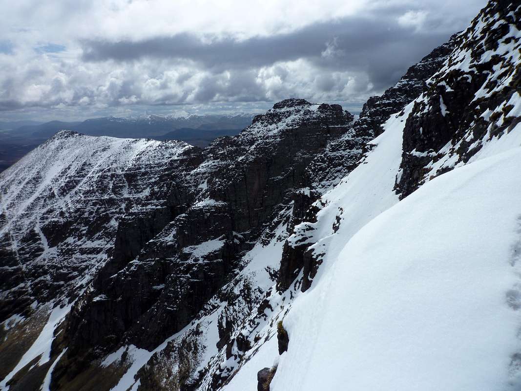
![View from the edge]() The impressive ridge of An Teallach
The impressive ridge of An Teallach seen from the slopes of Bidean a' Ghlas Thuill
Here and there we did discover icy sections but these proved to be no problem for vibram soles.
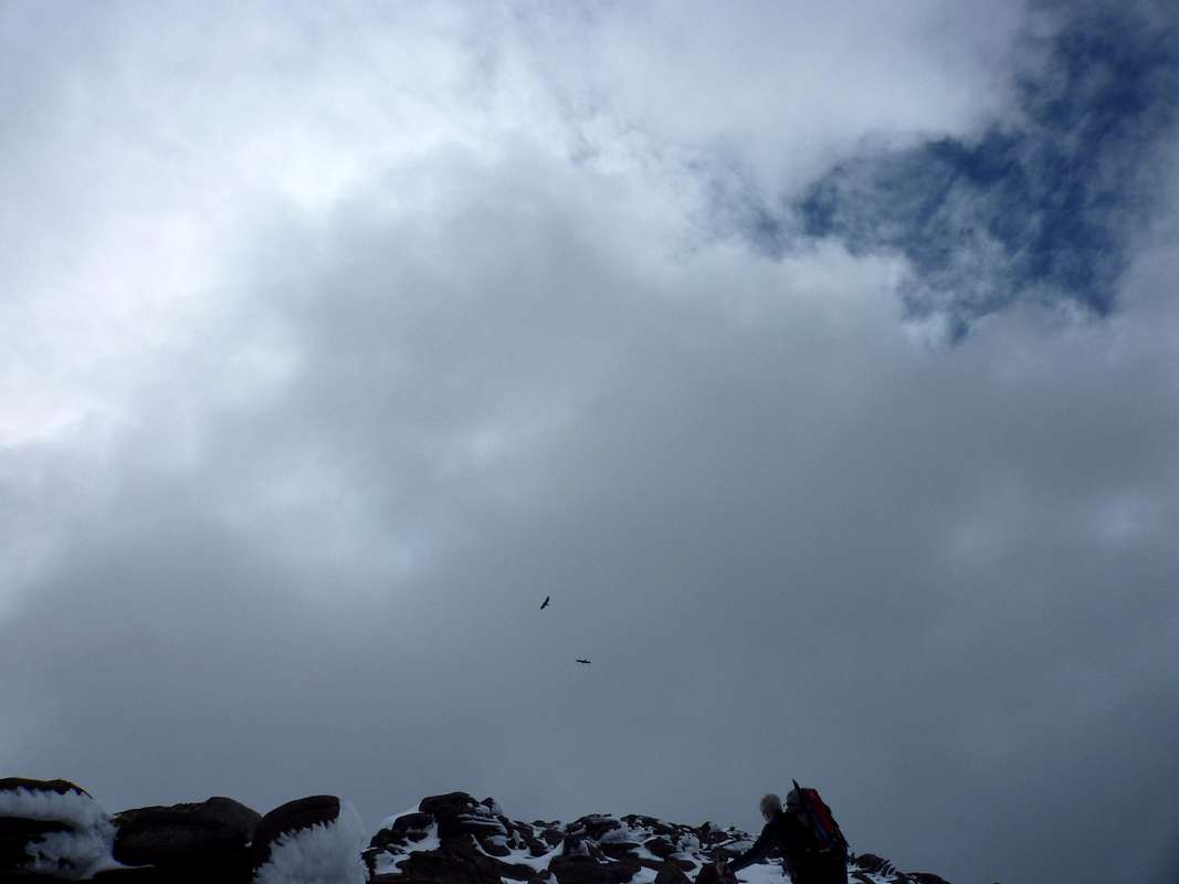
We had almost reached the summit of Bidean a’ Ghlas Thuill when an eagle suddenly soared up only about twenty feet above Ken’s head. I stopped in amazement uttering a shout of wow!!
![Soaring Eagles]() Ken disturbs a pair of Golden Eagles as he heads for the summit of Bidean.
Ken disturbs a pair of Golden Eagles as he heads for the summit of Bidean.Instead of whipping out my camera I just stared at the awe inspiring majesty of the huge bird
The Eagle vanished from sight briefly but soon returned with it’s mate and by the time I was ready for a picture they had soured high above us. Within what seemed like seconds they were half a mile away.
(we checked Dave’s bird book later back at the hostel and confirmed our suspicions that they were actually Golden Eagles.)
![Nearly there]() The last few metres to the top of Bidean
The last few metres to the top of Bidean
We were then just a few metres from the top.
![Bidien a' Ghlas Thuill - 1062 metres]() Ken reaches the top of An Teallach
Ken reaches the top of An Teallach
Ken soon after reached the trig station on the summit and so got his amazing views due to the clear skies above us.
As we stood admiring the views, we saw clouds descending and also boiling up from behind the ridge ahead.
So reluctantly we decided to descend before our view was ended.
Down below near the bealach we came across a couple ascending and exchanged a few words with them. By this time the summit was shrouded in cloud, definitely a case of the early birds getting their worms.
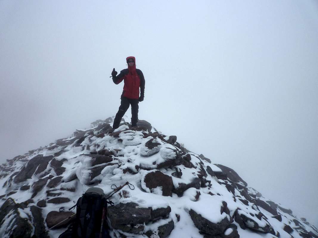
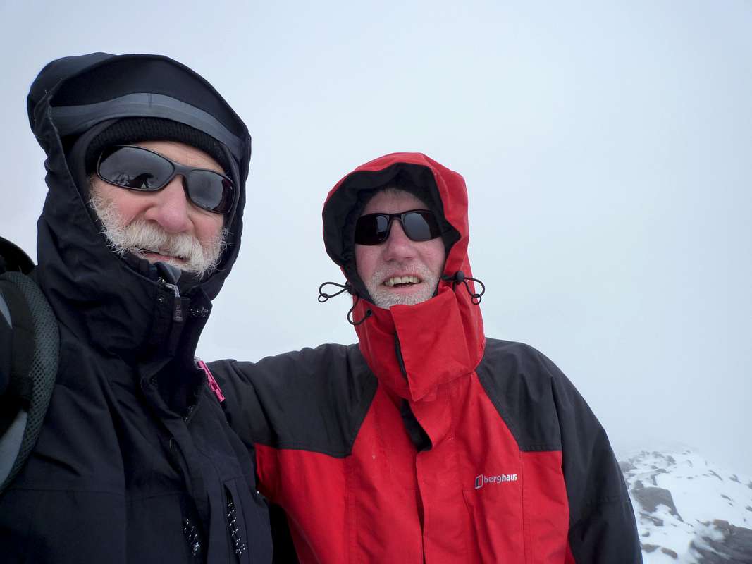
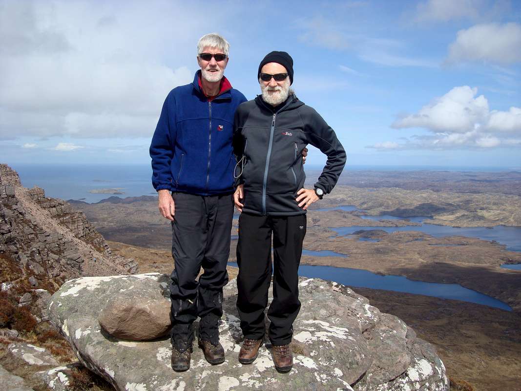
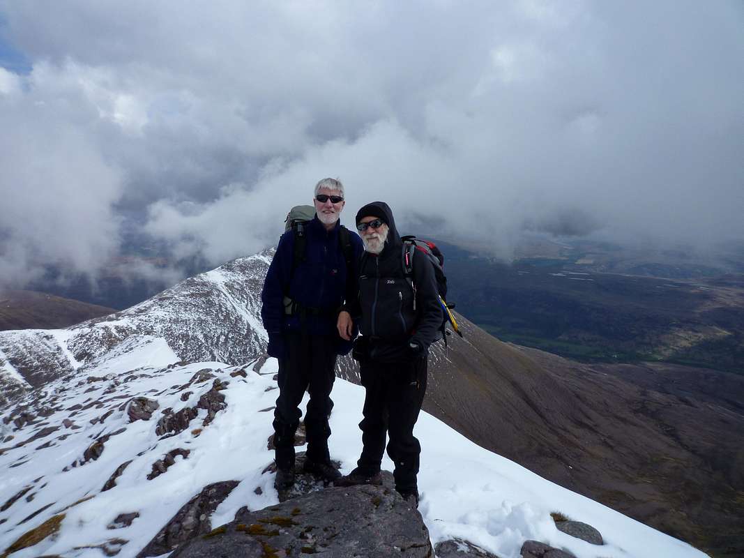
![Happiness is summit shaped]() Ken and Johnnie celebrate a fine climb on top of Bidean a' Ghlas Thuill
Ken and Johnnie celebrate a fine climb on top of Bidean a' Ghlas Thuill![Cloud inversions begin]() Clouds boil up behind the ridge of An Teallach - time to go down
Clouds boil up behind the ridge of An Teallach - time to go downOn the way back down. Ken suggested a diversion to attempt to avoid the boggy section that he had taken aversion to previously. So at the bottom of the snowy gully section we headed out to the west looking for the end of the stalker path.
This involved a fair bit of heather bashing and hopping over small streams but we gradually lost height without really locating an alternative path. I did spot a wee froggy on the way down and we had managed to circle around a small herd of red deer who were grazing off the trail.
![Red Deer]() The deer caught our scent and prepared to flee.
The deer caught our scent and prepared to flee.They eventually caught wind of us but seemed quite reluctant to leave their grazing spot.
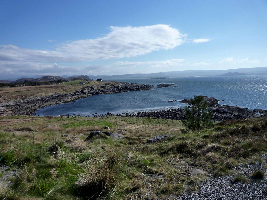
![West coast view]() One of the beautiful bays along the coastal route from Badcaul towards Gairloch.
One of the beautiful bays along the coastal route from Badcaul towards Gairloch. We hit the road at 3:00pm and decided to have a drive up the coast road towards Gairloch admiring the many deserted bays on the way.
Eventually we had pangs of hunger and decided to head back to the hostel to prepare a vast meal of pasta which took all evening to digest.
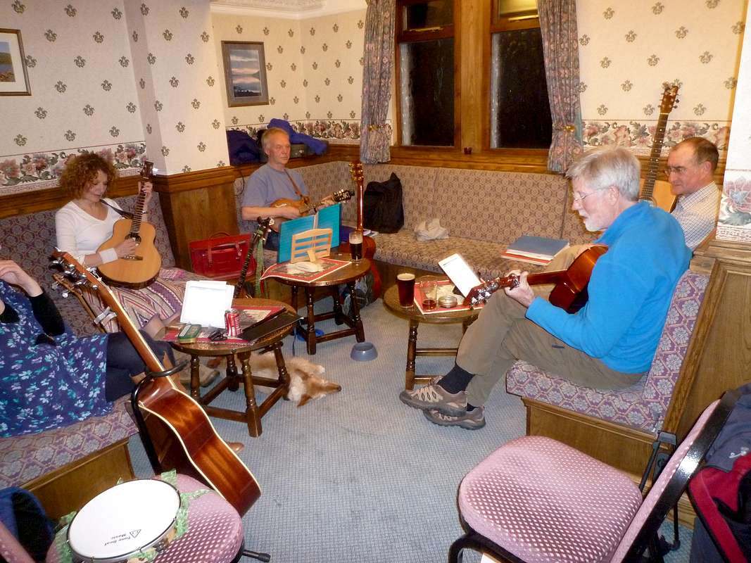
![Music session]() Ken was invited to Join the local music session in the Dundonnell Hotel and he took part with gusto.
Ken was invited to Join the local music session in the Dundonnell Hotel and he took part with gusto.
In the Dundonnell Hotel bar later we were pleasantly surprised to find that they had another real ale on tap, Red Cuillin from the Isle of Skye micro brewery. This helped a bit to wash down the pasta.
Whilst supping our first pint we noticed a gathering of local musicians that included our host Dave. I suggested to Ken that we move over to their corner of the bar as it would be more conducive to listen to their music rather that the raucous conversation of a table full of Glaswegians sitting closer to us.
We managed to find a small table with free seats and noticed a rack with two guitars at the side of it.
I suggested to Ken (a keen guitarist) that these must be for guests so he should select one and join in the session. In the mean time Dave had spotted us and encouraged us to join them.
Ken soon gave them a rendering of one of his currently favourite tunes.
I looked through their song book that they had placed a few copies of around their corner of the bar.
After collecting more beers to lubricate the tonsils, I tried to sing along whilst Ken played the guitar. It was a really great session and we thought that Colin would be green with envy knowing he had missed it.
Ken’s playing was well received but I’m not sure about my singing as I did belt out the verses of “Whiskey in the Jar” at a fair volume although it was much more like “dinna lissen ye” rather than “thin lizzy”.
Another beer saw us to the end of the session and we went back to the hostel well pleased with the evening. Next day, Ken was amazed that we had downed four pints as we are not really in serious training these days.
Day 6 - May 18th - Our last day
![Bothy route]() Ken heads for Loch na Sealga and the Shenevall bothy.
Ken heads for Loch na Sealga and the Shenevall bothy.Sadly we had arrived at the end of our week in Scotland, apart from our return day.
The balmy (ha ha!) weather of the previous day was replaced by the more usual heavy clouds and threatening rain.
We decided on a long walk at low level across the shoulders of Sail Liath and onwards to the shores of Loch na Sealga, about a 17km round trip. Although the rain held off, clouds were still low and views of the hills non existent.
However, the walk was pleasant, a mixture of rocky track and boggy grass. We did have a wee debate about the distance covered and the position we had arrived at. Ken informed me that I shouldn’t question the veracity of his GPS when solely basing my location estimates on instinct. However we didn’t come to blows about it and the whole week was as usual marked by our non-combatative companionship.
![Descending to the Bothy]() Ken heads down to the isolated bothy of Shenavall
Ken heads down to the isolated bothy of Shenavall
Around halfway on the outward leg, we met a young chap walking solo and discovered that he was doing the
Cape Wrath Trail, a trek of almost 200 miles from Fort William to Cape Wrath on the top of the Scottish mainland.
After chatting for a few minutes we wished him well on his three week odyssy and continued on our way.
We left the moor via a rocky gully that lead down to a plain bordering the Loch and here the trail seemed to peter out.
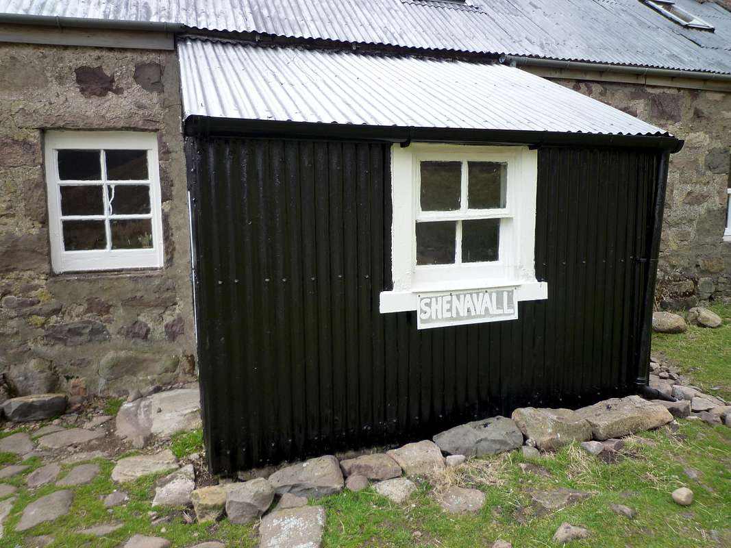
![Bothy entrance]() The bothy is very remotely located but convenient for those crossing the moors on the long distance Cape wrath trail.
The bothy is very remotely located but convenient for those crossing the moors on the long distance Cape wrath trail.We spotted a cottage below and descended to it. This proved to be the bothy of
Shenavall so we decided to stop there and after a brief look inside moved outside to the shelter of the bothy wall, made a brew and ate the sandwiches we had prepared at breakfast.
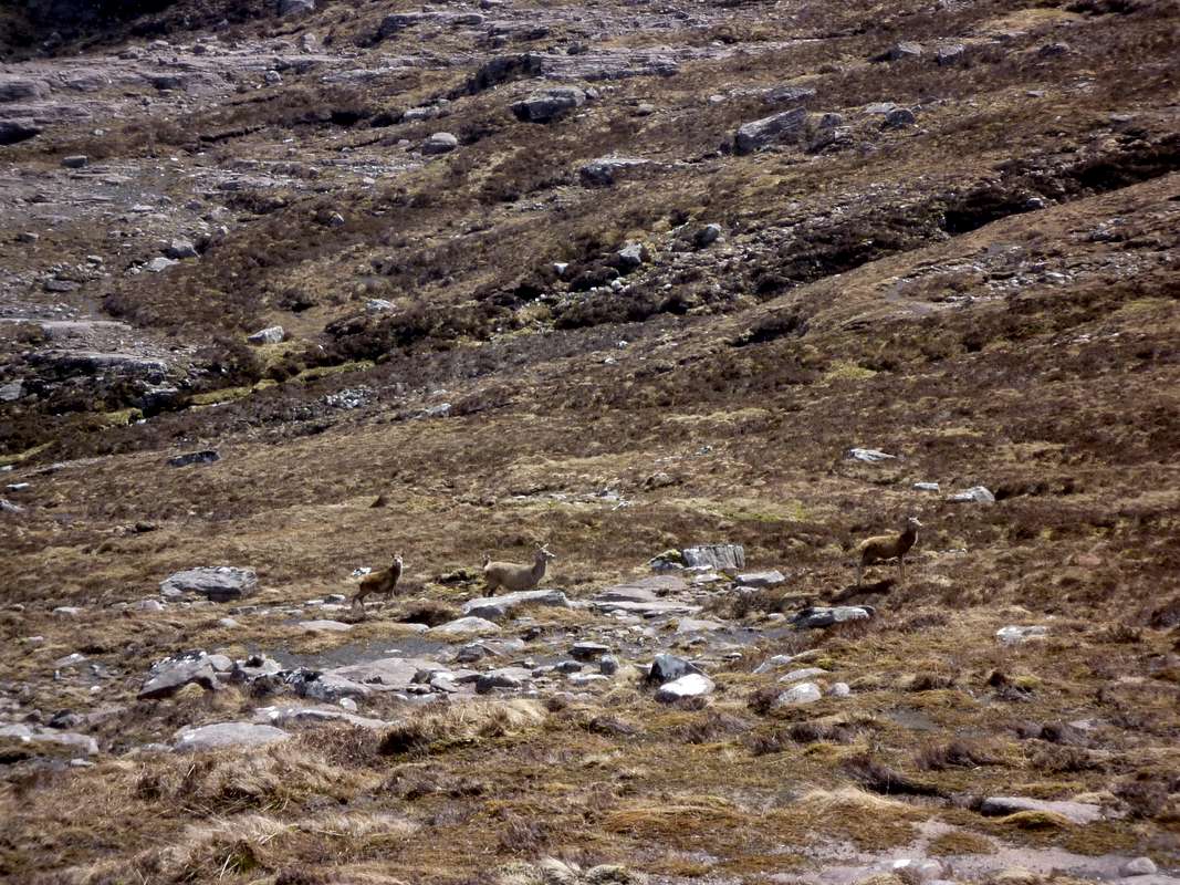
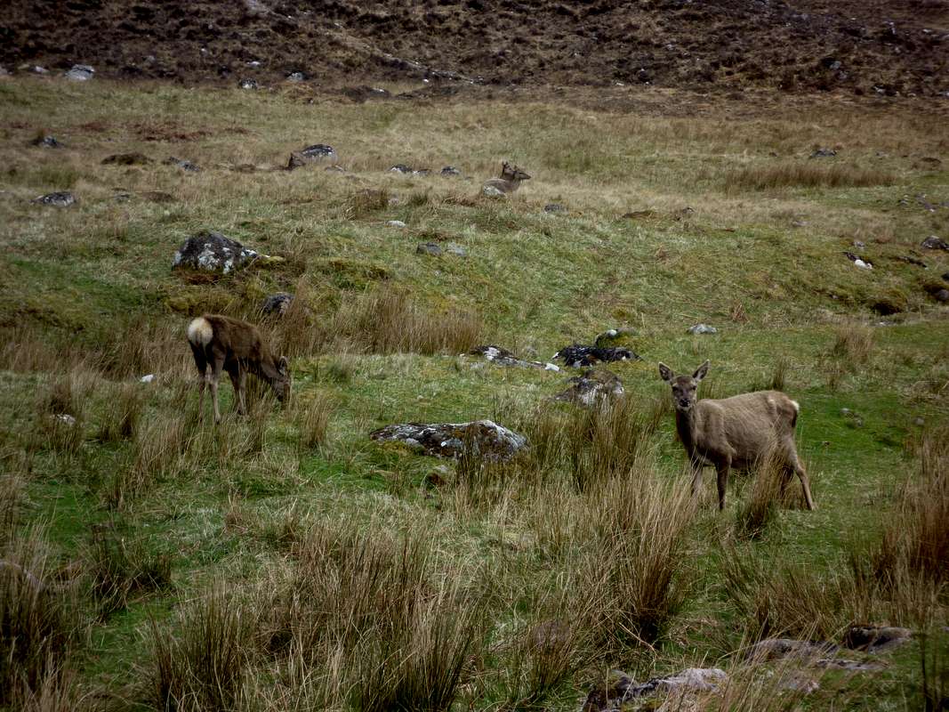
![Red Deer 2]() These deer seemed unafraid so may not have experienced the shooting season.
These deer seemed unafraid so may not have experienced the shooting season.
A few Red Deer were grazing near the bothy but they seemed unperturbed by our presence.
Luckily the rain held off and we returned to Dundonnell still dry.
Almost at the road we met a heavily loaded Scottish guy who proceeded to explain that he was looking for his mates who were hoping to use the bothy. Although his brogue was inexplicable to Ken I managed to fathom out that he was bringing a tent in case the bothy was full. I told him that we had only seen a three or four people so he should be sleeping in doors tonight. We arrived back at the car park at 5:00pm and drove back to the Hostel to cook our dinner.
Day 7 - May 19th - Going home
After a nourishing breakfast, we packed the car and said cheerio to Dave, telling him that we had really enjoyed his and Lynda’s hospitality.
The day was dreary but we had a pleasant drive back to Inverness where we topped up on petrol. Heading around the Cairngorm and passing Aviemore we stopped again at Pitlochry for coffee and scones before continuing on to the motorway junctions outside Glasgow. Here we passed a particularly splendid piece of
public art at the side of the motorway.
We had no more adventures and crossed the Lake District without incident, finally arriving back in Liverpool at 6:00 pm. Ken’s wife Jen had prepared a slap-up dinner for us and they had kindly agreed to put me up overnight.
The next day I left early at 5:50 am, heading back down south and arrived home at 11:30 am. Checking my mileage on the car saw that I had covered 1630 miles on the trip. As usual it was a great week if unfortunaltely far too short.


Comments
Post a Comment