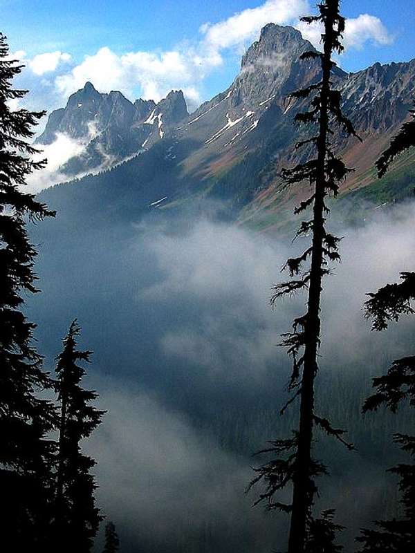
Overview
Highly visible and recognizable from the Mt. Baker region and just 0.4 miles from the USA/Canada border, American Border Peak looms in high relief above Tomyhoi Lake (W) and Silesia Creek Valley (E). Visitors of
Heather Meadows,
Goat Mt,
Yellow Aster Butte,
Tomyhoi Pk, and
Church Mt. do not soon forget American Border Peak's imposing faces. The mountain has a reputation for being harder than it actually is but the approach is arduous and often underestimated.
American Border Peak is part of a chain of 4 peaks starting with the Pleiades (SE),
Mt. Larrabee, ABP, &
Canadian Border Peak (N). The mountain is composed of ancient sediments and volcanics of the Chilliwack group (phyllites, slates, and greenstones) and are connected by a high ridge that runs above 6,000ft for nearly 4 miles.
No trails lead to American Border Peak's seldom visited summit. Rock quality is often poor and climbers must be wary of loose rock (helmets and strong nerves are highly recommended). Every route involves considerable cross-country navigation, bushwhacking, class 3, 4, & low-5 rock, exposure, and lots of scree and/or snow travel. Winter ascents are possible but rarely made due to the remoteness of the peak.
Views are expansive. American Border Peak
ranks 63rd in Washington with 2,794ft of prominence. It's central location looks directly into the North Cascades, Canada at the
Cheam and Coast ranges,
Mt. Baker &
Shuksan, and more. Waterfalls tumble down the precipitous East face of
Tomyhoi Peak directly W of you. Unfortunately, mining and logging have both slightly impacted this area, but its beauty remains captivating and strong, and mines offer further exploration possibilities.
![American Border Peak]() American Border Peak and Canadian Border Peak from Gold Run Pass American Border Peak and Canadian Border Peak from Gold Run Pass | ![American Border Peak from the...]() The west face The west face | ![Amazing Spires]() Spires on the ridge between American Border Peak and Mount Larrabee Spires on the ridge between American Border Peak and Mount Larrabee | ![Summit Block]() The summit block The summit block |
Getting There
Twin Lakes Aproach: Take exit 255 (Sunset/Mt Baker hwy) drive east 31 miles to the town of GlacierDrive another 13.5 miles and take a left on forest service road 3065 (Twin Lakes Road)Drive 6.7 miles (stay left at all forks) and park at Twin Lakes (also the trailhead for Winchester Mountain), parties with low clearance vehicles may need to park at the Yellow Aster Butte trailhead and walk the remaining two miles. Please be respectful and find a good place to park that allows other drivers further access and the ability to turn around.
Slesse (Silesia) Creek Approach: Drive East on the Trans-Canada Hwy 1; take the Sardis Exit (Vedder Rd); drive S to Vedder Crossing. Turn sharply LEFT (east) at the near side of the Chilliwack River Bridge. After 12.6 miles (21.2km) take the Slesse Creek Rd. After 3.7 miles a take the Right Fork toward to an army bridge and demolition area. Shortly after the bridge take the spur road heading SW up towards Canadian Border Peak. Drive as far as you can (the road may be in very poor shape), park, and hike the remainder of the road.
![American Border Peak and Mt....]() Most of the Twin Lakes approach traverses this slope Most of the Twin Lakes approach traverses this slope | ![Approaching the Shoulder]() The crux of the Twin Lakes approach, a much steeper hillside than it appears The crux of the Twin Lakes approach, a much steeper hillside than it appears |
Red Tape
A Northwest Forest Pass is required for each vehicle parked at either the Twin Lakes or Yellow Aster Butte trailhead, $5 Dollars per day or $30 for an annual pass.Northwest Forest Passes can be obtained at a variety of locations, including –
Maple Falls Shell Gas Station (also the last gas station before Deming)
REI - the nearest of which is at 400 36th St, Bellingham, (360) 647-8955
Routes
Southeast FaceThe standard route is what Beckey describes as the “Southeast Face.” The approach is from Twin Lakes and the climb itself is more of a face traverse followed by a chimney climb; mostly class 3-4 with some low class 5 that some groups solo through. The first ascent was on Sept. 14th, 1930, by Alec Dalgeish, Tom Fyles, Stan Henderson, and R.A. Fraser and the first winter ascent was in March 1958 by Henryk Mather and Hans Starr.
![The Real Climbing Begins]() The southeast face begins The southeast face begins | ![First Pitch]() The crux of the southeast face - below and to the left of the large chockstone The crux of the southeast face - below and to the left of the large chockstone |
Northeast Face
First ascent by Dwight Baker, Fred Beckey, and John Dudra, Sep. 21 1952. This route can be approached either by descending from the pass reached on the standard route, or by the same route used for Canadian Border Peak. Either traverse appears to be best done with snow cover. From the glacier directly below the northeast face, “Cross left onto the glacier to gain the mixed rock and snow of the upper NE face or first climb to near the col NW of the objective. A key feature of the face is a large 45-degree snow gully reached by a traverse onto the rock face. Move south occasionally on pleasant rock pitches of only moderate difficulty (class 4 but mostly class 3); occasional snow patches are encountered until late summer.” (Beckey, Cascade Alpine Guide vol. 3)
External Trip Reports
East Buttress (Illegal Entry Buttress)
First ascent by Don Serl, David Jones, Blair Griffiths, and Ross Nichol, May 23, 1982.Approach as for Canadian Border Peak, but traverse two bowls before ascending just short of the main glacier, climb follows mostly “Steep snow couloirs and runnels” (Beckey) before making its way toward the Northeast Face and the summit.
Route References
C.A.J 1930, 1983
B.C.M Nov. 1971, Dec. 1956
Mountaineer 1952
Appalachia June 1953
A.A.J. 1953Camping
The only actual campsites on the southern approach route are at Twin Lakes, a popular car camping location where fires are prohibited.Flat areas large enough to put a tent are rare, but can be found at High Pass, the boulders below the main ABP-Larrabee ridge, and on the southern part of summit ridge itself.Mountain Conditions
Check Snow Level Avalanche Forecast Weather ForecastRoad Conditions Remember that these are general warnings and forecast, always use good judgement and retreat if necessary. ![]() Photo courtesy of member Just B. From center left (the jagged peak) to right is Mt. Slesse (B.C), Mt. McGuire (B.C) Canadian Border Peak (B.C), American Border Peak, Mt. Larrabee, Yellow Aster Butte, and Tomyhoi Peak.
Photo courtesy of member Just B. From center left (the jagged peak) to right is Mt. Slesse (B.C), Mt. McGuire (B.C) Canadian Border Peak (B.C), American Border Peak, Mt. Larrabee, Yellow Aster Butte, and Tomyhoi Peak.

 37553 Hits
 92.66% Score
 40 Votes
 American Border Peak and Canadian Border Peak from Gold Run Pass
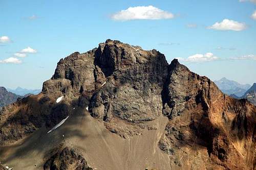 The west face
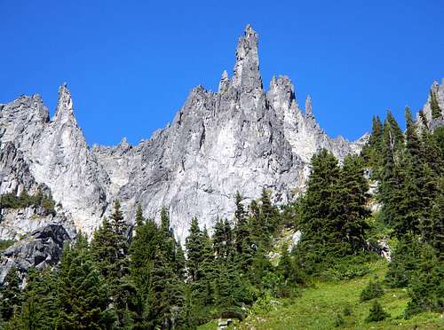 Spires on the ridge between American Border Peak and Mount Larrabee
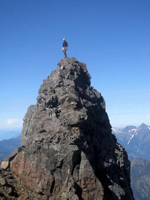 The summit block
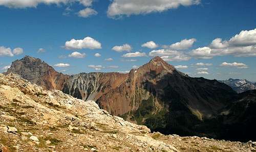 Most of the Twin Lakes approach traverses this slope
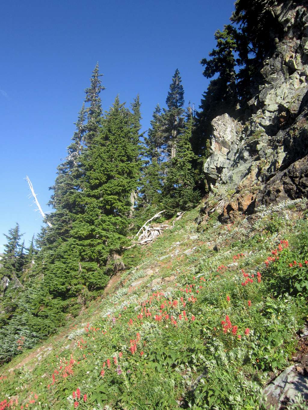 The crux of the Twin Lakes approach, a much steeper hillside than it appears
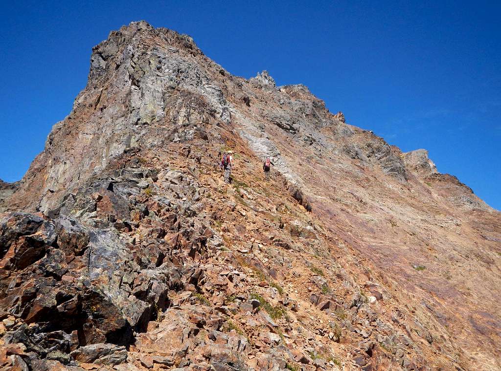 The southeast face begins
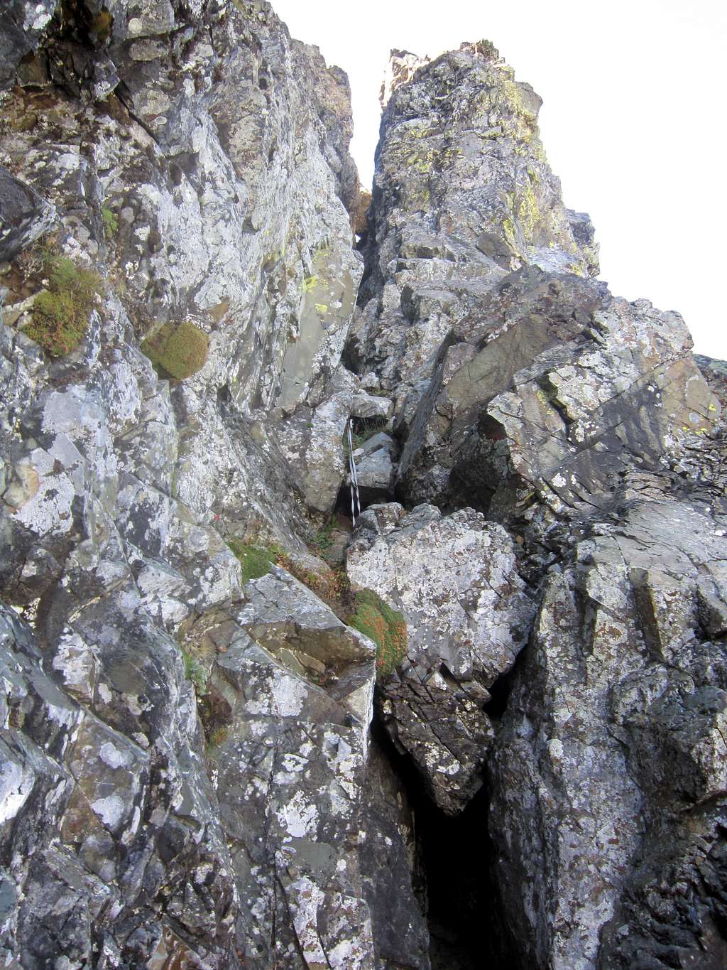 The crux of the southeast face - below and to the left of the large chockstone
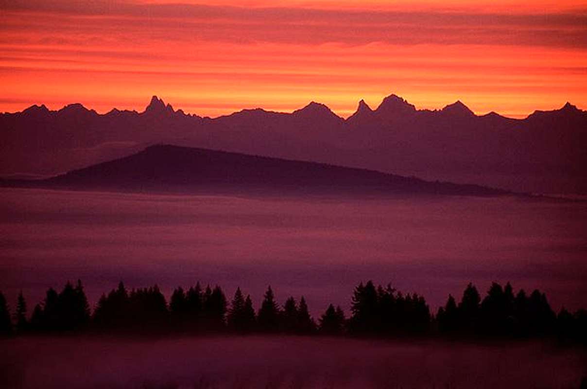 Photo courtesy of member Just B. From center left (the jagged peak) to right is Mt. Slesse (B.C), Mt. McGuire (B.C) Canadian Border Peak (B.C), American Border Peak, Mt. Larrabee, Yellow Aster Butte, and Tomyhoi Peak.