
-
 39624 Hits
-
 84.82% Score
-
 19 Votes
|
|
Mountain/Rock |
|---|---|
|
|
48.92700°N / 121.881°W |
|
|
Whatcom |
|
|
6315 ft / 1925 m |
|
|
Overview
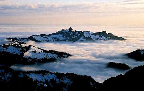 Curch Mountain seen from Tomyhoi Peak, Photo courtesy of Just B
A mere 40-minute drive away from Bellingham, Church Mountain looms vertically above highway 542. The first ascent was made by W.H. Garrett, John Lynch, W.H. Radcliffe, J.T. Shaw, Richard L. Smith and J.T Shaw in June 1891, while the first winter ascent was by Heinz Arens and Hermann F. Ulrichs in March 1930. The trail leading up to the previous site of a fire lookout, is a classic North Cascades day hike, on a clear summer day. In winter the mountain offers a more challenging and seemingly remote wilderness experience.
The bell-shaped summit block offers 360-degree views dominated by Mount Baker and Mount Shuksan. Whether you're here photographing wildflowers or making fresh tracks with your snowshoes, Church Mountain is worth the visit. Given its Southern exposure, Church Mt. melts out early (usually by mid-June). The mountain also has excellent winter access due to the low elevation of the trailhead.
The Southern portion of the mountain is composed of Chilliwack Group volcanic rock on top of Nooksack Group Strata. The rock is reasonably firm underneath but tends to be crumbly on top. It is widely covered with small stones and bits of gravel where the angle is slight enough for junk to accumulate. The vast majority of people who visit Church Mountain stop at the false summit, which is where the trail ends.
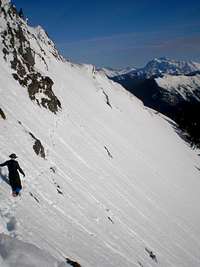
It is strongly recommended that only those with experience in rock climbing or difficult scrambling continue on to attempt the true summit. The scramble section is mostly class 3 with some class 4 moves. The exposure on the easiest scramble route is considerable, especially when crossing the loose gully. To make things worse, the strata is often down-sloping. This combination of conditions makes for one of the more risky scramble routes. Remember that if you are off-route you will likely be facing some "free 5.6 climbing on loose rock" as mentioned is Dow's route page.
Church Mountain is a great place to see wildflowers. Get here just after the snow melts out and you'll find fields of Avalanche Lily. Look for the famed Calypso Orchid along the side of the trail. Columbine, Lupine, Heather, Paintbrush, Purple Aster, Heliotrope, & Monkey Flower are all common here. Marmots whistle and goats scramble too, but remember to be prepared for mosquitoes and flies in the summer season.
 |
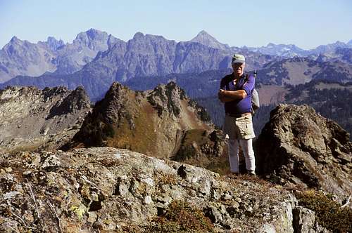 On the summit September 2004, photo courtesy of etsnyd |
 |
Summer Route:
Roundtrip 10 miles
Elevation gain 3,900ft
High Point 6,315
Class 3 / 4 rock scramble from lookout site to summit block
- Start at the Church Mountain Trailhead (2,400ft)
- Follow the wooded trail up many switchbacks until you reach the high meadows (4,900ft)
- Continue west up the left side of the meadow (on trail) to a rocky peak and former lookout site (6,000ft)
- From here there is a faint scramble boot path that leads down and over to a notch and then up to the summit (6,315ft)
 |
 |
 |
 |
 |
 |
Getting There

The Lookout Site
- Take exit 255, Sunset-Mt. Baker Hwy, off I-5
- Travel East 31 miles to the town of Glacier
- From the Glacier Public Service Center, travel east on Mt. Baker Highway 542 for 5.2 miles
- Turn LEFT on Forest Service Road #3040 (Church Mountain Road)
- Follow Road #3040 for approximately 2.5 miles to the end
The trailhead and parking area are located at the end of the road.
Due to the low elevation and short distance of the road, Church Mountain is one of the most accessible mountains in the Mount Baker Wilderness Area.
Always check Current Road Status
Red Tape
A Northwest Forest Pass is required for each vehicle parked at the Church Mountain trailhead $5 per day or $30 for an annual pass.
Where to get PARKING PASSES:
- SHELL GAS STATION: in Maple Falls, is on the right (heading east). NO GASOLINE AVAILABLE BEYOND THIS POINT!!! No gasoline is available between Maple Falls and Deming (heading west).
- GLACIER PUBLIC RANGER STATION: (360) 599-2714 On the right (heading East) as you leave the town of Glacier.
Closed for the season after October 11
- Bellingham REI: (360) 647-8955
400 36th St Bellingham. Take a left off exit 252 (WWU-Bill McDonald Parkway), another left, it's in the Haggen lot.
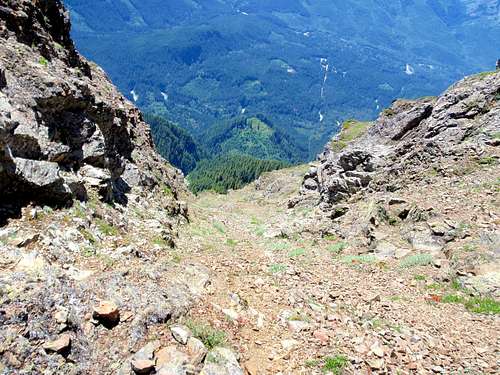
Exposure on the summit block
When To Climb
Church mountain melts out early and the access is good so those with snow travel skills should make avid use of it. The trailhead elevation is 2,400ft and the road is only 2.5m long.
Church Mountain is beautiful in both summer and winter. In summer you'll find an abundance of wildflowers. In winter you'll find crystal clear views of massive peaks.
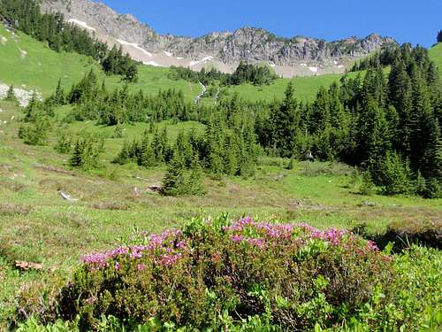 The upper meadows in Summer |
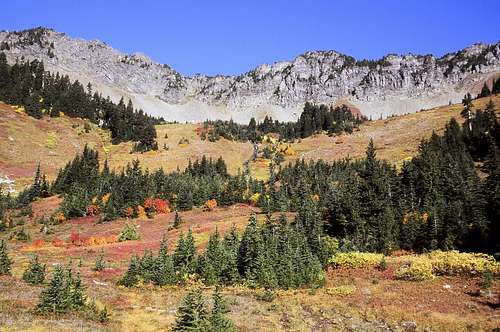 The upper meadows in Fall photo courtesy of etsnyd |
Camping
Camping is allowed on Church Mountain. No fires.
Campsites are available in the meadow once you break out of the trees.
Please use existing campsites and remember, Leave No Trace!
Mountain Conditions
Check Snow Level
Check Avalanche Report South, East, and Northeast Aspects
Check Weather Forecast
...More Info
Current Road Status
Remember that these are general warnings and forecast, always use good judgment and retreat if necessary.

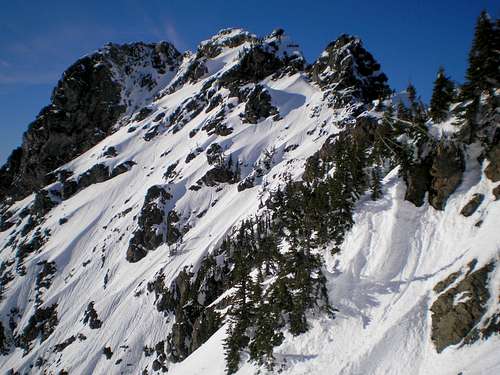
The summit block in Fall
photo courtesy of etsnyd
The summit block in Winter
photo courtesy of JDRogers
External Links
- Elvis's September 2010 Trip Report to the false summit
- TrailPair's August 2010 Trip Report to the false summit
- WTA's informative page including links to more trip reports
- National Weather Service's Surface Observation Map
This hyperlink leads to a National Weather Service map of all surface observation stations in Washington State. Run your cursor over the Mt. Baker area to get an idea about the weather at Church Mountain. - Northwest Weather and Avalanche Center
Run your cursor over the interactive map of Washington State to learn about the weather and avalanche conditions at Mt. Baker (close to Church Mountain).