
|
|
Area/Range |
|---|---|
|
|
41.81580°N / 123.617°W |
|
|
Hiking |
|
|
Summer |
|
|
7309 ft / 2228 m |
|
|
Overview
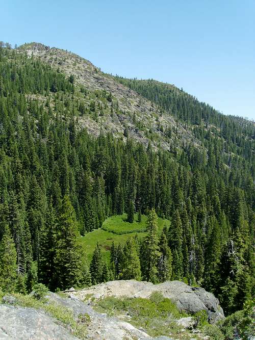
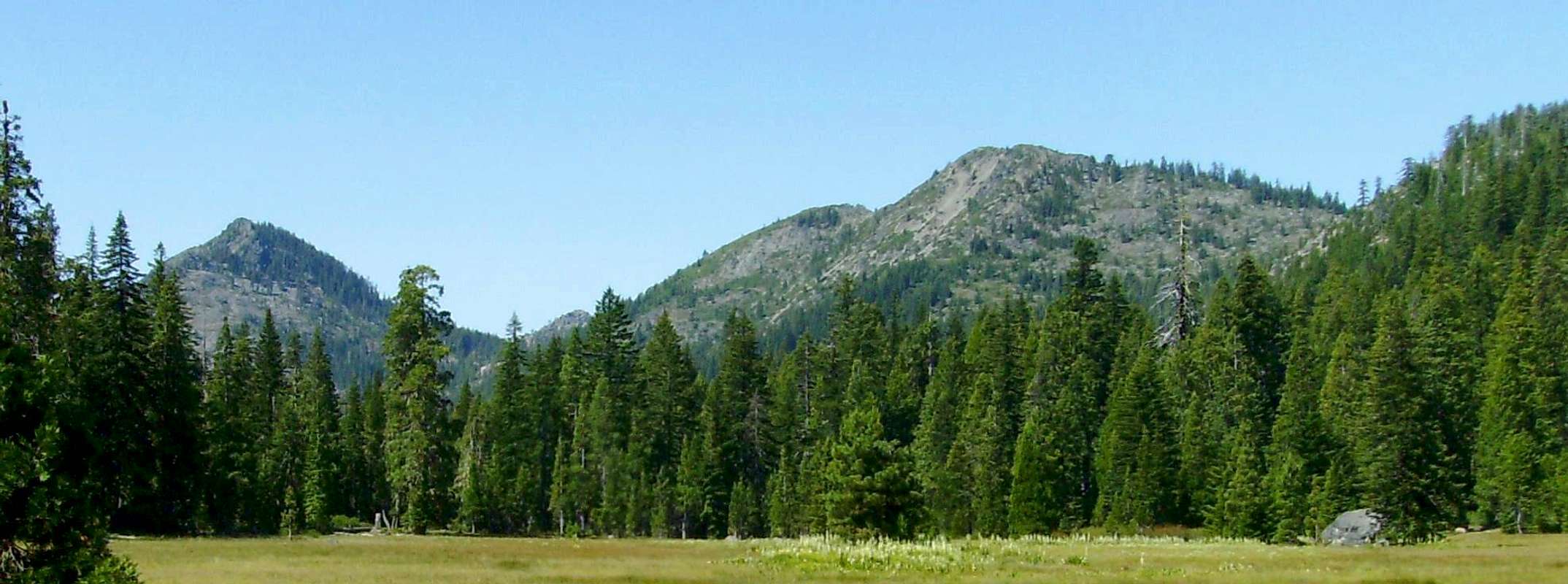
Open Meadow near El Capitan
Situated in the far northwestern corner of California, the Siskiyou Wilderness protects 182,802 acres of craggy peaks, forested ridges, deep glacier carved canyons and some of the most botanically diverse coniferous forests on the planet.
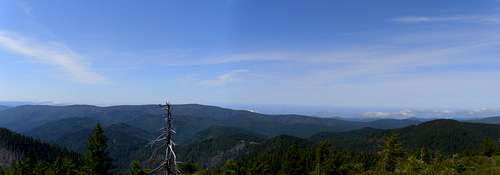
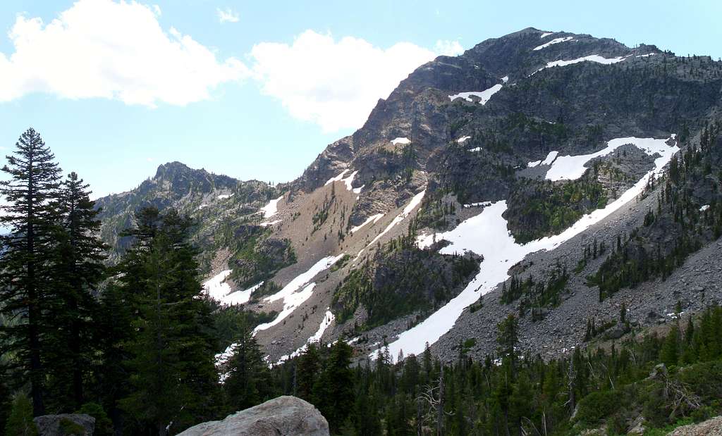
While not particularly high by most standards, don't be fooled into thinking these mountains are insignificant. What they lack in elevation, they make up for in relief, the Siskiyous are a very rugged range of mountains. This is especially true Siskiyou Wilderness. Elevations range from 700 feet near the mouth of Clear Creek to 7309 on the summit of Preston Peak. The wilderness sits on three national forests namely the Six Rivers, the Rouge River-Siskiyou and the Klamath.
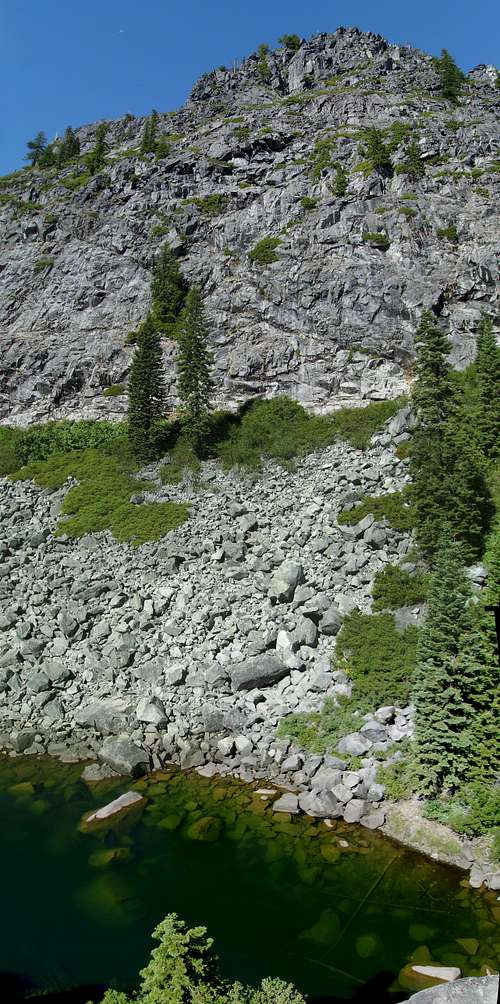
Although the Siskiyous do not exceed timberline, the range features many qualities one would expect to find in a true alpine range. Many areas show significant signs of glaciation, as evidenced in the many glacial lakes and barren rock exposures.
This is remote country, quite possibly the least visited chunk of mountains in California, but this is difficult to verify because the forest service doesn't keep track of visitation. The degree of solitude that can be found here is unparalleled, you can walk for days and not see a single trace of human presence besides a fleeting overgrown trail that fades in and out of the brush.
Most use is concentrated to the northwest corner of the wilderness, few of the trails found elsewhere are maintained on a regular basis. Large tracts of the wilderness are completely lacking in trails, especially in the southern reaches. Off trail travel can be a battle due to dense brush and unstable slopes.
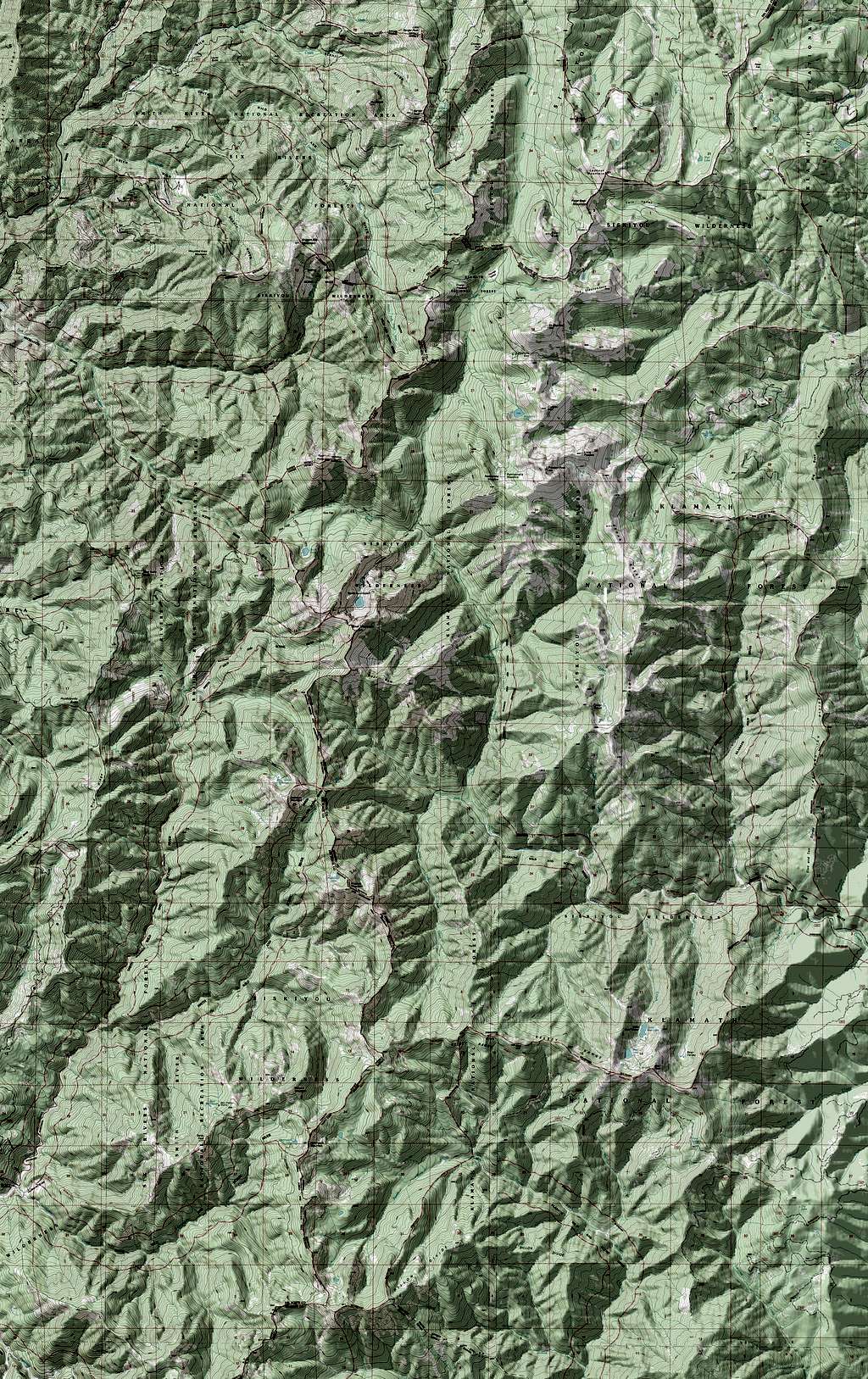
Geography / Geology
The Siskiyous are a part of the greater "Klamath Mountains". This name however mostly exists in guidebooks and a small selection of maps. Most Locals Know the names of the individual ranges but the collective term is largely unknown.

Many guidebooks make the claim that the Klamaths were once connected to the Sierras, only to be separated by lava flows from the nearby Cascades. Though the glaciated granite portions of the Klamaths do bare a striking resemblance to the Sierras this assertion is completely false. The Klamaths are a folded anticline that rose from the sea. As a result the geology of the area is complex and varied. Large areas of mantle rock came to the surface leading to the numerous serpentine outcrops. Most of the wilderness north of Youngs valley is composed of mantle rock.
 West slope of Preston Peak West slope of Preston Peak |
 Illinois River headwaters Illinois River headwaters |
 Peak 6121 Peak 6121 |
Other types of rocks common to the area are peridoite and some granite. South of youngs valley these two rocks alternate along the crest.
 The ocean viewed from the trail to Summit Valley
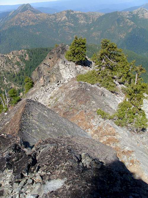
The Siskiyous are the largest subrange by area in the Klamath Mountains. They form two main crests, the first trending south to north from the town of Wichepec on the Klamath river to Oregon Caves National Monument. From Here the range bends and runs west to east, roughly along the California/ Oregon border until it merges with the Cascades.
Devils Punchbowl
Most of the north south trending crest is within the Siskiyou Wilderness. Some of the most rugged and remote territory in California can be found here. Due to its proximity to the ocean this area was hit much harder by the last ice age than the rest of the Siskiyous, making the effects of glaciation a lot more obvious.
 Northeast corner of the wilderness from Summit Valley Mountain
The wilderness is home to hundreds of glacial tarns ranging in size from a small puddle to deep mountain lakes. The headwaters of several major rivers begin here in classic glacially carved U shaped canyons.
 Bear Mountain (Dean) Bear Mountain (Dean) |
 Bear Cub Pass Bear Cub Pass |
 Summit of Bear Mtn (Dennis Poulin) Summit of Bear Mtn (Dennis Poulin) |
The higher ridge tops get up to 200 inches of precipitation a year. This is in sharp contrast to the 50 inches that fall on the lower eastern side. The range of precipitation coupled with the unique geology makes this area home to some of the most botanically diverse coniferous forests on the planet.
History
Long before Europeans arrived here the Yurok and Karuk tribes have considered the high country to be the center of the spiritual universe. Today local Indians still practice spiritual activities around Sawtooth Mountain. If you see any of them it is considered polite not to approach or speak to them.
 Northwest Ridge of Preston Peak Northwest Ridge of Preston Peak |
 The Lieutenants The Lieutenants |
Intrusive activities were generally limited due to the extremely rugged character of the land. Some mining roads were built but the higher country was never exploited like the lower surrounding hills.
 Raspberry Lake (Dennis Poulin)
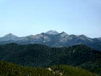
Preston and Bear from Ship mountain

Northwest ridge of Preston Peak
In the early 80s a the forest service began a radical project, a high quality ridge top road that would link the communities of Gasquet and Orleans. Once completed the road was supposed to create a boom for both communities with increased timber revenues. The road was nicknamed the "GO road", an abbreviation for Gasquet-Orleans. As the project neared completion several groups filed lawsuits over the environmental impact of such a road. The final link of the road was never paved, and with the 1984 designation of the Siskiyou Wilderness it never will be. Today these roads on either side of the wilderness still exist and seem bizarrely out of place for this remote area.
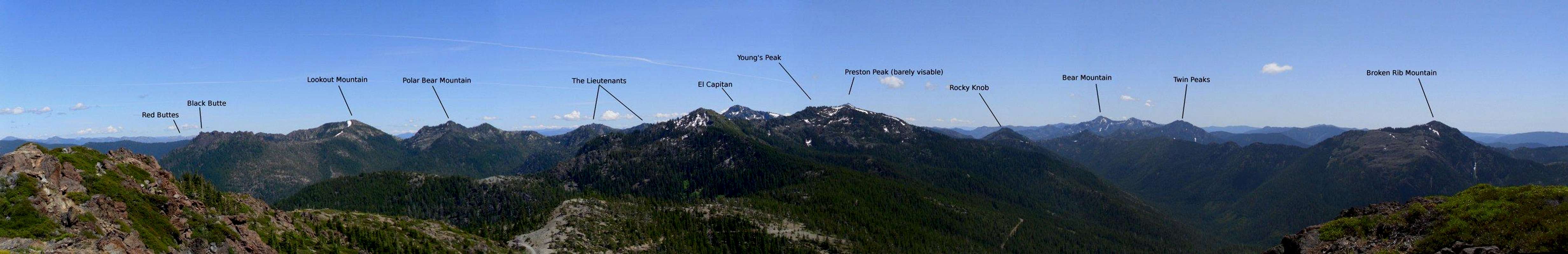
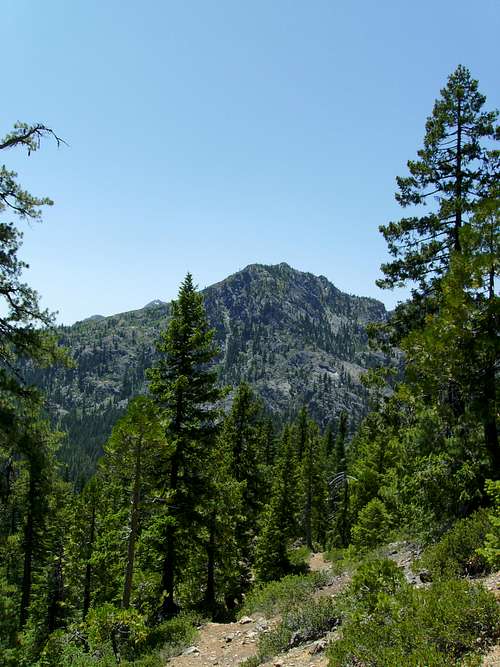
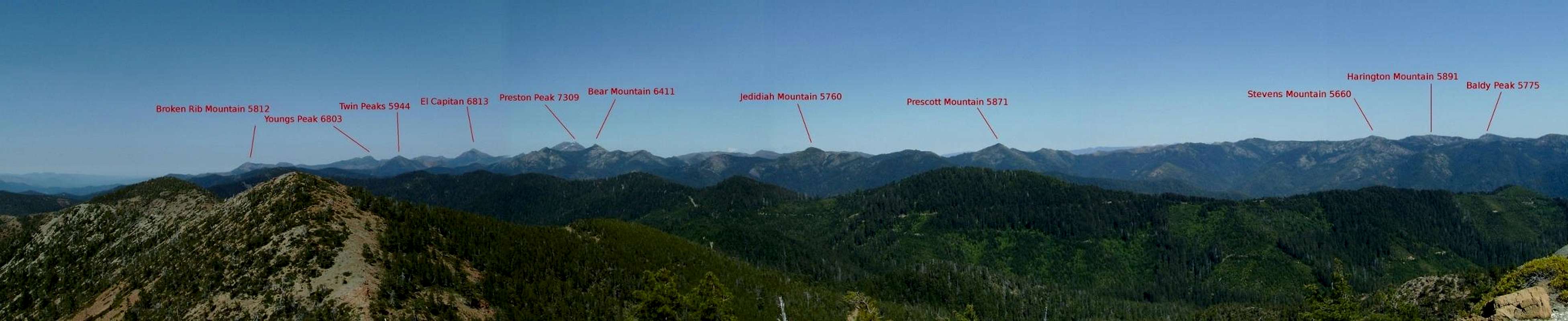
Major Peaks
Listed north to south
|
 Lookout Mountain Lookout Mountain |
 Broken Rib Mountain Broken Rib Mountain |
|
 Bear Cub Mountain Bear Cub Mountain |
 El Capitain El Capitain |
 Rocky Knob Rocky Knob |
 Black Butte Black Butte |
 Polar Bear Mountain Polar Bear Mountain |
|
 The Lieutenants The Lieutenants |
 Twin Peaks Twin Peaks |
 Youngs Peak Youngs Peak |


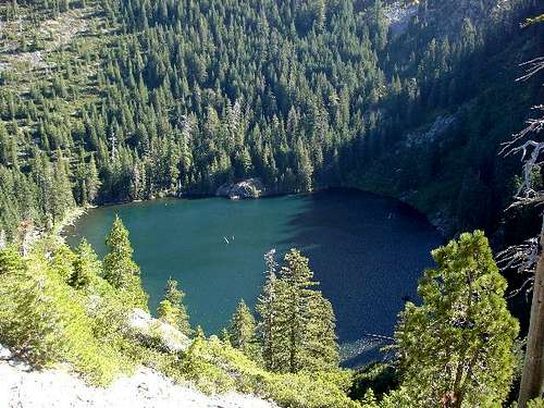
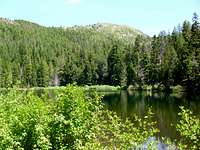
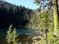
Lakes
One best features of the Siskiyou Wilderness is the abundance of mountain lakes found here. Most lakes were formed from glacial activity during the last ice age, giving them many alpine characteristics. Listed here are the major lakes that are accessible by trail. The wilderness is home to many more lakes not listed here, most of which require significant off trail bushwhacking to reach.
| Name | Location | Description | Photo |
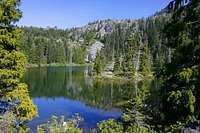
| Kelly Lake | .5 miles from Kelly Lake TH | Located only .5 miles from the trailhead, Kelly Lake is the most popular destination in the Siskiyou wilderness. Most visitors come for short day trips. Fishing is a popular activity here. |
 Kelly Lake (Zach Urness) Kelly Lake (Zach Urness) |
| Lieutenant Lake | Various distances, Young's valley TH, Black Butte TH, Poker Flat TH | Far away from any trailhead, this remote lake is set in a cirque beneath the towering Lieutenant Peaks. Regardless of which trailhead one begins from, reaching this lake will require crossing two mountain passes, meaning solitude is pretty much a guarantee here. The lake is unofficially named on the topo, and is known to some as Private Lake. |
 Lieutenant Lake Lieutenant Lake |
| Sanger Lake | Just outside the wilderness boundary on Road 18N07 | Located a stones throw outside the wilderness boundary, Sanger Lake offers a lot of the qualities one would expect to find at the lakes within the wilderness, but without the hike. The lake is popular with fishermen. |
 Sanger Lake Sanger Lake |
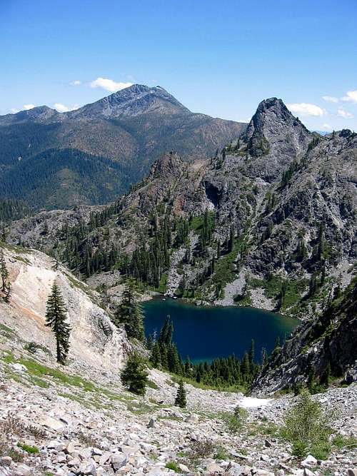
| Raspberry Lake | 7 miles from Young's Valley TH | Set beneath the dramatic Preston Peak, this deep mountain lake is one of the most scenic in the wilderness. The lake is packed with trout and offers some of the best fishing in the wilderness as well. The hike in follows an old road bed most of the way. |
 Raspberry Lake (Dennis Poulin) Raspberry Lake (Dennis Poulin) |
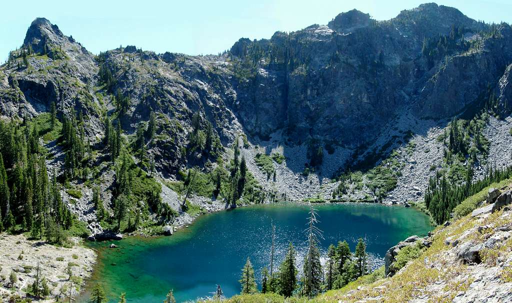
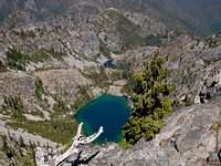
| Devil's Punchbowl | 6.5 miles from Doe Flat TH | The crown jewel of the Siskiyou Wilderness, Devil's Punchbowl is set in a deep u-shaped glacier carved valley. Steep granite walls shoot thousands of feet directly up from the lake. The lake has little vegetation to use as firewood, so be sure to bring a stove. Despite the strenuous hike required to get here, this is one of the most popular destinations in the wilderness. Solitude is not a guarantee on summer weekends. |
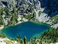 Devil's Punchbowl Devil's Punchbowl |
| Buck Lake | 1.5 miles from Doe Flat TH | A quick stroll from the Doe Flat trailhead brings one to Buck Lake. While not nearly as scenic as its neighbor Devil's Punchbowl, Buck Lake is none the less a pleasant location. The lake is a popular destination for day trips. |
 Buck Lake Buck Lake |
| Island Lake | 7 miles from Island Lake TH | A steep hike gaining close to 3000 feet takes one up to scenic Island Lake. The lake sits in a granite bench near the summit of Jedidiah Mountain. Due to the strenuous hike required to get here the lake sees little use. The current trail begins by following an old roadbed top the south fork of the Smith River, then climbs into the wilderness though a burned out forest. |
 Island Lake (Zach Urness) Island Lake (Zach Urness) |
| Bear Lake | 3.2 miles from Elbow Springs TH | Located on the eastern extent of the Wilderness, Upper and Lower Bear Lakes occupy a valley beneath Bear Peak. Views are sweeping for most of the hike in, and the lake offers fantastic camping. This section of the wilderness is seldom visited. |
 Lower Bear Lake (Zach Urness) Lower Bear Lake (Zach Urness) |
| Harington Lake | Various distances, South Kelsey TH, Elbow Springs TH, Gunbarrel TH | Situated near the geographic center of the wilderness the scenic Harington Lake is set beneath the granite cliffs of Harington mountain. Getting there requires a long hike from any direction, and the section of the Kelsey Trail from Bear lake to Eightmile creek has not been maintained in many years. But those willing to make the hike will be rewarded with some of the best and most isolated scenery the Siskiyous have to offer. |
 |
| Flat Iron Lake | 2 miles from the Elk Valley TH | Flat Iron Lake is the most notable of several tarns along the boundary trail. The lake is quite small and shallow, but carries a unique charm other lakes in the wilderness can not match. Most of the boundary trail is not maintained, and offers incredible potential for solitude to those with decent wilderness navigation skills. |
 |
Getting There
The Siskiyou Wilderness has 16 trailheads and over 100 miles of trails few of which are maintained on a regular basis. Note: the trailhead tables below are organized to coincide with the associated access roads, so if the directions for a particular trailhead seem incomplete read the section above it for more specifics.
 The imposing North Face of Preston Peak The imposing North Face of Preston Peak |
 Bear Cub Mountain Bear Cub Mountain |
 Summit Valley Summit Valley |
| Trailhead | Description | Directions | |
| Black Butte | The only westside trailhead accessible from Oregon. High clearance vehicles are helpful for this drive | From Obrein Turn on on Waldo Road/ county road 5550. Turn off on county road 5820 and drive through the "alternative community" of Takilma. If you make it out of Takilma alive turn right on Forest route 4906. Continue on for 5 miles, eventually the route number becomes 053 and you'll come to the signed trailhead. | |
| Youngs Valley | One of the most popular trailheads in the wilderness. The northern access to the Clear Creek National recreation trail. | From US 199 turn on Knopki Creek Road/Forest route 18N07. Continue for 17 miles to the fork with the road to Sanger Lake, turn right for another mile. | |
| Doe Flat | By far the most popular trailhead in in the wilderness. Devils Punchbowl in particular sees a lot of use. | From 199 turn on Forest route 16 / Little Jones Creek Road. After 10 miles turn left on Forest Route 16N02. Follow this road for 3 miles. | |
| Gunbarrel | Access to a campsite on the south fork of the Smith River. | From Little Jones Creek Road, at the junction with 16N02 head straight, this road is also numbered 16N02. Head Straight for 4 miles then turn on Route 16N18. Turn left on 15N34 for another mile. | |
| South Kelsey | This trailhead is accessible year round due to its lower elevation | Just past Hiouchi turn on South Fork Road. Continue on until you reach the junction with forest route 15 (the Gasquet Orleans or GO road). Continue 3 miles to a marked turn off to the trailhead. | |
| Summit Valley | Access to summit valley and a fire lookout. | Head Up the Go road for 15 miles to the signed trailhead. Park on the left | |
| Boundary/GO Road | Climb over the berm at the westside dead end of the GO road. | This is shown on maps as a trail, however this is just an old 4WD road that hasn't been maintained since the wilderness was designaed. |
 Preston Peak (Dean) Preston Peak (Dean) |
 Preston Peak Preston Peak |
| Trailhead | Description | Directions |
| Poker Flat | Access to the remote Twin valleys. | At Happy Camp turn left on road 7C01 (The State of Jefferson Scenic Byway). Pass West Branch Campground and turn left On Forest Route 18N33. |
| Kelly Lake | The most popular eastside trailhead, Kelly lake is only a .5 mile hike and sees a lot of day use. | On 7C01 Turn on Route 18N30 before West Branch campground. Trailhead is 5 miles up the road. |
| No Mans | This trailhead is accessible year round due to its lower elevation. This is the southern access to the Clear Creek National Recreation Trail | From the community of Clear Creek turn on Route 15N35 and follow it until it dead ends. |
| Elbow Springs | This is the Eastern Access to the Kelsey Trail. | From Clear Creek turn on Route 15N19 and follow it for about nine miles. |
| Elk Valley | Access to the boundary trail, a ridge top route that hasn't been maintained in decades. | Head north on the Forest Route 15 from Orleans (this is the eastern half of the GO road). After 16 miles turn right on Route 14N03. The trailhead is three miles up the road. |
| Forks of Blue | True No mans Land. | Head 14 miles up the Orleans half of the GO road. Trailhead is on the left. |
Camping / Regulations

From Sanger Peak

Raspberry Lake
Standard wilderness rules apply. Wilderness permits are not required in the Siskiyou wilderness however campfire permits are required if you plan to have a campfire or use an open flame stove.
Links/ Other info
Lower Devils Punchbowl
Klamath National Forest
1312 Fairlane Road
Yreka, CA 96097-9549
(530) 842-6131
fax 530.841.4571
TTY/TDD 530.841.4573
www.fs.fed.us/r5/klamath/
Rogue River-Siskiyou National Forest
3040 Biddle Road
Medford, OR 97504
(541) 618-2200
TTY 1-866-296-3823
www.fs.fed.us/r6/rogue-siskiyou/
Six Rivers National Forest
1330 Bayshore Way
Eureka, CA95501
707.442.1721
fax 707.442.9242
TTY/TDD 707.442.1721
www.fs.fed.us/r5/sixrivers/
Klamath National Forest Page on Siskiyou Wilderness