
|
|
Mountain/Rock |
|---|---|
|
|
48.13166°N / 121.62213°W |
|
|
Snohomish |
|
|
3940 ft / 1201 m |
|
|
Overview
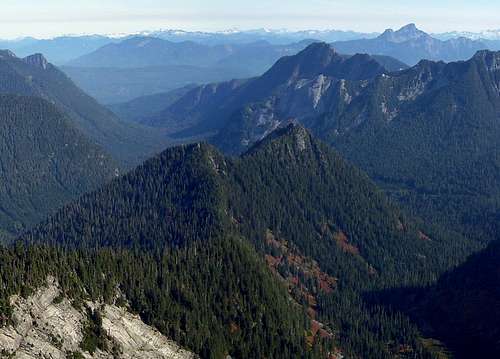
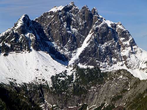
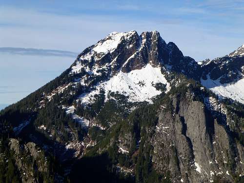
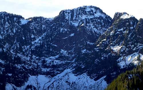
Bornite Mountain from Fletcher Peak. Behind the east summit are Exfoliation Dome and Voodoo Peak, Prairie Mountain and White Chuck Mountain in the background.
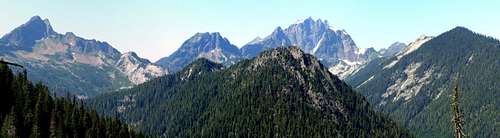
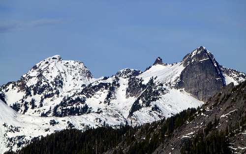
Bornite Mountain from Deer Creek Pass/Helena Peak Trail. In the background, from left to right: Liberty, Big Bear, Three Fingers, Bullon, Higher Squire
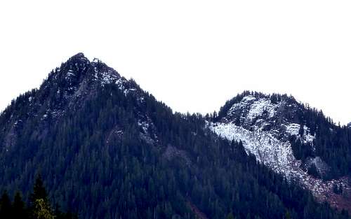
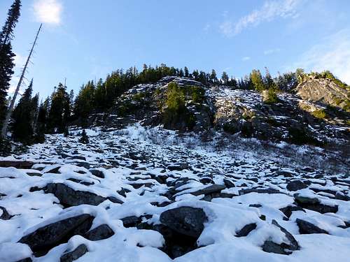
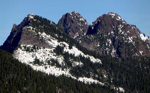
Bornite Mountain from FR2060. The true summit (east) is seen on the left side. The scramble route follows the wooded ridge just to the left of the open slopes to the saddle, then follows the ridge to the east summit.
Bornite Mountain is the unofficial name given to a 3940' peak located eight miles south of Darrington, WA. With 840' of prominence, Bornite Mountain could be considered something of a 'Napoleon' - that is, a peak with short stature, but large prominence. Most 'Napoleons' tend to stand alone - Bornite Mountain is somewhat unique, as it is completely surrounded by significantly higher peaks. Bornite Mountain is also unique in another way - it is the only sub-4000' peak in Western Washington (that I can think of) that has a rocky summit with unobstructed 360 degree views. Most of the scramble up Bornite Mountain can be made in heavy timber - this makes it particularly attractive as an early or late season scramble. Assuming you stay out of the obvious avalanche gullies, Bornite Mountain can be safely scrambled most months of the year, as long as FR2060 is not snow covered. Bornite Mountain's name originates from the Bornite Mine, a large, but unsuccessful copper mining operation (started in 1903) that was located on the flank of Liberty Mountain to the west.
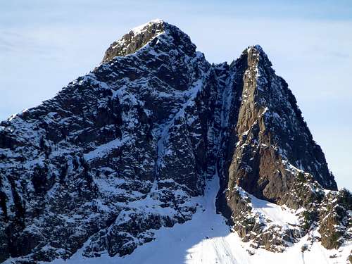
![Bornite Peak west summit from east summit]()
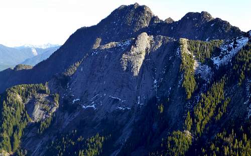
Bornite Mountain west summit from east summit. The route basically follows the trees immediately below the bare slopes to the saddle between the peaks, then follows the ridge to the east summit.
From the parking location, walk another 100 yards up the main road, then turn left (south) and head directly towards Copper Creek. Copper Creek is just wide enough to present a crossing challenge, so look for a sizable log jam at N48 08.475 W121 37.471 (you should be fairly close to this spot if you went straight to the creek). After crossing the creek, continue uphill, straight south. The idea is to aim for the wooded ridge just to the east of the main drainage that originates between Bornite Mountain's east and west summits. The east summit will be very obvious as you leave the parking area - just aim slightly to the right of it and you'll be on route. For the most part, the woods will be fairly open, with occasional patches of devil's club. At about 3000', I decided to traverse west, and continue up the main gully to the saddle between the summits (not recommended if avalanche conditions exist).
Getting There
From Darrington, follow the Mountain Loop Highway south for approximately three miles, and make a right hand turn on to FR2060 (Clear Creek Campground will be on the left). Follow FR2060 approximately 5.3 miles to a fork. Take the right fork (straight ahead - FR2065) for 0.5 miles to the Eightmile Creek Trailhead. If you have a low clearance vehicle, park here. If you have a high clearance vehicle (Subaru Outback or higher), continue another 1.3 miles on rough road, until reaching an overgrown spur that provides parking and turn around at N48 08.575 W121 37.387 Elev. 1780'.Route
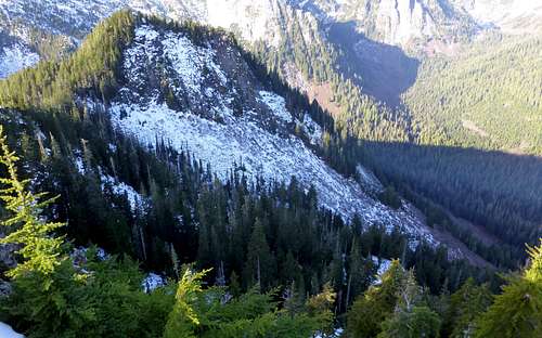
Bornite Mountain west summit from east summit. The route basically follows the trees immediately below the bare slopes to the saddle between the peaks, then follows the ridge to the east summit.
Bornite Mountain west summit from 3200'. I decided to ascend to the saddle between the east and west summit on these open slopes. During avalanche conditions, one could easily take a tree covered route further to the east.
From the saddle (N48 07.824 W121 37.667 Elev. 3550'), turn left (east), and follow the obvious ridge crest for 0.3 miles to the east summit block - the scrambling will be easy class 2.
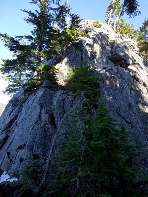
Bornite Mountain summit block. The first 10' are the most difficult, but there is no exposure. After that, about 30' of class 3 scrambling will put you on top of the summit block.
Upon arriving at the summit, I found the view to be much better than expected. It is kind of a neat experience to be standing on top of a peak, yet completely encircled by higher peaks. I did find a film canister summit register in the summit cairn (surprisingly enough, the contents were dry) - it had only the names of one party from 2005. If you do intend to sign the register, be sure to bring your own pencil.
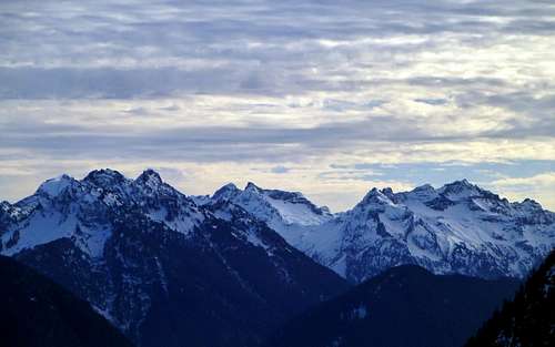
Monte Cristo peaks from Bornite Mountain
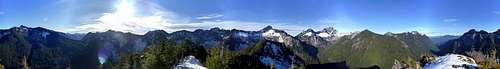
Bornite Mountain summit pano
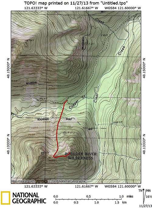
Bornite Mountain route map. Red line shows approximate route from 'trailhead' to summit.
Klenke - Feb 7, 2022 11:06 pm - Hasn't voted
updated Bornite Mine linkKevin, your link above is dead. Here's what I believe is its valid replacement: https://www.discoverdarrington.com/history-2/historical-places/bornite-mine/ Apparently the mine was at or very near Windy Pass but the satellite imagery shows no signs of mining operations there. It must have overgrown.