
-
 10703 Hits
-
 74.92% Score
-
 5 Votes
Overview: Access to Pleasant View Ridge
This trailhead in the San Gabriel high country is the southern end of the Burkhart Trail and provides access to the beautiful miles-long ridge known as Pleasant View Ridge overlooking the great Mojave Desert. This prominent ridge is separated from the main body of the San Gabriel range by a desert bound drainage, Little Rock Creek.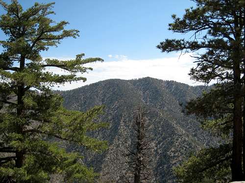 Pleasant View Ridge seen from the south
 Ridge dropping north from summit of Pleasant View Ridge
Pleasant View Ridge rises from the Mojave desert starting near Juniper Hills and winds southeasterly until reaching its end at 8,214’ Mt. Williamson. Three miles along the ridge northwest of Mt. Williamson, there is a distinct gap on the crest between Will Thrall Peak and Pallett Mountain known as Burkhart Saddle (6,959’).
The 7,893 foot summit of the mountain known as Pleasant View Ridge is a little more than a mile from Burkhart Saddle. The other accessible peaks along the ridge are Will Thrall Peak, Pallet Mountain and Mt. Williamson.
 Summit of Pleasant View Ridge (7983')
Pleasant View Ridge
To get to Pleasant View Ridge, take the Burkhart Trail from the trailhead to the junction with the Rattlesnake Trail just after crossing Little Rock Creek (about 2 miles from the trailhead).
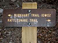 Junction. Trail to right goes into a closed area
Cooper Canyon
This trailhead also provides access to Cooper Canyon and the Cooper Canyon Trail Camp to the west. The signed Cooper Canyon Trail intersects the Burkhart Trail on your left 1.75 miles from the trailhead and about ¼ mile before the junction with the Rattlesnake Trail.
Driving Directions
From the 210 Freeway, exit at Angeles Crest Hwy (SR 2) and go north. At 9.5 miles, you will come to the Clear Creek Information Station and the junction with Angeles Forest Highway. Continue straight and in 4.5 more miles you will pass the junction with the Mt. Wilson Road at the Red Box Ranger Station and trailhead. Continue on SR2 for 20 more miles to Buckhorn Campground. The campground entrance is about ½ mile past the Mt. Waterman Ski Area. Be looking for the entrance on your left as it can be easy to miss. Proceed into the campground and follow the signs to the day use parking area, about .8 miles from the entrance. The trailhead is at the north end of the parking area.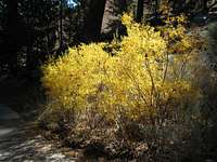 2007 Fall Colors in Buckhorn Campground
Red Tape
You will need an Adventure Pass or Golden Eagle Pass to park in the Buckhorn Campground day use area. These passes can be purchased ($5 per day or $30 for a yearly pass) at forest service visitor information stations located along SR2 or at major southern California sporting goods outlets.When to Visit
This trailhead can be accessed virtually year-round. During the winter, depending on the snow level, you may need 4-wheel drive or chains for your vehicle. Check forecast information in local newspapers or internet weather services during the winter months. Check with the California Department of Transportation (CALTRANS) (see link below) on road conditions and closures during the winter.Trailhead Amenities
The trailhead is located near the east end of a campground with 35 developed campsites. Currently, the sites are $12 per night. The campground is open April 1 through November 30.Other Information
USGS Topos Waterman Mountain 7.5 Juniper Hills 7.5Tom Harrison Angeles High Country Trail Map (1:63,360 scale)
San Gabriel Mtns. Recreation Topo Map (1:62,500 scale), Western Section
(Angeles National Forest and the Verdugo Mountains) by Fine Edge Productions
External Links
Angeles National ForestAdventure Pass information
California Dept. of Transportation