
-
 18421 Hits
-
 75.81% Score
-
 6 Votes
|
|
Trailhead |
|---|---|
|
|
Los Angeles |
|
|
Spring, Summer, Fall, Winter |
|
|
3000 ft / 914 m |
Overview: Where Grizzly Bears Once Roamed
Yes, there were Grizzly Bears in the San Gabriel front range up to the turn of the 20th century according to John Robinson (Trails of the Angeles). And they seemed to favor the Big Tujunga region where one of the trails from this trailhead will take you. The last verified Grizzly Bear was killed in 1916 in the lower Big Tujunga.From the trailhead, County designated fire road 2N79 climbs a slope overlooking the Arroyo Seco region to the southeast. Within half a mile, you will pass a water tank on your right and immediately encounter a junction. The fire road on your right goes towards Georges Gap Vista (right off Angeles Crest Highway) via the Hoyt Trail. An alternative is continue past the turnoff to Georges Gap on Grizzly Flat Road northeast dropping into the Clear Creek canyon bottom to emerge at the Clear Creek Fire Station near the Josephine Fire Road trailhead.
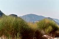
Back at the above junction, if you go left, another ¼ mile will bring you to a small saddle where the Big Tujunga Canyon area is first visible. Continue on the fire road, and about 2 miles from the start, you will come to another junction. Here, you are on the crest of the divide between the Arroyo Seco and Big Tujunga watersheds. If you continue straight ahead, the road proceeds west and then south to connect with the Mt. Lukens Fire Road (2N76). Mt. Lukens is about 3 and ½ miles northwest on the Lukens fire road.
 Mt. Lukens (5,074')
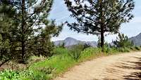 Mt. Lukens Fire Road with which the Grizzly Flat Fire Road connects
The other option at the junction/watershed divide is to take an unmarked road (there is a “No Fires” sign where the road begins) that goes west and then north to Grizzly Flat proper. You will drop about 400 feet to reach Grizzly Flat.
 Along fire road near Grizzly Flat, 9.01.07
Grizzly Flat is a conspicuous bench on the mountainside south of Big Tujunga and is cut abruptly on its east side by Vasquez Creek. There is a tree plantation here and there are good spots for camping.
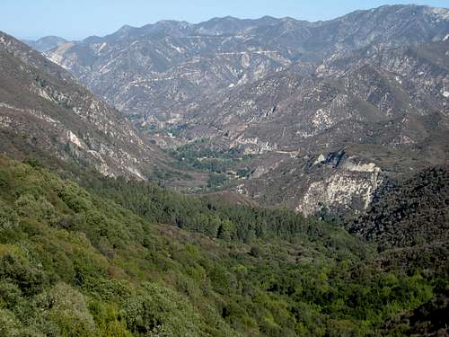 Grizzly Flat area seen from Grizzly Flat Rd. 9.01.07
At Grizzly Flat, the road ends and the Grizzly Flat Trail dropping into the Big Tujunga drainage begins.
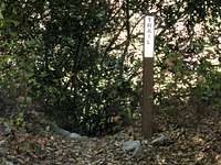 The beginning of Grizzly Flat Trail
This trail has a very remote feel to it and judging by its perennial overgrown nature, it is infrequently visited. The narrow trail proceeds northeast crossing a small creek, then down to Big Tujunga Creek, which you must ford, to end up near the Stonyvale Picnic Area and Vogel Flat Campground. It is about 3 miles from Grizzly Flat to the campgrounds on the trail. The bridge spanning Big Tujunga Creek in this area is a favorite spot for fishermen.
Driving Directions
From the 210 Freeway, exit at Angeles Crest Hwy (SR 2) and drive north for 6.3 miles. There is a large dirt parking area on the left side of SR2. The fire road begins on your left.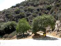 Grizzly Flat Trailhead 6.3 miles from La Canada
Red Tape
You will need an Adventure Pass to park your vehicle at this trailhead. There is no place along SR2 to this trailhead where you can purchase one so you will have to get one beforehand. They are sold at sporting goods stores ($5 per day and $30 for an annual pass).No permits are required for hiking any trails accessible from this trailhead.
When to Visit
The trailhead is, for the most part, accessible year-round. Rarely during winter will the snow level be low enough to put snow on SR2 and require chains to get to the trailhead.Other Information
Trailhead AmenitiesAbsolutely none. Just a dirt parking area by the highway with a sign and gate marking the start of the fire road.
Grizzly Flat Trail
The trail from Grizzly Flat into the Big Tujunga drainage is narrow, overgrown, and washed out in a few spots. It is apparent that it is one of the least frequented trails in the San Gabriel front range. Also be forewarned that poison oak abounds on this trail and particularly near its beginning, the plant has overgrown the trail. So wear long pants.
 Poison Oak plant grows high as well as low
Having said all that, however, this trail really gives you a feeling of remoteness as you drop into the Tujunga watershed.
As you get near Big Tujunga Creek, the trail can be difficult to follow crossing back and forth across the creek as it does.
Mountain Biking
Taking the Grizzly Flat Fire Road to the Lukens Fire Road is a great mountain bike route.
USGS Topos
Condor Peak 7.5
External Links
Angeles National ForestAdventure Pass information
California Dept. of Transportation