
-
 7400 Hits
-
 83.69% Score
-
 17 Votes
|
|
Mountain/Rock |
|---|---|
|
|
37.84750°N / 108.1256°W |
|
|
Dolores& San Miguel |
|
|
Hiking |
|
|
Spring, Summer, Fall, Winter |
|
|
12620 ft / 3847 m |
|
|
Overview
Dunn Peak is located in southwestern Colorado near the historic town of Telluride. It combines really well with two neighboring 13ers: Middle Peak and Dolores Peak. This part of San Juan Mountains is also called San Miguel Mountains. The main cluster of the San Miguel's is comprised of three 14,000 foot Peaks: Mount Wilson, El Diente and Wilson Peak, and one peak just under 14,000 feet, Gladstone Peak. Dolores, Middle and Dunn Peak are on the west side of San Miguels.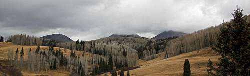
Dunn, Middle and Dolores Peak as seen from your drive in. Middle Peak and Dolores Peak summits are hiding in the clouds.
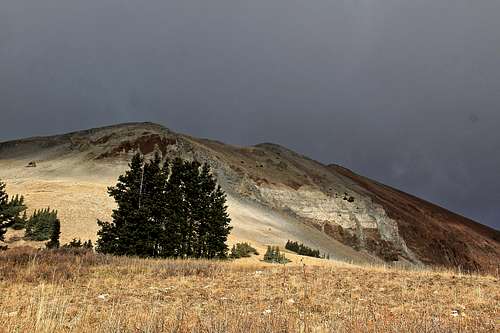
Is it a peak or a mountain? I noticed the The Guide to Colorado Mountains with Robert Ormes calls it a mountain once and second time calls it a peak, and all other sources, e.g. List of John, maps, and The San Juan Mountains with Robert Rosebrough call it a peak. I think it looks more like a mountain.
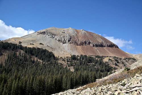
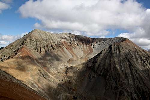
Dunn Peak as seen from below Middle Peak.
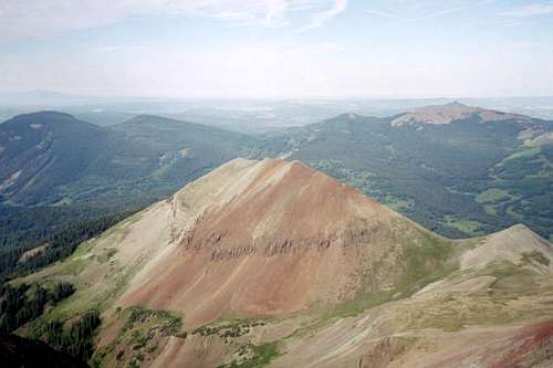
Looking down at Dunn Peak from the summit of Middle Peak
Colorado Rank: 915
Rise: 520 feet
Key Col: 12,120 feet
Isolation: 1.05 miles
Line Parent: Middle Peak
Wilderness: Lizard Head
Class: 2
The Guide to Colorado Mountains with Robert Ormers (sort of a bible of Colorado mountains) provides only a brief description: "For Dunn Mountain (12,595'), drive as for Lone Cone, but stay left on the Beaver Park Road at mile 2.8. At Beaver Park, continue right on FSR-611. In 3 miles, at the road fork, Dunn Peak's accessible south face is a 2 mile hike to the southeast. FSR - 611 continues 4 miles southwest to its high point on the San Miguel-Dolores River divide."
The San Juan Mountains with Robert Rosebrough gives some brief route description - see below in Route section.
Dunton Hot Springs - many years ago I bought a guide book to Colorado Hot Springs and was thinking about visiting these springs. When I saw the price, I could not believe it. Dunton hot springs are close to Dunn Peak, but the price is high, so I preferred soaking at home in my bathtub. It is a highly priced destination and expect to go way over 3000$ for a visit.
Getting There
From Highway CO 145 south of Telluride, drive over Lizard Head Pass and as you descend from the pass look for a road on your right (=west), Forest Service Rd. 535, sign says West Dolores River, Burro Bridge Campground and Dunton. Drive 9 miles on this road, pass the Killpacker Basin TH and TH for Navajo Basin. The road is a dirt road, but well passable for passenger cars. One mile before Dunton, turn on Forest Service Road 611. Drive about 5 miles on this road until it makes a sharp turn and crosses Fish Creek. Turn on a spur road leading to our trailhead and possibly also camping place. Camping is great here.Route
South Face - Robert Rosebrough mentions that south face is a grind over loose scree. The romp downhill is fun. I came from Fish Creek and ascended southeastern slopes trying to use as much tundra as I could. Higher up there are unavoidable sections of scree, but it was not very long. Once I reached the ridge, the walking was easy and the views of Middle Peak spectacular.North Ridge - Rosebrough describes that North Ridge is an easy snow climb in late spring or early summer. Once the snow is gone, the route is composed of small, but fairly stable scree. I descended this route and found it easy, nothing more that class 2. The views of West Ridge up Middle Peak from here are spectacular. Once at the saddle between Dunn Peak and Middle Peak, either continue onto the west ridge of Middle Peak, or descend down following a tiny creek back to the parking area at Fish Creek.
 SE slopes up Dunn Peak | 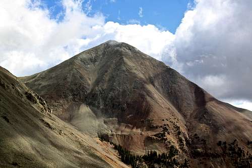 Dolores Peak from the slopes of Dunn Peak |
 Middle Peak as seen from the summit of Dunn Peak | 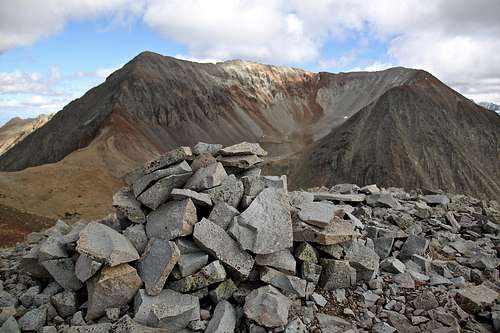 Summit of Dunn Peak with Middle Peak in the background |
 South Ridge Dunn Peak | 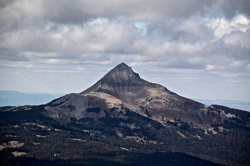 Lone Cone |
Red Tape
Driving to the trailhead, parking, primitive camping, and hiking are all free.Lizard Head Wilderness rules apply. The United States Congress designated the Lizard Head Wilderness in 1980 and it now has a total of 41,459 acres. It is prohibited to enter or be in the area with more than 15 people per group, with a maximum combination of people and stock not to exceed 25 per group. It is prohibited to build, maintain, or use campfire within 100 feet of any lake, stream of National Forest System Trail, above tree line, or within Navajo Basin. It is prohibited to posses a dog that is not under control, or that is disturbing or damaging wildlife, people, or property.