-
 9242 Hits
-
 93.81% Score
-
 44 Votes
|
|
Mountain/Rock |
|---|---|
|
|
45.79631°N / 7.11305°E |
|
|
Mountaineering |
|
|
9285 ft / 2830 m |
|
|
Overview

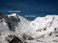
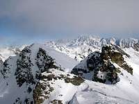
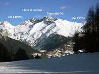
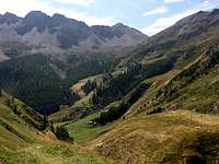
Testa Serena is a pyramid of scree and rock located on the watershed ridge, to the southeast of Colle di Serena (2.547m). It is an excellent point to enjoy vistas of the little-known surrounding valleys: Comba di Planaval to the west, the high hanging Valley of Bosses to the north, and Comba di Vertosan to the southeast.
First Ascents
- Unknown.
Getting There
BY CAR:- From Torino, Milano, etc: Motorway A5. Exit at Aosta Ovest.
- From Switzerland: through the Grand Saint Bernard Tunnel or the namesake pass. From France,through the Mont Blanc Tunnel or Petit Saint Bernard Pass: It is not necessary to take Motorway A5: you can drive on SS.26, in the direction of Aosta.
BY PLANE:
- Aeroporto "Corrado Gex" Saint Christophe (Aosta).
Another usual approach to this mountain, normally used in winter for the ski mountaneering route, starts from the Motorway of Gran San Bernardo (Italian side). Just before the toll gate you must follow (on the left side, coming from Aosta) the marks to Bosses and go along till you get Mottes - this is normally the starting point of an easy and safe ascent that, along gentle slopes, leads to the Col Serena, wherefrom you can get the summit without big efforts.
Route
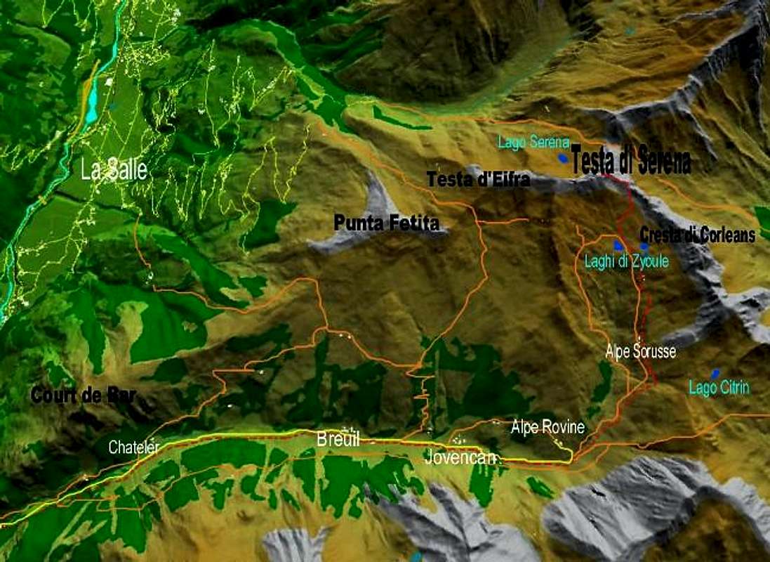
Campings
Remember that free camping is forbidden (except for emergency reasons, over 2.500m, from darkness until dawn).Mountain Condition
- Meteo: you can find all the needed informations at the official site of the Valle d'Aosta Region:
- Valle d'Aosta Meteo
Webcam
- WEBCAM on Aosta Valley:
- Webcam
Books and Maps
BOOKS:- "Guida dei Monti d'Italia-Alpi Pennine" (Vol. I°) di Gino Buscaini-Club Alpino Italiano/Turing Club Italiano, Luglio 1971 (in Italian).
- "80 itinerari di Escursionismo Alpinismo e Sci Alpinismo in Valle d'Aosta", di Osvaldo Cardellina, Ed. Musumeci, Giugno 1977 (in Italian); seconda Ed. Luglio 1981; terza Ed. Luglio 1984; (in French), prima Ed. Febbraio 1978; seconda Ed. Marzo 1980.
- Kompass "Monte Bianco Valle d'Aosta Sentieri e Rifugi" Carta turistica 1:50.000.
- I.G.C. Istituto Geografico Centrale "Carta dei sentieri e dei rifugi" 1:25.000.
- I.G.M. Istituto Geografico Militare 1:25.000.
Important Information
- REGIONE AUTONOMA VALLE D'AOSTA the official site.
- FONDAZIONE MONTAGNA SICURA Villa Cameron, località Villard de la Palud n° 1 Courmayeur (AO) Tel: 39 0165 897602 - Fax: 39 0165 897647.
- A.I.NE.VA. (Associazione Interregionale Neve e Valanghe).
Useful numbers
- Protezione Civile Valdostana località Aeroporto n° 7/A Saint Christophe (Ao) Tel. 0165-238222.
- Bollettino Valanghe Tel. 0165-776300.
- Bollettino Meteo Tel. 0165-44113.
- Unità Operativa di Soccorso Sanitario Tel. 118.
External Links
- Ski mountaneering route to Colle Serena The text is in Italian, but the enclosed photographic documentation is self-explanatory
- Ski mountaneering route to Colle Serena (2) A further description of the ski mountaneering route to Colle Serena by Ronfo : a set of photos with the related text in Italian
- Serena(Col): from Mottes - Valle Gran San Bernardo A set of photographic images from the site: www. gulliver.it


