-
 5247 Hits
-
 80.18% Score
-
 12 Votes
|
|
Mountain/Rock |
|---|---|
|
|
44.10649°N / 115.00098°W |
|
|
Hiking, Mountaineering, Trad Climbing, Mixed, Scrambling |
|
|
Summer, Fall |
|
|
10109 ft / 3081 m |
|
|
Overview
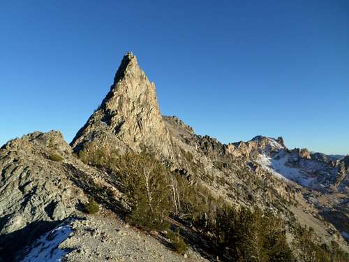
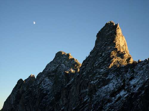
Located between Horstmann Peak and Mount Iowa in the northeastern part of the Sawtooth Range of Idaho, Fishhook Spire is an impressive technical tower situated on a rugged ridge. Per The Tom Lopez Idaho A Climbing Guide description, the original Fishhook Spire was located in the Baron Creek drainage and was named by Beckey and other early climbers because of it's shape like a fishhook. Because Fishhook Creek is in another area away from the Baron Creek drainage, the Beckey named Fishhook was changed to El Pima. The Iowa Mountaineers then dubbed the Fishhook Creek formation "Fishhook Spire", not for appearance but because of geographic location.
Getting There
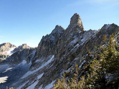
From the Redish Lake Backpacker parking area it is nearly 7 miles and 4350 feet of elevation gain to the summit, of which 4 miles and 3800 feet of elevation gain are off trail. From the end of the Fishhook Creek trail, cross country travel to the prominent saddle and small lake to the east of Horstmann Peak is required. From this small lake, follow the primary drainage to the south of Horstmann Peak and climb to the saddle between Fishhook Spire and Horstmann. Early season the east facing saddle is guarded with snow. From the saddle, the north ridge is seen and provides a blocky 5th class way to the summit (unverified). To reach the Southwest Route, navigate to the west and the base of the vertical rock. At a point where a gully heads up to the saddle between Mt Iowa and Fishhook Spire, find a prominent gully of mostly solid rock that leads up and between to towers on the ridge.
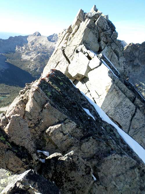
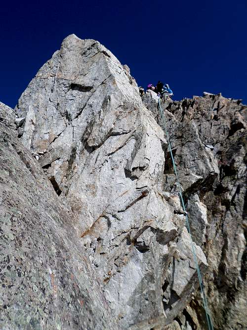
Route
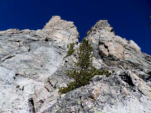
The Southwest Gully Route ascends a crack in a shallow gully for 200 feet of fairly sustained 5.5 climbing. The route was first climbed by R. Maynard and F. Chappel. From the top of the ridge traverse exposed rock to the high point. Snow or ice can cover the north sloping sections of the exposed summit ridge. To descend, two 80 meter rappels from the summit directly down the vertical west face gets you off.