It was December 2017 in the Cloud Peak Wilderness of the Big Horn mountains. John and I had just snowshoed many miles from before the trailhead in order to reach Cloud Peak. But it was cut short. Now we were on our way back. The peak would have to wait for when there was more time.
Trudging back through the snow to the vehicle was when we first discussed a Gannett Peak expedition through the heart of the Wind River Range. "Maybe some day" was the consensus. Then in 2019 came an unexpected surprise. A message from John popped up on my phone. It was an invite to join him and two others for a hike to Wyoming's high point at the very end of June, from June 29 to July 3. The idea was exciting, though I reluctantly said that maybe I would join. Then I knew my decision after calling the ranger station. The ranger had disclosed that Elkhart Park trailhead to Titcomb Basin was still largely snow-covered. I'd reached the foot of Bonney Pass from this direction a couple years prior, when the trail was completely dry, and that was hard enough. So as much as I wanted to join, I had to decline. The idea of snowshoeing for maybe 30 or more miles sounded too much like that time in the Bighorns. It also seemed that reaching Gannett Peak would be very unlikely in such conditions. John alone ended up making it atop an ice-covered Bonney Pass that year, but the rest of the crew had stayed behind in the basin.
Then came the spring of 2020. We now understood how much of a hindrance the snow could be. Mid-July became the planned time for another attempt at Gannett Peak. We kept an eye on the local conditions better by making more phone calls to the Pinedale Ranger District and by keeping tabs on online sources such as Pinedale's local outdoor shop that provided trail conditions online. Snow melt by early July was clearing the way for a hike into Titcomb Basin.
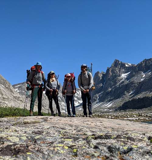
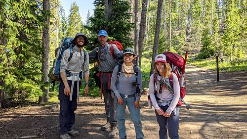
Unfortunately, of John's 2019 group, only he and Gen could make this trip. I contacted a friend of mine, Ceci, who'd never visited the Winds. She was all about joining us. And so it was. John, Gen, Ceci, and I would embark on a rugged journey toward the middle of the continent come July.
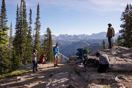
Special Gear
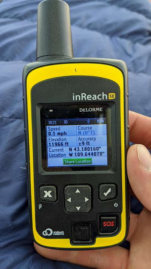
We'd only take two cooking elements--Jet Boils that John and Gen would carry. I'd leave my MSR Pocket Rocket behind. We'd each bring helmets and harnesses, seven pounds of rope and some ice pickets. We were sure to have six days of food in case we went longer than the expected five days back there. Another special concern was water bladders since camping below the peak somewhere at the foot of the mountain was the plan. We'd take a total of three bladders--two 4-liter bladders and one that was a 6-liter. These bladders were mostly precautionary in case camp below Gannett was waterless. In terms of filtration, John managed to borrow a special water filter--an MSR Guardian--and I'd bring along a Sawyer mini as a backup, plus the infamous potable water tablets. In the event that the group had to split up for whatever reason, we'd have two Garmin DeLormes with the InReach communications capabilities. Also, we all had numerous bug sprays and head nets since we knew mosquitos could be relentless this time of year in the Winds. We also knew that some of these more special items might be unnecessary, but we decided to bring them along just in case.
Other Precautions
Lastly, we considered possible setbacks due to health issues. Everyone was very healthy, but we did have two concerns that we'd have to keep in mind. First, Ceci was going to be coming from sea level, so we knew that altitude-related illness was possible. Second, John had been having some back issues a week prior to when we had planned to start hiking. He had gotten better, though his confidence in himself had yet to fully return.
We met at a hotel in Pinedale on the evening July 14.
Day 1 - July 15
Trailbound at Dawn
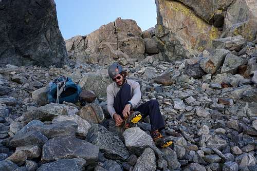
Obo's is a quaint general store in Pinedale with a nice deli. At 05:00 we arrived there to get some of the delectable breakfast sandwiches we'd heard about. A group of workers made it there first though. The stagnant line of people and the silence of the place brought out our impatience quickly. We settled for some coffees and pre-made sandwiches and muffins. Then we went up the winding road to the Elkhart Park trailhead. The sky was clear and it was cool out.
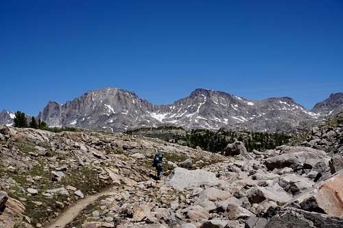
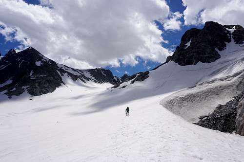
At approximately 06:00 via the Elkhart Park/Pole Creek Trailhead we began the 15-mile route to the Titcomb Basin with 50- to 75-Liter packs varying in weight from roughly 45 pounds to 60 pounds. We took breaks every 30 to 45 minutes or so. We took a longer break at the well known Photographer's Point. It was one of the last nicely shaded areas that we'd have to take advantage of. The mosquitos were swarming there more than anywhere else so far. We met a nomad who'd been traveling the country. He wore a mosquito net while we depended on our bug spray and swatting hands.
Beyond the Canopy
By late morning it was hot beneath the cloudless sky. We were glad to find shaded places to rest just off the trail when we could. After Seneca Lake that became harder to do. The sun beamed down on all things beneath it. At the same time, extraordinary views became more and more present.
It was good to see everyone doing well.
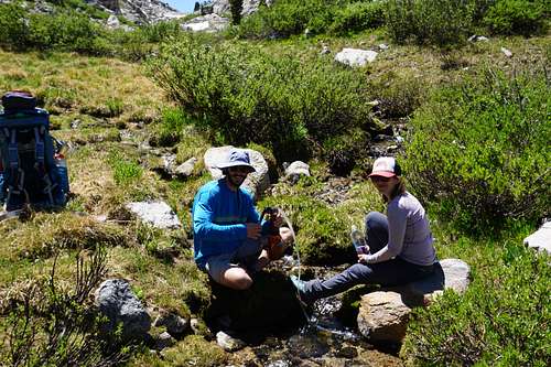
The special water pump definitely managed to fill up one liter per minute of filtered water from the various streams and lakes we encountered. As a comparison, the mini Sawyer seems to filter a liter in approximately 5 minutes. We were surely fortunate given the mosquitos, though some may argue, and rightly so, that taking longer to fill up water allows for a better rest along the way.
John stayed mostly out front, though he and Gen switched off occasionally. I held the rear most of the time. An incessant tiny jingling sound was up ahead. Gen's bear bell, I remembered. The Wind River Range is known as grizzly bear territory, but I betted John that we'd never see one. He'd owe $5 if he would have agreed to the bet. Still, the bear spray was constantly ready. Tensions would ease though once we got to the Titcomb basin--it's arguable whether anyone has ever actually seen a bear in Titcomb Basin. The large numbers of people in this area were undoubtedly the biggest deterrents.
John asked Gen about her knees at mile 10 or so. She'd begun to feel some pain from, as she'd figure later, too much beer and not enough training during quarantine. We continued on.
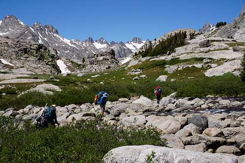
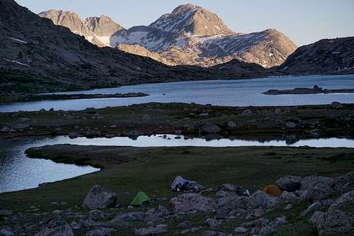
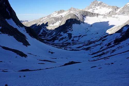
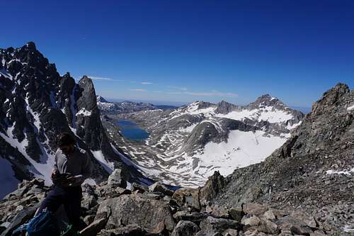
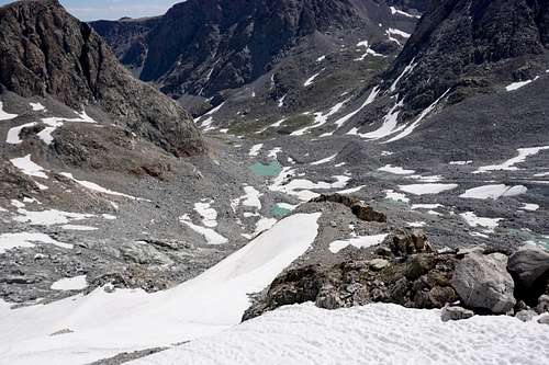
Titcomb Basin - Base Camp
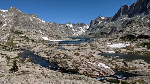
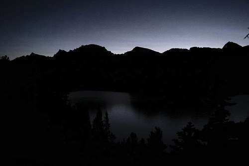
We all seemed equally grateful to reach the camping spot. It was a perfect meadow between the upper and lower Titcomb lakes that had a rushing stream on its east side. Though this required a stream crossing to get to and from the main trail, we weren't going to complain. One of the best traits of this camp was that it happened to allow for barefoot walking, and even walking with socks on. The soil was somehow that dry while the ground was somehow that soft. Of course we had the world-class views as well.
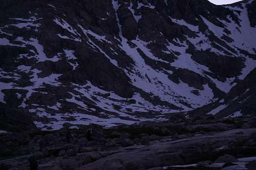
Looking south over the lower Titcomb lake near dusk
View to north while at camp in Titcomb Basin - courtesy John
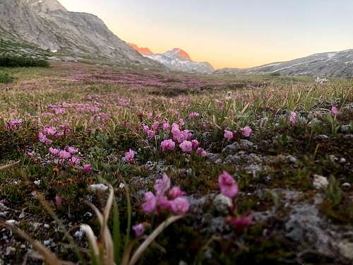
Sunset in the basin allowed for some stellar photos. One particular stood out to me that Ceci got on the first evening of the adventure.
Patch of flowers in the Titcomb Basin of the Wind River Range at sunset - courtesy of Ceci
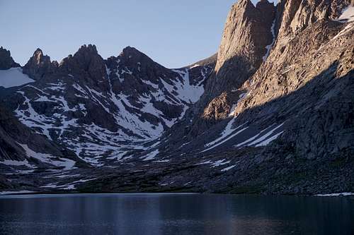
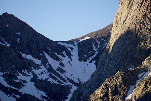
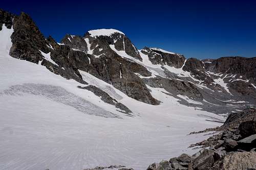
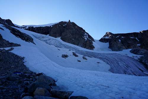
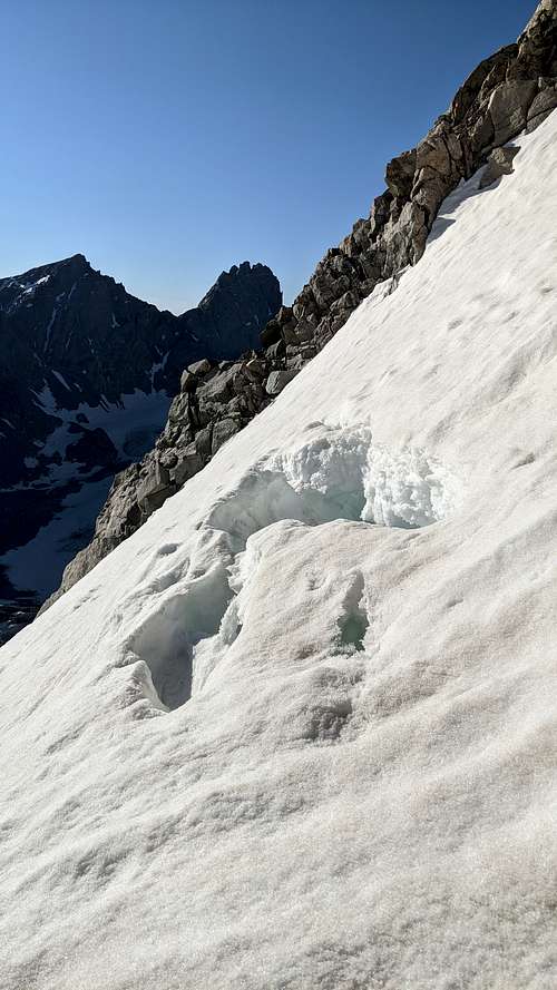
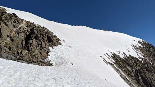
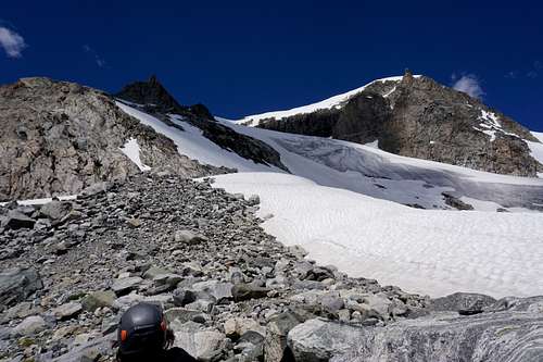
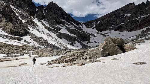
In 2017 when I'd ventured into this area, I didn't really grasp what stood between Gannett Peak and Titcomb basin. I had simply turned back after snapping a quick picture of the basin's back end. This time was different though. Approximately 2.5 miles from camp was when the slope began to require crampons and an ice axe. From afar it appeared vertical. We were counting on it seeming more and more navigable the closer we got--a blessing the mountains seem to often give after a climber has put in a solid effort. John was reassuring as well. The fact that he'd reached the top a year prior was encouraging, though he made it clear that it wouldn't be easy.
Bonney Pass as seen from the south on south side of upper Titcomb lake.
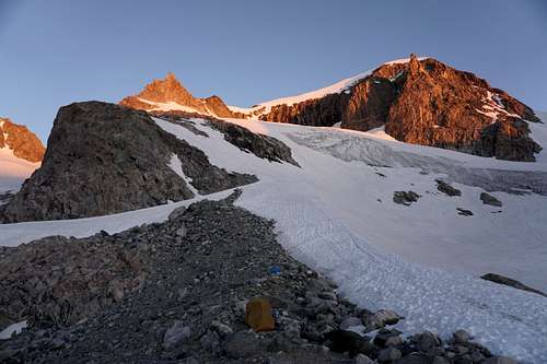
The more daunting-looking upper south face of Bonney Pass
"We're going to have to go up that?" Ceci asked after we set up our camp. The previous year Gen had declined to go any farther when getting uncomfortable toward the middle of the pass. It was the exposure that had bothered her more than anything, John said. The plan was to use ice pickets in case anyone became too uncomfortable with the slope.
We then discovered that Ceci had been struggling to breathe right since the beginning. She had stuck with those hard miles all the way to camp while quietly suffering. It then seemed unlikely that she would make it over the pass.
We began discussing plans in the event that she or anyone else wanted to hang back and return to camp if ascending seemed too overwhelming. John encouraged Ceci to at least give it a shot. In my mind it seemed highly likely that she would not go, however. She emphasized how she would surely enjoy her time at and around camp if she did stay.
At approximately 21:00 we settled in for the night. The temperature was perfect, and the mosquitos weren't around, most likely due to the light breeze that was drifting through the basin. With stars speckled across this remote stretch of Wyoming sky, we all drifted off to sleep.
Day 2 - July 16
Heading to Bonney Pass
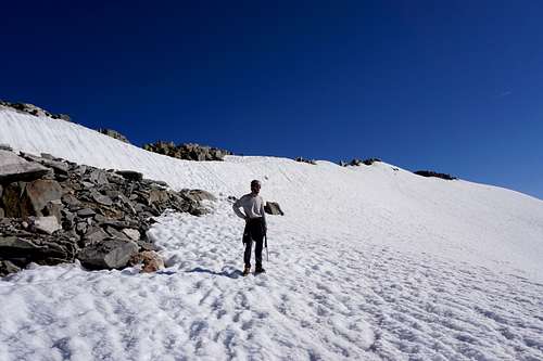
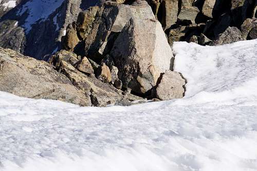
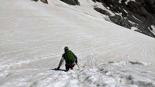
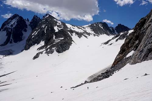
04:00 came early. And Ceci and I had come from the Pacific time zone, so it was 03:00 according to our bodies. We aimed to reach the pass before it became soft and slushy under the summer sun. Movement in the other tents quickly became audible. The terrain turned from lush greenery and soft, moist ground to hard slopes of snow with some streams, visible and invisible, running beneath it. We all put our crampons on after Ceci slipped and started sliding toward a hole in the snow that had water rushing beneath it.
After another 10 minutes or so, the terrain completely hardened to snow with rocks jutting out from beneath it in places here and there. The contour was similar to a contact lens that was placed concave side up. We were heading up toward the northern edge. Though the two-and-a-half miles had not been particularly difficult, Ceci was too breathless to want to continue on. John showed her how to operate the DeLorme Garmin InReach device, and we then agreed to exchange communications at 19:00 that evening. I was immediately sad that Ceci would be staying behind alone.
"I'll watch you guys from down here," Ceci said to us.
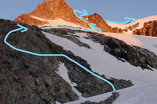
The team heading toward the south face of Bonney Pass near dawn
We continued on.
Bonney Pass in Ernest
Soon enough we were on a continually steepening slope below the pass. Where it finally leveled out was high above at just more than 13,000 feet. Gen, John and I kept climbing. I looked down and Ceci was a tiny spec now. About a quarter way up the slope, John and Gen encouraged me to proceed while they took it a little more slowly as Gen began to doubt her abilities. I was wondering how she would fair on the ascent if her knee was still hurting. And how was John's back doing? I found myself crawling up the slope until about the halfway point before fatigue set in. The pack was heavy, but oxygen intake seemed most problematic. Luckily the snow was solid, providing a secure hold when I hammered in the pick end of the ice axe. Every so many feet I'd find a large enough rock that served as a ledge to rest on in sitting position while facing toward Titcomb Basin.
John and Gen down below to the left on south side of Bonney Pass
Just next to me was my ice axe stabbed into the snow, which I could grab if need be. After three or four more breaks, I turned to look down the slope. John and Gen had been in one spot for perhaps 10 minutes now. I came to the resolution then that if they both were having problems and wanted to turn back, that I'd just get to the top of the pass and come back down. John then peered around the corner of where they'd been sitting. "Gen's turning around," he yelled up to me. I nodded. It was disappointing to hear that, but I felt a sense of relief that that both her and Ceci would have company.
While I watched Gen heading back down, John started climbing toward me. I continued to rest. I was struggling more now. The seven pounds of rope and about eight liters of water were only a portion of what I was carrying. John's pack was similarly heavy, though he'd get the rope at some point per our agreement. Continuing, I quickly slowed again. John had now reached me as I had moved toward the rocks on the northeastern side of the slope. We both stopped to rest. John explained that the ice pickets and rope were simply too much for Gen to want to deal with.
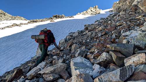
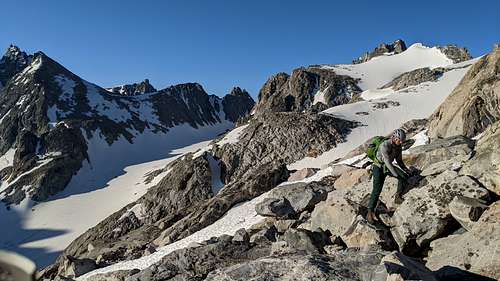
An observer would have been able to easily see that we were crampon shy since we decided to scramble up the east side of the pass on some scree that was almost too loose to climb safely. Whoever led up the 40-yard stretch had to make sure the other wasn't too close to where rocks might start tumbling. When the section ended, we had to cross one more stretch of snow.
The slope of Bonney Pass seemed to go on and on forever. John and I scrambled for part of it.
One might say that we were fatiguing enough at this point such that instead of wisely crossing over to the west side of the pass where the slope seemed shallower, we stayed on the right. We frankly weren't comfortable with lateral movement across the grade. Consequently, we met a much steeper section of snow, seemingly a 55-to-60-degree slope versus 45 degrees (what the other side of the pass there seemed to be). The instance demonstrated how important it is to trust the tools, which were primarily the crampons and ice axe. Without enough experience, it's too easy to get psyched out while in the midst of this kind of exposure.
Finally we were almost on solid ground again. John led the way toward the rocks, just in time for one of his crampons to come off during one of his last few steps. It was a valuable lesson to put as much muscle as possible into securing our crampons before any kind of traverse.
Resting at the top of Bonney Pass was a big relief. John seemed to be doing well, and though I still felt lightheaded, the views around us were surreal.
Descent to Dinwoody Glacier
Though John had reached this point last year, this was my first time peering across the Dinwoody glacier to see Gannett Peak's summit ridge in the distance. It looked formidable, perhaps impossible, from where we stood. It caused some doubts, but we nonetheless relented to our desire to explore what was ahead.
Then it dawned on me that I'd left my sunglasses in the tent during the morning rush to get out of camp. A sense of defeat briefly washed over me. I would go all the way back so I didn't get snow blind like Messner had coming off of Everest. Then a perfect excuse to continue on flashed through my mind as brightly as the snow shone under a summer sun: If worse came to worse I could put one of the semi-translucent handkerchiefs over my eyes as we went.
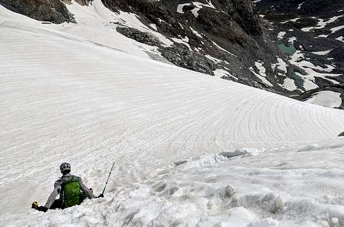
One can take two very different ways up and down the glacier side of Bonney Pass. The most popular is on the snow. The slope is perhaps not as steep as the Titcomb side of the pass, and it's probably only half as long before it shallows out. The other way is through the rock piles that are between the top of the pass and the Dinwoody glacier. It's arguably much more work to take the route down the rocks. Sometimes ignorance is not bliss, as became our case.
Carefully pivoting and stepping down over rocks that you fear may tumble your way can get very tiring. We never recorded how long this traverse took, but it seemed to take an hour or so. With the little sleep and heavy packs, we finally managed to reach the foot of this section. The Dinwoody glacier lay in front of us. We rested for a few minutes and then we started off again.
Crossing the Dinwoody Glacier
It quickly became a windless, sun-baked mile or two.
We were almost to the Gannett's southeastern scree field that we'd chosen as our next objective. I slowed while John trudged onward at a more steady clip. He was almost to the rocks. Whenever I'd look up from the glacier, I saw weird shades of pink on the snow-covered mountaintops. A feeling of dizziness and nausea set in. I couldn't tell if it was from the brightness or the altitude or the heat, or if it was something else. John was now up there taking his crampons off 40 or 50 yards ahead. I stopped and took some deep breaths.
"You okay?" he asked.
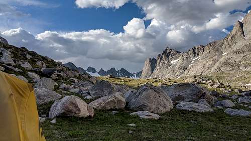
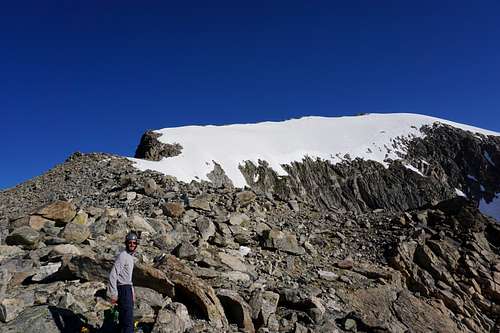
After informing him of my condition, I trudged through the last steps to finally get off the snow. We took a break and I downed a couple energy gummies. After five minutes I felt a little better and we began our ascent up a scree field. We both hoped to find a reprieve up there. We slowly weaved our way. Upon cresting this edge of the top of the foot of the mountain, we felt relief to see a number of camp areas there. Each had a circular wind wall that people had built with the mountain's smaller rocks.
Advanced Camp below Gooseneck Pinnacle
We set up camp, and John said he was going to rest for a little while since he wasn't feeling great. He was now a little nauseated too, and his back was bothering him some.
The mountains behind John's tent made for an epic scene.
I got my tent up. More nausea came as I shifted around to organize things better. Dizzy feelings were coming and going. Soon enough I was laying down too. It was breezy, though still plenty hot. Looking up toward the summit ridge produced feelings of wonder and anxiety. The sky was a uniform blue while the snow across the mountain was nearly blinding.
The layout of the mountain seemed easy if not for the worrisome bergschrund. As many mountain enthusiasts know, bergschrunds are a a topic of much concern with Gannett and other mountains. The earlier in the season, the more in-tact the snow bridge will be. It melts away slowly during the summer months, and then it mostly disappears, exposing the gaping crevase that is the top edge of the glacier and the bottom of the snow slope above. It certainly had to be unlikely that either of us would fall through, I thought as I rested there.
In the meantime John had typed up a message for the girls so they could know our status and so we could check theirs. Then he reported to friends and family that we were all safe and in two groups now. He also received a weather report that the next day would be partly cloudy with 0% chance of thunderstorms, with gusts of wind up to 44 miles per hour.
One of the two DeLormes we were fortunate enough to borrow for status updates and emergencies
30 minutes seemed to pass. Then John appeared at my tent. We were both feeling a little better.
I got up, and we stood there looking at what we were facing. John inspected a screenshot of a route to the summit that he'd saved on his phone. "It looks like he went that way over the gooseneck glacier." Just as he said that, I looked up and realized how the Gooseneck glacier must've gotten its name.
Evening came and it became cooler out. The sky turned a deeper blue. We were both nervous at the thought of climbing this territory that we had not dealt with before. I thought of my mom's words of warning that the peak was reportedly one of the most difficult to reach in the United States. It had indeed been hard so far. We gazed up toward the darkening mountain. If either of us were more out of shape, I was thinking, we would be sitting back in Titcomb Basin right now.
We discussed the bergschrund more and what condition we thought it would be in by 06:00 or 07:00 in the morning. The earlier we started, the better. Sunshine would hit the highest slopes of the mountain first.
It cooled more. The time was 21:30 or so. The wind began to pick up, and we retired to our tents for the night. Then a couple Tylenol and a Benadryl, and earplugs. The night quieted as I drifted off to sleep.
Day 3 - July 17 - Summit Day
Sleeping In
At 04:30 our alarms went off. I wondered what John was thinking. Sitting up and peering through the clear part of the tent, I didn't see any movement where he was. I unzipped my door and leaned back while still in a daze there in the twilight. Then John appeared.
"Hey man."
"How are you feeling," I asked.
"I feel OK. My back's bugging me a little bit and I didn't sleep very much. I'm thinking we give it another hour."
After another hour or so, and after some breakfast and packing up and placing our packs in a spot away from the campsites, we were ready with a small 45-Liter pack that we'd share to carry mainly our crampons, snacks and four liters of water.
Gooseneck Pinnacle to the Bergschrund
Then we began scrambling up the 100-foot section south of the Gooseneck to avoid the snow slope just to the right of it. A fall down that could make for a "Quick sentence," as John put it.
From our tents we crossed the rock field and then a narrow strip of snow. Now we were where the mountain steepened and where climbing in earnest would begin. As we had done with Bonney Pass, we focused on climbing the rocks as much as we could. John led the way as the more experienced technical climber. He made the climb up to the level below the "Pinnacle" quite a bit easier than I did. But the climbing was enjoyable to both of us nonetheless.
By the time we reached the bergschrund, we realized that dawn for Gannett Peak is earlier than dawn for the rest of Wyoming. It stands so tall and so due east that sun beamed onto it much sooner than one might think.
John and I both looked into the decaying areas of the bergschrund. It already seemed to be softening in the morning sun. Over the most heavily trafficked section, two piercing dark holes were visible at the bottom of two separate boot prints that climbers had collectively made recently. The snow bridge we were on seemed no thicker than a foot. Neither John or I brought the rope. We'd have to chance it, but we'd do so quickly. We also both had height to our advantages, so if we fell through, we'd be closer to the opening than the average person. That thinking was probably more to rationalize continuing on than anything else though. Still, it was uncomfortable thinking of collapsing through the bridge as I went and then John went. Before we knew it though, we were up above it. Perhaps 50 more feet of slope remained before we were at more rocks to scramble. This section of snow slope above the bergschrund seemed slightly less steep than the steepest section of Bonney Pass.
Above the Berg and across the Summit Ridge
The next rocky section was a nice reprieve from what we'd just traversed. Despite us each worrying that the angle of the summit ridge might be too steep to stomach, we pressed onward. It seemed that we soon enough only had a few hundred more yards to go prior to reaching the peak.
John led a ways as we got closer and closer to the ridgeline.
Traversing the snow slope near Gannett's summit ridge
We each had some doubts that the remaining stretch of snow would be forgiving, but our hopes remained high enough. We took to the summit ridge. John was growing more nervous. I knew the slope to our east had to look daunting as it fell steeply away from the mountaintop we were on. My focus was on exactly where I was taking every step while remaining prepared to fall to my left for a self-arrest if needed.
Some areas were soft near some of the rocks that lined the ridge on the way to the summit. We stepped into a few knee-deep patches of snow that luckily brought no harm. This was somewhat of a knife-edge type of ridge section. Then the slope widened. A larger section of rocks were standing slightly higher than where we were.
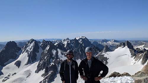
And we were there on Gannett Peak, approximately two-and-a-half hours after starting.
At The Top of Wyoming
Five minutes later, another couple of guys showed up. They were kind enough to take our pictures before hurrying back down the mountain.
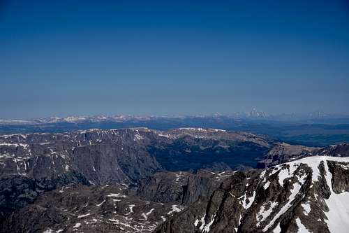
Visibility was immaculate as we looked in all directions. The Grand Teton was even visible 60 miles or so to the northwest.
We were high up above Bonney Pass by approximately 1000' as well.
While we snacked on the summit, I realized that we weren't alone. An American pika quickly scurried among the rocks as it watched us.
After taking in the views for 5 more minutes or so, we saw more groups coming up the mountain. By the end of the day, we calculated that 14 people, including us, had summitted. Either way we wanted to get down before we were contending with too much slushy snow, particularly when descending Bonney Pass into Titcomb Basin.
Getting Down
We of course snapped more pictures on the way down, and we decided that I'd again cross the bergschrund first since I had perhaps 40 more pounds of body weight than John. Just before crossing, I sprawled out like a star and gravity slid me the rest of the way over the hidden crevasse without incident. John took similar measures, and we were soon toward the bottom of the mountain while thinking of the remaining journey ahead.
Now we had our work cut out for us. We took about 15 minutes to refill water from the tiny Sawyer mini that I'd brought along. Then a breeze started blowing steadily. It was gaining strength too. We got onto the Dinwoody Glacier to return up Bonney Pass. John took off ahead while I remained a ways back to take some pictures. Some of the clouds had an intimidating look, as if they might rain down on us at any time.
The Dinwoody Beneath Threatening Skies
As the angle changed, the weight of our packs continued to challenge us. John was moving more quickly than I was, but we were still each taking breaks every so many steps. I began counting. 30 steps; stop; 5 to 10 deep breaths; 30 more steps; stop, etc. Then the southernly breeze turned into wind gusts of 40 to 50 miles per hour. Clouds were quickly crossing the sky, heading northeast as we were in the middle of the glacier. Some of the clouds began to look like cumulonimbus clouds that could generate rain at least. Then came the largest one we'd yet to see. It was ominous and dark. John turned to me and pointed at it. I shook my head. We were both a little worried of getting struck by lightning, and so we put the pedal down as much as we could to reach the rocks at the base of Bonney Pass's north side. We both agreed that it was safest to set the crampons aside while lightning seemed possible. The rocks seemed to offer us more protection than what laying down on an open snow field could do.
A little rain came just after we'd settled onto the rocks to remove the crampons. Then for a minute we noticed sleet. Then the precipitation was gone completely after a couple more minutes. But the sky still seemed to be roiling. Another group had been heading toward us from Gannett. They appeared as a small speck on the vastness of the Dinwoody Glacier:
Two barely-visible adventurers crossing the Dinwoody glacier to reach Bonney Pass after summitting Gannett Peak
The toil of another Bonney Pass
John quickly wished he'd stayed in crampons.
"I'm regretting this already," he said.
"You can always put 'em back on, but I'm staying on the rocks."
I began having the same issue I'd had coming up the other side of the pass. It was taking all the energy I had to move upward. I wouldn't have thought that John's training at 14,000' was much different than mine at 10,000' to 11,000', but it seemed that I was mistaken. John and I remained within sight of each other, but I was moving like a turtle or a tree sloth over the scramble. I took a five-minute break to down some snacks in hopes that some energy returned. A group of two that we'd seen on the mountain was already passing me on the snow slope that they'd decided to stay on. A big group of six that we'd seen while coming down the mountain was next. They had just gotten down from Gannett Peak, but they were approaching quickly, and I was getting irritated at the idea that they'd catch up with me despite the fact that they were hardly carrying anything. I carefully kept scrambling around the rocks while John waited, perched in a spot some 200 vertical feet above. I was reminded of a time in the Rubies when bighorn sheep were staring at me from above as I hiked up toward them. The wind had become unforgiving, but it was the mountains. A couple times I had to right myself after almost being toppled by two particular sudden gusts that seemed to have a speed of near 50 or 60 miles per hour.
In the end I barely beat the group of six up the mountainside. John and I geared up and we chatted with the group as they prepared as well for the descent. We led the way down to start. As you might imagine though, they were quickly ahead of us. I encouraged John not to wait up for me, but he remained perhaps no more than 100 feet away the whole time. The snow was slushy. Despite other people's boot prints, and despite my very best efforts at heel plunging straight down the snow, it was still difficult getting stable footing with the heavy pack and with legs that felt completely out of gas.
"Just use the tracks that are already there," John called up to me. But it wasn't that easy. Soon enough I figured out that glissading was my best, safest option instead of collapsing. My legs were at their limit. With the ice axe in the right hand and the trekking pole in the left, I sat down and started sliding. I was next to John before I knew it. It felt good to be sitting and sliding down the now annoying slope.
Down below, the other group was near the bottom of the pass. We actually saw perhaps four or five of them fall down in that area. We figured that it could've been intentional falling to practice self-arrest techniques, or the snow was just that slushy now. Nonetheless, we continued to take our time until the slope leveled out.
Back to Basin
It was a nice feeling to be back near camp in the Titcomb Basin, but we still had a couple miles to go. And for me it had become a true slog. I encouraged John to keep going because I needed more of a break. He was hungry while I was spent. It was somewhere around this time that my ice axe slipped off my pack, never to be seen again (by me, at least).
The last two miles dragged on for both of us, but we eventually got back to camp to tell stories of the adventure. It was good to hear that Gen and Ceci had been enjoying themselves for the most part--Ceci had continued to suffer the effects of mild altitude sickness, but her and Gen had enjoyed being schedule-free in such a beautiful place versus the waking up at dawn that John and I had kept subjecting ourselves to.
That evening we discussed plans for the following morning. We decided to move no more than five miles, perhaps to one of the Seneca lakes, and to set up camp there. That would give us plenty of time to enjoy the hike out on Sunday, and we'd have a nice buffer for relaxation on Monday before heading back to work.
Day 4 - July 18
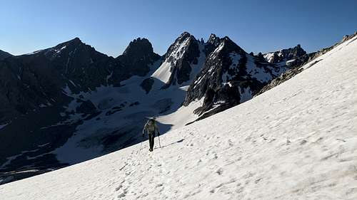
Titcomb Basin to Seneca Lakes
We all seemed to sleep decently, and after breakfast we took a selfy in the basin.
We decided to depart via the western side of the lower lake, which had no trail. We looked at it as a refreshing detour away from the most beaten path that went along the east side of the basin. Though I did worry that we'd end up regretting it, we only saw a minor delay when we had to take some time to find a stream crossing. And John got one of the best photos of what we were leaving behind for another time.
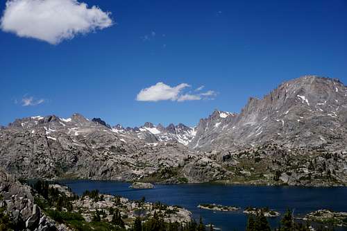
After the crossing, we were on the trail and making good time to our lunch spot at Island Lake. A nice breeze came off the lake as we enjoyed some snacks and cold water. Afterward we traversed more of the territory's rolling terrain, which led to another amazing view.
Wind River Range above Island Lake looking north
Right after leaving the basin and making a small descent, Ceci reported that she was feeling better. She didn't want to lose her acclimatization by returning home at sea level, but she hadn't found a home in the mountains yet. Gen's knee felt better, and John and I were welcoming the less strenuous hiking with every step.
But as is the case with much of life, trade-offs were inevitable. The farther we got away from the Titcomb Basin meant more standing water and less wind, and therefore more mosquitos. We would stop for water or some quick pictures, and they would come, albeit mostly repelled by our DEET-covered skin and clothes. Still, they were relentless. After about six miles had passed, we arrived at our next camp just off the main trail that overlooked the massive Seneca Lake. It was still plenty warm out, and Ceci and I took a dip and filled up water down at the lake. John and Gen sat on a breezy ledge up near camp as John took out the DeLorme to issue the nightly status report. Part of it read "Mosquitos in plague proportions." We were all glad to put the tents up and find refuge within at 21:00 or so.
With the fly off of the tent, Ceci counted 17 blood-thirsty mosquitos resting up above before the air turned cool and coaxed them back to their nests. It became dark, and the sky was a sight to see.
It became the stillest of evenings. I couldn't sleep until well after midnight.
Day 5 - July 19
Continued Mosquito Mayhem at Seneca and Beyond
We awoke at 04:30 or so to beat the heat and the bugs that would come with it. The horizon above Seneca Lake was one to remember as the sky grew a brighter blue. The ladies had slept well while John had stayed up worrying about bear. He'd thought he heard something in the night too. And he had. It had been a rodent chewing up one of his trekking pole's handles.
A Wind River horizon at dawn while preparing for the final nine miles out
All packed up, we were going to boil some water to get a last dehydrated meal in our stomachs. But the mosquitos had ostensibly learned that we were out and about. With the JetBoil idea quickly becoming breakfast bars to go, we fled the scene with probably hundreds of the tiny blood suckers in hot pursuit.
Once we reached the canopy where the mountains were less visible, the awe of the Wind Rivers had disapated some. But we still had good opportunities to catch glimpses of them while crossing the numerous meadows during the last several miles.
Through one particular wooded section of the trail I inhaled a couple of mosquitos. The second one had me gagging and feeling forced to don the mosquito net. We trotted onward while I'd occasionally feel the tickle of that last mosquito in my throat. I'd stop and give into the gag reflex some more before continuing on.
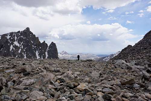
We averaged approximately 2.5 miles per hour, and by no later than 10:00 on Sunday we were back at our vehicles in a very full parking lot. It was hot out, and we'd hardly stopped in nine miles. Though we were ready to get back to the busy world that we all knew so well, we weren't. To have had a couple more days to explore around the Titcomb Basin would've been prime, I thought. At least the mountains would remain there for all of time as we know it.
Perhaps next go-round would be the Glacier Trail route, we agreed. That way everyone could at least see Gannett Peak. Or maybe everyone would get the experience needed to do Bonney Pass. We'd simply have to see, just like with anything. Another year would mean another adventure, one that would perhaps be a continuation of this, where the rugged saga continues to be written, deep in the heart of the Wind River Range.
Parents refers to a larger category under which an object falls. For example, theAconcagua mountain page has the 'Aconcagua Group' and the 'Seven Summits' asparents and is a parent itself to many routes, photos, and Trip Reports.


Comments
Post a Comment