Atop Wyoming's Tallest
On my first trip to the Wind River Range, a few things stood out to me. I was surprised by the vast amount of people using the trail system out of the Elkhart Park trail into the Titcomb Basin area, the sheer amount of named pinnacles and mountains in the Gannett area, and the fact that there was a paved road all the way to the trailhead at nearly 10,000 feet. Additionally, there were so many lakes and smoothed granite outcroppings on the approach hike, it was reminiscent of the area north of Yosemite, particularly the Carson - Iceberg Wilderness region. The work of glaciers was so prevalent in not only the smoothing and lakes, but also in the Erratics: lone boulders left behind in strange and
interesting spots. Some of these 2-ton boulders were perfectly on top of
smaller rocks, clearly the beautiful work of nature.
We headed out from the Boise, Idaho region
and made our way over toward Pinedale, WY. To my surprise, the Wind River Range
is not much further from our area than the Tetons. I've been climbing the
Tetons for years, but given the wilderness restrictions, backcountry crowds, and
the tourist trap money pit known as Jackson Hole it's good to discover an
alternative climbing area in Wyoming. The town of Pinedale, just outside
of the Winds has a distinct cowboy feel to it. It was larger than I envisioned, but not completely over-run with National Park visitors. We followed the
paved road to the Elkhart Park Trailhead above Fremont Lake and slept at the
trailhead. For those traveling from lower elevations this would be a good acclimatization
strategy. During the middle of the night a loud thunderstorm with downpour
rolled through the area. At least one lightning strike was on the nearby
ridgeline. This would be the last of any chance of precipitation for our
trip.We met our friends and headed out onto
the trail. My pack felt particularly heavy with several days of food and
climbing gear in it. I've been used to lightweight climbing packs and long day
assaults on 2 or 3 day peaks. Gannett would be different though, and for a
change it was good to have a few backcountry "luxuries" and actually
camp in the backcountry. The trail starts out forested with a few open
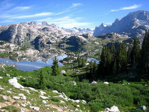
meadows with the first area of note being the Photographer's Point area.
Near here, we got our first views of the Gannett area and surrounding 13,000
foot peaks. Past Barbara Lake, Hobbs Lake, Sapphire Lake we reached the
impressively large Seneca Lake and rested on one of the many small rock
"chairs". The mosquitoes weren't too bad yet at this point and
as we snaked around Little Seneca Lake. We were entering the realm
of "beyond day hikers" as the nature of the terrain was a series
of ups and downs over small passes and into beautiful lake basins.From
a random sampling of conversations, it was apparent that the area attracts not
only Gannett climbers, but also general backpackers, fisherman, day hikers,
trail runners, and those utilizing the pack animals. One way to get your
equipment to the backcountry is to hire a mule team to carry it while you hike
in with a lightweight pack. We passed Mt. Lester, a peak that dominates
the view to the south from the Titcomb Basin. Another gorgeous lake in
Island Lake is one of the last before the Titcomb Basin is reached. The
decision was made to camp in lower Titcomb instead of upper Titcomb so that
there would be a slightly longer summit day with a lighter pack rather than
going the full 17.5 miles with the big pack. Still, 15 miles with this
weight was a good day.
![Glacier Travel on Gannett]()
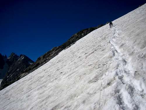
The next morning we woke around 2am and got a good start on
the summit bid. Once the base of Bonney Pass was reached, we put on the
cramp-ons and stepped our way to the pass. The slope is mellow and in July
you can utilize the snow the whole way. At Bonney Pass we had our first
views of Gannett as the sun came up. The northwest side of Bonney Pass was
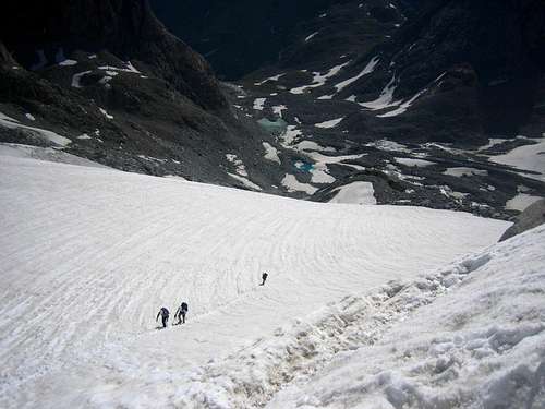
half snow, half scree as we descended onto the Dinwoody Glacier. The
glacier was in great shape and mostly closed up so we trudged ahead un-roped at
our own paces. The slopes leading to the Gooseneck Glacier presented no
difficulty and the steepest part was at the bergshrund about 300 feet beneath
the Gooseneck Pinnacle and ridgeline. There was a short 6 foot section of
almost vertical snow followed by a steep snow slope above, but the steps were
perfect as we gained the ridgeline. The ridgeline snaked north, then east
to the summit ridge. A few exposed, but very safe areas led to the summit
at a cluster of rocks where an enormous summit canister contained a summit
log. The views were particularly impressive down the north side of the
peak and the Tetons were visible in the distance. The descent presented
only one problem and that was above the bergshrund where rap anchors can be
utilized. The webbing is set up so that a double rope rappel will take you
past the steepest parts. This section is also down climbable for those
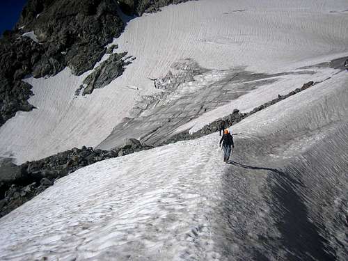
comfortable with this during optimal snow conditions. We reached the camp
late that afternoon at a very relaxed pace and hiked out the next day.
![Approaching Titcomb basin]()


Comments
Post a Comment