MikeLJ - Oct 23, 2018 1:09 am - Voted 10/10
Great tripHi Brenda,
Looks like a great trip.
I visited the Wind River Mts back in 2002 and everything looks good there.
Mike
|
|
Trip Report |
|---|---|
|
|
43.18452°N / 109.65407°W |
|
|
Aug 12, 2018 |
|
|
Mountaineering, Trad Climbing |
|
|
Summer |
A successful summit was attained with patience, endurance, and a big set of cajones. It took us four days, including a well-received rest day. We planned for five days. Began August 9 and ended on the 13th. Overall, the route was enjoyable with the exception of the crux pitch midway through Wells Creek. This proved to be a significant obstacle with heavy packs. Our essential gear setup was as follows: 4-season tent, 60m twin ropes, crampons, mountain axes, barebones rock rack (cams .5 - 1 handful of nuts, and tricams red to black), Petzl microtraxion, belay devices, helmets, water filter, etc.
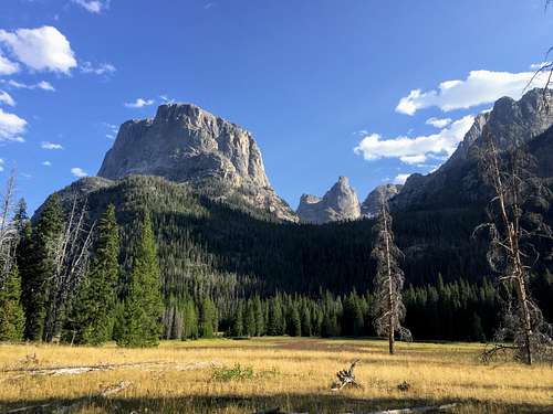
We began late in the afternoon the at the Green River trailhead. We coasted for 12 miles across beautiful and flat terrain to the point where we left the trail to make camp at the base of Wells Creek canyon, past Tourist Creek. Had no problem finding a place to camp despite arriving in the dark. We hid some wine in a Yeti bottle in the river. This would come in handy later :)
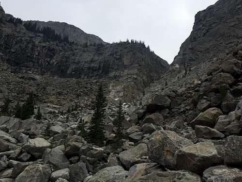
Wells Creek was the crux of the trip for our 3-person party. We woke up at around 9AM and got going by 10. I was pretty chipper that morning. I was thinking it would be a shorter day since the mileage to our camp at Scott Lake was low. Sure, it was gonna be steep and difficult terrain, but I was excited to see what the wild Winds had to offer. The canyon begins in a forest that I found enjoyable to hike through despite being pretty steep. It was nice and shady. We stayed high until the trees began to thin and the boulder-hopping began. It was hard but not nearly as bad as I was imagining. Especially since there were lots of wild raspberries growing in the mid-section of the boulder field! Oh yeah!
We reached the crux of the route, the Cleft, at around 2-3:00 PM. The water was still plenty high, no chance of crossing the river for us.
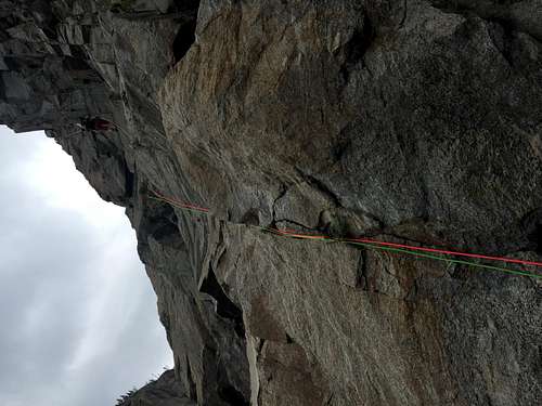
I underestimated the difficulty of the Cleft, particularly with 40-pound packs and hiking boots. It's rated a 5.6, but it's a little on the sandbagged side. One of our team members got a little excited and began scrambling up the pitch right off the bat. We had been planning on roping up for this section, and he was carrying the second twin rope. This was frustrating. He scrambled a little way up and found a fixed rope. He stopped at this point, using the fixed rope to aid him. and Nate got on the sharp end of the rope while I belayed at the base of the pitch. Nate led excellently despite the difficulty, his backpack and gear were swinging back and forth as he made his way up to a barely two-person belay ledge on the right. I followed. It was difficult with the pack and I ended up using the fixed rope to brute force my way up to Nate. The rope had a big, ugly, core-shot! Not fun to see.
We climbed up further, over the rest of the steepest section, and into the next part of the cleft: a series of narrow ledges that are easier in difficulty (no-fall 4th to easy 5th) but still very exposed with plenty of loose rock. It took a while to get all three of us up the steep pitch. I had plenty of time to mull over the shifting boulders under my ass as well as the complete absence of anchors that I had. Tensions were high. Cuyler dropped his belay device (didn't help) but besides that, we made it out without incident. I'll end this section with a very succinct quote from Nate:
"Haha it was bullshit"
- Nate, on leading the Cleft pitch
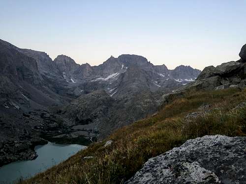
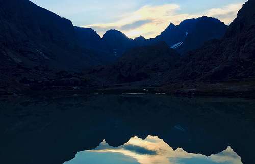
We rested at a small stream and ate some Starbursts. Cuyler and Nate scouted a short distance ahead to find a large boulder blocking our way up the river. It seemed possible to get up, but it was sketchy at best and we felt a little turned off to more excitement. On the descent, we found that the boulder was passable, but would have involved some interesting waterfall scrambling. Instead of going up the rest of the drainage, we cut straight upward and then traversed over in hopes of being able to come down on the less steep, far west side of Scott Lake. It was a safe, but very steep climb. We gained an unplanned 800ft as a result of that, but were able to navigate safely down to our campsite. We arrived after 9PM. What a goddamn day! I was exhausted. We were able to get a beautiful view of the west side of Gannett, though!
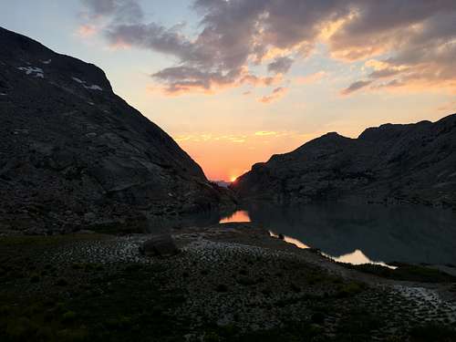
Since we had given ourselves an allotment of time for weather and rest, we opted to take a rest day instead of going straight for the summit. This gave us a full day to sun on the rocks, nap among the wildflowers, and take in some views and plenty of calories. This was the first proper rest day I've ever done, and it was worth it. It made our summit day much easier physically and mentally, and Nate did some scouting up the moraines. Very much worth the time, especially in such a beautiful area.
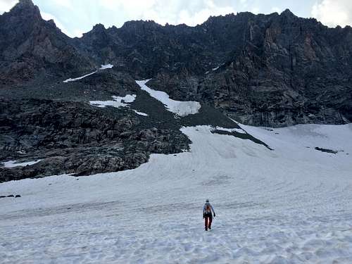
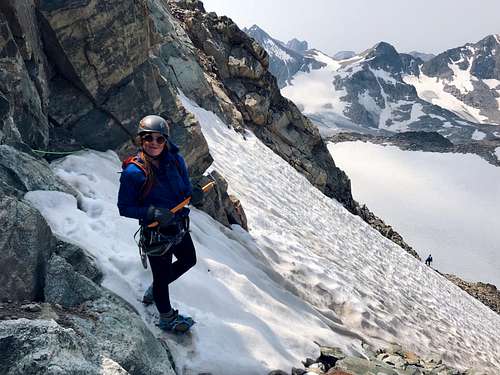
We woke up and left camp at 5AM. We ascended the first moraine up to an unnamed lake, then cut right up the second moraine. Going left leads to a tarn that's closer to the base of the mountain as the crow flies, but it is brutally steep. Right is a little more gradual, and it spits you out onto the Minor glacier sooner, which makes for considerably easier going than the rolly talus slopes. We were planning on climbing the short couloir to the left in the picture, but after a short discussion, we decided to go up the wider tongue of snow on the right, traverse a short way over rock, and cross the couloir at the top. We had heard rockfall that morning, so going that way shortened the amount of time we were exposed to the huge talus slope directly above the couloir.
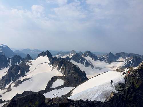
We crossed the couloir and headed up the talus slope uneventfully. The rock seemed more solid on the right side of the slope as opposed to the center or left. We reached the saddle and climbed up a steep, but unexposed 4th class section and walked along the ridge to the summit! We summited at 10AM sharp. There were a couple other groups that had come up the eastern side. We ate some snacks, called our mothers, and headed down.
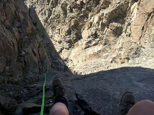
We discussed taking Tourist Creek up and out instead of dealing with the Cleft again, which would require getting up another 1000ft or so pass, getting down unknown terrain, and backtracking 2-3 miles to our basecamp site (I forgot to mention, we stored extra food in bear bags down there as well). Nate convinced me getting down wouldn't be as bad as getting up, and he was right. We left the valley at around 8:00 AM the next morning, rappelled off the large boulder, and down the cleft. The rock there was still loose in most places we set up. We left a few pieces of gear and slings at the top of the steep section, but the rope didn't catch and the rock didn't fall. Success in my book! Removed old webbing around some very loose rock as well. After leaving the narrow canyon, we hiked all the way down Well's Creek and back to our basecamp. Our wine was waiting for us in the river.
We hiked out from there and made it back to the car, then drove the long drive back home.
All in all, it was a good trip. I learned a lot about myself and what it's like to work with a team. It was a great test of my physical, mental, and social abilities. Wells Creek may be best done later in the season, as the river in early August was uncrossable and I really wouldn't recommend doing the Cleft with heavy packs unless your team is strong and experienced. A loop going up Tourist Creek and down Wells Creek seems like it may be a good way to skip over the difficulty of getting up the Cleft.
Hi Brenda,
Looks like a great trip.
I visited the Wind River Mts back in 2002 and everything looks good there.
Mike
Comments
Post a Comment