The Wind River Mountains are one of the finest outdoor destinations in the West, with Gannett Peak standing as its tallest peak. During a Cascade climbing trip in 2008, Dave proposed this idea of using GPS waypoints he had gathered over past trips to make a spring attempt on Gannett Peak. The additional snowpack mileage gave us a projected distance of 48 round trip miles.
.
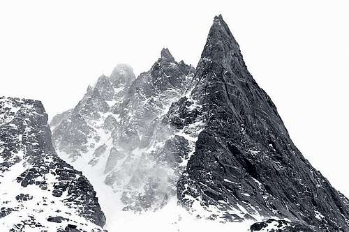
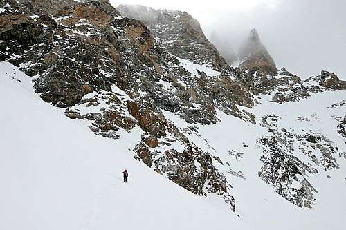
![Gannett from Bonney]() Gannett Peak, Wind River Mountains, Wyoming (photo: SawtoothSean).
Gannett Peak, Wind River Mountains, Wyoming (photo: SawtoothSean).DAY 1: SLC to Photographers Point
With work, family, school and other responsibilities, we had to plan the trip far in advance. Of course, weather is always the variable in such situations, but the forecast called for two stormy days at the beginning of our trip, with better weather during our intended summit day. With anticipation and optimism we took off at 7:00 a.m. from Salt Lake City and made it to the trailhead about noon.
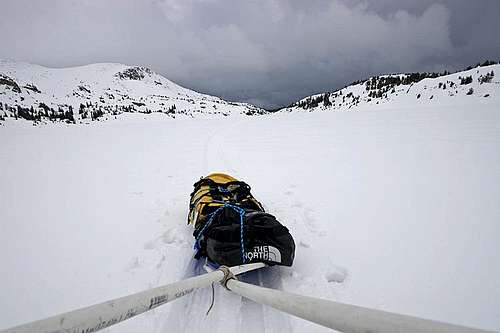
The road to Elkhart Park is only plowed within 4 miles of the official trailhead. To our relief, local trucks had beat the first mile of road into solid, stable ruts. But after that progress, our truck began to high-center, so we left good enough alone, parked the car, and began our hike. Each of us hauled between 80-100 pounds of gear, carrying the majority of it in our sleds.
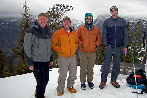
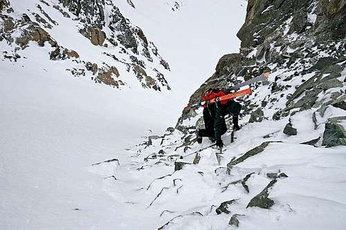
![Gannett Peak Ski Tour, May 2009]() Dave, Matt, Levi and Ben.
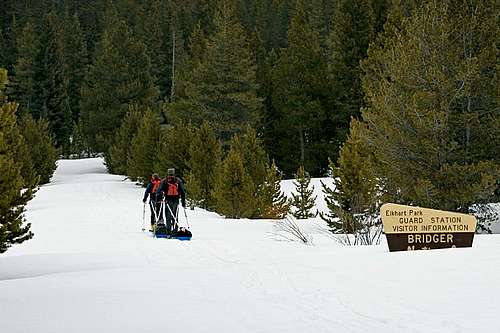
Dave, Matt, Levi and Ben.![Gannett Peak Ski Tour, May 2009]() Skiing through Elkhart Park.
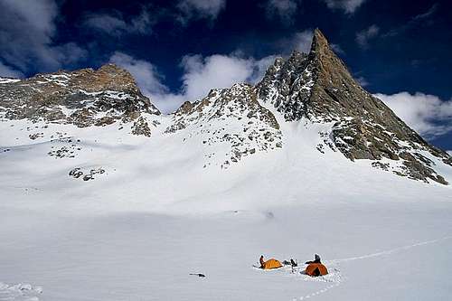
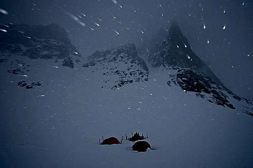
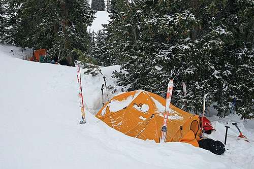
Skiing through Elkhart Park.![Gannett Peak Ski Tour, May 2009]() Camp 1 near Photographers Point.
Camp 1 near Photographers Point.DAY 2: Photographers Point to Little Seneca Lake
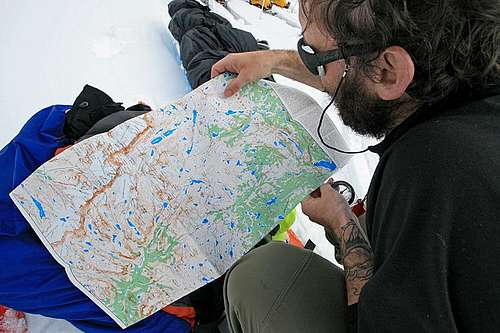
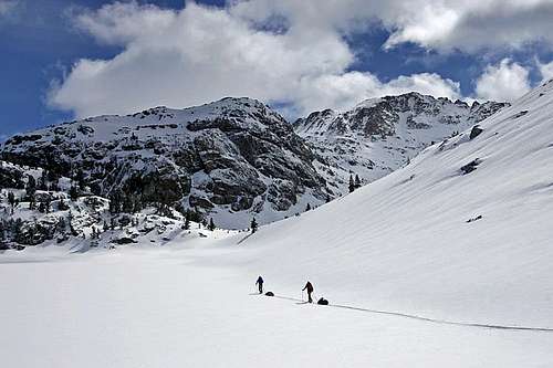
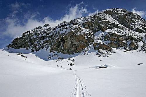
We made about 6 miles our first halfday, and had worked out the nuances of our sleds and pullcords. We had a nice trail to follow from other ski parties, but an overnight snow storm dropped six inches of snow and covered all remaining evidence of their path. We resorted to our GPS waypoints, maps, and compasses to navigate the trickiest part of the trail from Photographers Point to Seneca Lake. On paper the route is obvious, but in the environment of thick forest, undulating hills, and multiple lakes, proper orientation and choosing the most efficient path of travel can be tough. Our progress was slower than we would have liked, but we made it to the north shoreline of Seneca Lake by dusk. We set up Camp 2 just in time for another snow storm.
![Gannett Peak Ski Tour, May 2009]() The joy of navigation. "Where exactly are we?"
The joy of navigation. "Where exactly are we?"![Gannett Peak Ski Tour, May 2009]() Crossing Seneca Lake.
Crossing Seneca Lake.![Gannett Peak Ski Tour, May 2009]() Camp 2 between Seneca Lake and Little Seneca Lake.
Camp 2 between Seneca Lake and Little Seneca Lake.DAY 3: Little Seneca Lake to Titcomb Basin
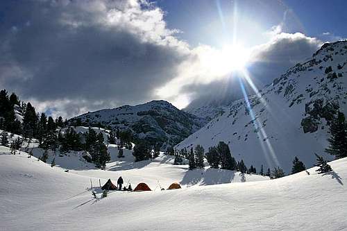
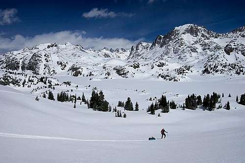
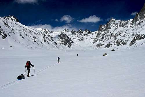
The weather forecast called for two days of storms, then clearing weather. We crossed our fingers that Day 3 would bring the sunshine and blue skies we anticipated. We were particularly excited because today we would be entering Titcomb Basin, with its stunning scenery. The fine weather and open terrain made for easy travel and we sailed up to the top of Titcomb Basin by mid-afternoon. I'm definitely using the word "sailed" too liberally because we were all dead by the time we stopped for camp. The last two miles was a test of wills and counting footsteps.
![Gannett Peak Ski Tour, May 2009]() Bluebird morning near Little Seneca Lake.
Bluebird morning near Little Seneca Lake.![Gannett Peak Ski Tour, May 2009]() Crossing Little Seneca Lake.
Crossing Little Seneca Lake.![Gannett Peak Ski Tour, May 2009]() Along Indian Pass Trail.
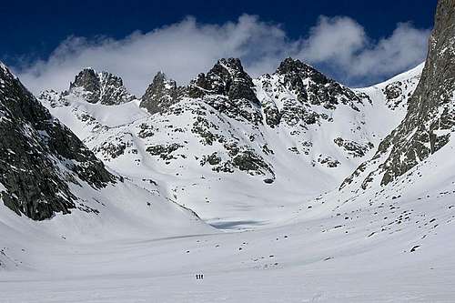
Along Indian Pass Trail.![Gannett Peak Ski Tour, May 2009]() The stunning spectacle of Island Lake and Titcomb Basin.
The stunning spectacle of Island Lake and Titcomb Basin.![Gannett Peak Ski Tour, May 2009]() Crossing Titcomb Lakes.
Crossing Titcomb Lakes.![Gannett Peak Ski Tour, May 2009]() Awesome perspective (three skiers near the bottom middle).
Awesome perspective (three skiers near the bottom middle).![Gannett Peak Ski Tour, May 2009]() Traveling upper Titcomb Basin.
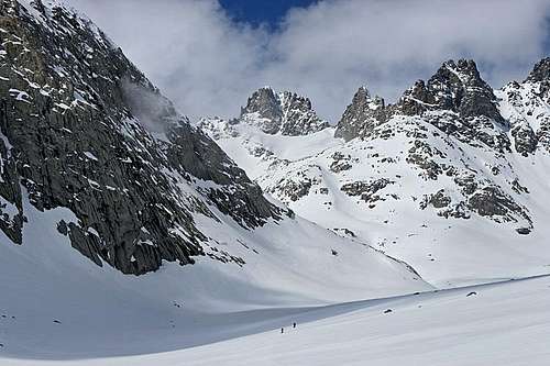
Traveling upper Titcomb Basin.![Gannett Peak Ski Tour, May 2009]() Another shot of upper Titcomb Basin.
Another shot of upper Titcomb Basin.![Gannett Peak Ski Tour, May 2009]() Looking down Titcomb Basin.
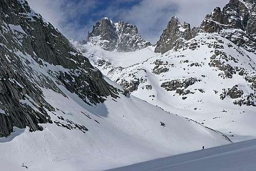
Looking down Titcomb Basin.![Gannett Peak Ski Tour, May 2009]() Camp 3 at the base of Mount Helen near Bonney Pass.
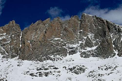
Camp 3 at the base of Mount Helen near Bonney Pass.![Gannett Peak Ski Tour, May 2009]() Mount Sacajawea to Fremont Peak.
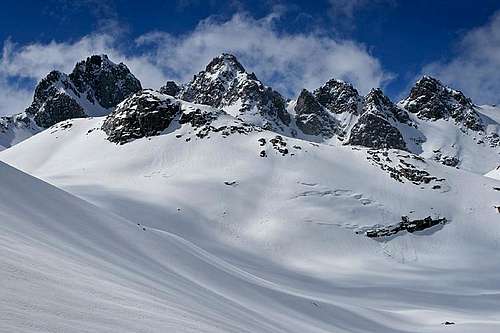
Mount Sacajawea to Fremont Peak.![Gannett Peak Ski Tour, May 2009]() Peak 12,205
Peak 12,205![Gannett Peak Ski Tour, May 2009]() American Legion Peak, Winifred Peak, and Twin Peaks.
American Legion Peak, Winifred Peak, and Twin Peaks.DAY 4: Storm Day
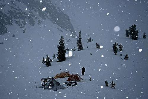
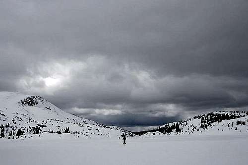
As we cooked dinner we listened to the local NWS forecast over our radio. The forecast called for sunny morning skies, with unsettled weather in the afternoon. "Perfect," we thought, "let's wake up early, catch the morning weather window, and summit Gannett Peak!" Unfortunately, all of our pent up enthusiasm was squashed the next morning when we looked outside the tent. We held out hope until 10:00 a.m. (which we felt was our latest possible hour to make a summit bid), but ended up using the "storm day" we had planned into our schedule. Our continued NWS forecasts gave us the wonderful confirmation that the skies were sunny everywhere but the high Wind River Mountains, and the remainder of our trip didn't look much better. All we needed was one more decent morning, but it appeared our weather window was shutting.
![Gannett Peak Ski Tour, May 2009]() Where are the sunny skies?
Where are the sunny skies?![Gannett Peak Ski Tour, May 2009]() Slighty better conditions in the late afternoon.
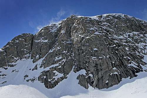
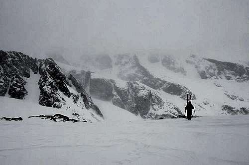
Slighty better conditions in the late afternoon.![Gannett Peak Ski Tour, May 2009]() Mount Helen.
Mount Helen.DAY 5: Summit Day
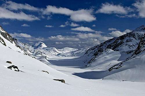
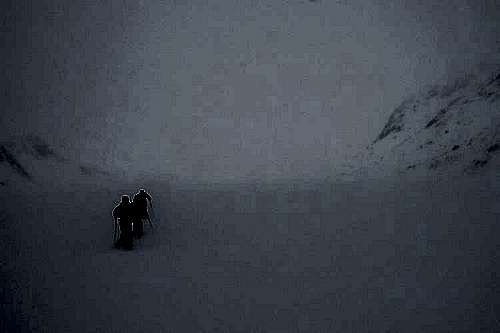
With no more "storm days" built into our schedule, Day 5 was summit day...no matter what. The morning was cloudy, but pleasant, and we felt we could make it if the weather held steady. Yet by the time we hit the top of Bonney Pass, a new wave of ferocious weather was gaining strength. At the top of Bonney Pass we could see Gannet Peak being swallowed in a white-out, and we knew the correct decision was "Go home and live to climb again." The decision was very disappointing after all that hard work, but brutal 70mph winds wouldn't allow us to deliberate long, either continue along the Dinwoody Glacier or descend now, there was no time to spare. Without forehand knowledge of the summit cornice structures and avalanche observations, we just couldn't commit in low visibility and high winds.
![Gannett Peak Ski Tour, May 2009]() Pleasant conditions in the early morning.
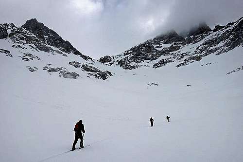
Pleasant conditions in the early morning.![Gannett Peak Ski Tour, May 2009]() Ascending Bonney Pass.
Ascending Bonney Pass.![Gannett Peak Ski Tour, May 2009]() The upper pass was a solid slope of ice, so we scrambled up the rocks. We were too lazy to get out the crampons.
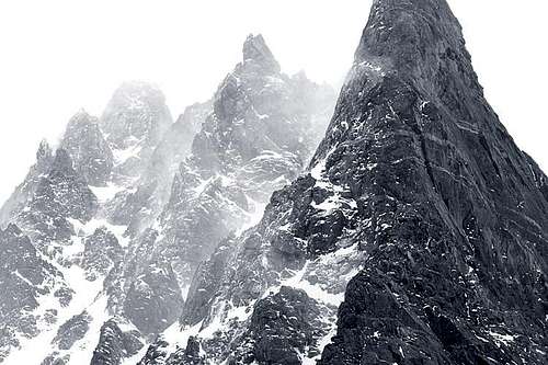
The upper pass was a solid slope of ice, so we scrambled up the rocks. We were too lazy to get out the crampons.![Gannett Peak Ski Tour, May 2009]() Gannett Peak.
Gannett Peak.![Gannett Peak Ski Tour, May 2009]() This is the same view 10 minutes later. Brutal winds.
This is the same view 10 minutes later. Brutal winds.
We descended back to camp with the storm intensifying. We could waste the day in our tents, then break camp the next morning, but instead decided to get on with it and broke camp in the blizzard. We pressed on to Island Lake where we could use the trees as a shelter from the wind.
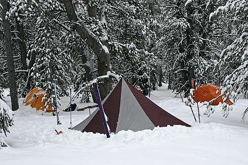
![Gannett Peak Ski Tour, May 2009]() Breaking camp.
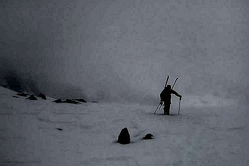
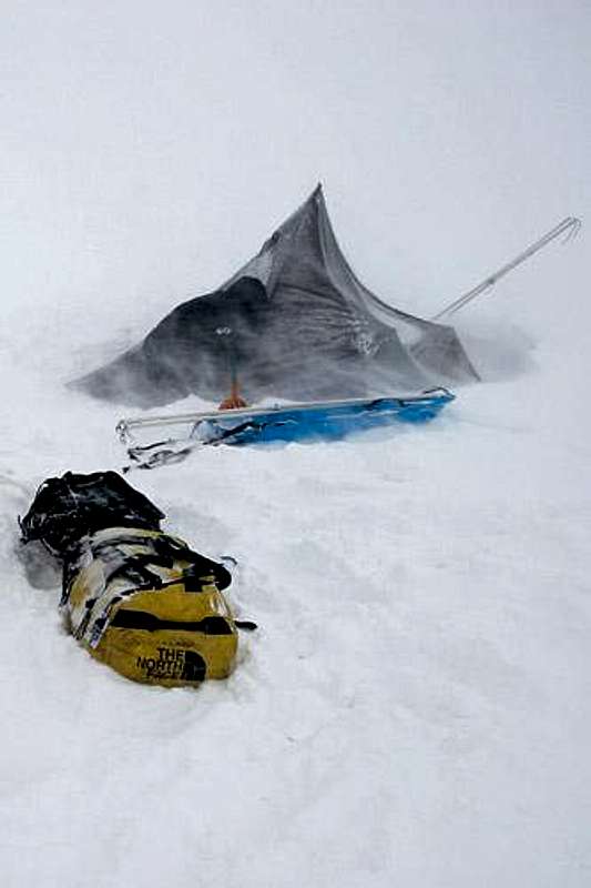
Breaking camp.![Gannett Peak Ski Tour, May 2009]() Crossing Titcomb Basin in a wild storm. Winds were head-on. Gusts were so strong we would be pushed over or slide backwards on our skis.
Crossing Titcomb Basin in a wild storm. Winds were head-on. Gusts were so strong we would be pushed over or slide backwards on our skis.![Gannett Peak Ski Tour, May 2009]() Camp 4 at Island Lake.
Camp 4 at Island Lake.DAY 6: Island Lake to SLC
The next morning at Island Lake just was just as stormy as the one before, giving us some validation that we had made the right decision to descend. Still, we couldn't help but imagine what adventure and scenery was waiting beyond Bonney Pass. Our plan was to get back to Photographers Point, then make for the trailhead on Day 7. Yet by the time we made it to Photographers Point, it was early afternoon and we were feeling good. We opted to finish the battle and get home. We made it to the car at sunset, totally exhausted. My saving grace the last few miles was imaging the monster burger I was going to eat in Pinedale. We hit the diner 15 minutes before closing. I think I would have wept like a child had I not gotten that burger! Afterward, we hit the road, promising lively conversation to keep the driver awake. We made it home safely at 2:00 a.m. Here's to next year!
![Gannett Peak Ski Tour, May 2009]() Crossing Seneca Lake.
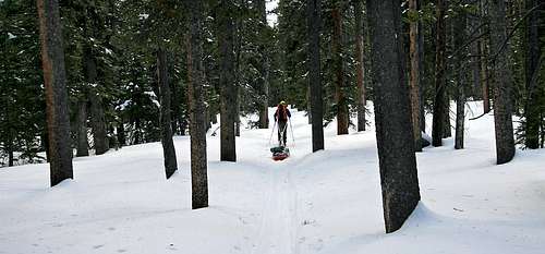
Crossing Seneca Lake.![Gannett Peak Ski Tour, May 2009]() Endless miles of forest.
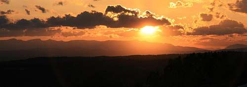
Endless miles of forest.![Gannett Peak Ski Tour, May 2009]() Reaching the car at sunset.
Reaching the car at sunset. 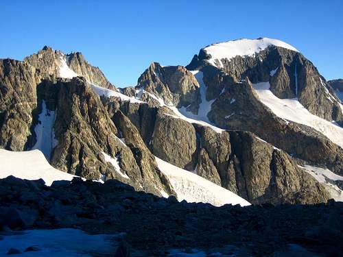


Comments
Post a Comment