
-
 6638 Hits
-
 86.85% Score
-
 23 Votes
|
|
Mountain/Rock |
|---|---|
|
|
36.42476°N / 116.84288°W |
|
|
Inyo |
|
|
Hiking, Scrambling, Canyoneering |
|
|
Spring, Fall, Winter |
|
|
510 ft / 155 m |
|
|
Overview
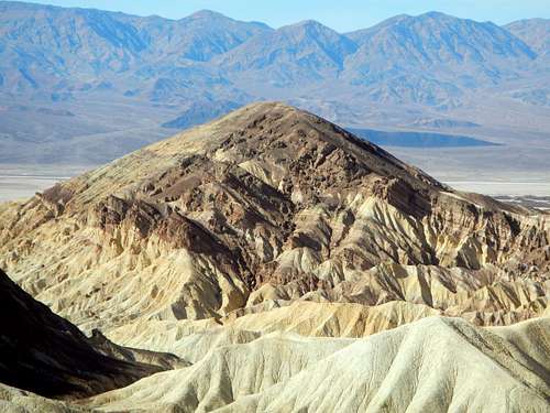 Conglomerate Strata Of The East Face
Although not a large mountain by any standards, Golden Canyon Peak has some very interesting qualities and a very high fun-factor for those who go to the summit. As noted on the map, the summit point is 510 feet above sea level. But this altitude does not accurately represent the overall stature of the mountain, considering the trailhead is located 200 feet below sea-level. Taking this into account, where the base of the mountain starts, "Golden Canyon Peak" is actually 700 feet tall.
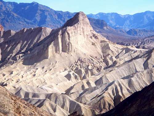 Manly Beacon Seen From Golden Canyon Peak
Golden Canyon Peak is a geologically unique rock and mud formation located in the desert badlands of Death Valley. A compact combination of conglomerate layers, differing in color, composition, and the ability to resist the elements, is what created the unique appearance of Golden Canyon Peak. Darker rocky layers were formed in an alluvial fan 5 million years ago while the lighter colored mudstone below was formed on the bottom of a lake. On some maps, Golden Canyon Peak is indicated as Point 510. This mountain is not officially named. The name "Golden Canyon Peak" was chosen as the best representation for this site considering that Point 510 is located at the very mouth of Golden Canyon and is also visible from the parking lot. Quotation marks in the listing name indicate the unofficial naming.
 A View Of Telescope Peak
The area surrounding Golden Canyon has a number of other peaks which are worth exploring. It's possible to climb several peaks in one day and for those who are in good shape, this might be the best way to enjoy Death Valley. I would suggest climbing nearby Manly Beacon and Red Cathedral. For those who are not summit motivated but enjoy scrambling, the south face of Golden Canyon Peak is riddled with erosion gullies. Many of these can be followed up for hundreds of feet without ever exceeding easy Class 2 and 3. But be careful when you encounter the darker, conglomerate rock layer, which is loose.
The Route
 The Route
Beginning at the Golden Canyon parking lot, take a look up at the peak on the left side of the canyon. It's bigger than it looks, 700 feet above. You might have noticed a white-ish trail on the darker rocks of the upper slope, visible from Badwater Road. That upper trail is the goal, but to get there you must ascend through a narrow gully. Walk into the canyon for between 150 and 200 yards.
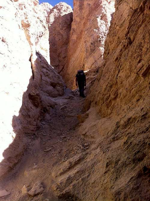 Ascending The Gully
Watch along the left-hand wall for the opening of a side gully. In fact there are several, but the one you want should be the first large one, big enough to walk into. Follow this up for several hundred feet until you come to "the tatas". This unique formation is how you will know that you have followed the correct gully. If you come onto something different, like a chockstone or some other impasse, then descend back to the canyon bottom and try the next gully over.
 Ascending The Gully
At "the tatas", cut up and to the right out of the gully. The mudstone here is a little difficult to ascend and it may not seem like the right way, but soon you will come to the trail. Pass over the rib between the ascent gully and the next one over, eventually crossing the top of a third gully. The slope evens out and becomes devoid of sharp features.
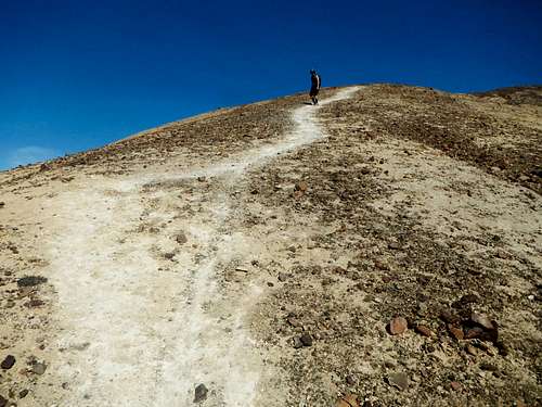 The Trail On The Upper Slope
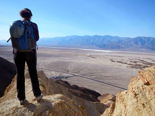
At this point there will be some clear evidence of previous travel. The trail is hardly visible at the top of the gullies but becomes more defined as it climbs the upper open slopes. Reaching the ridge crest, continue east to the true highpoint, just beyond a cairn. Views of Golden Canyon below, Red Cathedral, Manly Beacon and the Coffin Range to the east, the vast expanse of Death Valley to the west with the Panamint Range beyond, are very rewarding.
 On The Summit
Red Tape
The highest temperature ever recorded in Death Valley was 134 degrees Fahrenheit. This is the all-time-high record for North America. So what does this have to do with Golden Canyon Peak? The answer is that it would be foolish at best, and fatal at the worst, to attempt to climb Golden Canyon Peak during the heat of the day in summer. Even in the winter it can be very hot. Bring lots of water!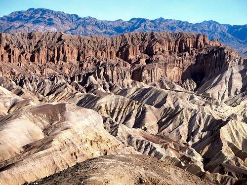 Red Cathedral Seen From The Summit
As with all the canyons in Death Valley, Golden Canyon is not a place you want to be if there is the possibility of a heavy rain. As you may notice in the first stretch of the canyon, there used to be an asphalt walkway. This was ripped out by rushing water in 1976. Thankfully, this kind of precipitation is extremely rare in the valley. Average annual rainfall is merely 1.9 inches.
There is a $20 park entrance fee for visiting Death Valley, but unlike most National Parks, this is a self-pay fee. Please stop by the Furnace Creek visitor center to pay your fee and get your free park map and information pamphlet.
 Near The Summit