
|
|
Mountain/Rock |
|---|---|
|
|
36.04483°N / 115.47223°W |
|
|
clark |
|
|
Scrambling |
|
|
Spring, Fall, Winter |
|
|
6308 ft / 1923 m |
|
|
Overview
 path toward canyon
 summit view toward trailhead
Getting There
From the junction of state highways 159 and 160 just south of the town of Blue Diamond, head west toward Parumph, NV for approximately 4.75 miles and turn off to the right into the paved mountain bike parking area which has restroom facilities. road from hwy 160 to trailhead
Red Tape
While this peak is located in Red Rock National Conservation area, there are no requirements for an entrance permit in this remote portion.See Red Rock NCA Home Page
Camping
There is a campground located south of SR159 two miles east of the entrance to RRCNCA. There is no developed campground within Red Rock NCA, although backcountry camping with a permit is allowed.Route description
 route overview
 view up canyon
 black velvet climbing walls
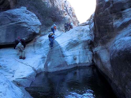 try not to swim
 route up from canyon
As the Google earth route photo indicates, the route out of the canyon initially heads NE toward the base of some cliffs before turning NW ascending a steep gully leading up toward a saddle before once again turning NE up the final several hundred feet to the summit.
 View from trailhead
T. White - May 26, 2020 6:17 pm - Voted 9/10
Also accessible from the Mountain Springs and Little Zion trailheadsRoughly 1,000 fewer feet elevation gain from Mountain Springs, and manageable stretches of Class 3 near the end. Not sure about the route from Little Zion before it intersects with the Mountain Springs Peak trail, but it must not be too tough since a number of people did it on the day I summitted.