
-
 32851 Hits
-
 88.19% Score
-
 26 Votes
|
|
Mountain/Rock |
|---|---|
|
|
36.10950°N / 115.4965°W |
|
|
6924 ft / 2110 m |
|
|
Overview
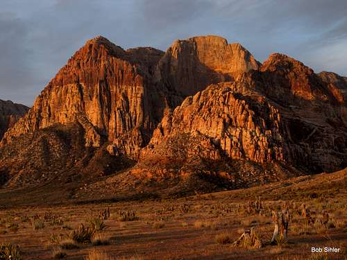
Red Dawn in Red Rock Canyon
Located in scenic Red Rock Canyon National Conservation Area (RRCNCA), Rainbow Wall, though arguably a component of the well-known Rainbow Mountain massif, is an adjacent big wall feature that is actually 114 feet or so higher than Rainbow Mountain itself. Additionally, Rainbow Wall and Rainbow Mountain are separated by two semi-distinct saddles (well, one semi-distinct saddle and one distinct notch), thereby adding leverage to the “separate mountain” argument. Who really cares, though? This enormous sandstone wall, visible from nearly all of RRCNCA’s Scenic Loop, is a beautiful and beckoning beast, reminiscent of walls seen in Zion, and a worthwhile endeavor for the weekend hiker and big wall climber alike.
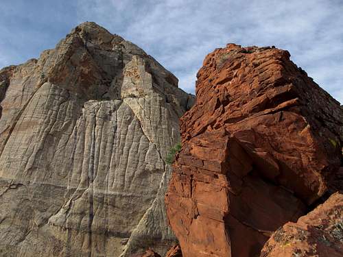
Rainbow Wall
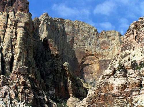
The views straight down the huge wall to the bottom of Juniper Canyon (approx. 1,500 feet) from the summit are awesome.
Morning view of Rainbow Wall
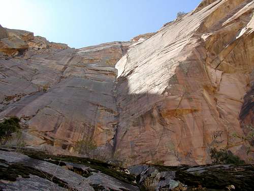
By BranchWhitney
Routes
The standard scrambling route (Class 4) for Rainbow Wall goes through Oak Creek Canyon (route page attached to this one). There also exists a longer route, with more route-finding, via Gunsight Notch Peak. Additionally, one can climb Rainbow Mountain via the 5.2 Rainbow Direct route or via the 5.0 Juniper Canyon Scramble and then head over to the Rainbow Wall summit.
Although several technical rock routes exist for this peak, right now there are only two covered on SP:
The MountainProject page has three more:
- Desert Solitaire-- 5.9 A3+
- The Original Route-- 5.12
- Brown Recluse-- 5.12 a/b
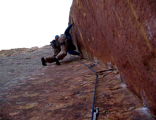
On the Original Route-- Onsighting the dihedral after Rainbow Ledge. Photo by glahhg.
Getting There
From Summerlin, drive west on Charleston Boulevard, which becomes SR 159. About 3 miles from the end of town, look for the signed entrance to the Scenic Loop.
1) Get on the Red Rock Canyon NCA Scenic Loop and follow it for approx. 11 miles to the signed Oak Creek Canyon dirt road turn-off. Follow the well-maintained dirt road for a mile or two to a well-marked parking area. The parking area is spacious and even has a restroom. The trailhead, which is at the south end of the parking area, is signed for Oak Creek Canyon.
2) You can avoid the fee and the one-way loop drive by parking at the unmarked but easily seen trailhead for North Oak Creek Trail located along SR 159 a short distance west of the loop drive's exit. This, of course, adds some hiking distance each way-- 0.9 mi. Hiking in from the signed Oak Creek Canyon TH off 159, which reaches the canyon via South Oak Creek Trail and the Chinle Trail, adds 1.5 mi each way-- definitely not recommended unless the other TH off 159 is closed for some reason.
![Mount Wilson, Rainbow Mountain, Rainbow Wall, and Juniper Peak]()
Mount Wilson, Rainbow Mountain, Rainbow Wall, and Juniper Peak
You can also call 702-363-1921 to talk with someone at the visitor’s center.
2) You can avoid the fee and the one-way loop drive by parking at the unmarked but easily seen trailhead for North Oak Creek Trail located along SR 159 a short distance west of the loop drive's exit. This, of course, adds some hiking distance each way-- 0.9 mi. Hiking in from the signed Oak Creek Canyon TH off 159, which reaches the canyon via South Oak Creek Trail and the Chinle Trail, adds 1.5 mi each way-- definitely not recommended unless the other TH off 159 is closed for some reason.
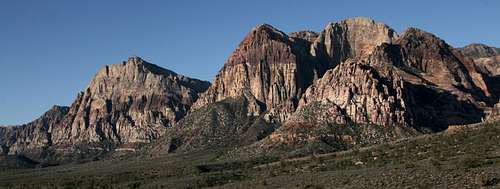
Mount Wilson, Rainbow Mountain, Rainbow Wall, and Juniper Peak
Red Tape
There is a daily entrance fee of $7 per vehicle (2013). Annual and interagency passes are available (the Interagency Pass, AKA the America the Beautiful Pass, grants access to all federal fee areas for a year).
Hours the Scenic Drive is open:13-Mile Scenic Drive
Note: these hours are subject to change. To be safe and sure, contact the park before visiting.
Hours the Scenic Drive is open:13-Mile Scenic Drive
| November through February | 6 a.m. to 5 p.m. |
| March | 6 a.m. to 7 p.m. |
| April through September | 6 a.m. to 8 p.m. |
| October | 6 a.m. to 7 p.m. |
Note: these hours are subject to change. To be safe and sure, contact the park before visiting.
The BLM (the agency that manages this area) allows dogs in the backcountry. Please keep them leashed and pick up their feces.
When To Climb
Rainbow Wall can be climbed any time of year, though spring and fall are without question the best seasons.Camping
There are no campgrounds off the Scenic Drive in RRCNCA. There is a campground outside it, though; see here for more details. Bivouacs and backcountry camping are permitted, but with permits and restrictions. Use the link at the end of this page to find out more.Mountain Conditions
Weather for the Las Vegas area.You can also call 702-363-1921 to talk with someone at the visitor’s center.
External Links
- Panorama from the summit of Rainbow Wall
360 degree, interactive panorama from the summit of Rainbow Wall. - BLM site for RRCNCA