
-
 6597 Hits
-
 81.18% Score
-
 13 Votes
|
|
Mountain/Rock |
|---|---|
|
|
46.69799°N / 12.17822°E |
|
|
Hiking, Skiing |
|
|
Summer, Fall, Winter |
|
|
7487 ft / 2282 m |
|
|
Overview
 Lungkofel / Monte Lungo seen from Sarlsattel Lungkofel / Monte Lungo seen from Sarlsattel |
Together with Sarlkofel / Monte Serla Lungkofel / Monte Lungo forms the north-easternmost bastion of the Prags / Braies Dolomites. The two mountains are connected by a short ridge, the lowest point of which, Sarlsattel, offers the best ascent route to either summit. Both mountains are famed for their views but nevertheless see only few ascents, if compared to their mighty neighbour, Dürrenstein / Picco di Vallandro in the south. Though the mountains are much lower their ascent routes are longer with more elevation gain to scale.
 |  |  |
Lungkofel / Monte Lungo is somewhat hidden from view. While its neighbours tower above Pustertal / Val Pusteria or Höhlensteintal / Val Landro our summit rises above the meadows of Bad Altprags / Bagni di Braies, inside the Prags / Braies Dolomites. Its west face is a sheer, 700m limestone affair, rising like a sentinel above the easy ski runs of the area. North and south faces are also very steep and only to the east does the mountain connect with the aforementioned Sarlattel. The summit appears like a pulpit, high above the valleys of the area.
 |  |
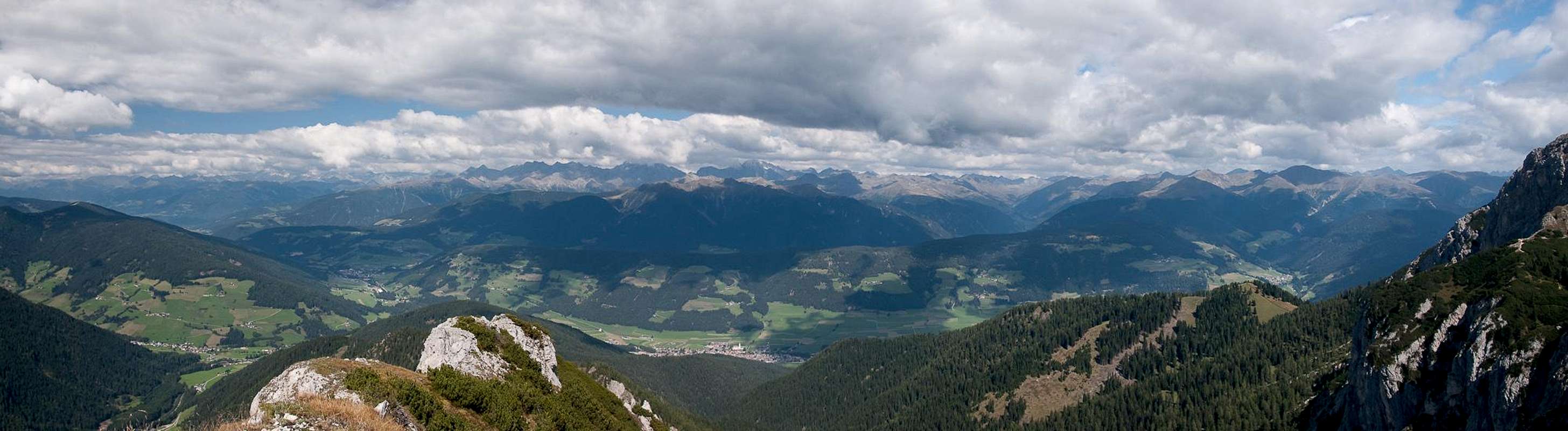
Lungkofel / Monte Lungo is often climbed together with the higher Sarlkofel / Monte Serla, but only as an afterthought if time allows. However, a visit to the summit offers wonderful views of the Prags / Braies and Sexten / Sesto Dolomites with the glaciated mountains of the Zillertal Alps and Hohe Tauern shining across Pustertal / Val Pusteria from afar.
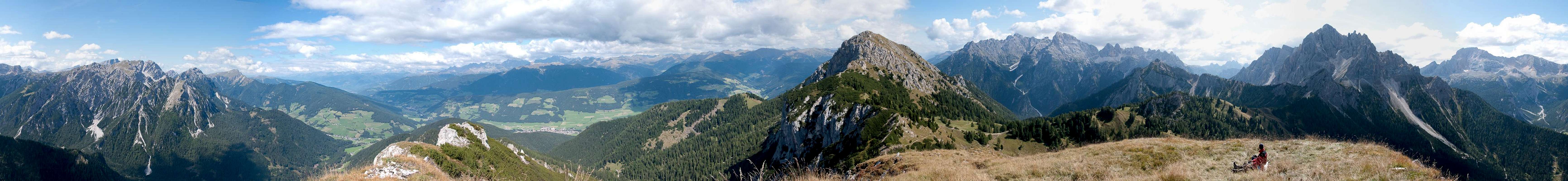
360° Summit Panorama
  |
Getting There
 |
From The North
- Take A22 Brenner Motorway to exit Brixen / Bressanone
- Turn off onto SS49 east to Bruneck / Brunico or Toblach / Dobbiaco
From Austria (East)
- Take A12 Inntalautobahn to exit Kufstein.
- Turn onto B178, later B161 south in direction Kitzbühel.
- At Mittersill B161 turns into B108 which heads through Felbertauern Tunnel.
- Take B108 until Lienz were you turn right (west) onto E66 which on the border crossing turns into SS49 to Toblach / Dobbiaco and Bruneck / Brunico.
From Udine
- Take A23 north to exit Carnia.
- Turn off onto SS52 which leads through several detours to Innichen / San Candido
- Turn east on SS49 to Toblach / Dobbiaco and Bruneck / Brunico.
From Venezia
- Take motorway S27 north towards its end near Belluno.
- Turn onto SS51 towards Cortina d’Ampezzo and on to Toblach / Dobbiaco.
Red Tape
 Lungkofel / Monte Lungo seen from the north-east
In 1980 an area of 25680ha has been set aside for the natural Park Fanes Sennes - Prags. You are required to treat the Natural Park with care: leave animals and plants in their place, use trails (especially when mountain biking), and take the official open roads with your car.
For more information you can look at the parks official website
Accommodation
For hotels and apartments have a look at the websites of the towns and cities of the area:Weather Conditions
 Sarlkofel, Lungkofel and Dürrenstein seen across Pustertal
Maps & Books
Books
The Prags Dolomites / Dolomiti de Braies are not as well covered in terms of Guidebooks. The list below offers the German books I know of dealing with the area but there certainly are more, especially Italian ones.
- Dolomiten 5 - Sexten - Toblach - Prags
F. Hauleitner
Rother Verlag
ISBN: 3 7633 4199 4
- Dolomiten
P. Fleischmann
Kompass Verlag
ISBN: 3 8705 1409 4
Sextener Dolomiten extrem - Alpenvereinsführer
R. Goedeke
Rother Verlag
ISBN: 3 7633 1255 2
Maps
The most commonly used maps are the ones by Kompass and by Tabacco. The Kompass one is good as an overview map while the Tabacco one offers more details.
- Bruneck - Toblach / Brunico Dobbiaco
Kompass Map WK 57
ISBN: 3 85491 064 9
Scale: 1:50000
- Dolomiti di Braies / Pragser Dolomiten / Marebbe / Enneberg / Plan de Corones / Kronplatz
Tabacco Map 031
Scale: 1:25000