
|
|
Mountain/Rock |
|---|---|
|
|
52.97430°N / 3.99602°W |
|
|
Gwynedd |
|
|
Hiking, Mountaineering, Trad Climbing, Toprope |
|
|
Spring, Summer, Fall, Winter |
|
|
2329 ft / 710 m |
|
|
Overview
Moelwyn Bach is best known as the little sister of its neighbouring peak, Moelwyn Mawr. Some 50 metres its junior, the mountain is rarely an objective in its own right and is most often done in conjunction, via the ridge of Craigysgafn, with the larger Moelwyn. Despite its smaller size, the mountain is a much more complex beast, being home to a variety of rock climbs and mini-scrambles. The mountain’s Southern-Western Cliffs, in fact, offer some of the Moelwynion's best mid to high grade routes, notably Man in the Moon (E5 6a), Igam-ogam (E1 5b), Maen Tŵr Og (E2 5c) and Expose (E4 6a/b). Despite boasting a high number of quality routes, climbers rarely visit the mountain, preferring instead to stop short at one of the area’s more accessible crags, such as Clogwyn y Bustach, Clogwyn yr Oen and Craig y Wrysgan. Expelling the extra effort to reach Moelwyn Bach therefore, can pay huge dividends for those looking for somewhere quiet to climb, but unwilling to compensate on quality. |
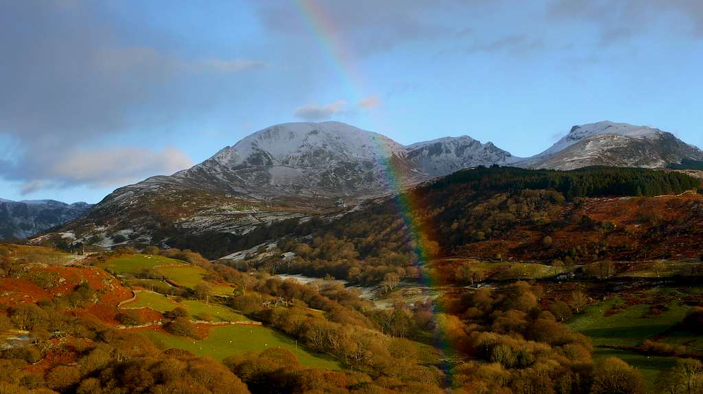
Moelwyn Bach (left) and Moelwyn Mawr (right) (Photo by mills)
Rock Climbing
The climbing on Moelwyn Bach is split between its Summit Cliffs, the Summit Nose, the Southern-Western Cliffs and Craigysgafn. The South-Western Cliffs are by far the more complex of these and has the greatest number of routes. Unless otherwise stated, routes are listed from left to right, and are graded and rated with the aid of the Climbers’ Club Guide to Meirionnydd, so for full descriptions, please refer to this source. Please be aware that the Moelwynion are a trad climbing venue and bolting is strictly prohibited. Routes are rated using the British Adjectival Grading System. Technical grades are generally only given to climbs graded adjectivally as Hard Severe (HS) or above. A conversion table of international climbing grades by SP member Corax is available: download it here. Route Symbols:
Summit CliffsThe crag beneath the summit on the east side of the mountain (SH 663 338) is around 45 metres high and gives a few climbs of Difficult to Very Difficult standards. Summit NoseThe prominent nose (SH 660 440) seen from the Moelwyn Ridge is about 27 metres high an can be climbed anywhere at about Difficult standard. There is a short overhanging section, which is obviously much harder, giving a brief but strenuous problem. |


Southern-Western CliffsThese cliffs take the form of a series of scattered outcrops on Moelwyn Bach’s southern ridge (SH 655 434). They’re home to a number of great routes on that perfect Moelwyn quartzite, furthermore, they’re south facing and catch the sun all day. |
| No. | Name | Length | Pitches | Adjectival Grade | Technical Grade | Quality | Restrictions |
|---|---|---|---|---|---|---|---|
| 1. | Arberth | 30m | 2 | HVS | 5a |  | |
| 2. | They'll Never Keep Us Down | 10m | 1 | E4 | 6a |  | |
| 3. | Moonrazor | 15m | 1 | E2 | 5c | | |
| 4. | Tir Na Nog | 44m | 2 | HVS | 5a | | |
| 5. | Man in the Moon | 25m | 2 | E5 | 6a |  | |
| 6. | Igam-Ogam | 39m | 2 | E1 | 5b, 5b | | |
| 7. | Non Welsh-Speaker's Conundrum | 40m | 1 | E4 | 5c | | |
| 8. | The Dogs Dinner | 21m | 1 | HVS | 5a | | |
| 9. | On Easter Island | 20m | 1 | E4 | 6a | | |
| 10. | Maen Tŵr Og | 20m | 1 | E2 | 5c | | |
| 11, | Yr Holltalluog | 21m | 1 | HVS | 5a | | |
| 12, | Beneath the Underdog | 46m | 1 | HVS | 5a | | |
| 13. | The Misfortunes of Elphin | 23m | 1 | E2 | 5c | | |
| 14. | Exepel of Air | 15m | 1 | E4 | 5c | | |
| 15. | Cym Haul | 18m | 1 | VS | 4c | | |
| 16. | Sundance Kid | 18m | 1 | HVS | 5a | | |
| 17. | The Slot Machine | 20m | 1 | E4 | 6a | | |
| 18. | Expose | 15m | 1 | E4 | 6a/6b | | |
| 19. | Agenda | 24m | 1 | E1 | 5b | | |
| 20. | On Impulse | 6m | 1 | E5 | 5c | | |
| 21. | Thor's Wall | 20m | 1 | E5 | 6b | | |
| 22. | Loki Crack | 18m | 1 | HVS | 5a |  | |
| 23. | Fifth Anniversary | 18m | 1 | E2 | 5c | | |
| 24. | Penbwl Corner | 37m | 1 | VS | 4c | | |
Mountain Conditions
This section displays the mountain conditions for Snowdonia, of which Moelwyn Bach is a part. Click on the widget for maps and further information. This Snowdonia weather forecast is generated by the Met Office Weather Widget |
When to Climb and Essential Gear
Moelwyn Bach can be climbed at anytime of the year, however in poor conditions the mountain may be best avoided. April to September offer the most reliable conditions and one will need all the equipment one usually carries for a day in the mountains, which in Wales means full waterproofs and sturdy boots as a minimum. If you’re lucky enough to climb the mountain in winter conditions then an ice axe and crampons would be very useful. |


Getting There
Moelwyn Bach is located in the southern Moelwynion, between the valleys of Cwm Croesor in the west and the Vale of Ffestiniog in the east. The mountain can be approached from either of these valleys, both giving an interesting walk in. Cwm Croesor may only be reached from the south. If you’re coming from the east therefore, leave the A487 in Penrhyndeudraeth (SH 611 389) and take the A4085 north in the direction of Beddgelert (SH 590 481). Just after the village of Garreg (SH 612 416), there is a right hand turn (SH 614 420), which is signposted for the village of Croesor (SH 630 447). The village is reached after around 3km. Park in the small National Park run car park in the village. There's also a great parking spot at the highest point of the Croesor to Rhyd road (SH 635 434), just outside the forested area on the Rhyd side and directly below a prominent telegraph pole. If you’d rather start your walk from the Vale of Ffestiniog, the most convenient starting point is the small car park just above the village of Tanygrisiau. To reach it, leave the A470 at the roundabout in Blaenau Ffestiniog (SH 697 460) and take the A496 in a southerly direction over the railway line. Continue along the A496 for a kilometre or so to a small junction on the right hand side (SH 688 448). Take this junction and then turn left immediately, following the signs for the Ffestiniog Power Station; 500 metres down the road there’s a café on the left hand side; it’s a great place to start and end a day in the hills. Pass the café and follow the curving road up the hill to the car park at the top of Tanygrisiau (SH 683 453). |
 Moelwyn Bach Moelwyn Bach(Photo by Bryan Benn) |  Moelwyn Bach Moelwyn Bach(Photo by daveyboy) |  Craigysgafn Craigysgafn(Photo by daveyboy) |
Red Tape and Access
No red tape or access issues here! For climbers, hill walkers and mountaineers, the British Mountaineering Council (BMC) runs a Regional Access Database, which holds mountain/crag specific information on matters of conservation and access, including issues such as nesting restrictions, nature designations and preferred parking. If you are in any doubt about any particular access arrangement, or need to report an incident, you should contact your local BMC Access Representative or the BMC Access Officers for Wales: Elfyn Jones. |


Camping and Accommodation
There’s an almost unlimited supply of accommodation within the Snowdonia National Park so it would be inappropriate to list it all here. For budget accommodation it’s worth checking out some of the following sites: Youth Hostel Association in WalesIndependent Hostel GuideCampsites in Gwynedd |
Maps
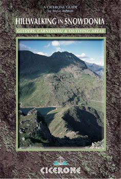
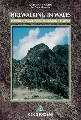
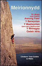
Guidebooks
|
|


External Links
 Moelwyn Bach (Photo by Nanuls) Moelwyn Bach (Photo by Nanuls) Craigysgafn (Photo by daveyboy) Craigysgafn (Photo by daveyboy) Moelwynion (Photo by daveyboy) Moelwynion (Photo by daveyboy) Moelwyn Bach (Photo by daveyboy) Moelwyn Bach (Photo by daveyboy)Government Bodies and Official Organisations Snowdonia National Park Authority Association of National Park Authorities Royal Commission on Ancient & Historical Monuments in Wales Hiking, Climbing and Mountaineering Organisations and Companies British Mountaineering Council Plas y Brenin National Mountain Centre Weather Tourist Information North Wales Tourism Partnership Local Information from Gwynedd.com Local Information from Snowdonia Wales Net Travel Welsh Public Transport Information Accommodation Youth Hostel Association in Wales Maps and Guidebooks Cordee Travel and Adventure Sports Bookshop Wildlife and Conservation |