|
|
Mountain/Rock |
|---|---|
|
|
52.79151°N / 3.98675°W |
|
|
Gwynedd |
|
|
Hiking, Mountaineering, Trad Climbing, Bouldering |
|
|
Spring, Summer, Fall, Winter |
|
|
2461 ft / 750 m |
|
|
Overview
There are two summits known as Diffwys in the Rhinogydd. Those familiar with the range, as well as the nuances of the Welsh language, should not be surprised, since the name is reserved for those places that are considered to be wild, wastelands, high, steep, huge or awful. For the early inhabitants of this part of Meirionnydd, the Rhinogydd had all of these properties, and little has changed to this day. Where Diffwys really shines though, is in what it offers to the rock and winter climber. Strung out along the shores of Llyn Bodlyn, a lake which had its waters raised by the construction of a dam in 1894, are the north facing crags of Craig Bodlyn, which at their western end, are higher than any other in the range. This is not a crag for those who prefer their climbing to be easily accessible; there’s no quick way to this spot, with prospective climbers faced with a choice of a long flat approach or a short steep one. Whichever option they choose, they will have to work up a sweat to complete it. Those who do make the effort will be rewarded with some of the longest grit routes in Britain as well as a large number of single pitch lines to boot. Don’t expect an easy time here though, there is only one route graded below Very Severe while the hardest line comes in at a very respectable E7 6c. Craig Bodlyn also holds the only recorded winter climbs in the Rhinogydd, though owing to the crag’s low altitude and close proximity to the sea, only the onset of a new ice age is likely to yield anything approaching favourable conditions. |
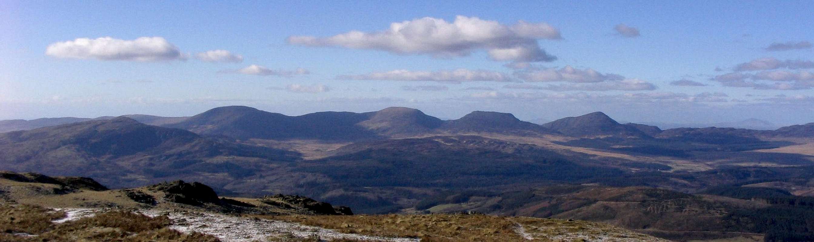
The Rhinogydd. From left to right - Y Garn, Diffwys, Y Llethr, Rhinog Fach and Rhinog Fawr (Photo by Nanuls)
Routes
Rock ClimbingThe climbing on Diffwys is split between two principle crags, namely Graig Bodlyn and the smaller Llawllech. Craig Bodlyn is by far the more complex of the two and is itself split into a number of smaller crags and buttresses. Unless otherwise stated, routes are listed from left to right, and are graded and rated with the aid of the Climbers’ Club Guide to Meirionnydd, so for full descriptions, please refer to this source. The Climbers’ Club have also produced a free pdf, which provides details of first ascents recorded after 2001: download it here. Please be aware that the Rhinogydd is a trad climbing venue and bolting is strictly prohibited. Routes are rated using the British Adjectival Grading System. Technical grades are generally only given to climbs graded adjectivally as Hard Severe (HS) or above. A conversion table of international climbing grades by SP member Corax is available: download it here. Route Symbols:
Craig BodlynCraig Bodlyn (SH 649 236) is the mother of all Rhinog crags and is fittingly described in the Climber's Club guide to the area as “a sort of Frêney amongst Fontainbleau”. It has in many places now succumb to the tendrilled advances of the local vegetation, and those wishing to climb some of the older routes may need to include a pair of secateurs on the rack. Fear not though, for there are some clean walls to be found here too, and one of particular interest is the relatively recently developed Silver Screen. The Silver Screen |


The Silver Screen is the most leftward of Craig Bodlyn's crags, located some 100 metres east of the lake, nestled in a small bay a little above the valley floor. It is home to steep and brutish climbing. |
| No. | Name | Length | Pitches | Adjectival Grade | Technical Grade | Quality | Restrictions |
|---|---|---|---|---|---|---|---|
| 1. | Fame Drain | 18m | 1 | E3 | 5c |  | |
| 2. | Stars in Our Eyes | 12m | 1 | E3 | 5b |  | |
| 3. | Silverback | 11m | 1 | E7 | 6c |  | |
| 4. | Anxiety | 25m | 2 | E6 | 6b, 6a | | |
| 5. | The Silver Usurper | 23m | 1 | E6 | 6b |  | |
| 6. | R.H. 100% | 20m | 1 | E6 | 6b | | |
| 7. | Dynocology | 21m | 1 | E6 | 6b | | |
| 8. | Destiny | 24m | 1 | E6 | 6b | | |
| 9. | Streaker | 15m | 1 | E3 | 6a | | |
| 10. | Gazump | 5m | 1 | E1 | 6b | | |
| No. | Name | Length | Pitches | Adjectival Grade | Technical Grade | Quality | Restrictions |
|---|---|---|---|---|---|---|---|
| 11. | Not-So-Soft | 6m | 1 | HVS | 4c | | |
| 12. | Get Laid Twice | 6m | 1 | E2 | 6b | | |
| 13. | Silence Can Speak | 6m | 1 | E2 | 6a | | |
| 14. | Wall-to-Wall Sunshine | 5m | 1 | E1 | 5c | | |


| No. | Name | Length | Pitches | Adjectival Grade | Technical Grade | Quality | Restrictions |
|---|---|---|---|---|---|---|---|
| 15. | Wild Around | 9m | 1 | E1 | 6a | | |
| 16. | The Wild Within | 11m | 1 | E2 | 6a | | |
| 17. | And Janet Street Porter Walked By | 12m | 1 | E4 | 6a | | |
| 18. | Duck! | 20m | 1 | E2 | 5c | | |
| 19. | Boys in Toys | 20m | 1 | E1 | 5b | | |

Craig Bodlyn (Photo by Nanuls)
| No. | Name | Length | Pitches | Adjectival Grade | Technical Grade | Quality | Restrictions |
|---|---|---|---|---|---|---|---|
| 20. | The Arête | 15m | 1 | VS | 4a | | |
| 21. | Receding | 12m | 1 | E4 | 5c | | |
| 22. | Forked Lightning Conductor Crack | 8m | 1 | E1 | 5c | | |
| 23. | Watch Point | 11m | 1 | VS | 4c | | |
| 24. | Impale Face | 11m | 1 | E1 | 5c | | |
| No. | Name | Length | Pitches | Adjectival Grade | Technical Grade | Quality | Restrictions |
|---|---|---|---|---|---|---|---|
| 25. | Gaardevarre | 10m | 1 | S | | | |
| 26. | Finmark | 10m | 1 | HVS | 4c | | |
| 27. | Purple Rain | 10m | 1 | E4 | 5c | | |
| 28. | Haircurler | 10m | 1 | E4 | 5c | | |
| 29. | The Bodlyn White | 8m | 1 | E2 | 5c | | |
| 30. | Rail to Oblivion | 9m | 1 | E5 | 6a | | |

Craig Bodlyn Main Wall (Photo by Nanuls)
| No. | Name | Length | Pitches | Adjectival Grade | Technical Grade | Quality | Restrictions |
|---|---|---|---|---|---|---|---|
| 31. | Porky | 78m | 4 | HVS | | | |
| 32. | Mochan | 108m | 5 | VS | 4c, 4a, 4c, 4b | | |
| 33. | From the Rocks | 80m | 2 | E4 | 5c, 6a/b | | |
| 34. | Galium | 98m | 4 | HVS | 4a, 4c, 4c, 5a | | |
| 35. | Inigo | 95m | 4 | VS | 4b, 4b, 4b, 4c | | |
| 36. | Nardus | 100m | 4 | VS | 4b, 4c, 4c | | |
| 37. | Man Is Fauna | 95m | 3 | E4 | 4a, 6a, 5c | | |
| 38. | Mass Extinction | 100m | 3 | E5 | 4c, 6a, 5b | | |
| 39. | The Spade | 103m | 7 | VS | | | |
| 40. | Srtictus | 104m | 5 | E1 | 4b, 5a, 5b, 5b | | |
| 41. | High Girdle | 118m | 6 | E1 | 4c, 5a, 5a, 5b, 4c | | |
| 42. | Certificated | 24m | 1 | E4 | 6a | | |
| 43. | Blacklist | 25m | 1 | E5 | 6a | | |
LlawlechLlawllech (SH 636 228) is located around half a kilometre to the south-west of Craig Bodlyn and provides a day's worth of good routes on nice clean rock. |
| No. | Name | Length | Pitches | Adjectival Grade | Technical Grade | Quality | Restrictions |
|---|---|---|---|---|---|---|---|
| 44. | Lawless | 15m | 1 | VS | 4c | | |
| 45. | One Law for One | 15m | 1 | E3 | 5c | | |
| 46. | Tower of Libel | 24m | 2 | HVS | 5a, 4c | | |
| 47. | The God Summons | 24m | 1 | E4 | 6a | | |
| 48. | A Roof Over Head Makes Home | 18m | 1 | E2 | 5c | | |
| 49. | Turn Vertical When Life s Flat | 8m | 1 | HVS | 4c | | |
| 50. | Dr Irish Watches | 9m | 1 | E2 | 5b | | |
| 51. | The Tywyn Weird Route Name Society Bolt-less Competition Climb | 9m | 1 | E1 | 5a | | |


Winter ClimbingUnfortunately the close proximity of these mountains to the sea and the frequent arrival of Atlantic depressions pushing warm, moist air over the range, even in the middle of winter climbing conditions are infrequent and unreliable. This combined with the relatively long walk in to the best locations has led to a lack of exploration and recorded winter climbs in the area. However a number routes have been recorded on Craig Bodlyn, which are listed below from left to right and greded using the Scottish Winter Grading System. For full descriptions see Cicerone's Welsh Winter Climbs by Malcolm Campbell and Andy Newton. |
| No. | Name | Length | Pitches | Scottish Grade | Technical Grade | Quality | Restrictions |
|---|---|---|---|---|---|---|---|
| 52. | Chain Gang | 150m | 4 | V | 6 | | |
| 53. | Riskophilia | 150m | 4 | V | | | |
| 54. | Cryogenics | 60m | 2 | V | 5/6 | | |
| 55. | The Screaming | 70m | 2 | V | 6 | | |
| 56. | Diffwys Gully | 120m | III | | |
Mountain Conditions
This section displays the mountain conditions for Snowdonia, of which Diffwys is a part. Click on the widget for maps and further information. This Snowdonia weather forecast is generated by the Met Office Weather Widget |
Essential Gear
Diffwys can be climbed at anytime of the year, however in poor conditions the mountain's rock routes are best avoided, particularly if the weather has been wet. March to April offer the most reliable conditions. Of course this all depends on ones ability as a mountaineer/climber, and what might be comfortable for some may seem daunting to others. If you’re lucky enough to climb the mountain in winter conditions then an ice axe and crampons would be very useful. If you're lucky enough to climb the winter routes on Craig Bodlyn, then ice tools, rigid crampons, a suitable winter rack and double ropes would be even more useful. |
Getting There
Diffwys is located in the southern portion of the Rhinogydd and can be approached from numerous directions. The best stars however, are all located on the range’s western side, either starting in Cwm Nantcol or Dyffryn Ardydwy The best starting point is probably from near Cil-Cychwyn (SH 633 258) in Cwm Nantcol, which can easily be reached along narrow roads by leaving the A496, which runs along the coast from Llanulltyd near Dolgellau in the south to Blaenau Ffestiniog in the north, at Llanbedr or Dyffryn Ardydwy. Alternatively it’s also possible to approach the mountain from the south by parking at Bontddu (SH 672 188) or Cwm Mynach (SH 684 215). The routes from here are less satisfying that the other options though. The area can also be reached by rail, however getting from the stations to the mountains themselves can be difficult as public transport is pretty infrequent and hitching can be a bit of a nightmare these days. |


Red Tape and Access
No red tape or access issues here! For climbers, hill walkers and mountaineers, the British Mountaineering Council (BMC) runs a Regional Access Database, which holds mountain/crag specific information on matters of conservation and access, including issues such as nesting restrictions, nature designations and preferred parking: If you are in any doubt about any particular access arrangement, or need to report an incident, you should contact your local BMC Access Representative or the BMC Access Officers for Wales: Elfyn Jones. |
Camping and Accommodation
There’s an almost unlimited supply of accommodation within the Snowdonia National Park so it would be inappropriate to list it all here. For budget accommodation it’s worth checking out some of the following sites: Youth Hostel Association in Wales Independent Hostel Guide Campsites in Gwynedd For more local options, there are a number of campsites that surround the range. Nearby campsites can be found at Cae Gwyn Farm (SH 713 297) to the east of the range, and Merthyr Farm (SH 600 319) to the west. For wild camping, both Llyn Hywl (SH 662 267) and Llyn Bodlyn (SH 648 239) make excellent locations. |

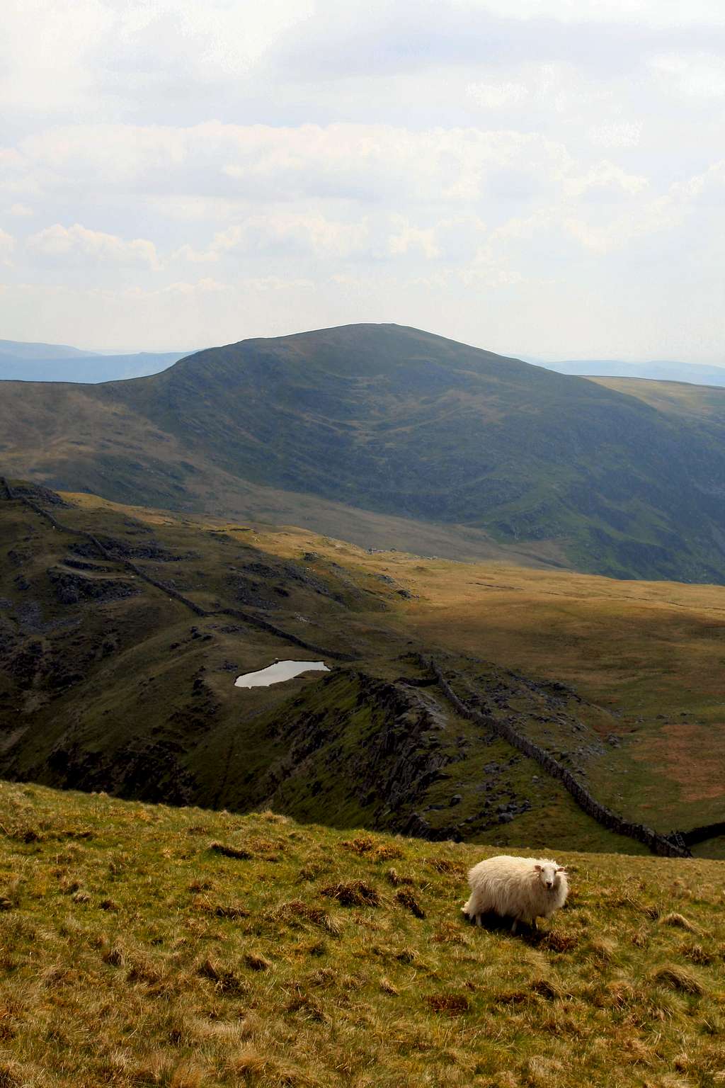
Y Llethr (Photo by Nanuls)
Maps
|
| Navigation Maps Ordnance Survey 1:25k Explorer Series OL 18 Harlech, Porthmadog & Bala/Y Bala Ordnance Survey 1:50k Landranger Series 124 Porthmadog & Dolgellau Harvey Map Services 1:25k Rhinogs/Rhinogydd Harvey Map Services/BMC 1:40k Snowdonia South Road Maps |
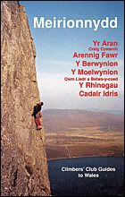
Guidebooks
|
|


External Links
 Rhinogydd (Photo by Nanuls) Rhinogydd (Photo by Nanuls)Government Bodies and Official Organisations Snowdonia National Park Authority Association of National Park Authorities Royal Commission on Ancient & Historical Monuments in Wales Hiking, Climbing and Mountaineering Organisations and Companies British Mountaineering Council Plas y Brenin National Mountain Centre Weather Tourist Information North Wales Tourism Partnership Local Information from Gwynedd.com Local Information from Snowdonia Wales Net Travel Welsh Public Transport Information Accommodation Youth Hostel Association in Wales Maps and Guidebooks Cordee Travel and Adventure Sports Bookshop Wildlife and Conservation |