
|
|
Mountain/Rock |
|---|---|
|
|
53.07210°N / 4.08005°W |
|
|
Gwynedd |
|
|
Hiking, Mountaineering, Trad Climbing, Bouldering, Ice Climbing, Mixed, Scrambling |
|
|
Spring, Summer, Fall, Winter |
|
|
3560 ft / 1085 m |
|
|
Overview
| " There we stood on the Wyddfa, in a cold bracing atmosphere... enjoying a scene inexpressibly grand, comprehending a considerable part of the mainland of Wales, the whole of Anglesey, a faint glimpse of part of Cumberland; the Irish Channel, and what might be either a misty creation or the shadowy outline of the hills of Ireland. Peaks and pinnacles and huge moels stood up here and there, about us and below us, partly in glorious light, partly in deep shade. Manifold were the objects which we saw from the brow of Snowdon, but of all the objects which we saw, those which filled us with delight and admiration, were numerous lakes and lagoons, which, like sheets of ice or polished silver, lay reflecting the rays of the sun in the deep valleys at his feet."
George Borrow - Wild Wales (1862) |
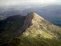
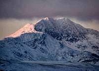
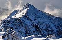
If you're British, then Snowdon's a mountain that's hard to ignore; at 1085 metres it's the highest mountain in Wales (and England too) and dominates the rugged landscape of the Snowdonia National Park. On a clear day, its summit can be seen from as far away as Pembrokeshire, the Isle of Mann and, on days of exceptional clarity, even Ireland. More of a range than a single mountain, Snowdon is host to several subsidiary peaks, each of which are notable mountains in their own right. Its summit is located at the range's centre and radiates six fabulous arêtes, each separated by deep Cwms and beautifully clear glacially carved lakes. These arêtes bare the mountain's subsidiary peaks, which include the iconic Crib Goch, the historic Y Lliwedd, Wales' second summit, Garnedd Ugain and the tranquil outpost of Yr Aran./p>
The mountain is a theatre of geological, natural and human history with the remnants of each epoch played out on its rocky slopes. From its formation as a submerged volcano during the Ordovician, through its sculpting during the Pleistocene, through the first Mesolithic settlement of its slopes, and on to the exploitation of its mineral wealth during the Victorian era, it's a truly timeless creation.
Its beauty and fame make it one of the busiest mountains in the UK, with around 350,000 visitors reaching its summit each year, arriving either on foot or via the Snowdon Mountain Railway. There are many routes to Snowdon's summit and range in difficulty from easy plods, through to fun scrambles and challenging multi-pitch climbs. The most popular route is the Llanberis Path which usually teems with tourists, however much quieter ascents can be found for the experienced, notably from Cwm Glas Mawr.
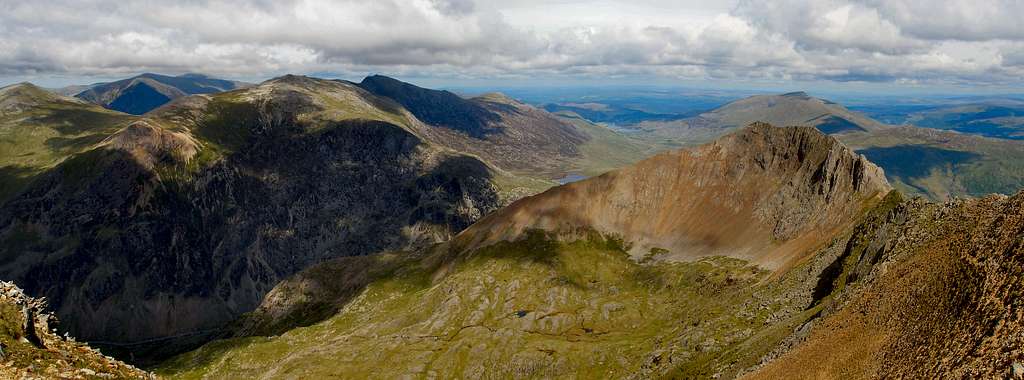
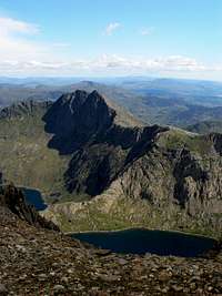
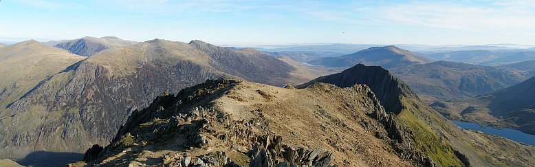
The Glyders from Clogwyn y Person, Snowdon. The mountains from left to right: Y Garn (947m), Pen-yr-Ole Wen (978m; background), Glyder Fawr (1,000m), Glyder Fach (994m), Crib Goch (923m) and Moel Siabod (872m; background)
(Photo by Nanuls)
(Photo by Nanuls)
The Peaks
| " I must not pass over in silence the mountains called by the Welsh Eryri, but by the British Snowdon, or the mountains of Snow, which... seem to rear their lofty summits even to the clouds.
"Geraldus Cambrensis - Itinerarium Cambriae (1191) |
This table lists the peaks of the Snowdon group, click on the mountains name to go to its SP page (if one exists).
Okay a quick explanation about what qualities made these summits eligible to be in list - to put it simply they must qualify to be on at least one of the UK's official mountain lists; any of them. Now I'm sure some of SummitPost's international members, and probably a good number of British ones, will be scratching their heads and wondering what the hell some of these lists mean (Buxton & Lewis anyone!?!). Well I'm not going to tell you, there just isn't room here to explain them all fully, however if you are wondering here are some links to some relevant pages, several of which are already here on SP – Hewitt, Nuttall, Marilyn, Buxton & Lewis and Dewey.
|
How to use this Section: At the moment this is pretty simple; the map is scrollable, zoomable and clickable - go have a play. The table is also pretty simple; all you have to do is look at it. The key below explains what the different headings mean. Key
|
| Rank | Photo | Name | M | Ft | Range | Sheet 1:25k | Sheet 1:50k | Grid Ref | Map 1:25k | Map 1:50k | Ma | SM | H | SH | N | BL | D |
|---|---|---|---|---|---|---|---|---|---|---|---|---|---|---|---|---|---|
| 1. |  |
Snowdon/Yr Wyddfa | 1085 | 3560 | Snowdon | 17W | 115 | SH609543 |  |
 |
 |
 |
|
|
|
|
|
| 2. |  |
Garnedd Ugain/Crib y Ddysgl | 1065 | 3494 | Snowdon | 17W | 115 | SH610551 | |
|
|
|
|
|
|
|
|
| 2. |  |
Crib Goch | 923 | 3028 | Snowdon | 17W | 115 | SH624551 | |
|
|
|
|
|
|
|
|
| 3. |  |
Y Lliwedd | 898 | 2946 | Snowdon | 17W | 115 | SH622533 | |
|
|
|
|
|
|
|
|
| 4. |  |
Y Lliwedd East Top | 893 | 2930 | Snowdon | 17W | 115 | SH623532 | |
|
|
|
|
|
|
|
|
| 5. |  |
Lliwedd Bach | 818 | 2684 | Snowdon | 17W | 115 | SH627532 | |
|
|
|
|
|
|
|
|
| 6. |  |
Yr Aran | 747 | 2451 | Snowdon | 17W | 115 | SH604515 | |
|
|
|
|
|
|
|
|
| 7. |  |
Moel Eilio | 726 | 2382 | Snowdon | 17W/254 | 115 | SH555577 | |
|
|
|
|
|
|
|
|
| 8. |  |
Llechog | 718 | 2356 | Snowdon | 17W | 115 | SH606567 | |
|
|
|
|
|
|
|
|
| 9. | |
Moel Cynghorion | 674 | 2211 | Snowdon | 17W | 115 | SH586563 | |
|
|
|
|
|
|
|
|
| 10. |  |
Foel Gron | 629 | 2064 | Snowdon | 17W/254 | 115 | SH560568 | |
|
|
|
|
|
|
|
|
| 11. | |
Gallt yr Wenallt | 619 | 2031 | Snowdon | 17W | 115 | SH642532 | |
|
|
|
|
|
|
|
|
| 12. | |
Craig Fach | 609 | 1998 | Snowdon | 17W | 115 | SH634552 | |
|
|
|
|
|
|
|
|
| 13. | |
Foel Goch | 605 | 1985 | Snowdon | 17W | 115 | SH570563 | |
|
|
|
|
|
|
|
|
Geology
| "Approaching Llyn Llydaw, the full grandeur of this wonderful valley bursts on the beholder. A lake rather more than a mile in length, and of a green colour, like some of the lakes of Switzerland, obliquely crosses the valley. Around it rise the cliffs of Lliwedd, Crib Goch, and Pen-y-Wyddfa, seamed with veins of white quartz that gleam like streaks of snow on the tall black rocks circling the vast amphitheatre, the scarred sides and rugged outlines of which, sharply defined against the sky, may well seem, till attempted, hopelessly inaccessible to the unpractised climber."
Andrew Ramsey - The Old Glaciers of Switzerland and North Wales (1860) |
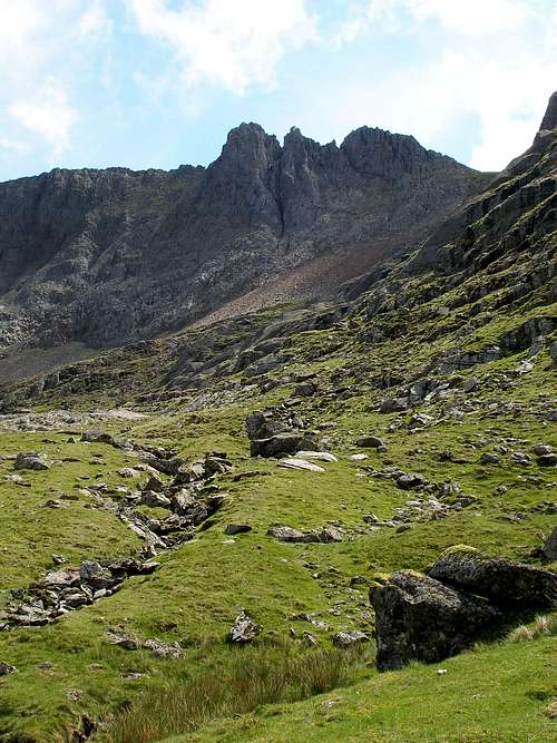
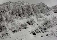
The main structural feature of Snowdonia is the broad belt of rugged mountains that runs diagonally across it through the mountain groups of the Carneddau, Glyderau and Snowdon, which corresponds with the complex downfold of Ordovician rocks known as the Snowdon Syncline.
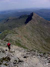
 Clogwyn y Person Arête(Photo by Nanuls)
 Crib Goch(Photo by Nanuls)
 The bedrock geology of Snowdonia
The oldest bedrock within the region is a series of Cambrian rocks which rest unconformably on the older Pre-Cambrian formations, forming a trough that marks the establishment of a sedimentary basin that covered all of Wales, much of England, parts of Ireland and extended into Belgium. The basin was situated on the edge of a continental mass which lay to the south-east, with the Iapetus Ocean on the north-west.
At the end of the Cambrian Era, slight uplift exposed the erosional deposits, and a new period of submergence during the Ordovician led to more deposition and more unconformity. The Ordovician period is characterized by periods of intensive volcanic activity. Volcanism spread throughout the region and eventually culminated in eruptions of central Snowdonia giving birth to Snowdon, the Glyderau and the Carneddau. This volcanic activity coincided with the continued deposition of marine sediments and was a prelude to the later closure of the Iapetus Ocean. Though volcanic activity ceased at the end of the Ordovician, marine sedimentation continued into the Silurian. At the end of the Silurian, earth movements culminated in the Caledonian Orogeny, a major period of uplift, folding and fracturing which partly destroyed the marine trough and resulting in the closure of the Iapatus Ocean and the resultant continent-continent collision.
The Devonian period is followed unconformably by strongly transgressive Carboniferous rocks and a marine transgression that covered the whole of North Wales. During the Tertiary Era, North Wales was situated at the edge of a landmass which was undergoing uplift in relation to the development of the North Atlantic Ocean.
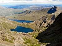
During the late Pleistocene glacial phase, a large British Ice Sheet developed in response to global cooling. This ice sheet developed by coalescence of several ice centers, one of which was centred in North Wales. Welsh ice was centered on the Migneint Plateau and the Arenig Mountains with outlet glaciers radiating from that centre. These outlet glaciers carved fairly extensive glacial trough valleys, some good examples are the valleys of Nant Ffrancon and Llanberis Pass.The freshest glacial deposits and landforms plus those found in high mountain areas were last formed/modified during the Late Glacial event (Loch Lomond Stadial or Younger Dryas) approximately 11,000 - 10,000 yrs BP. Snowdon bears the scars of the Pleistocene ice, most obviously manifesting itself in the glacial cirques of Llyn Llydaw, Glaslyn, Llyn du'r Arddu and Llyn Glâs. Even at the ice age's maximum the summits of Snowdon, Garnedd Ugain, Crib Goch, and Y Lliwedd remained above the ice sheet as nunataks. Snowdonia is an area which once supported local glaciers during the Loch Lomond Stadial. Glaciers emerged from the cwms and were channelled down existing valleys (carved during the previous glacial phases), and in a few cases carved out new ones.
First Ascents
| " Look back a thousand years, a thousand years more,There were boys afoot by Llydau's shore…" |
For centuries Snowdon and the mountains of Snowdonia where ignored and avoided by the outside world, with only local Sheppards, bandits and fugitives venturing into their higher reaches. It was not until the Tudor period that outside interest began to bring intellectuals, scientists and explorers into the area, and not until the Stewart period that the first recorded ascent of Snowdon was made. Thomas Johnson was botanist from London who visited Snowdonia in 1639 in pursuit of plant specimens. Not happy with simply observing the mountain from the surrounding valleys, he along with two companions, a local guide and an interpreter climbed the mountain from Caernarfon along the Beddgelert Route. He wrote an account of their ascent in his book The Itinerary of a Botanist which was published later that year:
 Crib Goch by GP Abraham
 Beddgelert circa 1830
 Llanberis Pass circa 1830
 Castell Dolbadarn circa 1830
“…we betook ourselves to our British Alps. The highest of all these is called Snowdon by the English, and Widhfa by the Britons… The whole mass of the mountain was veiled in cloud… leaving our horse and outer garments, we began to climb the mountain. The ascent at first is difficult, but after a bit a broad open space is found, but equally sloping, great precipices on the left, and a difficult climb on the right. Having climbed three miles, we at last gained the highest ridge of the mountain, which was shrouded in thick cloud. Here the way was very narrow, and climbers are horror stricken by the rough rocky precipices on either hand of the Stydian marshes, both on this side and that… We sat down [on the summit] in the midst of the clouds, and the first of all we arranged in order the plants we had, at our peril collected among the rocks and precipices, and then we ate the food we had bought with us”The party also attempted to climb Carnedd Llywelyn but didn't make it to the summit as their guide refused to go near the cliffs, complaining that he was afraid of eagles. Unfortunately for Johnson his first mountaineering trip to Snowdonia was also his last, as 5 years later in 1644, he was killed fighting for the Royalists in the English Civil War. Johnson's motives for climbing Snowdon were purely scientific in nature and it wasn't until 1756 that the first ascent was made for purely modern reasons, pleasure and exercise. This honour goes to Lord George Lyttelton of Hagley, a prominent politician and accomplished poet who toured Snowdonia during that year, “so that I may, by this ramble, preserve a stock of health that may last winter, and carry me through my parliamentary campaign”.
The first recorded rock climb in Britain took place on Snowdon in 1798, impressively on 'the most formidable rock face in Snowdonia' – Clogwyn du'r Arddu, which lies a mile northwest of the summit. The Rev. William Bingley, accompanied by his friend Rev. Peter Williams, had made a number of mountain expeditions in Snowdonia in search for botanical specimens. On this occasion they were studying the flora at the base of Cloggy, as it is affectionately known, and decided to search the cliff for more specimens; Bingley's description of their climb indicates that they ascended the Cloggy's East Terrace:
“I wondered to Clogwyn du'r Arddu, to search that rock for some plants which Lewyd and Ray have described as growing there. The Reverend Mr. Williams accompanied me, and he started the wild idea of attempting to climb up the precipice. I was too eager in my pursuit to object to the adventure, and we began our laborious task without once reflecting on the dangers that might attend it. For a little while we got on without much difficulty, but we were soon obliged to have recourse both to our hands and to our knees, in clambering from one crag to another. Every step now required the utmost caution, and it was necessary to try that every stone was firm in its place before the weight of the body was trusted upon it. I had once laid hold of a piece of the rock, and was in the act of raising myself upon it, when it loosened from its bed, and I should have been precipitated headlong, had I not in a moment snatched hold of a tuft of rushes, and saved myself. When we had ascended somewhat more than halfway, there seemed no chance of our being able to proceed much farther, on account of the masses of rock above us. We rested a moment from our labour to consider what was to be done. The danger of again descending was much too great, for us to think of attempting it, unless we found it absolutely impossible to proceed. On looking down the precipice, for at least three hundred feet, seemed almost perpendicular. We were eager in our botanical pursuit, and extremely desirous to be at the top, but I believe it was the prospect downwards that determined us to brave every difficulty. It happened fortunately that the steep immediately above us was the only one that presented any material danger. Mr Williams having on a pair of strong shoes with nails in them, which would hold their footing better than mine, requested to make the first attempt, and after some difficulty he succeeded. We had along with us a small basket to contain our provisions, and hold the roots of such plants we wished to transfer to his garden; this he carried behind him by means of a leathern belt fastened round his waist. When therefore, he had fixed himself securely to part of the rock he took off his belt, and holding firmly by one end, gave the other to me: I laid hold, and with a little aid from the stones, fairly pulled myself up by it. After this we got on pretty well, and in about an hour and a quarter from the commencement of our labour, found ourselves on the brow of this dreadful precipice, and in possession of all the plants we expected to find.”
Despite their impressive exploit, it had almost no influence on the development of British climbing. They were not climbers in the modern sense of the word, and they did not climb for the sake of it, but for the pursuit of plants. They did not venture back onto the rock and they inspired no followers, it would be a long time before climbers returned to Snowdonia and even longer before anyone attempted to ascend Clogwyn du'r Arddu.
Snowdon Café
| " The Wyddfa is about thirty feet in diameter and is surrounded on three sides by a low wall. In the middle of it is a rude cabin, in which refreshments are sold, and in which a person resides through the year, though there are few or no visitors to the hill's top, except during the months of summer.
"George Borrow - Wild Wales (1862) |
 Snowdon Café (late 1930s)
 Snowdon Café (May 2007)
 The building site (May 2007)
 New Snowdon Café (2010)
Since the beginning of the 19th century it has been possible to buy refreshments on Snowdon's summit. The first proper building to be constructed near the summit was erected in 1815 by the Beddgelert guide William Lloyd and was mostly used as a shelter for climbers, although some people did use it as an overnight stop. The first person to sell refreshments was a copper miner named Morris Williams who began selling tea, coffee, bread, butter and cheese from a small stall. The first proper hut wasn't built until around 1837/38 and had stone outer walls with an inner lining of neatly planed boards.By 1847 a conglomeration of wooden huts had been constructed around the summit cairn and two hotels, 'Roberts Hotel' (named after the guide John Roberts, famed for summiting Snowdon over 2000 times) and the 'Cold Club' (run by another famous guide William Roberts, no relation) competed for the custom. The hotels were owned respectively by the Victoria Hotel and the Dolbadarn Hotel, of Llanberis, and little love was lost between the two Roberts who would do nothing to help each other out when necessity required.
Conditions in the hotels were far from luxurious with as many guests as possible packed into one room, and little sleep was had by anyone.In 1896 the Snowdon Mountain Railway, then run by the Snowdon Mountain Tramroad and Hotels Company, opened and the first trains arrived at the summit. The company eventually took control of the two hotels and in 1898 started to rebuild them. Many new additions were made to the summit complex and a small hut was built on the site of the present café, which was soon replaced by a small stone station for the railway workers.
The old Victorian buildings suffered greatly from the harsh weather conditions and by the 1930s they were in dire need of replacement. It was decided that a new multipurpose building housing the station, a shop and a café would built.The café, designed by the famous architect Clough Williams-Ellis, was completed in 1935. Its main architectural feature was several huge windows along the front and sides of the building, which offered outstanding views of Snowdonia; unfortunately they were smashed in a storm 6 months after their installation and had to be replaced with much smaller ones. Many years later, Prince Charles described the building as “the highest slum in Wales”.
By the late 1990 it had become clear that the Williams-Ellis building was in need of a bit of an overhaul. In 1997 it was decided that a refurbishment was impractical and that a new building should replace it. In 2001 the design was unveiled to the public and following public consultation planning permission was granted in 2004. The new building would be built out of locally sourced sustainable materials and designed to be more sympathetic with the landscape.In December 2006 a competition was held to decide the name of the new building and Hafod Eryri, which means “Upland Summer Residence of Snowdonia”, was chosen. During the autumn/winter of 2006 demolition started on the Williams-Ellis building, ready for construction to begin in summer 2007. When the Snowdon Mountain Railway re-opened in March of that year it only ran as far as the Clogwyn Station at 770m. The building was due to be completed in the summer of 2008, however, hold-ups and a couple of particularly cold winters delayed construction. The new café was finally opened on the 14th June 2009.
Snowdon Mountain Railway
| "The solitude of Snowdon has departed. Its beautiful cone is hotel-crowned, a railway station keeps it perpetual company, and, as seen from Llyn Llydaw, it is such a strange mixture of the sublime and the ridiculous that its old friends turn impatiently away and regard other things."
G.D. and A.P. Abraham - Rock-Climbing in North Wales (1906) |
 Snowdon Mountain Railway (1930s)
 Snowdon Mountain Railway (August 2010)(Photo by Bryan Benn)
The idea of a train running from Llanberis to Snowdon's summit had been discussed for many years, but it wasn't until 1871 that a Bill was presented to Parliament to incorporate a company to do so. The bill was later withdrawn after the landowner of the time, George William Duff Assheton Smith of the Faenol Estate, objected to the bill and would not grant his support. He felt that the railway would be of little benefit to the village of Llanberis and that it would create an unnecessary scar on the landscape. The local townsfolk and small-holders living on Snowdon's slopes where of a different opinion and were deeply conscious of the fact that Llanberis needed something to encourage the tourist trade in the area.In 1894 the North Wales Narrow Gauge Railway, which ran a service from Porthmadog through Beddgelert to Caernarfon, changed the name of the Rhud-Du station to the Snowdon Station (despite it being more than 3 miles from the summit) and succeeded in attracting an increased number of travellers and tourists. The villagers of Llanberis felt the pressure of the increased competition this created, as the focal point of tourism began to move away from Llanberis towards Beddgelert. A petition was bought before Assheton Smith asking for his support to build a railway, this time he eventually succumbed and in November 1894 the Snowdon Mountain Tramroad and Hotel Company was established.Building the new railway was to be a daunting task, the machinery and materials had to be dragged up the mountain by horse and sled. After two years of preparations and construction at three minutes to eleven on Thursday the 9th of January 1896 the first train to reach the summit left the Llanberis Station. Only the railways directors and staff where present on this first journey and it wasn't until Easter Monday the 6th of April 1896 that it finally opened to the public after a total expenditure of £76,000, which is roughly equivalent to £8,000,000 today.
Wildlife and Conservation
| "Snowdon is the loftiest peak in this island south of Scotland, and one of the most beautiful that is to be seen anywhere… "
W.P. Haskett Smith - Climbing in the British Isles Volume II: Wales and Ireland (1895) |
Snowdon is part of the Eryri/Snowdonia Special Area of Conservation (SAC), and is therefore strictly protected under the EC Habitats Directive. Snowdonia SAC covers an area of 19737.6 hectares (197 square km) and includes within its boundaries many of Snowdonia's highest mountains including Snowdon, the Glyderau, and the Carneddau.
he area is rich with important habitats, according to the Joint Nature Conservation Committee (JNCC), who are the statutory adviser to Government on UK and international nature conservation, Snowdonia has the best-developed and most extensive areas of Siliceous alpine and boreal grasslands in Wales and is the largest example of the habitat type south of Scotland. The principal sub-type present is U10 Carex bigelowii – Racomitrium lanuginosum moss-heath, but there are also fragments of U7 Nardus stricta – Carex bigelowii grass-heath. Snowdonia SAC is also the largest site in Wales representative of siliceous scree. The site has extensive screes of igneous rocks with large stands of U21 Cryptogramma crispa – Deschampsia flexuosa vegetation; associated species include fir clubmoss Huperzia selago. Bryophyte and lichen-dominated screes are also well-represented and include important populations of rare and local montane and oceanic species, such as Marsupella adusta, Marsupella stableri and Cornicularia narmoerica. The area also contains the most extensive and diverse examples of hydrophilous tall herb fringe communities in Wales. Fragmentary stands of the habitat type occur on pumice tuff and other base-enriched igneous rocks at a range of altitudes throughout the site. The vegetation is floristically somewhat impoverished compared with Scottish examples but includes many of the species found further north, such as globe-flower Trollius europaeus, wild angelica Angelica sylvestris and holly-fern Polystichum lonchitis. It is important as a southern outlier for arctic-alpines such as alpine saw-wort Saussurea alpina and black alpine-sedge Carex atrata. There are also some southern species, which are absent further north, for example Welsh poppy Meconopsis cambrica.
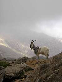 Feral Goat (Photo by igneouscarl)
Snowdonia is representative of Calcareous rocky slopes with chasmophytic vegetation at one of its most southerly outposts in the UK, and contains the most extensive and diverse examples of these communities in Wales. Crevices in base-rich igneous rocks support a characteristic assemblage of plants, with a large number of arctic-alpine species. These include a number of nationally rare species, such as alpine saxifrage Saxifraga nivalis, tufted saxifrage S. cespitosa, alpine meadow-grass Poa alpina and alpine woodsia Woodsia alpina. A species of particular interest is the Snowdon lily Lloydia serotina, which in the UK occurs only in Snowdonia, in rock cracks and crevices on calcareous and more siliceous substrates, and is here at its northern limit in western Europe. The site also has extensive examples of Siliceous rocky slopes with chasmophytic vegetation right at the southern edge of the habitat types range. Acidic crevice communities occur throughout the site on igneous outcrops and include populations of stiff sedge Carex bigelowii, fir clubmoss Huperzia selago and forked spleenwort Asplenium septentrionale. Atlantic species, including Wilson's filmy-fern Hymenophyllum wilsonii and a wide range of bryophytes, are also well-represented.
 Stonecrop (Photo by Nanuls
Llyn Idwal, located just to the north of Glyder Fawr, represents a fine example of oligotrophic waters. It is a relatively small, shallow, upland corrie, in contrast to Llyn Cwellyn, also in Snowdonia, and complete ice cover has been recorded in winter. No overall change in the lake's water chemistry has been found since the mid-19th century, and the water quality is considered to be high. The site has a good representation of typical plant species, including quillwort Isoetes lacustris, water lobelia Lobelia dortmanna, shoreweed Littorella uniflora, bulbous rush Juncus bulbosus, alternate water-milfoil Myriophyllum alterniflorum and intermediate water-starwort Callitriche hamulata. Bog pondweed Potamogeton polygonifolius has been recorded from stream inlets, and pillwort Pilularia globulifera is reported from this site. Emergent and floating vegetation is mainly confined to the shallow sub-basin at the south end of the site, where floating bur-reed Sparganium angustifolium forms extensive mats, alongside stands of common reed Phragmites australis, water horsetail Equisetum fluviatile and bottle sedge Carex rostrata.
Wildlife in the area is in abundance with some 50 species of flower, around 50 species of fern, nearly 50 species of moss, 7 species of clubmoss, around 50species of lichen, over 70 species of fungus and fungoid, over 60 species of hornwort, quillwort, stonewort and liverwort, and nearly 30 species of conifer occupying the valleys and mountain sides of the area. Countless insects feed upon and live within this vegetation with some 40 species of butterfly, over 50 species of moth, around 50 species of beetle, around 50 species of spider, 6 species of grasshopper, 15 species of hymenoptera (bees, wasps and ants), 16 species of dragonfly, as well as countless other species of insect. There area also around 50 species of molluscs, 5 species of crustacean.
Within the sites lakes, streams and marshes live a plethora of amphibians and fish including 3 species of Lamprey, and 14 species of bony fish including Brown and Rainbow Trout, Atlantic Salmon, and European Eel. Of the amphibians living in the area are the Common Frog, Common Toad and Palmate Newt.
Although rarely seen reptiles also live within the area including the Adder, Common Lizard, Grass Snake and Slow-worm.
Among the species of mammals that can be found there are Feral Goat, Brown and Mountain Hares, Grey and Red Squirrels, European Rabbit, European Mole, Eurasian Badger, Pine Marten, Polecat, stoat, Weasel, Red Fox, European Otter, West European Hedgehog, Brown Rat, three species of mice, three species of shrew, two species of Vole and no less that thirteen species of bat.

General site character
Inland water bodies (standing water, running water) (2%)
Bogs. Marshes. Water fringed vegetation. Fens (15%)
Heath. Scrub. Maquis and garrigue. Phygrana (19.7%)
Dry grassland. Steppes (34%)
Alpine and sub-alpine grassland (1%)
Broad-leaved deciduous woodland (0.3%)
Inland rocks. Screes. Sands. Permanent snow and ice (27%)
Other land (including towns, villages, roads, waste places, mines, industrial sites) (1%)
Information provided by the Joint Nature Conservation Committee
Routes
| " The Welsh have a proverb: 'It is easy to say yonder is Snowdon; but not so easy to ascend it.' Therefore I would advise you to brace up your nerves and sinews for the attempt."
George Borrow - Wild Wales (1862) |
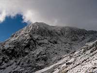
Snowdon, it can be confidently said, is by far the most visited mountain in Wales. Many just come to stare at it from the car park, others to take the train to the summit for a cup of tea in the mountain's newly re-built café. Many, many others however, visit the mountain with more ambitious plans, be they hikers, rock climbers, or that increasingly rare creature these days, the winter climber. While some come only with the megalomaniacal obsession of climbing the highest mountain in Wales, most come with the understanding that prestigious titles aside, the mountain offers a gargantuan range of high quality routes, which are often steeped in the rich history and myth of their sport.
This section attempts to summarise what Snowdon has to offer the visiting mountaineer, be they aspirant or expert. In doing so, it will inevitably lean towards giving focus to what are thought to be the most popular or highest quality routes and in doing so, will sadly miss out on some of the less known, but fondly thought of lines. The author recommends therefore, that any reader planning to visit Snowdon should also consider consulting one of the many high quality guidebooks that are available for the area, a perhaps less than comprehensive list of which, can be found in the Guidebooks section of this page.

Snowdon (left) and Yr Aran (right) from Beddgelert Forest
(Photo by Nanuls)
(Photo by Nanuls)
Hiking
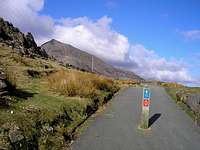
Almost all of Snowdon is designated as Open Access Land under the auspices of the Countryside Rights of Way (CRoW) Act 2000. What this means for the hiker is that they can pretty much take what ever route they like to the top, whether there's a path present or not. Most will not want to thrash through bog and bracken however, and will be more interested in taking one of the more conventional routes up the mountain. The table below provides details for the mountain's most travelled paths, which all begin at clear, well established trailheads and are easily reached via public transport.
| Photo | Route Name | Length | Description |
|---|---|---|---|
 |
Llanberis Path | 7km | Considered to be the 'Normal' route to Snowdon's summit, it starts at the Llanberis Mountain Railway Station and follows a gradual path up the northwest ridge. Always busy with tourists, long and somewhat boring, it's included here only for the sake of completeness. Avoid if you dislike crowds, litter and seagulls. |
 |
Rhyd Ddu Path | 5km | The route starts at the Rhyd Ddu car park on the A4085 road between Caernarfon and Beddgelert and a station on the Welsh Highland Railway. It begins gradually but increases in gradient as it traverses the spine of Llechog and on to Snowdon's summit itself. Combined with the Ranger Path (below) it makes an interesting and enjoyable horseshoe. |
 |
Snowdon Ranger Path | 5km | The route starts at the Snowdon Ranger station car park on the A4085 road between Caernarfon and Beddgelert. A gradual route to begin with that gets increasingly steep as it traverses the back of Clogwyn Ddu'r Arddu and on to Snowdons summit. Combined with the Rhud Ddu route it makes an fun compact horseshoe. |
 |
PYG Track | 5km | One of the most popular of Snowdon's routes, the PYG Track, starts at the Pen y Pass car park and shares the same first leg as the Snowdon Horseshoe (a long and classic mountain day). It separates from this route at the base of Crib Goch and traverses around the slopes of the mountain before ascending steeply, in a zig-zag motion, up the southern flank of Garnedd Ugain. |
 |
Miners Track | 5km | Another very popular route, which also starts at the Pen y Pass car park but instead of climbing up towards Crib Goch, bears south and follows the edges of Llyn Teyrn, Llyn Llydaw and Glaslyn. At Glaslyn it rises steeply to join the zig-zags of the PYG Track. |
 |
Y Lliwedd Route | 6km | Usually only used as the descent route of the Snowdon Horseshoe, Y Lliwedd also offers a pleasant line of ascent. The route, which is a sort of cross between a hike and a Grade 1 scramble, begins at Pen-y-Pass and takes the southern path around Llyn Llydaw, climbs up the eastern ridge of Y Lliwedd, descends along its western ridge to Bwlch y Saethau, before climbing the final leg to Snowdon's summit via its broken southern face. |
|
Cwm Glas Routes | 4/6km | These two routes ascend the mountain via Cwm Glas Mawr and are probably the quietest two hikes on Snowdon. The longer route starts at Pen-y-Pass and follows the PYG Track to the base of Crib Goch, where it skirts northerly around the North Ridge of aforementioned summit, around the Clogwyn Person Arête and up onto Garnedd Ugain.The shorter of the two starts at Ynys Ettws (SH 624 567) and follows Cwm Glas Mawr southwest until the base of Garnedd Ugain, and then joins the first route following the western flank of the Clogwyn y Person Arête.From Garnedd Ugain the Cwm Glas routes join the Llanberis Path and carry on together to Snowdon's summit. |
 |
Watkin Path | 6km | This historic route was built by Sir Edward Watkin, who owned a chalet at the foot of the path, to allow his guests to climb Snowdon in safety. It was opened in 1892 by William Gladstone (he of Prime Ministerial fame), then aged 83, who walked as far as the spot now called Gladstone Rock and commemorated by a plaque. Starting at Bethania and ascending the mountain via Bwlch y Saethau, this route gains the most absolute height of any other on Snowdon. |
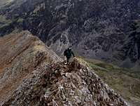
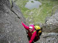
Scrambling
Snowdon's numerous faces are home to many scrambles and low end technical climbs, only a few of which are listed below. Some of these routes can easily claim to be some of the best for their grade in the country and are extremely worthwhile objectives for anyone visiting the area. To aid the reader with identifying these routes, the table below has been split into buttresses and subsidiary summits. For full descriptions of most of these routes see Steve Ashton's excellent guide, Scrambles in Snowdonia or Garry Smith's North Wales Scrambles. The following section is not intended to be a comprehensive guide to the mountains scrambles, but more of a way of pointing the reader in the right direction.
| Photo | Route Name | Grade | Description |
|---|---|---|---|
 |
Snowdon Horseshoe | 1 | This route is the classic mountain traverse of Wales and one of the finest mountaineering routes in Britain, incorporating the almost vertical knife edge of Crib Goch with scrambles on Crib y Ddysgl and Y Lliwedd. The route starts at Pen-y-Pass and ascends Crib Goch via its East Ridge then following the main ridge on to Crib y Ddysgl, Garnedd Ugain and Snowdon. The Descent is made via Bwlch y Saethau and over Y Lliwedd, finishing back where it started at Pen-y-Pass. In winter it becomes a very long Grade II climb, which can be a challenge to finish in daylight. |
| Crib Goch | |||
 |
Traverse of Crib Goch | 1 | This fantastic scramble links Crib Goch with Snowdon and involves delicately clambering over jagged pinnacles and balancing along narrow ridges. Probably the most popular scramble on Snowdon, it is most often completed as part of the Snowdon Horseshoe. |
 |
East Ridge | 1 | This is the normal preliminary route on to Crib Goch's main ridge, and consists of easy scrambling up a blunt narrowing ridge which terminates on the summit of Crib Goch itself. |
 |
North Ridge | 1 | The cliffs of Dinas Mot give way to the long, gently rising North Ridge. Although the scrambling is not quite as enjoyable as that of the East Ridge, this route makes for a much quieter alternative and joins said route on Crib Goch's summit. |
 |
North Ridge via Jammed Boulder Gully | 3 | At the point where the Dinas Mot cliffs curve rightwards into Cwm Glas, the rockface breaks into a series of buttresses separated by steep gullies. The Jammed Boulder Gully is one of these and provides a short and tricky route up onto the North Ridge. |
| Clogwyn y Ddysgl | |||
 |
Clogwyn y Person Arête | 3 | Another classic. The lonely steep arête rising from Cwm Glas Mawr is a popular choice with those who have already done the Snowdon Horsehoe and are looking for something a bit harder, wilder and less travelled. It's an aesthetic line, which follows the crest of a narrowing ridge to the summit of Garnedd Ugain and is gained either by an easy gully on its right or directly up the Parson's Nose at around Difficult to Very Difficult standards (see rock climbing section). |
| Y Lliwedd | |||
 |
Traverse of Y Lliwedd | 1 | The final wing of the Snowdon Horseshoe provides a worthwhile easy scramble in itself, taking the scrambler up and down two broad backed ridges amongst some truly spectacular surroundings. |
 |
West Peak via Bilberry Terrace | 3 | Possibly the best and most difficult scramble in Wales, this route takes a devious but logical line up Lliwedd's West Peak. Long and serious, with few options of escape, it should only be undertaken under good conditions by competent and confident scramblers. |
 |
Y Gribin and East Ridge | 1 | This ridge scramble starts in the middle of the pass that separates Llyn Llydaw from Glaslyn and rises in a south-westerly direction onto Bwlch y Saethau. The scrambling is comparable to the East Ridge of Crib Goch, taking the climber up a broad ridge to begin with, followed by a broken face to Snowdon's summit. Despite being right in the middle of Snowdon's busiest Cwm, it rarely sees any ascents, making all the more worthwhile in this author's opinion. |
| Clogwyn Du'r Arddu | |||
 |
Eastern Terrace | 1 | While Cloggy might be a climber's paradise, the same can't be said for the scrambler. This route follows a gradually widening terrace that slants across the cliff face and is usually used as a line of descent by climbers. For those interested in the history of British climbing, this is though to be the route taken by the Reverends Bingley and Williams on their first ascent of the cliff in 1798. |
 |
Western Terrace | 2/3 | The Western Terrace is a more difficult and sustained route than its eastern neighbour; it rises diagonally rightwards beneath the overlapping slabs of the West Buttress. It's an awkward and insecure scramble that is probably better off avoided. |
| Llechog | |||
|
Llechog Buttress | 2/3 | There are two Llechog's on Snowdon. This route, and the next one, are on the Llechog in the Llanberis Pass. A beautifully quiet route up a short ridge taking the climber straight from the bottom of the Llanberis Pass to the Snowdon Railway track just below the Clogwyn Station. The scrambling is intricate and difficult making up for the fact the route ends so far down the Llanberis Path. |
|
Llechog Ridge | 1/2 | A handy escape route from the Llechog Buttress if things get a little hairy, this is an easy scramble over good rock that can be hazardous when wet due to a generous covering of lichen. |
| Cwm Llan | |||
|
Tregalan Couloir | 2 | A serious scramble, this remote line is surprisingly varied and follows the edge of a scree filled gully. One of the beauties of the route is that it is rarely ascended, an exceptional quality on Snowdon. |
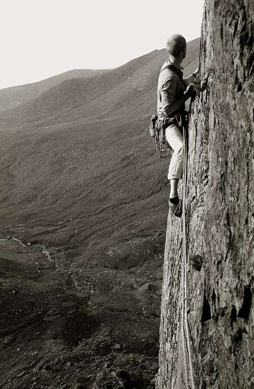
Rock Climbing
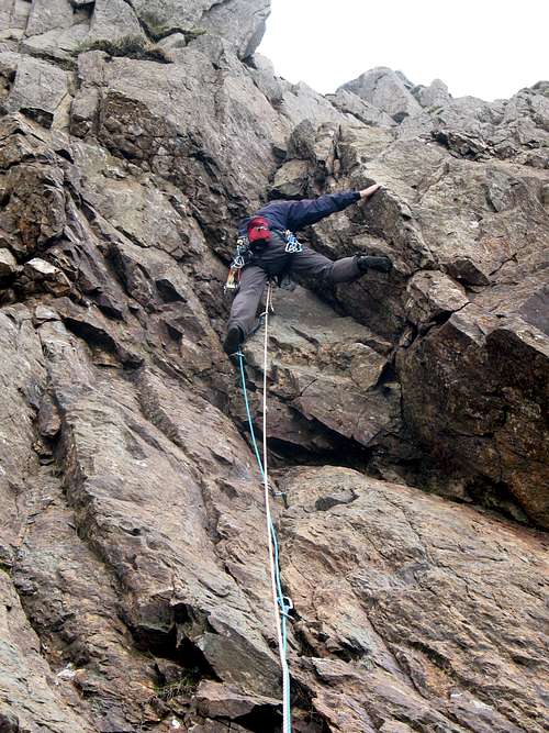
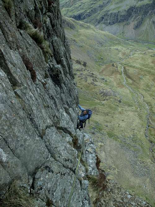
As has been described in an earlier chapter, Snowdon is said to be the scene of Britain's first rock climb (one of many as it happens!), and has played an important role in the development of the sport. Its various cliffs, crags and outcrops bristle with quality routes, and while fashions in climbing may change, Snowdon has always had something on offer for those looking for a bit of adventure.
Snowdon's cliffs vary from small and intimate valley crags to towering, Alpinesque mountain buttresses. Given the sheer number and diversity of Snowdon's climbing venues, it is inevitable that the mountain should be covered by not one dedicated guidebook, but many, the tally currently reaching five. To aid the reader, the relevant guidebook for each cliff has been given alongside each description. Of course these are not the only guidebooks to contain details of climbs on Snowdon; there are a number of general guidebooks covering North Wales available too, these are, in order of date published:
Rock Climbing in North Wales by Paul Williams (Constable)
North Wales Rock by Simon Panton (Ground Up)
North Wales Classics by Jack Geldard (Rockfax)
North Wales Climbs by Mark Reeves, Jack Geldard, Mark Glaister (Rockfax)

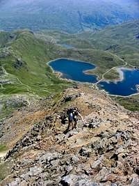
Y Lliwedd from Llyn Llydaw (Photo by Nanuls)
For those interested in such things, the first guidebook to North Wales rock, Rock Climbing in the British Isles, Volume 2 Wales and Ireland, was published way back in 1895 by W.P. Haskett Smith. This was followed by a more 'modern' incarnation of the guidebook in 1906 in the form of G.D. and A.P. Abraham's Rock Climbing in North Wales. Then in 1909 J.M. Archer-Thompson and A.W. Andrews produced the Climbers' Club's first guide, and the first guidebook dedicated to a specific cliff in Wales, The Climbs on Lliwedd, and so marked the dominance of the Club over detailed guidebooks in Snowdonia.
As is the case throughout the UK, rock climbs on Snowdon are graded using the combined adjectival and technical grading systems. To get an idea of what this means, Rockfax have a frankly excellent table plus explanation on their website.
| Photo | Cliff/Crag | Grid Ref. | Description |
|---|---|---|---|
 |
Clogwyn Du'r Arddu | SH 599 556 |
Affectionately known as 'Cloggy', Clogwyn Du'r Arddu is perhaps the best known of all Snowdon's climbing areas and has been described by Leo Houlding as "the best crag in the world". Located on one of Snowdon's western ridge's it rises ominously above Llyn Du'r Arddu and is divided into eight main climbing areas - the most impressive being the East Buttress. Development really took off here in the 1950s when the likes of Joe Brown, Don Whillans and John Streetly amongst others put up some of the hardest climbs of the day; it has remained popular ever since. It is still home to some of Wales' hardest lines, including the now infamous Indian Face (E9 6c), established by Johnny Dawes in 1986, who described the ascent as being like "swimming with sharks". Guidebook: Clogwyn Du'r Arddu |
 |
Y Lliwedd | SH 623 534 |
Perhaps the classic rockface of Snowdonia, Y Lliwedd has been at the centre of British rock climbing since its conception. Over 1,000 feet high and half a mile wide, the cliff is divided into four main buttresses intersected by grassy ledges. While the style of climbing it offers has fallen slightly out of fashion of late, it was an object of obsession for the Victorian and Edwardian rock pioneers and consequently, the scene of many a triumph and tragedy. It was also the site of considerable training activity for the 1953 British Everest Expedition. These days, perhaps the most travelled route is Avalanche/Red Wall/Longland's Continuation (Severe 4b), a 12 pitch extravaganza with a serious alpine feel. Guidebook: Lliwedd |
 |
Crib Goch | SH 625 553 |
One of Snowdonia's most iconic peaks, Crib Goch is better known for its scrambling than its rock climbing. A number of routes have been recorded on its expansive and pinnacled northern face, though all with the exception of one, Reade's Route, are of little interest to the climber. The aforementioned route however, has gained something of a classic status. Having first been climbed by W.R. Reade and G. L. Bartrum way back in August 1908, today it's rated as Very Difficult and, for the grade, boasts a very interesting crux pitch!Guidebook: Llanberis |
 |
Clogwyn y Ddysgl | SH 616 554 |
This quiet ridge rises in a southerly direction out of Cwm Glas Mawr, adjoining the main ridge just below the summit of Garnedd Ugain. It is another of Snowdon's cliffs, which perhaps for its alpinesque aura, attracted the attentions of Britain's early climbers, its first ascent said to have been completed by an unknown wandering Parson with a penchant for ridges. Consequently, most of its routes are of an old-fashioned nature, the best of which are probably The Gambit (Very Difficult), Rectory Chimneys (Very Difficult) and the Parson's Nose (Difficult or Very Difficult). Guidebook: Llanberis |
 |
Dinas Mot | SH 627 563 |
Dinas Mot is a large and immensely important cliff located at the end of Crib Goch's North Ridge. Its main attraction is its fantastic central triangular slab known as The Nose, a worthy opposite to the Pass' other classic cliff Dinas Cromlech. Its Western Wing is split by two gullies and its Eastern Wing is a towering buttress with lots of delicious overhangs. The rock is fantastic throughout and yields such classic routes as The Cracks (Hard Severe 5a), The Direct Route (Very Severe 5b), Diagonal (Hard Very Severe 5a) and Super Direct (E1 5b). Guidebook: Llanberis |
 |
Cyrn Las | SH 613 559 |
Cyrn Las, also known as Diffwys Ddu, is close to Craig y Rhaeadr (above) and dominates Cwm Glas Mawr, from where it rises. It is divided into three buttresses and is one of Snowdon's more popular crags; it therefore tends to get quite busy. It boasts some great multi-pitch routes up to around 250 metres, including Main Wall (Hard Severe 4b), The Grooves (E1 5b), Lubyanka (E3 6a) and Long Kesh (E5 6b).Guidebook: Llanberis |
|
Craig y Rhaeadr | SH 622 652 |
Located near Dinas Mot on the northern edge of Crib Goch's North Ridge, Craig y Rhaeadr, also known as Diffwys Ddwr, is most famous for its eponymous waterfall which runs down its centre and in the right conditions turns into a quality ice climbing spot. In summer it offers a handful of single and multi-pitch rock routes, the best of which are probably The Wall (E1 5a), Silent Spring (E3 5c) and Ghosts (E3 5c). Guidebook: Llanberis |
 |
Cwm Glas Mawr | SH 619 568 |
Quiet, with a remote feel, despite being in the middle of Snowdonia's busiest climbing destinations, Cwm Glas Mawr is home to a number of small crags and boulders which are home to a number of mostly difficult climbs including Spitting Image (Hard Very Severe 5b), Rembrandt Pussyhorse (E3 6a) and Pretty Girls Make Graves (E6 6b). The bouldering's good too! Guidebook: Llanberis |
 |
Craig Aderyn | SH 639 543 |
This small crag is situated a wee bit off the beaten track, just below Llyn Teyrn in Upper Cwm Dyli. It comprises of a smooth and reasonably angled slab, which provides a handful of interesting routes up to about Very Severe 4c. The pick of the bunch is almost certainly Jacob's Media (Hard Severe 4b), which gives exciting long run-outs on perfect rock. A trip here is best combined with a visit to the Cwm Dyli Boulders; both can be reached by crawling under the pipeline that provides water for the Cwm Dyli hydro-electric power station, and a short walk across bog. Guidebook: Llanberis |
 |
Llechog | SH 597 537 |
Not to be confused with the much less interesting Llechog in the Llanberis Pass, this Llechog, is a striking cliff that can be clearly viewed from Snowdon's summit and is best reached from the Rhyd Ddu Path. It's a large cliff consisting of a maze of short slabs interspersed with grassy ledges and bounds the southern rim of Cwm Clogwyn. Notable routes include Central Rib (Very Difficult), The Pickpocket (E2 5c) and Slopey (E3 5c). Guidebook: Cwm Silyn and Cwellyn (Eifionydd) |
 |
Nant Gwynant | SH 616 494 |
The crags on the eastern side of Snowdon lie strung out along the idyllic valley of Nant Gwynant. Their low altitude and easterly position, not only give them an entirely different feel to Snowdon's other crags, it also makes them excellent wet weather options, since it rains much less frequently here. Of all the crags, Clogwyn y Wenallt and Clogwyn y Bustach are probably the best known and consequently the most visited. In terms of routes, the former crag can boast a good proportion of starred routes, including mid-grade classics Bovine (Hard Very Severe 5b), Ovine (Very Severe 4c) and Boxine (Very Severe 4c), while on the latter, the largely subterranean struggle up Lockwood's Chimney (Difficult) really stands out. Guidebook: Tremadog |
Winter Climbing
Unfortunately the close proximity of Snowdon to the sea and the frequent arrival of Atlantic depressions pushing warm, moist air over the area, even in the middle of winter climbing conditions are infrequent and unreliable. Having said that, when conditions are good, they are pretty damn good and if you're lucky enough to be in the area when conditions are right, then Snowdon offers winter routes for climbers of all abilities.
Winter routes in Snowdonia are graded using the Scottish Winter Grading system, which uses increasing Roman numerals to rate the difficulty of climbs. The system can be difficult to get to grips with for those unfamiliar with it, since it makes no distinction between snow ice, water ice and mixed routes, therefore when choosing a route, reading the description is critical. For full descriptions of most of the routes on the mountain see Malcom Campbell and Andy Newton's Welsh Winter Climbs, which is now supplamented by Mark 'Baggy' Richard's North Wales Winter Climbing. For the very occasional visitor, Jack Geldard's North Wales Classics also has a short section on winter climbing, complete with sparkly colour topos.
| Photo | Cliff/Crag | Grid Ref. | Description |
|---|---|---|---|
 |
Snowdon Horseshoe(Grade I/II) | - | Okay, this clearly isn't a crag, but because it goes pretty much everywhere (well nearly), it's going to be described as one (well kind of). This truly superb route is around 12km long and boasts around 1,000m of climbing, which clearly makes it one of the best mountaineering expeditions in Wales. The route is long and arduous and special care is needed when descending, meaning that the party should be fit, well equipped and experienced. Ice axes are essential and crampons are highly recommended. |
 |
Y Lliwedd | SH 623 533 |
All the things that make Y Lliwedd so unappealing for some summer climbers make it an absolutely superb destination for those looking for winter action. Huge, north facing, an over abundance of flora and wet and greasy rock means that it doesn't take much for it to come into condition, and hose with the right skills will find plenty to keep them busy. All the routes are hard and involve mixed climbing, combined with a lack of decent protection and woeful belays. Route finding, just as it is in summer, is also a weighty challenge in itself and so a summer recce is advised. Check out Central Gully (V), Central Gully Direct (VI) and Slanting Gully (V, 6) for a taste of the best climbing. |
 |
Clogwyn y Garnedd | SH 610 546 |
The magnificent north face of Snowdon is one of the most popular winter faces in Snowdonia and is home to some absolutely classic routes. High and north facing, it holds snow like nowhere else on the mountain and consequently, is a popular choice on any given weekend; don't come here in search of solitude. The face has an excellent range of low to mid grade routes making it an ideal beginner venue, but beware, in poor weather route finding becomes troublesome and the long walk back to the car park something of an endeavour. Its best and most popular climbs are the excellent Central Trinity (I/II) and Right-Hand Trinity, but if these prove too busy to endure, both Snowdop (III/IV, 4) and Cave Gully (III, 2) prove worthy alternatives. |
 |
Clogwyn du'r Arddu | SH 602 555 |
When draped in its winter garments, the steep, dark cliffs of Cloggy are an even more foreboding presence than in summer. Unfortunately, these occasions are rare. Those who find themselves here at the right time will find themselves presented with a peculiar mix of pure winter routes and transformed summer climbs. Perhaps the best of these are Jubilee Climb (V) and The Black Cleft (VII, 7), normally a horrific and slippery summer route (E2 5c) first ascended by Joe Brown and Don Whillans on one of their early visits in 1952). |
 |
Moel Eilio | SH 564 566 | Situated below the Moel Eilio Horseshoe on Foel Gron, at the head of Cwm Dwythwch, these diminutive cliffs offer a handful of routes that are worth a look in the right conditions. There are three obvious gullies on the crags, all of which are between 60 and 70 metres long and are graded between II and III. A further three gullies, again around 70 metres high and graded between II and III, can be found on the south west flank of the mountain on the areas of crags called Y Diffwys. |
 |
Cwm Llan: Clogwyn Du | SH 605 533 |
This extensive crag is the most continuous area of rock to be found on the massive back wall of Cwm Treglan and forms the eastern flank of Snowdon's South Ridge. It's a quiet and wild part of the mountain, ideal for those looking to escape the throngs of climbers who usually occupy Snowdon's more popular areas. The cliff is home to a handful of routes, the best of which are Shadow Gully (II/III, 3) and Tregelan Groove (III, 3). |
|
Cwm Dyli | SH 650 543 | The gorge of the Afon Glaslyn lies above the power station in the Nant Gwynant valley and is readily seen across the valley from the road about 2km south of the Pen y Gwryd Hotel. Its height and aspect don't suggest it as a common ice climbing venue, but in rare spells of extreme cold, it freezes and has been climbed. It is good fun and gives extended bouldering throughout its length with some pitches up to IV. |
|
Craig Cwm Beudu Mawr | SH 630 555 |
A good spell of cold weather will turn this low altitude crag into something of a beginners winter wonderland, with a mix of easyish snow and ice routes. The hardest routes only reach Grade III, the best being Dodo Gully (III) and Pterodactyl (II/III, 4). |
 |
Crib Goch | SH 625 553 | One of Snowdonia's most iconic peaks, when conditions are right, the ridges and gullies of Crib Goch transform from easy scrambles and climbs, winter routes of equal quality. A traverse of any of the mountain's ridges can be climbed at around Grade I and are best done after a good volume of snow and neve has had time to accumulate. Those looking for something a bit harder will find good fun on the North West Face, where routes of Grade II and III can be found. |
|
Dinas Mot | SH 625 563 |
In spite of being relatively low on the mountain's side, Dinas Mot receives considerable drainage from above, and in very cold conditions, has several good ice falls. Routes are generally in the low-mid grades and Jammed Boulder Gully (III, 4), Jammed Boulder Buttress (IV/III, 4), Black Cleft and The Chute (III/IV, 4) are all well worth a look. |
|
Craig y Rhaeadr | SH 620 561 |
In particularly cold winters, Craig y Rhaeadr becomes on of Snowdonia's best ice climbing venues. Central Ice-fall Direct (VI, 6) might be the vest route of its grade in Wales, while Chequered Wall (VI), Waterfall Climb (IV, 5), Cascade (V, 5) and Cascade Right-Hand (V) are superb examples of their type. |
 |
Cyrn Las | SH 613 559 |
The main crag of Cyrn Las is great in summer, but is somewhat lacklustre in winter. However, the wetter courses to the left, which are to be avoided in summer, are often in winter condition and consequently, very popular. The crag is most famous for two routes, Sergeant's Gully (II) and Face Route (IV, 4) but good fun can also be found on Gwter Fawr (I) and The Great Gully (III/IV) too. |
 |
Clogwyn y Ddysgl | SH 610 550 |
Clogwyn y Ddysgl is perhaps the best of the Llanberis Pass winter climbing areas, being home to a good mix of routes set within a remote and beautiful setting. The crag is best know for the iconic Clogwyn y Person Arête, a grade 2/3 scramble in summer, and a great Grade II/III mixed climb in winter. While the crags holds a number of other good climbs, the other line that must be mentioned here is Parsley Fern Gully (I), one of the best climbs of its grade in Snowdonia. |
|
Cwm Glas Bach and Cwm Hetiau | SH 619 565 |
Not quite as impressive as its bigger neighbour, Cwm Glas Mawr, Cwm Glas Bach, holds a remarkable quantity of ice when the conditions are right. It's remote, beautiful and well worth a visit. Cwm Hetiau is another solitary corner of the mountain, which also becomes satisfyingly icy in the depths of winter. They're so close their best described as one. While the routes here don't quite match the quality of what's on offer in the neighbouring Cwm, they are at least of some interest. The 7 pitch Railway Gully (II/III, 3) for example, is a great, long and easy angled route ideal for ice novices. |
Bouldering
Bouldering on Snowdon is very much focused around Llanberis Pass, with areas such as the Cromlech Boulders and Wavelength offering almost limitless problems for those who seek them. The quality and quantity of what's on offer is so vast that the Pass has become well known to British climbers as one of the best bouldering venues in the country, and is consequently, extremely popular with those visiting the area. For those looking for something a bit quieter, outlying areas such as Cwm Dyli and Clogwyn y Bustach make excellent alternatives to The Pass' hustle and bustle and, in all fairness, are home to some excellent problems in their own right.
Snowdon is fortunate in having a growing number of excellent guidebooks that describe, in various degrees of detail, the bouldering problems on the mountain. For the climber who is more interested in trad and sport routes than bouldering, both the Climbers' Club's Llanberis guide and Ground Up's North Wales Rock have sections on bouldering, the former being the better of the two because it covers a far smaller area. Those after something a bit more comprehensive should look no further than Simon Panton's North Wales Bouldering / Bowldro Gogledd Cymru, an excellent bilingual guide that is entirely dedicated to the art of bouldering.

Bouldering Areas of the Llanberis Pass
(Photo by Nanuls)
(Photo by Nanuls)
| Photo | Cliff/Crag | Grid Ref. | Description |
|---|---|---|---|
 |
Cromlech Area | SH 629 566 |
While the Cromlech Boulders themselves are on the northern side of the Llanberis Pass, and therefore technically not on Snowdon, their fame, as well as the sheer quality and quantity of their bouldering problems, would make their absence here a bit of misnomer. Easily the most accessible bouldering venue in Wales, it's remarkable that they exist at all; for in 1973, they nearly succumbed to the dynamite of Gwynedd County Council's highway engineers. The scenery is outstanding and the problems, which range from V0- to V11 (Sub Society), are all superb, so its not surprise that they receive considerable attention from North Wales' bouldering community, who often descend on the area after work and on weekends. Be sure to either get there very early or very late as parking could prove difficult; alternatively, you could just get the bus.Other good bouldering spots in this part of the Pass include, Jerry's Roof, which is home to one of the area's hardest problem, Mr Fantastic (V12), Pont y Gromlech Slabs, which offer the outstanding The Seam (V3), the more limited Craig Llwyfan and the distinctive Barrel. |
|
Further Pass Oddities | SH 620 571 |
A little further down the Pass are a disparate collection of boulders, mostly scattered on the Snowdon. The boulders just above the road and just below Clogwyn y Grochan, give rise to a number of problems the best of which is Jerry's Wall (V8), while just below the road and Clogwyn y Grochan is a low slopey traverse, Pritch's Traveres, which goes at V4. A little further down the road are the Obedience Boulders, which has a range of problems from V2 to V6. Further right a series of slabs and walls lead up towards the main Cwm Glas Bach crags, which hold a number of problems, the best of which is Moose's Toothpaste (V5). A little down the hill is another slabby bluff, which produces Thumb Boy (V5). Further down the Pass is the secluded craglett known as the Gentleman's Wall. It's home to problems from about V3 to V6.Finally, just up the road from Nant Peris are the distinctive Pac Mann Boulders, a minor venue that is home to a small number superb problems from V5 to V12! There are many more problems to be found in the pass, too many quite frankly, to attempt to document here |
 |
Wavelenghth | SH 621 566 |
The most expansive area of bouldering on the mountain, the area known as Wavelength encompasses the boulders on the southern side of the Llanberis Pass, around the well known trad climbing venues of Dinas Mot, Cyrn Las and Cwm Glas. The area is home to the Ynys Ettws Boulders, Pie Shop Boulders, Grooves Boulder, Upper and Lower Satellites, The Dome, Beyond the Dome Boulders, Utopia Boulders and the eponymous Wavelength Block. The latter two are particularly worthwhile, since the offer some of the best bouldering in the Pass. Utopia's iconic form, is probably the most popular, thanks to its ease of access as well as the huge variety of low to mid grade problems that it yields; be sure to check out The Pebble (V6), The Flake (V0-) and Utopia Groove (V2) if visiting. While less popular, the bouldering at Wavelength is arguably even better, with The Groove (V4) and King of Drunks (V6) as its stand out problems. |
 |
Cwm Dyli | SH 641 541 |
If you're looking for a remote, secluded and incredibly beautiful spot, far from the roadside commotion of The Pass, then the Cwm Dyli Boulders are definitely for you. You'll just have to walk a fair bit, sometimes over bog and sometimes under water pipes, to get there. This, should not of course, bother you, for the bouldering in Cwm Dyli easily lives up to the spectacular surroundings in which it sits. The problems lie mostly in the low to mid grades, with Teyrn Crack (V3 or V1 with a standing start), being perhaps the best. Those looking for something a bit harder will also find something to entertain them in the form of Spanner Job (V8) and Sabotage (V10). Given their close proximity, a trip to the boulders may also be combined with a trip to Craig yr Aderyn (see rock climbing section); that is of course, if you don't mind carrying the extra gear. |
|
Clogwyn y Bustach | SH 652 534 |
Despite having a wide array of boulders, liberally spread through the woodland under the main crag, Clogwyn y Bustach offers relatively little for the boulderer, Nevertheless, there are some excellent problems here, which range in difficulty from V1 to V12. Given its sheltered location and numerous overhanging problems, it's a good venue for a wet day. Stand out problem is Elephantitus (V6). |
Mountain Conditions
| " It is very seldom the traveller gets a proper day to ascent Snowdon; for often, when it appears clear, it becomes suddenly and unexpectedly enveloped in mist, by its attraction of clouds, which just before seemed remote and at great heights. At times I have observed them lower to half their height, and notwithstanding they have been disperse to the right and to the left, yet they have met from both sides, and united to involve the summit in one great obscurity."
Thomas Pennant - Tours in Wales (1810) |
Forecast
This section displays the mountain conditions for the Snowdonia National Park, in which Snowdon is located. Click on the widget for further information and maps.
This Snowdonia weather forecast is generated by the Met Office Weather Widget
Web Cameras
Webcams are a graet way of getting up-to-date weather information. Currently there are quite a few webcams in Snowdonia, only a few cameras located in the Snowdon area - even fewer are actually reliable. The section below provides links to the very best. These feeds are hosted by external sites, so obviously we can't be held responsible if a camera happens to be malfunctioning.
When To Climb and Essential Gear
| " The very first essentials in the equipment of a mountaineer, Alpine or British, are health and condition. 'As frontlets between his eyes' are the words 'mens sana in corpore sano.' The mens sana may be taken as read. To the man of unhealthy, unwholesome mind, the Voice of the Mountains can never appeal, the call of the wild can never reach his heart, and if such a one by ill chance take part in any serious expedition, he is pretty sure to do something insane which will, as likely as not, endanger himself and the whole party."
C.E. Benson - British Mountaineering (1909) |
Most ascents are made in the spring and summer and during the high season many of the popular routes can feel more like a bus queue than a mountain ascent. However, if one avoids weekends and public holidays, or employs some cunning route choices, a quiet day can be had e.g. through Cwm Glas or over Y Lliwedd. The area is often cloudy and showers are frequent so full waterproofs are always essential no matter what the weather forecast. A good pare of boots, a map, a compass and a hat are also a necessity.
 Snowdon(Photo by Bryan Benn) Snowdon(Photo by Bryan Benn) |
Clogwyn Du'r Arddu(Photo by mills) |
 Snowdon(Photo by Bryan Benn) Snowdon(Photo by Bryan Benn) |
Most scrambles can be done with no more extra gear than one might carry for a hike, but for the harder routes, some may choose to carry a helmet, rope, harness and a small rack of slings, crabs and nuts; if attempting the West Peak of Y Lliwedd via Bilberry Terrace for example, to carry all of these items is highly recommended.
The best time for rock climbing is from late spring to early autumn, when there is little chance of snow and ice and the crags dry out much faster. For the long, multi-pitch routes, a reasonable sized rack will probably be necessary. Most routes will require half ropes of 50 metres length, though on the longer, easier routes, a single rope will probably suffice. It's worth emphasising that the crags on Snowdon are big, serious and vulnerable to the area's fickle climate so be sure to carry enough food, water and warm, waterproof clothing. On the longer and/or less accessible routes, a headtorch may prove to be a very handy piece of kit; this is even truer in winter.
The Snowdon Mountain Railway stops running at the beginning of October, therefore, in winter, the mountain is much quieter. When snow and ice is likely, walkers should carry an ice axe and wear crampons. For true winter routes, specialist winter and ice climbing equipment is necessary and owing to the unpredictable nature of the mountain's snow and ice, these lines should only be attempted by those with experience of winter mountaineering techniques. Despite Snowdon's comparatively low altitude winters can be very cold, with temperatures dropping to near Arctic levels; many inexperienced walkers and climbers have been caught out in these conditions, most are rescued by mountain rescue teams however, on occasion, the consequences are much more serious.

Red Tape and Access
| “ In my opinion mountains should not belong to private individuals. Great objects belong, or should belong, to the nation.”
A. L. Bagley - Climber's Club Journal (Vol. IV No.13 September 1901) |
No red tape or access issues here!
For climbers, hill walkers and mountaineers, the British Mountaineering Council (BMC) runs a Regional Access Database, which holds mountain/crag specific information on matters of conservation and access, including issues such as nesting restrictions, nature designations and preferred parking.
If you are in any doubt about any particular access arrangement, or need to report an incident, you should contact your local BMC Access Representative or the BMC Access Officers for Wales: Elfyn Jones.
 Yr Aran(Photo by Nanuls) Yr Aran(Photo by Nanuls) |
 Llyn Dinas(Photo by mills) Llyn Dinas(Photo by mills) |
 Cwm Llan(Photo by Mike Terry) Cwm Llan(Photo by Mike Terry) |
Getting There
| "…This was one of the many beautiful lakes [Llyn Cwellyn], which a few days before I had seen from the Wyddfa. As for the Wyddfa I now beheld it high above me in the north-east looking very grand indeed, shining like a silver helmet whilst catching the glories of the setting sun.I proceeded slowly along the road, the lake below me on my right hand, whilst the shelvy side of Snowdon rose above me on the left. The evening was calm and still, and no noise came upon my ear save the sound of a cascade falling into the lake from a black mountain, which frowned above it on the south, and cast a gloomy shadow far over it."
George Borrow - Wild Wales (1862) |
There are numerous starting points dotted around the base of the mountain, all in close proximity to good roads that are serviced by regular bus routes.
Probably the most common starting point for Snowdon is the Pen-y-Pass car park (SH 647 555), at the zenith of the Llanberis Pass, which can be reached easily by road on the A4086 that runs between Llanberis (SH 582 598) and Capel Curig (SH 719 580). Both the Miner's Track and the PYG Track begin here, as does one of the Cwm Glas Routes. Owing to its spectacular position and the popularity of the routes that start there, the Pen-y-Pass car park often fills up quickly, so if you want to park there, a very early start is recommended. If the car park is full there is some parking around 1.5km to the east along the roadside near the Pen-y-Gwryd Hotel (SH 660 558). These parking options are both pay and display with a full day's parking costing £10 (up-to-date as of September 2010). If you cannot find parking in this area, then there is a Park and Ride just down the road in Nant Perris (SH 607 582), see below for further details. Pen-y-Pass is an ideal starting point for those wanting to climb on Clogwyn y Garnedd, Y Lliwedd, Crib Goch and Clogwyn y Ddysgl.
Do not park in the Pen-y-Gwryd Hotel car park - this is for guests only.

The alternate start for the Cwm Glas Routes starts a little further down The Pass, at a small bridge over Afon Nant Peris near Blaen-y-Nant (SH 622 568). While there is very limited parking here there is a scheduled bus stop, so it is advised that the local bus service is used to reach this one.
The Llanberis Path starts in Llanberis (SH 582 598), which has plenty of parking. The town is on the A4086 and can be reached from the north via the A487 by turning off at Caernarfon (SH 482 627); or from the south via the A498, which runs from Tremadog (SH 562 400) through Beddgelert (SH 590 481) to Pen-y-Gwryd (SH 660 558) where it meets the A4086.
The Watkin Path starts at the Nant Gwynant car park (SH 627 506) near Bethenia, which is on the A498 between Beddgelert (SH 590 481) and Pen-y-Gwryd (SH 660 558). Though not as busy as Pen-y-Pass, parking is limited, so again an early start is recommended. This is a good starting point for those looking to climb in Cwm Llan.
The Snowdon Ranger Path starts at The Snowdon Ranger Station car park (SH 565 551) on the Welsh Highland Railway, and is located on the A4085 between Beddgelert (SH 590 481) and Caernarfon (SH 482 625). This is an ideal starting point for those wanting to climb on Clogwyn Du'r Arddu (SH 602 554).
The Rhyd-Ddu Path starts at the car park nest to the railway station in the village of Rhyd-Ddu (SH 571 525), which is also located on the A4085 between Beddgelert (SH 590 481) and Caernarfon (SH 482 625). Use this path to reach the routes on Llechog.
All car parks are serviced by the park and ride in Nant Perris (SH 607 582) which runs regularly all day, every day, throughout the summer (including weekends and bank holidays). They are also serviced by the Snowdon Sherpa bus service which has various stops around the mountain and runs from Llanberis, Bettws y Coed, Caernarfon, Beddgelert, Bethesda, and Porthmadog. Be sure to check timetables first as you don't want to end up missing the last bus and find yourself stuck.
The Rhyd-Ddu and Snowdon Ranger paths can also be reached on the Welsh Highland Railway, which runs steam trains between Caernarfon and Porthmadog.
Camping and Accommodation
| "From the point of view of historic interest and association Pen-y-gwryd Hotel is the Welsh counterpart of Wastdale Head. It is situated about a mile from the top of Llanberis Pass on the Capel Curig side. Gorphwysfa or Pen-y-pass Hotel stands at the top of the pass ; it possesses the advantage of being at a higher level and closer to the crags than its more famous neighbour."
G.D. Abraham - British Mountain Climbs (1909) |
Way back in 1895, in the first rock climbing guidebook to be written for Snowdonia, the grandfather of British rock climbing W.P. Haskett Smith wrote, “Llanberis… is the most accessible of all the mountain resorts in Wales. As a consequence… the place is often intolerably overrun, especially during the late summer and autumn. The true lover of the mountains flees the spot, for the day-tripper is a burden and desire fails.”, and the same can be said to this day. It does however, have a plentiful supply of tourist accommodation, including a Youth Hostel Association hostel. The real draw of Llanberis is however, the café/bunkhouse/institution that is Pete's Eats; if you're a climber, then this is a must do destination.
Haskett Smith was more complimentary of Beddgelert, which he describes as “one of the gates of Snowdonia, and it is the gate by which the judicious will enter. It is, moreover, perhaps the prettiest mountain resort in Wales”. Many will agree, but it is perhaps more touristy today, than it was in 1895. The village has a handful of shops, pubs, campsites, B&Bs, hotels and other facilities and is a good alternative to Llanberis' weary facades.
 Snowdon(Photo by Nanuls) Snowdon(Photo by Nanuls) |
Y Lliwedd(Photo by daveyboy) |
 Clogwyn y Garnedd(Photo by Bryan Benn) Clogwyn y Garnedd(Photo by Bryan Benn) |
See the links below for some suitable recommendations:
Camping
The following links are for campsites within a reasonable distance of Llanberis:
Snowdonia Park
Camping in Llanberis
Llwyn Celyn Bach.
Those looking for something a bit wilder might want to try some sites around Capel Curig, which include Garth Farm, Gwern Gof Uchaf, Gwern Gôf Isaf Farm and Dolgam. The latter is an excellent base if you plan to walk/climb Snowdon from Pen-y-Pass.
The Beddgelert area also offers an array of beautiful locations to camp including Beddgelert Forest, Cae Du and the Cwellyn Arms.
Hostelling
There is an almost unprecedented number of hostels surrounding the mountain that are located wonderfully close to Snowdon's main trailheads. YHA Pen y Pass is the best placed of these and is located right at the start of the PYG Track, Miner's Track and Snowdon Horseshoe routes. YHA Capel Curig is a little further away but has the advantage of being close to a number of shops and pubs. YHA Snowdon Ranger is, funnily enough, very close to the start of the Snowdon Ranger Path, and YHA Bryn Gwynant is very close to the start of the Watkin Path. The Plas y Brenin National Mountain Centre in Capel Curig also has a bunk house, and has its own indoor climbing wall if you're still feeling energetic after your day on the mountain. My personal recommendation is the bunkhouse above the aforementioned Pete's Eats in Llanberis, a café that is a true icon of Snowdonia's climbing scene.
 Y Lliwedd(Photo by Bryan Benn) Y Lliwedd(Photo by Bryan Benn) |
 Snowdon(Photo by mills) Snowdon(Photo by mills) |
 Snowdon(Photo by Bryan Benn) Snowdon(Photo by Bryan Benn) |
Other Accommodation
It wouldn't be appropriate to list hotels or B&Bs here, but if your looking for a hotel with a strong mountain heritage then the Pen-y-Gwryd Hotel, located just above Llanberis Pass is for you. The hotel was established 1810 and was the base for much of Snowdonia's early climbing scene, and has been host to many of Britain's pioneering climbers including George Mallory, George and Ashley Abraham, Owen Glynne Jones, Sir Edmund Hillary, Tenzing Norgay, Chris Bonnington, Joe Brown, Don Whillans, Menlove Edwards, Wilfred Noyce and many, many more.
Maps
| " A map should always be taken. Bartholomew's inch to the mile maps are sufficient for almost all expeditions. If possible, however, one should consult the 6-inch Ordnance Survey Maps, and put in on the smaller map the escarpments."
C.E. Benson - British Mountaineering (1810) |
Guidebooks
| "Books on Snowdon are simply countless, and the same remark applies to the pictures which have been taken of it and the panoramas which have been drawn from it."
W.P. Haskett Smith - Climbing in the British Isles Volume II: Wales and Ireland (1895) |


External Links
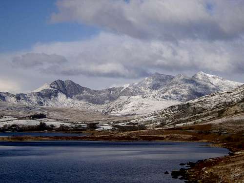 Snowdon (Photo by daw37)
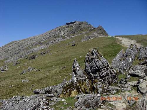 Snowdon Cafe (Photo by DrJonnie)
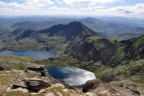 Glaslyn, Llydaw and Y Lliwedd (Photo by Jake80)
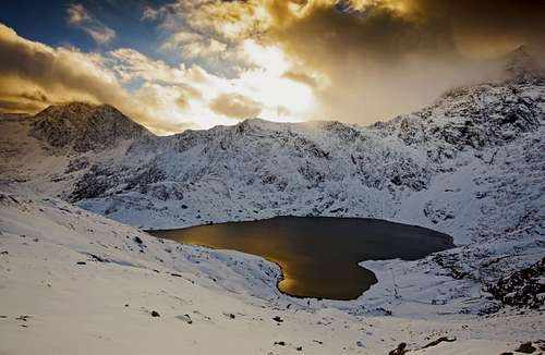
Government Bodies and Official Organisations
Snowdonia National Park Authority
Association of National Park Authorities
Royal Commission on Ancient & Historical Monuments in Wales
Hiking, Climbing and Mountaineering Organisations and Companies
British Mountaineering Council
Plas y Brenin National Mountain Centre
Weather
Tourist Information
North Wales Tourism Partnership
Local Information from Gwynedd.com
Local Information from Snowdonia Wales Net
Travel
Welsh Public Transport Information
Accommodation
Youth Hostel Association in Wales
Maps and Guidebooks
Cordee Travel and Adventure Sports Bookshop
Wildlife and Conservation