
-
 27771 Hits
-
 88.12% Score
-
 26 Votes
|
|
Mountain/Rock |
|---|---|
|
|
39.36830°N / 106.1492°W |
|
|
13857 ft / 4224 m |
|
|
Overview


Getting There
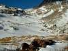
Montgomery Reservoir Trailhead (10,920 feet)The standard way of approaching these mountains is from the east via Wheeler Trail, a very rough 4WD road that starts from the Montgomery Reservoir Trailhead. This can be accessed by taking the northern of two turnoffs for Park County 4 off of Colorado 9. According to Gerry Roach's distances, this junction is 1.1 miles south of the summit of Hoosier Pass, and 10.7 miles north of the U.S. 285-Colorado 9 junction in Fairplay. There is a small sign marking the road "Park County 4." It is a dirt road and goes downhill for a while, but the road is plowed to the reservoir through the winter. There is a gate partway back the road along the reservoir, which is most likely closed in winter.
Here is the route description from this trailhead: CT "Clipper"
Clinton Reservoir Trailhead (11,060 feet)
Also accessible in winter, this trailhead is located along Colorado 91 and allows access to Clinton's northwest ridge. This is a slightly shorter climb to get to Clinton Peak's summit, and according to Gerry Roach it will "stimulate your alpine yearnings." However, I am yet to attempt this alternative route.
Fremont Pass Trailhead (11,040 feet)
Located farther south along Colorado 91, this trailhead too is accessible throughout the winter. It gives access to Traver Peak's west side. This is a much shorter climb, but BEWARE, it should only be attempted when snow conditions are good. With good snow, this is a class 2+ scramble up to Traver's summit.
Note: For all you purists out there, you may have noticed that none of these trailheads offer quite 3,000 feet of vertical gain. You will just have to park farther away if you want to achieve that goal.
 |  |  |  |  |
Red Tape
No camping is allowed at the Montgomery Reservoir. There are currently no fees for accessing these mountains, and to my knowledge they are all on public ground.Weather Conditions
For current weather and 10-day forecast for the Alma area, Click Here.Note: While this is the nearest town with which to gauge the weather for this mountain, plan on temperatures being cooler than the downtown forecast. Also, don't take warnings or threats of storms lightly. Weather is bound to be worse above timberline; always be prepared!
(Forecast provided by weather.com)
 |
When To Climb
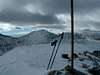
For optimal weather conditions, climbing and hiking this area is obviously best during the June-September season. However, during that time beware of thunderstorms, and always start early.Also, because of their accessible trailheads, these peaks can easily be summitted year round, and offer some fun winter climbs. The main thing to be concerned about in winter is avalanche danger, as some of these slopes are quite susceptible.
External Links
- Wheeler Trail to Wheeler Lake
For 4x4 enthusiast who wish to drive the Wheeler Trail to Wheeler Lake instead of hike it, check out this page.