
|
|
Mountain/Rock |
|---|---|
|
|
45.58509°N / 24.55848°E |
|
|
8316 ft / 2535 m |
|
|
Overview
The Fagaraş Mountains are the most interesting and massive mountains that form part of the Carpathian Mountain range of Romania. They cover an area of nearly 3,000 square kilometers, which unfolds on the east-west ridge over 70 km of mountainous terrain, with peaks often reaching altitudes of over 2000m.
From north to south the width of the range is over 40 km. It presents a smooth structure, with an austere beauty and storied glacial interfluves, where the bioclimate outlines the particularities that form the typical alpine landscape of the Fagaraş. The most important and noteworthy sector of high ridges, across which run most marked paths along the Olt Valley (360 m) is the CFR Curmătura Mărului to Tama. It runs along the administrative border of Sibiu county but stops right of the town of Bran.
An overview of the Făgăraş actually reveals two types of landscape. One is high and ruiniform, shaped by glaciation and the other, called glacial and nival, is spectacular in shape with rounded monotonous shapes, especially hewn by torrents or rivers that have dug deep and narrow valleys. This is a good example of river-torrential landscape.
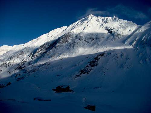
Negoiu Peak
If we look upon the Făgăraş mountain range from up in the air, we would immediately notice their pronounced asymmetry. Thus, the tectonic rift that caused the collapse and the forming of the Transylvanian depression has also created steep individual mountains.
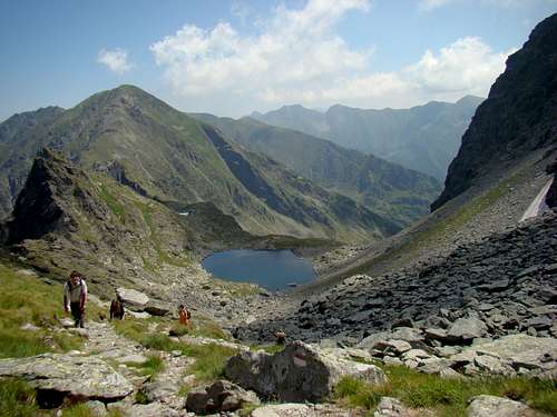
In the north part, the land is very steep, 2,000 meters in altitude, over a distance of 10 km in the corner of Viştei, while below 2500 m in the valley, the village Viştişoara barely reaches 600 meters. Over 80% of the Fagaraş landscape maintains some traces of quaternary glaciations, highlighted by numerous glacial lakes present in the entire region.
The main ridge is supported in the northern part by 26 "buttresses" or short legs and strong slopes, 17 of these ridges are extended by hills to Olt Country (which is due to the waters eroding but also forming many deposits). Other 5 edges do not reach this area, which ends somewhere midway and four edges (from east to west - Podragu, Serbota, Suru, where skiing is popular) are the shortest.
We must note that the eight of the 14 peaks exceeding 2,500 m in the Romanian Carpathians are in Fagaraş. These are: Moldoveanu, Negoiu, Viştei , Căltun-Lespezi, Cornul Calţunului , Vânatoarea lui Buteanu , Hârtopu şi Dara. The Fagaras range is located in a very densely hydrographic network of the Carpathians (0.8 km / km), mountain streams are all tributaries of the Olt (north - north west) and Arges (south).
More than 60 glacial lakes form 24 ha of the Fagaras body of water: Bâlea 4,65 ha, Podragu 2,86 ha(15,5 m deep), Urlea 2ha, Capra 1,83 ha, Avrig 1,48 ha, Balea 4.65 ha, 2.86 ha, Podragu (15.5 m deep), Urlea 2 ha, Goat 1.83 ha, 1.48 ha Avrig.
The lake found at the highest altitude in the country, 2282 m - Lake Tăul Mioarele, which exemplifies a rare phenomenon, it rotates. Values of global solar radiation annually register 110 Kcal/cm2 for Fagaras lasting 1800 hours per year (this calculation is valid up to 1000 m and 1500 m from north to south).
Temperatures average 1-2 degrees between north-south sides. The annual average temperature is between 0-2 degrees Celsius. Average temperatures in January range between 7-9 degrees Celsius while in July the temperature reaches 7 degrees. The maximum ever recorded is 20 degrees C. The wind blows predominantly westward. Annual rainfall is 1200-1400 ml/m2.
The Fagaras Mountains are part of the Carpathians. They lie between the Olt Valley in the west, the rivers Bârsa Gorşetului and Dâmboviţa in the east and the Fagaras Depression in the north. The mountain range measures 70 km in length, 40 km in width and cover an area of approx. 3000 km2.
In the north the mountain range is bordered by the Fagaras Depression, also known as the backbone of Country Fagaras. To the west, the Olt Valley precisely marks the border between the Fagaras Mountains on one side and the Lotrului Mountains on the other side. In the south, the mountain ridges continue with Muscelele Arges and Campulung. The Campulung, Bradetu, Arefu, Jiblea depressions continue to a certain extent towards the southern limit.
The eastern limit of the Fagaras Mountains has been a subject of discussion among specialists. It can be included in a contained area on the right side of the Damboviţa Valley. Tourism-wise it can be regarded as a streamline Tamas, Barsa and Curmatura, which is the boundary where the geology is different (by Tamas on the right are crystalline shists, limestones in the Piatra Mountains on the opposite side). The limit Iezer - Papuşa (in south Fagaras) comprises of the Dambovita Valley Stream and Boarcăşu Oticu Brook that flow into the Raul Doamnei (the Lady’s River).
Getting There
I’ve had a lot of great hikes in Fagaras! If you have the time, energy and nerve, don’t miss these fantastic mountains!
The mountainous range consists of a huge ridge, ranging from east to west, placed right in the middle of the country. Its slopes are very steep in the north, and smooth in the south. Therefore, the fastest way to get there is via the roads and railways in the north, where the Transylvanian Ucea and Avrig train station have their main entry points.
The Fagaras mountain range gathers 14 peaks of over 2500 m in altitude. Does this remind you of something? Moldoveanu (2544 m) is Romania’s highest, whereas Negoiu (2535 m) dominates the Western part of the massif. Crossing the main ridge of Fagaras, from east to west or the other way around, is a great challenge. Why don’t you try it?
Depending on the number of tourists who use them and also on the distances to the various tourist attractions of the mountain, the main access points are:
Balea Lake-the main entrance point for accessing the north-eastern mountainsides. Lake Balea is reachable by taxi, bus or personal vehicle from the town of Curtea de Arges or from Sibiu by driving on one of the most beautiful road in Romania, the Transfagarasan Road, which was built at the highest altitude in Romania. From Balea Lake there is a main access route to the summit, through Lake Călţun - Strunga Dracului.
Porumbacu - The second entering point for accessing the north-western mountainsides. Porumbacu is reachable by train, bus or personal vehicle from the town of Sibiu, Victoria (it is 40 km away from Sibiu). From Porumbacu there are two different main access routes to the summit. One leads towards Negoiu Chalet to the north-west of Negoiu peak through Piatra Prânzului and the other one leads to Negoiu Chalet to the north-east through Râul Mare Valley.
Piscu Negru Chalet- The Third entering point for accessing the south-eastern mountainsides. Piscu Negru is reachable by taxi, bus and personal vehicle from the town of Curtea de Arges on the beautiful road in Romania, Transfagarasan Road, the highest road in Romania. From Piscu Negru complex there is a shorter access route to the summit, through Piscul Negru forester's lodge-Călţun Lake-Strunga Dracului.
Climate & Weather
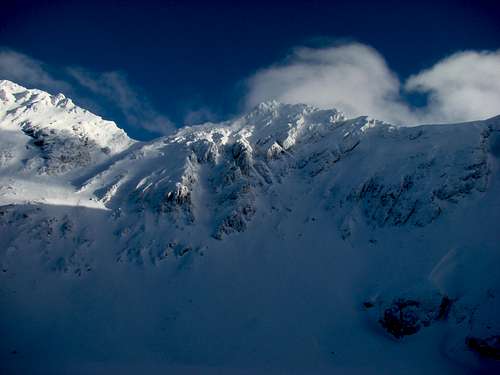
Because of their height, Fagaras Mountains have a harsh climate of their own. Between 500 and 2500m altitude the atmospheric pressure varies between 716 and 560mm. The air temperature drops of 0.5-0.6 degrees Celsius with each hundred meters in altitude. At 1800m the yearly average temperature is of 2 degrees Celsius below zero and the highest temperature can reach 25 degrees Celsius while the lowest may be of 38 degrees Celsius below zero.
Despite the spectacular landscape, in Fagaras Mountains, large rock walls are not easy to find. Even so, climbing places can still be found here. These are places like "Coltul Balaceni"("The Balaceni Corner") on "Sambata Valley", the eastern and western wall of "Vanatoarea lui Buteanu Peak", the eastern wall of "Lespezi Peak" (above "Lake Caltun"), "Arpasel-Vartopel Ridge" and the northern ridges of Fagaras Mountains.
But if Fagaras Mountains are not very difficult to climb in summer, in winter, very few climbers dare to take on the mountains. Almost every place in the high area poses some difficulties, with danger stalking climbers step by step. In winter, the main ridge and the northern ridges are notorious for the risky situations they pose to climbers and it is recommended that only skilled and experienced climbers attempt the climb.
WARNING: In winter avalanches can be fatal due to the fact that the mountain rescue teams are not equipped with the latest equipment. Mobile phones can not be used in the Fagaras Mountains except on the high peaks and in some other places. Cases of viper bites can also be fatal if first aid is not immediately applied.
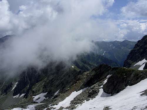
In the mountains, winter lasts from November through to May or June, with heavy snows obliterating paths and winds lowering temperatures well below freezing. Under these conditions, the Fagaras Mountains are the preserve of well-equipped alpine mountaineers. Hikers return as soon as the snows begin to melt. However, the weather is changeable even in the height of summer, with mist or rain always being a possibility. Paths are marked by marks painted on rocks or trees, however a map (unfortunately, accurate ones are hard to find) or a local guide is essential. Accommodation is provided by chalets, which range from hotels with restaurants to basic facilities.
Mountain climate is harsh, with specific temperate and subpolar climate. The average annual temperature is 2-6 degrees C in the bottom area with beech and spruce forests and with many degrees below zero in the alpine meadows. The west wind blows almost constantly, reaching high speeds in winter.
The rainfall, which is among the most abundant in the country, reaches up to 1400 mm in the alpine area. At altitudes above 1900 m, it falls mostly as snow. During the year and at altitudes over 2400 m, the amount of accumulated snow could form a 7-8 m thick layer. Therefore it is here that massive avalanches occur most frequently in our country. There are rare days when the sky over the Fagaras Mountains is completely blue. The weather can change several times during the day.
Generally, the Fagaras Mountains have a harsh subpolar climate. Climate elements: temperature, wind, clouds and precipitation depend on altitude and slope orientation. The alpine winter is long, from six to seven months, while the summer lasts about two and a half months; spring and autumn are transitional seasons and are short.
Air temperature varies with altitude, by about 1° with each 200 m in altitude. The high average annual temperature is 2 degrees C below 0; the average is -9 degrees during the winter months and 7 degrees C in summer as the southern slope is somewhat higher. This indicates that the ridges in the middle of summer high temperature can drop below 0 degrees C.
Prevailing winds blow westward and northwestward. In the winter, the wind can reach a speed of over 120 km/h. In spring, there is not much wind or snow. There is a local wind that blows from Fagaras and makes the snowmelt. Cloudiness is almost always present during the day. Generally, in late February, early March and mid-October there are days when the mountains are not covered by clouds. Otherwise clouds and fog are common in the Fagaras. The Fagaras Mountains obstruct wet winds from the west and the north. There is also a high level of rainfall, which increases with altitude. June is the rainiest month, as the frequency of rainfall decreases towards September. Snows can fall anytime and do not depend on the season in the Fagaras ridges of over 2000 m in altitude, but in general, snow covers high peaks from mid-October to late May and early June.
The earliest period of snowfall is in early September. The last snowfall is the second week of June. Snow is thick in the valleys and on the eastern slopes crevices. The increase in snowfall is low, especially in the first months of winter, and high in the second half of March or early April.
Avalanches are the greatest danger facing climbers, skiers and tourists who made winter climbs in the Fagaras Mountains. The biggest and most dangerous avalanches recorded in Romania occurred here. Generally, avalanches are possible on all the steep slopes of the Fagaras Mountains; this is one of the factors that must be taken into account during winter in the high mountain zone. Superficial snow layers are another danger for winter sports aficionados who visit the Fagaras ridges.
When To Climb
As any summit, Negoiu Peak can be climbed, the whole year round, depending on your climbing skills.
Winter is longer on Negoiu because of the position of the massif where there is lots of snow. It usually covers the highest area from October to November. It accumulates till May when it slowly begins to melt. Depending on the year, snow can cover the highest area until the end of June. It is also very cold up there. Temperatures around -15C are not rare.
You need full winter equipment. The easiest way to reach Negoiu Peak in winter is from Negoiu Chalet. The climb is long so you have to be in good shape, but you do not need technical training till you reach the ridge. The climb is only reserved for experienced mountaineers and climbers. Pegs and steel ropes from Strunga Dracului can be found under snow so you are free to climb some places where the cliffs are almost perpendicular. Other routes are easy in winter but cannot be done in one day, in one direction.
Perhaps the best time to climb is at the end of March and in April when it is still cold and there is still snow.
Spring is almost non-existent in the heights of the Fagaras Mountains. It is much like winter but with longer days, which is good for longer routes. Snow quality will deteriorate after mid-May. May is not a good month to climb. There are still lots of snow but its quality is poor.
When the snow disappears the weather suddenly becomes like summer. But you can find remnants of spring in the lower sections of the Negoiu routes where there is still green. Flowers blossom in June and July.
The summer months on Negoiu are July and August. If you don’t like crowds then you had better avoid the summer months, if it can be called so, because temperatures around Negoiu don’t exceed 15°C very often. That happens on hot days when temperatures in the Romania plains and on the coast reach 30°C.
No equipment is needed in summer, except helmets and ropes for some trails (not necessary, it depends on your personal taste). Even in this time you will see quite a lot of snow, depending of the year. Always have warm clothes with you, rain is possible on Negoiu any time in the summer.

Autumn is perhaps the best time to visit if you don’t like crowds. In September and October, days are still quite long, the views are great, though the sun is not so strong. At the beginning of October forested areas are beautifully colored, there are lots of larch trees that turn golden.
WARNING: While the Negoiu Peak is not very difficult to climb in summer, in winter, very few climbers dare to attempt the peaks. Almost every place in the high area has its own difficulties and climbers face danger step by step. In winter the main ridge is famous for the risky situations, which climbers who attempt the peak find themselves in. It is therefore only recommended that skilled and experienced climbers make the ascent.
In winter avalanches can be fatal due to the fact that the mountain rescue teams are not equipped with the best equipment. Mobile phones can not be used in the Fagaras Mountains except on the high peaks and in some others places. Viper bites can also be fatal if first aid is not immediately applied.
Chalets and Refuges(Shelters)
There are many possibilities of accommodation, from camping grounds to boarding houses and chalets. You must book in advance because they might be overbooked for the entire year.
1.“Valea cu Pesti” (Fish Valley)4* Hotel
This chalet has 2 stars and is situated on the shores of Lake Vidraru, on the Transfagarasan, 39km from Curtea de Arges. It was built in 1969 during the Communist dictatorship and for a long time it was not part of the tourist circuit, as it was in the property of the Romanian Communist Party and was mainly used by members of the Ceausescu family. The chalet is built on four levels and is surrounded by woods on the east side of the hill and so all rooms are built on the western side of the chalet with panoramic views stretching along Lake Vidraru.
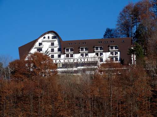
"Valea cu Pesti" Hotel
Chalet has 60 doubles rooms with TV and bathroom.
-Contacts: Telefon receptie: 0755.300.003; 0745.012.761; 0374.230.000
Tel/fax: 0248.721.070
Web: www.valea-cu-pesti.ro
E-mail: valeacupesti@gmail.com
2.“Cumpana” (Sweep) Chalet
Cumpana Chalet is located on the western shore of Lake Vidraru, 45 km from Curtea de Arges and 15 km from the Vidraru Cumpana Dam in a depression at 840 m altitude.
The chalet has 34 rooms with a capacity of 88 seats in the following structure:
17 rooms with two beds and bathroom with bath (with TV)
14 rooms with three beds with bathroom (5 triple rooms with no TV, 9 triple rooms with TV)
1 apartment 2 beds with color TV and bathroom with tub
2 rooms with 5 beds (one room with two beds and one room with three beds with the same bathroom)
The Cumpana restaurant (Class-II) can seat 100 on the ground floor and 30 on the terrace.
"Cumpana" Chalet
The Cumpana camping ground is located near the chalet and the camping site can accommodate 52:
26 wooden houses with 2 beds
3.000 mp Tent camping and caravan site - 3,000 m2
CONTACT: Romica Popescu – Manager of Cabana Cumpana; Romeo Smith - Manager of Chalet Cumpana
http://www.cabanacumpana.ro/
Mobile: (004) 0745 013 120; (004) 0745 013 120
Fax: (004) 0248 721 109 Fax: (004) 0248 721 109
E-mail: posada_cag@yahoo.com; posada_cag@yahoo.com;
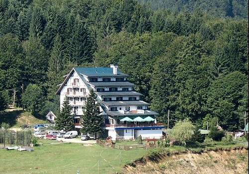
3.“Paraul Capra” Chalet
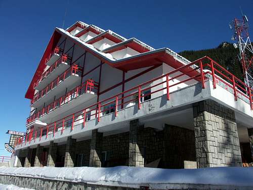
Situated at an altitude of 1585 m on the Transfagarasan Road. This resort is the only location that was invested in to encourage the tourism in the whole mountain area, making it the most modern and complete establishment built in the Fagaras Mountains tourism area.
The chalet can accommodate visitors in 27 double rooms, all equipped with bathroom, shower, TV connected with cable television and automatic heating.
"Paraul Capra" Chalet
The restaurant has a capacity of 80 people. Festive events are organized here - like company parties, birthdays, dinner parties or private events. The food generally consists of traditional Romanian dishes, but the kitchen can satisfy, upon specific request, the various tastes. The specialty of the house is venison. The current menu can always be offered at special prices.
The conference room here can seat 50 and can be ideal for company meetings and reunions, seminars, conferences, brainstorming or team building sessions. It is to be noted that the chalet offers its full services for corporate meetings and countless possibilities for relaxation and entertainment.
Visitors can engage in a series of related activities, from sightseeing visits to Vidraru Bâlea Dam City, Poienari etc., to mountain hiking e.g. Mount Ghiţu, starting from Căpăţâneni and winter sports (climbing, skiing or sleighing).
Tourists will be as engaged in a fantastic, games exceptional interior comfort and the natural wilderness.
CONTACTS: Telephone: 0040.248.721.451; 0040.248.721.452;
Fax: 0040.248.50.60.47
http://www.hotelcapra.ro
4.Cascada Chalet
The Bâlea Waterfall Chalet is situated in the Fagaras Mountains at an altitude of 1234 m.
Facilities:
-73 beds in rooms of 2 to 3 beds and 2 apartments with TV
-Restaurant with full board
-Bar
- Hygiene unit in every room
Contact: Tel: 269/211703
E-mail: baleacascada@yahoo.com
URL: www.balea-turism.ro
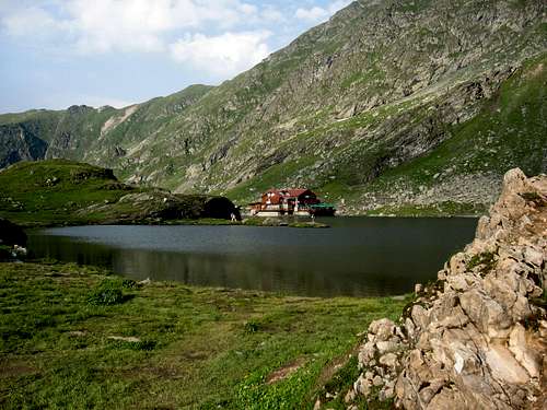
5.Balea Lake Chalet
The Bâlea Lake Chalet, a three-star chalet lays in the middle of the most grandiose mountain complex the Romanian Carpathian Mountains and during the cold season there is an Ice Hotel located at 2034 m. It is accessible by the Transfăgărăşan Road (DN 7C) from the south, Pitesti, Curtea de Arges, Vidraru Piscu Negru and from the north on DN1 by Cartisoara.
"Balea Lake" Chalet
The landscape is characterized by unmatched austere beauty, jagged and steep rocks, rare endemic flora and dripping waterfalls. The chalet can easily be reached during summer and winter by Bâlea Cascade cable.
CONTACT: IF Klingeis
office@balealac.ro; office@balealac.ro;
Tel: 0040-269-523.517 Tel: 0040-269-523.517
Fax: 0040-269-523.517 Fax: 0040-269-523.517
Fax: 0040-269-523.111 Fax: 0040-269-523.111
Mobile: 0040-745-072.602 Mobile: 0040-745-072.602
http://balealac.ro/balea-lac
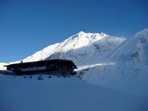
6.Paltinul Chalet
The chalet is located near Lake Bâlea, at an altitude of 2044 meters, and can accommodate 26 people in double rooms, rooms of four and an apartment. One can also rent sport equipment, and professional mountain assistance is also ensured.
Terms:
-34 beds in 2 suites and 15 rooms with bathrooms and TV
-Hot water and central heating
-Restaurant and terrace with 90 seats
-Location: in the Bali circus near Bâlea Lake
Altitude: 2050 m
Cabanier SC Bâlea Tourism SA Telephone: 0269 523505; 0269 211703; 0269 524277; 0724 244464; 0744 638823 Phone: 0269 523505, 0269 211703, 0269 524277, 0724 244464, 0744 638823
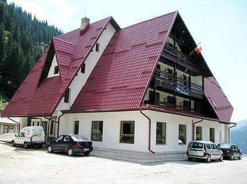
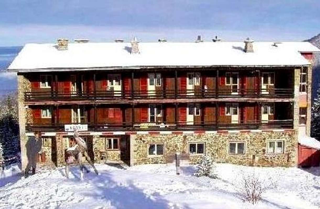
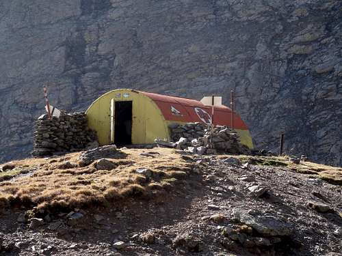
7.The Negoiu Chalet
The Negoiu chalet is situated on the edge of Serbota Peak atop of the pine forest. Altitude: 1540 m.
The chalet comprises of three buildings: the main house or the new cottage, the old cottage and the annex building. In the new cottage, the walls on the ground floor and the second floor are built of stone and wood. Each floor has a balcony facing south many of which are as long as the entire building.
On the ground floor there is a lounge, a dining room, a kitchen and the home of the administrator. The two floors, divided in the same way, including five or seven bedrooms. Each layer has its own bathroom. It can house up to 240 people in summer and 120 in winter.
It is a starting point on the way the Negoiu Peak.
CONTACTS: Tel: 0744.573875 / 0721.765016 / 0768358240
If we do not answer, please send us an SMS.
http://www.negoiu.ro/
8.The Refuge Caltun(Shelter)
Terms:
- 15 to 18 places to bunk in camp conditions
- it is well insulated from wind
- Location: On the shores of Lake Caltun between the peak and Laitel Caltun, 5 minutes from the ridge trail
Altitude: 2135
The refuge Caltun
Starting point on the way to Negoiu
Rules for the shelter:
Do not forget to leave your shelter as you would like to find it as clean and whole as possible, with the door closed!
The mountain shelter is to be used only for survival, during the night or in case of emergencies due to health problems or bad weather conditions, that render further hiking hazardous. Tourists are allowed to spend one night at the shelter; if the weather conditions do not allow tourists to continue their journey the following morning, the stay may be extended until it will be safe to continue their hike.
Visitors have to clear the shelters at the request of the Mountains Safeguard Administration personnel or of other individuals authorised by the PCNPA, if the facilities are used for other purposes than the ones previously mentioned.
It is strictly forbidden to make fires in the shelter; instead all visitors should use Primus type gas stoves. As for the other shelters located elsewhere, fires may be built only in the specially designed fireplaces found on the spot.
Please don not deteriorate the shelters!
Please close the shelter doors, otherwise they may be affected by wind!
Please do not leave any waste at the shelters!
It is strictly forbidden to build fires in the shelters located on the ridge!
Being a wilderness area, the camping is permissible anywhere, but a better option is to use the huts on the route.
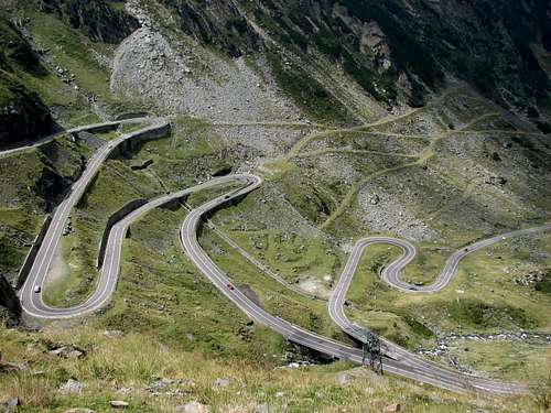
Transfagarasan Road
If we had to express it briefly, the Transfagarasan (DN 7C) is just the road that passes through the Fagaras Mountains (the highest mountains in Romania – Moldoveanu peak – 2544 meters) and it connects Walachia and Transylvania.
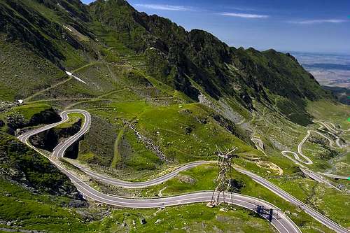
But in fact the Transfagarasan road is more than that. It is the road that leads to the highest altitude in Romania, 2042 meters, in the Bâlea Glacial Hollow. It has two traffic lanes of 92 km long. Because of the countless turns, the average speed is maximum 40 km per hour. Along this route there are 27 viaducts and bridges, and the longest road tunnel in Romania – 887 meters that passes through the Paltin Mountains, from Lake Capra to Lake Bâlea. The ventilation of the tunnel is naturally made, thanks to the extremely strong currents.
The traffic lane inside the unlighted tunnel is only 6 meters wide and there is a one meter broad sidewalk.
Tourists who would like to “venture” on the Transfagarasan Road are advised to climb it from the south to the north.
Romania’s most famous road runs from Arefu village (at kilometer 61 of DN7C) in the county of Arges, to the county of Sibiu, somewhere near Cartisoara village (at the crossroad with DN1).
The landscape is fantastic and the differences of altitude and the curves represent a challenge for both cars and drivers. Unfortunately, because of the weather conditions, the Transfagarasan Road is opened for only a few months every year, usually from July until October.
The most important tourist attractions are Lake Vidraru and Vidraru Dam, which is one of the largest in Europe, then Poenari Fortress (built in the time of Vlad Ţepes), Bâlea Glacial Lake and Bâlea Waterfall. How it was built
The Transfagarasan was built between 1970 and 1974. A brief presentation of numbers might be difficult to follow, but for those who have the patience to read it, it is worth mentioning that about 3 million tones of hard rocks were dislocated, 830 transverse works and 290 000 cubic meters of masonry were made for building the 92 kilometers of road. For building the Capra – Bâlea Tunnel there were over 41 000 cubic meters of rocks excavated. 20 tones of dynamite, 3 573 tones of cement, 89 tones of concrete steel, 24 000 of anchors, 129 tones of brazed nets, 14 200 square meters of encasements, 1750 meters of concrete tubes, 4 100 meters of pipes, 50 tones of metal composites, 6 900 cubic meters of grit, 6000 cubic meters of gravel, 3 000 tones of crushed rocks and 740 lighting lamps were also used.
Some of those who worked at the construction of the Transfagarasan are retired nowadays. They often speak about the sacrifices that were made in order to build the road that leads to the sky. Before its construction, it was impossible to cross the mountains, not even on horseback. But it is said that once, before becoming president, Nicolae Ceausescu stopped by the village Arefu and the idea of a road that passed through the mountains crossed his mind.
During the construction a lot of men lost their lives, like in the case of Vidraru. Unfortunately the documents didn’t register these numbers. But the survivors say that it is about a hundred. Many of those who died weren’t even found in the precipices in which they had fallen. It is also said that when the tunnel was built, the miners who were in charge with the planting of the explosive were hanging on each other, in groups of 20 or 30, in order not to be unbalanced by the strong wind into the precipices.
A story that has been spreading by word of mouth refers to a monk named Nectarie. After the construction of the Transfagarasan road, he climbed it with his car, a Trabant, up to Lake Capra, where he was caught by an avalanche. He left the car at Capra, and he threw himself on the snow, being carried by the “wave”. It is said that he remained alive, while his car was found after 6 months, when the snow melted away.
Balea Waterfall and Balea Glacial Lake
Bâlea Waterfall, located in the Fagaras Mountains, is one of the most famous waterfalls in Romania. It lies at an altitude of 1234 meters and the waterfalls from 68 meters.
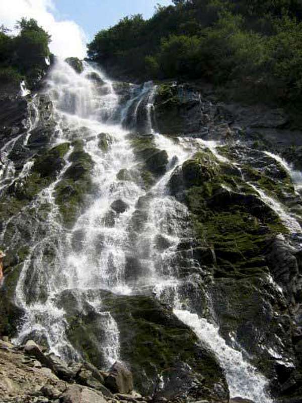
Bâlea Glacial Lake is a real monument of nature (formed in a glacial circus). It is 360 meters long, 240 meters broad and 11 meters deep. Situated at 2 034 meters altitude, the lake is between the Olt Valley (Olt Canyon) and the foot of Piatra Craiului Mountains. It is accessible by car during the summer, and the rest of the year by a cable car from the “Bâlea Cascada” chalet.
Since 1932, the lake and about 180 ha of land around it were declared a reservation of scientific merit. We must also mention the fact that the first ice hotel in Eastern Europe was built near the lake in 2006.
Transfagarasanul Lake Bâlea Chalet and Bâlea Glacial Lake are located at an altitude of 2034 meters.
In summer one can practice boating on the lake, while in winter one can skate, play hockey or curling on the frozen surface of the lake. One can also climb down from the Waterfall by skiing, on a 10 kilometers route with a 600 meters difference in altitude.
The fauna
The fauna in the Fagaras Mountains is most representative of the country. If we start to climb heights, we see a world of invertebrates, no less than 1500 species of beetles (coleopteran), 800 butterfly species (Lepidopterae). Lizards and amphibians are well represented by the mountain lizard (Lacerta viviparous), the adder (Anguis fragilis), the wood snake (Elaphe longissima), the black adder (Vipera berus), the salamander (Salamandra salamandra), and the forest frog (Rana temporaria). In the rapid waters, as in most mountain lakes, there is trout (Salamo trutta fario).
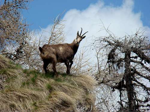
Animals include: deer (Capreolus capreolus) deer (Cervus elaphus), a smaller species of black bear (Ursus arctos formicarius), and wild cats like the lynx (Lynx lynx), wild cat (Felix sylvestris), tree marten (Martes Mustela). The chamois live in alpine areas (Rupicapra Rupicapra).
The birds are the chaffinch (Fringila coelebis) sheet of wood (Anthus spinoletta), hazel (Tetrastes bonasia), blackbird (Turdus surface of the polymer), buzzard (Buteo buteo), wild cock (Tetrao urogallus), black grouse (Lyrurus tetrix), the bald eagle (Aegypius monachus) and the rock eagle (Aquila chrysaetos).
The vegetation and flora
The vegetation types in the Fagaras Mountains differ as the altitude increases. There are forests and alpine zones, each on different levels.
a. The Forest Zone
The Evergreen Oak Forests Level
The evergreen oak covers the land at the foot of the massif and it reaches 500m; the oak (Quercus robur) can be found on wet spots.
The Beech Level
The beech tree is spreading across the mountainous areas at altitudes of 600 to 1350m. Through the glades, corydalis cava ("brebenzi de munte") and ranunculus carpaticus ("galbinele de munte") can be found and on the forest floor and grasslands one can find agrostis tenuis ("iarba vantului"), festuca rubra ("paiusul rosu"), and campanula persicifolia, with its blue-purple flowers.
On the Transylvanian slope the spruce fir and the fir penetrate the beech forest at the foot of the mountain with larch, a deciduous conifer, rarely appearing. The Coniferous Level
The conifers start appearing from 1300m up to 1700m on the north slope, and 1800m on the south side. This is also the superior limit of this forest, dominated by the spruce fir (picea excelsa). Bilberry bushes (vaccinium myrtillus), orchids (listera ovata) and hieracium transsilvanicum ("vulturica") appears through spruce fir forests. Telekia speciosa ("laptucul oii") which can reach 2m in height, grows in moist, shadowy valleys, along the streams. It has wide leaves with a maximum of 30cm in diameter and large yellow flowers.
Graminaceae such as festuca rubra ("paiusul rosu") and the nardus stricta ("parul porcului") grow in the meadows of the spruce and fir level.
b. The Alpine Zone
The Inferior Alpine Area
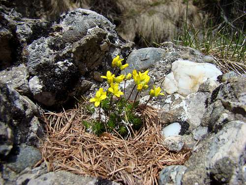
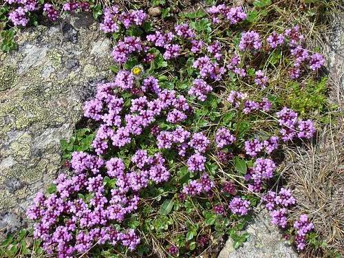
During the seasons, variety of plants grow at this level: pinus montana ("tufisurile de jneperi"), followed by the billbery, the vaccinum vitis idaea ("merisor"), juniperus nana ("ienupar pitic"), alnus viridis ("anin de munte") which is a certain indicator for places, which must be avoided. The agrotis rupestris ("iarba stancilor" - "rock's grass") dominates the meadows and in spring there is also the crocus vernus, prima eltior ("ciubotica cucului"), trollius europaeus ("bulbucii de munte"), which is a protected plant.
The Superior Alpine Area
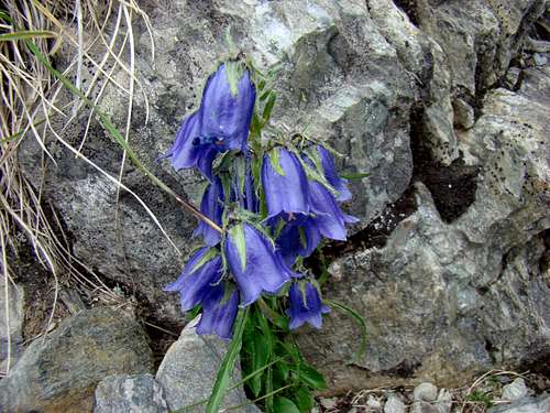
This area has some of the roughest climate. The vegetation includes carex curvula ("pajisti de coarna") and flowers as the gentiana lutaea ("ghintura galbena"), a protected plant, gentiana nivalis ("gentziane"), campanula alpina, armenia alpina. The rhododendron kotschyi ("smardanul" or "mountain peony") can be found along with these plants. It is also a protected plant, which blossoms between June or July.
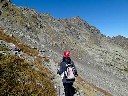
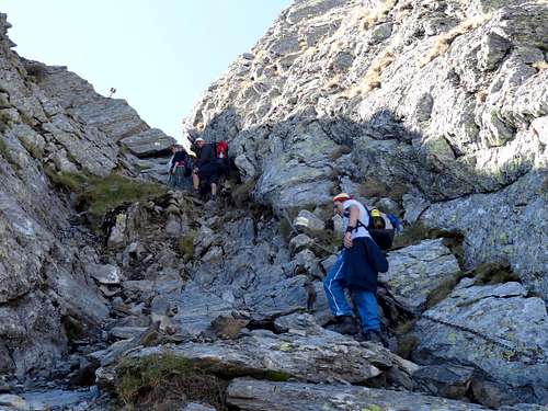
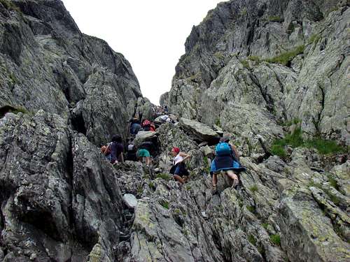
Routes Overview
1. Negoiu hostel - Negoiu peak through Piatra Prânzului
Duration: 3 1/2-4 -blue triangle
Height difference: +1050/-50 m
Note: Dangerous during winter
The blue triangle trails start at the tourist lodge and turn left. The first section of the road leads us through the woods to reach the rivulets. There are 9 wooden bridges across these rivulets. This section is called Drumul Zmeilor (Kite Road). Once we are out of the woods we ascend up to Saratii valley. We cross the valley and climb down to a brook. 1 ¾ hours away from our starting point we reach Piatra Prânzului.
Our road to the main ridge takes us through fallen rocks. We soon reach a forest. The cave under Negoiu Peak, 2258m is 150m away to the left. This cave is 17m long and its floor is always covered in a layer of ice.
Strunga Doamnei
The dizzying height of Saratii offers us a view on such famous cliffs as Arcul Cleopatrei (Cleopatra’s Arch), Foarfeca (The Scissors) etc. One more ascent and we find ourselves in Popasul lui Mihai (Michael’s Pass). The red streak trails leads us to the other side of Saratii rock by crossing Negoiul Mic Peak, 2485m. Here we descend to a small pass. The last ascent takes us to Negoiu peak (2535m).
2. Cumpana hostel - Negoiu peak
Duration: 12 h - red triangle
Height difference: +2000/-550 m
Note: Dangerous during winter
The red triangle trails start at the tourist lodge and go towards the lake. After walking 4 kms we reach Cumpanitel valley where the trails start. Another 40 minutes and we reach a spring. We find a sheep fold at 1650m altitude. We go around Clabucet peak (1717 m) and the blue streak trail starts to accompany us on our way to the Marginea mountain pastures.
The blue streak trail turns right while we turn left, climb the winding roads and then take part in a rugged descend to the forest road. After about 30 minutes we reach the meeting point of Izvorului Scarii and Izvorul Negoiului brooks (1338m). A little higher it forks to the left.
We follow the path turning right and climb to the Piscului lui Cazan ridge. We descend into the valley, then enter the woods, climb to the other side of the valley, cross a waterfall and descend to the brook called Izvorului Negoiului through an area covered by juniper trees. We leave the brook behind and start climbing Negoiu. After 5 hours of walking from the meeting place of the two brooks we reach Popasul lui Mihai, which is close to Negoiu Peak (2535 m).
3. Saua Caprei - Negoiu peak
Duration: 4 1/2 - 5 h - red stripe
Height difference: +1025/-800 m
Note: Dangerous during winter
Leaving Capra saddle behind we go towards Fereastra Bâlei and then Şaua Paltinului. Here we find a trail traveling to Lake Bâlea. We go south and reach an area full of springs. We take another trail this time to Piscul Negru.
Then we reach a section with strings. Crossing an area between rocks we reach saua Doamnei dominated by Laita (2397m) peak. We go round the peak reach a saddle, descend below the ridge, another stringed area and after a somewhat more difficult winding section we reach peak Laitel (2390m.) A rugged descent into Şaua Laitei and soon we reach Lacul Caltun.
We keep going north till Portita Caltunului then we cross a section of fallen rocks. We meet another trail. We cross an area with stone slabs, then climb on a winding road until we get a glimpse of a natural cauldron on our left. This leads to Strunga Doamnei accompanied by a yellow streak trail.
We climb to Strunga Dracului and find the yellow streak trail coming from Strunga Doamnei.15-20 minutes of climbing and we reach peak Negoiu (2535m).
4. Piscul Negru forester's lodge – Lake Călţun - Negoiu peak
Duration: 4-4 1/2 h - blue triangle
Height difference: +950 m
Note: Dangerous during winter
The blue triangle trails start at Piscul Negru forester’s lodge and travel through Capra valley into the woods. 1/2 hour away from our starting point we reach another forester lodge. Higher in the area of juniper trees the road leads to Saua Paltinului, where it takes another turn. We climb to a glacial threshold, and in order to reach Lake Călţun, we have to climb two more thresholds. At the end of the last ascent we reach the lake, where the lifeguard cabin in on the shore.
Strunga Dracului
We keep going north till we reach Portita Caltunului. Then we cross a section of fallen rocks. We meet another trail. We cross an area with stone slabs then climb on a winding road until we get a glimpse of a natural cauldron on our left. This leads to Strunga Doamnei accompanied by a yellow streak trail.
We climb to Strunga Dracului and take the yellow streak trail coming from Strunga Doamnei. After 15-20 minutes of climbing and we reach peak Negoiu (2535m).
5. Lake Călţun - Negoiu chalet, through Strunga Ciobanului
Duration: 3 1/2 - 4- red streak
Length: km
Height difference: +300/-600 m
Note: Dangerous during winter
The red streak trail starts at Lake Călţun. At Portiţa Călţunului the Red Cross trail takes over the lead and guides us to Strunga Dracului. The rocky area turns into a grassy one, which is the threshold to Strunga Ciobanului. On the higher, rockier sections of the pass ropes facilitate the climb. Once we reach 2308m altitude we start descending on the other side of the pass.
From Piatra Prânzului on, it is the blue triangle that shows the way. After a continuous descend we reach Valea Sărăţii, we cross the water, follow a narrow path, go through an area covered by juniper trees and we finally go into the woods. Once we come out of the Negoiu woods, the tourist lodge comes into sight.
Maps of Negoiu
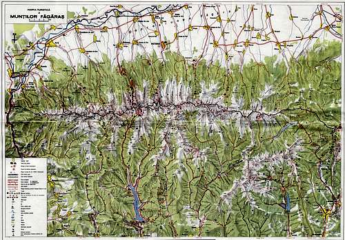
Fagaras Mountains Map
Mountain guides
If you want to hike Negoiu summit, but you are not so experienced, being accompanied by a mountain guide is advisable. The Mountain guides in this area, especially in Sibiu Brasov, have a long tradition.
More info on the website of the Romanian guide: Romanian mountainguide
Price for a solo tour with a guide is very reasonable, much cheaper with more persons.
Weather Information
Mountain conditions on Negoiu Peak are known thanks to Sibiu meteo station.
Best overview of daily data values is provided by Sibiu area meteogram:Local Weather
You can also observe current conditions and forecast for this area on the Wunderground meteo site.
Wunderground - Sibiu page:Wunderground Sibiu area meteogram
Current weather and forecasts can also be found on the Romanian Environment Agency page: INMH
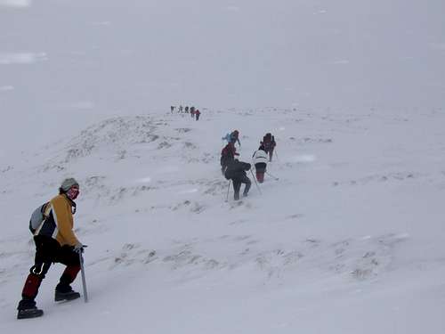
Summit Shots
Some of people's summit shots.
 |
 |