
-
 17255 Hits
-
 88.39% Score
-
 27 Votes
|
|
Mountain/Rock |
|---|---|
|
|
47.01212°N / 11.87328°E |
|
|
Alto Adige/Tyrol |
|
|
Mountaineering, Ice Climbing, Skiing |
|
|
Spring, Summer |
|
|
11049 ft / 3368 m |
|
|
Overview
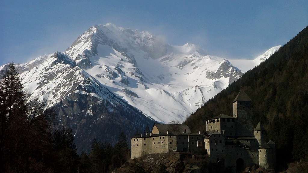
Sasso Nero/Schwarzenstein 3370 m
Sasso Nero/Schwarzenstein 3370 m is one of the finest and most important peaks positioned on the watershed ridge between Italy (South side) and Austria (North side) of the Aurine Alps. As all the mountains belonging to the region South Tyrol/Alto Adige, located near the boundaries between Italy and Austria, this peak has two names: Schwarzenstein, the original Tyrolean name, and Sasso Nero in Italian. It is one of the highest mountains in the main range of the Alpi Aurine (Zillertal Alps according to the German nomenclature). It lies between Turnerkamp (South-West) and Grosser Loeffler (North-East) and offers great views, mainly of Grosser Moeseler, Turnerkamp and Grosser Loeffler.

The mountain is very well known and frequented both on the Italian side and on the Austrian one, in fact each side presents a fine standard route with low difficulties. Anyhow the difference in level is considerable and for this reason it is advisable to stay overnight at Rifugio Vittorio Veneto/Schwarzensteinhütte (on the Southern side) or at the Berliner Hütte (on the Northern side).

|

|
Getting There
South side (Italy)
The starting point to climb on the italian side is located in San Giovanni in Valle Aurina, exactly at the parking lot at the Hotel Stallila.
Road access
From A22 Autobrennero exit Bressanone/Brixen and follow the Val Pusteria road to Brunico/Bruneck - Campo Tures/Sand in Taufers - Valle Aurina/ Ahrntal - S. Giovanni /St. Johann in Ahrn - Stalilla/Stalliler 1470 m, where you can park your car.
Walking approach to the Schwarzensteinhütte/Rifugio Vittorio Veneto.
Starting from the Stalliler / Stallila, an old and authentic "alm", follow the signposted forest road up the Rotbachtal, getting a wooden alm where you can choose whether to continue on the forest road or on the path, passing near a waterfall formed by the Rötbach (Rio Rosso). A little further on you will return to the forest road. Shortly after, you reach the Schöllberg Alm. Always on the forest road you continue, with the possibility, in some points, to cut the road with trail, up to the Daimer Alm, where the forest ends. From here the path becomes steeper but well worn, with several hairpin bends. A wonderful and refreshing well (“Quelle”) is encountered at about 2300 m.With a steep section we remount the edge of the vast glacial moraine (loc.Sandraine). At about 2500 m the path reaches the base of the Rotbachkees. Ignore the Stabeler Höhenwegon the left (trail 24A) and keep the right (trail 23) progressively heading towards the Cresta di Rio Torbo. Ignore also the path 19 (on the right), reaching after some steps another fork. On the right we ignore a further invitation to the path n. 19. The other two options lead both to the Schwarzensteinhütte/Rifugio Vittorio Veneto. Two climbing possibilities:
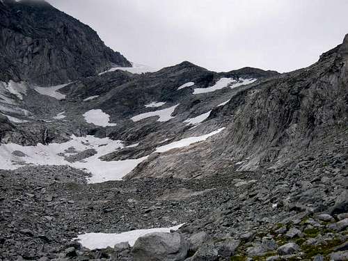
- the Normal route, on the left, which leads up to the Schwarzensteinhütte/Rifugio Vittorio Veneto hut over the Rotbachkees ("Kees" = glacier) with the Ferrata Glacier - Gletscher Klettersteig. Nowadays the glacier is in strong retreat, little more than a few patches of snow.
- the Via Ferrata "Kamin" - Kamin Klettersteig, the path in the middle at the junction, is a good alternative (word "Kamin" on a boulder), which climbs up to the shelter. The “via ferrata” begins at about 2700 m and it has been rebuilt. With a traverse to the attack of the ferratina, which is located on the W wall of the Cresta di Rio Torbo.
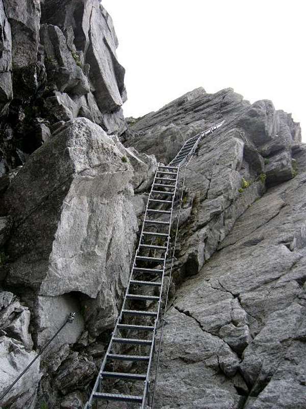
The Via Ferrata is short and easy, even if a little exposed, and it's equipped with wire ropes and various ladders. It follows a stretch, well served of trail sign, between rocky blocks, up to gain the summit of the Cresta di Rio Torbo. Above it is placed, like an eagle's nest, the Rifugio Vittorio Veneto. The ascent takes about 4 hours. The difference in altitude is 1452 m.
North side (Austria)
The starting point to climb on the Austrian side is the Gasthof Breitlahner.
Road access
By car from Innsbruck: motorway A12 - exit Zillertal - Mayrhofen - Zemmgrund - Ginzling - Gasthof Breitlahner (1,257 m) - car park (parking fee)
By car from Italy: from Bolzano take the A22 Brennero highway towards Brennero. After the pass you are in North Tyrol, go on towards Innsbruck and from there take the A13, exit Jenbach and take the Zillertal road n. 169 to Fügen, Zell am Ziller and Mayrhofen. In Mayrhofen continue on the road 169 to Ginzling (Guest House Breitlahner, paying parking). The starting point for the hike is the Gasthof Breitlahner in Ginzling, where there is also the Naturparkhaus center. The resort can be reached by the bus line 4102 or by car. Parking in Breitlahner is charged.
Walking approach to the Berliner Hütte
From the Gasthof Breitlahner take the trail 523, which runs along the long Zemmgrund Valley. After a short steep stretch, the path enters the valley and after a mainly flat part, it slowly starts to go up, passing near the Klausenalm and Schwemmalm alps, then near the Grawandhütte refuge and the Alpenrose Hütte. Soon after this latter hut, the path head to left and after the "Memorial to the fallen soldiers" gets the refuge Berliner Hütte at 2042 m. 3-4 hours from Breitlahner. The difference in altitude is 787 m.

|

|
Summer Route South Side (from the Schwarzensteinhütte / Rifugio Vittorio Veneto, Italy)
The ascent from the Schwarzensteinhütte / Rifugio Vittorio Veneto to the top takes 1.5 hours. The difference in altitude is 446 m.
Summer Route North Side (from The Berliner Hütte, Austria)
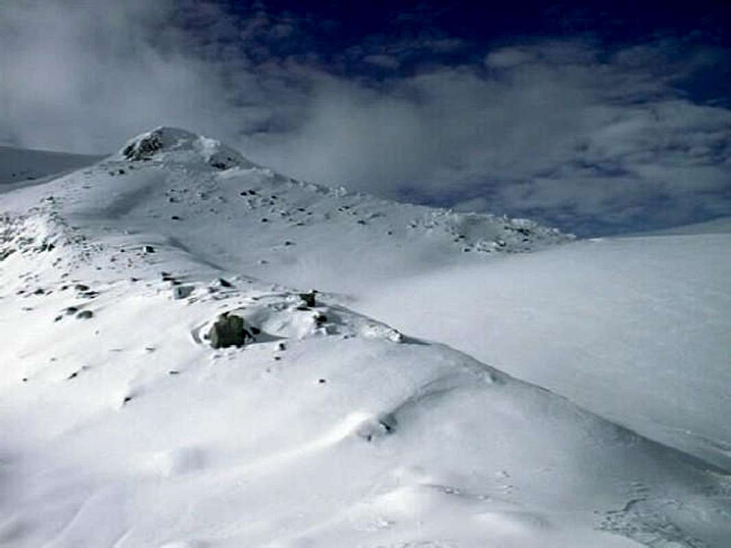
The starting point is the Berliner Hütte 2,044 m. Follow the signposted trail leading up east. After half an hour turn right (south) at the signpost saying "Schwarzenstein". It's another hour to the lower end of the Schwarzensteinkees ("Kees" = glacier). Climb straight up the glacier to the ridge. It's not difficult, and not dangerous. To my knowledge, there are no crevasses in this part of the glacier.

|

|
At the ridge, turn right (west) and follow the rather flat "ridge", still on the glacier. The final ascent to the summit is on the rocks. It is easy. The ascent from the Berliner Huette to the top takes 4.5 hours. The difference in altitude is 1,324 m.
Ski Route South Side (From The Schwarzensteinhütte / Rifugio Vittorio Veneto)
The Schwarzensteinhütte / Rifugio Vittorio Veneto is open in March and April. The ascent from the hut to the summit is fairly straightforward. It takes 1.5 hours. The difference in altitude is 446 m.
Getting There (Schwarzensteinhütte / Rifugio Vittorio Veneto - Ski Routes)
By car: Bruneck / Brunico - Tauferer Tal / Valle di Tures - Ahrntal / Valle Aurina - St. Johann in Ahrn / S. Giovanni - then, depending on the route you are going to take (see below), either to Tribbach (1,260 m), where you can park your car, or to the Stalliler (1,470 m), where you can also park your car
The normal ski route up to the Schwarzensteinhütte / Rifugio Vittorio Veneto leads through the Tribbachtal, the valley to the east of the Rotbachtal. The ascent from Tribbach to the Schwarzensteinhütte / Rifugio Vittorio Veneto takes 4.5 hours. The difference in altitude is 1,662 m.
You can also ascend through the Rotbachtal, following more or less the summer route. The ascent from the Stalleler to the Schwarzensteinhütte / Rifugio Vittorio Veneto takes 4 hours. The difference in altitude is 1,452 m.
Huts

Rifugio Vittorio Veneto/Schwarzenstein Hütte 3026 m - It's the highest hut in the Alpi Aurine/Zillertal Alps. The new hut is an architectural attraction with breathtaking views of the majestic peaks and mountain ranges of the Vedrette di Ries Nature Park, the Aurine Alps, the Hohe Tauern and even the Marmolada.
Situation: dominant position on the forcella di Rio Torbo
Owner: Provincia autonoma di Bolzano
Open: 15 of June - 30 of September
Size: 50 persons

Berliner Hütte 2044 m DAV Sektion Berlin - An ancient and imposing mountain refuge
Situation: Schwarzensteinalm in the upper Zemmgrund Owner: DAV Sektion Berlin Guardian: Rupert Bürgler
Open: 15 of June - 30 of September
Size: 177 persons + 14 in the winter-shelter
Email: berlinerhuette@aon.at
Hut's phone: 0043 676 7051473
Getting There: from Gasthof Breitlahner in Ginzling in 3-4 hours
When To Climb
Mountaineering: from July to September
Ski-mountaineering: March, April
Mountain Conditions
Weather
Current avalanche conditions
Meteo
Guidebooks and maps


“Alpi Aurine” by F. Cammelli – W. Beikircher – Collana Guide dei Monti d'Italia C.A.I.-T.C.I.
"Ahrntaler Berge - I monti di Valle Aurina" map 1:25.000 - Mapgraphic Bolzano
External Links
- Aktuelles von der Schwarzensteinhütte Page with updated photos, and links of interest
- Austrian Map online Online digital maps of Austria (OEK 50, OEK 200 and OEK 500) by the BEV (Bundesamt für Eich- und Vermessungswesen) - in German