Overview
![Daxspitze (2645m), Rollspitze (2850m), Hühnerspiel (2748m), Weißspitze (2714m)]() Daxspitze (2645m), Rollspitze (2850m), Hühnerspiel (2748m), Weißspitze (2714m) as seen from Hoher Lorenzen Daxspitze (2645m), Rollspitze (2850m), Hühnerspiel (2748m), Weißspitze (2714m) as seen from Hoher Lorenzen |
The Tux Main Ridge of the Zillertal Alps is one of the most important ridges in the eastern part of the Alps. It accompanies the traveller, who uses the Brenner Motorway to get across the mountains to the south between Matrei and Sterzing / Vipiteno. It culminates in Olperer (3476m) from whence it gradually drops until it reaches the Schlüsseljoch Saddle / Passo delle Chiave at 2212m to the south. Beyond the saddle, even further to the south, there is a small group, consisting of four major and three minor summits. The former are
- Daxspitze / Punta del Tasso (2645m)
- Rollspitze / Cima Rolle (2806m)
- Hühnerspiel / Cima Gallina (2748m)
- Weißspitze / Punta Bianca (2714m)
. The whole group is rather isolated as two profound valleys surround it on the eastern, southern and western sides. While most of the Tux main ridge is made up from granite, this subgroup consists of glacial debris, clearly indicating its origin as a giant side morraine of a glacier which flowed town the Pfitsch Valley / Val di Fizze to its south and east. Thanks to the formation by the glacier the summits of the subgroup have rather shallow slopes to the west, while their eastern sides drop abruptly into the valley below.
One of the four main mountains of the little group clearly stands out among the rest. Weißspitze / Punta Bianca has a summit which is made out of limestone of almost marble-like quality. It shines out brightly and though the summit block is rather small the mountain can be clearly distinguished from the rest. As for popularity - Weißspitze is certainly less popular than its neighbours. There is a ski-lift to Hühnerspiel, from which an ascent of the highest summit, Rollspitze, is just a matter of a few steps. Weißspitze is separated from these two summits by a profound saddle. There are two connecting trails but they seem to be rarely done.
The two usual routes to Weißspitze are both fairly easy until you reach the summit block. From there on it is an exposed scramble across the polished limestone/marble rocks. The normal route uses the broad western spur of the mountain, a long and straight but fairly easy approach. There is some exposure where the path leans across the valley which separates the mountain from neighbouring Hühnerspiel. A far more beautiful route is the south-west ridge, which starts at the Saun summit (Monte Sommo) and leads across Riedspitze / Cima di Novale and Bairnockspitze / Punta del Dosso before reaching Weißspitze. However, this route is exposed on its eastern side where the ridge leans towards the Pfitsch Valley / Valle di Vizzes. Due to the very loose composition of the slopes the very ridge has been fenced in several places - rather to protect sheep and cattle than to care for errant hikers. However, be sure to say on the safe side - on the far side of the fences the turf gets very unstable.
Views
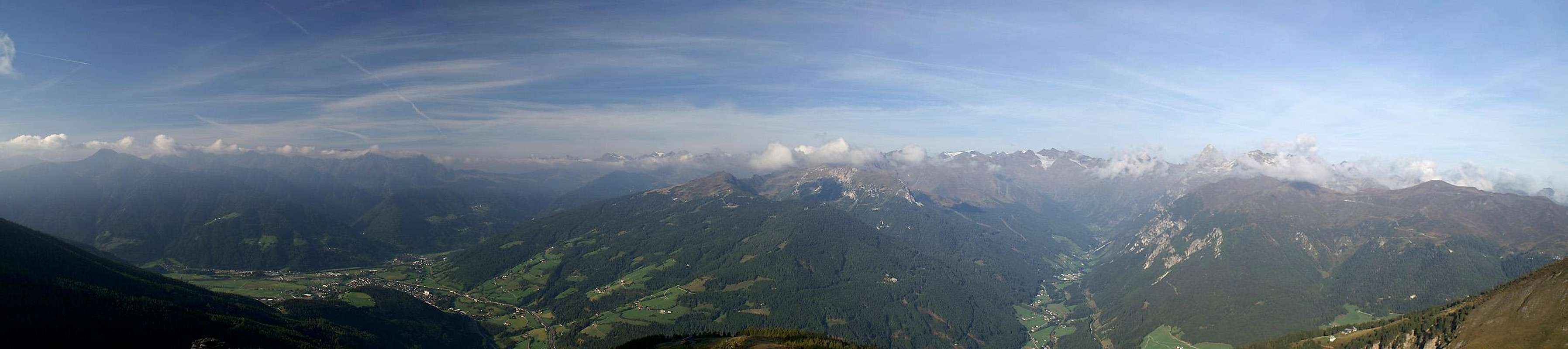
Western panorama taken from the slopes of Weißspitze |
It wasn't the perfect day for views but when we climbed Weißspitze on Sept 28th 2006 clouds were rolling around the summit offerind dramatic aspects of the mountains around. With a bit of luck you could see as far as Cevedale through the gaps in the clouds.
Getting There
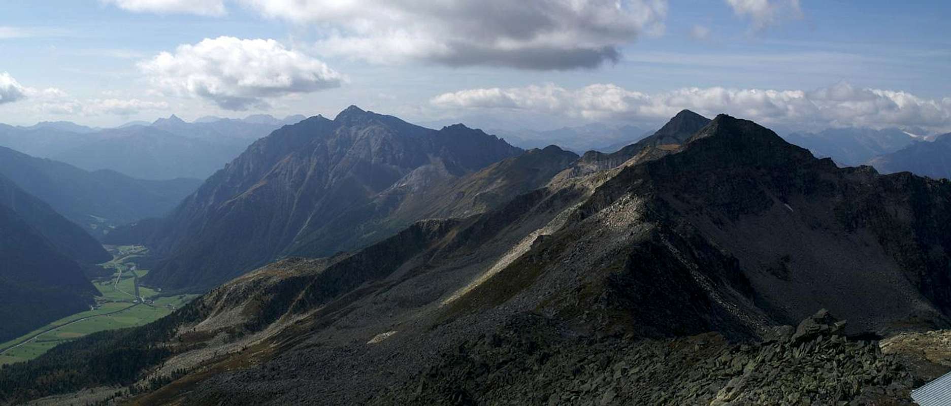
Weißspitze, Rollspitze, Daxspitze, Wolfendorn, Weißseespitze above Pfitscher Tal |
The mountain can be easily reached from the Brenner Motorway A22. Take the exit Sterzing / Vipiteno and take SS508 into Pfitscher Tal / Val di Vizze. In Wiesen / Prati take a mountain road in direction Schmuders / Smudres, through which you have to drive. For the traverse from Saun to Weißspitze park at the Braunhof farm, for the direct ascent along the normal route park at Brantner Alm. If you want to combine both routes into a loop, Brantner Alm is the better trailhead as there is a shortcutting direct slope traverse from Saun to the farmhouse.
Red Tape
There is no red tape for Weißspitze or either of the two routes described here. However, there is a nature preserve between Weißspitze and Hühnerspiel in the Schloßtal Valley. Also, the area is sometimes used for military training by the Italian Army. While it will not be closed during these time you may meet several dozen soldiers on the way to the summit.
Accommodation
The following link offers accomodation in the greater Sterzing / Vipiteno Area. While the town can often be crowded there are a lot of hotels and appartments in the many valleys which meet nearby.
Sterzing / Vipiteno and Surroundings (Italy)Weather Conditions
Maps & Books
Maps
- Digital Maps
- Regular Maps
- Sterzing / Vipiteno
Kompass Map WK 44
1:50.000
ISBN: 3-85491-050-9
Books
- Rund um Sterzing
Henriette Klier / Walter Klier
Rother Verlag
ISBN: 3-7633-4167-6
- Zillertaler Alpen
H. Klier / W. Klier
Alpenvereinsführer
Rother Verlag
ISBN: 3-7633-1269-2

 9730 Hits
 90.81% Score
 33 Votes
 Daxspitze (2645m), Rollspitze (2850m), Hühnerspiel (2748m), Weißspitze (2714m) as seen from Hoher Lorenzen


 View across the Sterzing / Vipiteno Basin by Markus80