Weisssteinspitze / Monte Tap de Cadene

Weisssteinspitze / Monte Tap de Cadene

Page Type Page Type: Mountain/Rock
Location Lat/Lon: 46.64000°N / 12.73000°E
Additional Information Elevation: 8133 ft / 2479 m
Sign the Climber's Log

Overview


Geographical Classification : Eastern Alps > Carnic Alps > Carnic Alps Main Ridge (West) > Weißsteinspitze

Weißsteinspitze photo_id=120510

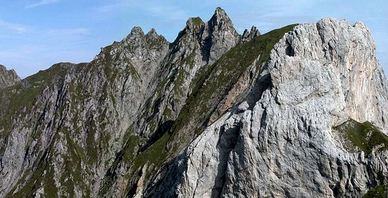
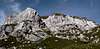
Weißsteinspitze - I'm afraid I have to use the German letter 'ß' here, 'sss' just looks too dumb - is one of a handful of limestone mountains which pop up their cliffs in the central part of the Carnic Alps Main Ridge (West). Together with Monte Peralba, Monte Chiadenis, Monte Avanza, Monte Avastolt and Torkarspitze (Monte Pietra Bianca) it forms a white limestone island in the otherwise black and overgrown ridge. Not unlike the reefs or atolls, which they were during the Ordovicium Age, when the whole area was covered by a sea.

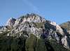
From the west Weißsteinspitze, a twin peaked summit, shows a near vertical limestone face, which is where most of the climbing routes upon the mountain are located. From the south and east it shows a very steep grass covered slope. Here the two normal routes ascend the mountain. Both are UIAA grade II with not many places to put protection. Especially near the summit the paths become steep and exposed.

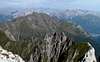
In importance Weißsteinspitze cannot keep up with the neighbouring Monte Peralba and Monte Chiadenis. Both are very popular destinations, especially among Italian climbers and hikers. On Weißsteinspitze you will almost have the same views, while you can enjoy the solitude of a mountain-top, which is hard to reach.

Route Overview - Climbing Weißsteinspitze


As I have done on other pages I will only include the abstracts of the climbs here. Complete descriptions can be found in the German Alpine Club Guidebook (German): P.Holl: Karnischer Hauptkamm, Rother Verlag, ISBN: 3-7633-1254-4.
  • West Ridge (normal ascent)
    Rated: II
    First Climbed: 1896 (Prunner)
  • South Flank
    Rated: II
    First Climbed: 1896 (Prunner)
    See route.
  • South Face "Plattenzauber"
    Rated: VI-
    First Climbed: 1985 (Ponholzer, Wallensteiner, Ortner)
    Length: 250m
  • East Face
    Rated: IV+
    First Climbed: 1986 (F., A., P. and H. Unterluggauer)
    Length: 150m
  • Eastern crevice
    Rated: VII-
    First Climbed: 1975 (Stemberger, Guggenberger, Sommer)
  • North-East Face - Eastern Gully
    Rated: IV
    Length: 300m
  • North-East Face - Eastern Gully
    Rated: III+
    Length: 300m
  • North-East Face - Western Gully
    Rated: III
    First Climbed: 1924 (Rudovsky)
    Length: 300m

Getting There


Western Main RidgeWest Central Main RidgeCrode dei LongerinPeralba - Chiadenis - AvanzaEast Central Main RidgeBiegengebirgeKellerwand - Hohe WarteMooskofel GroupRinaldo Group
Interactive map of the western part of the Carnic Alps Main Ridge. The numbers refer to the respective subgroups as given on the Carnic Alps Main Ridge (West) Page. Click on them to get the subgroup description. Weißsteinspitze is located almost exactly where the subgroups 2, 4 and 5 meet..

I'm afraid I can only give reliable directions for the northern trailhead at Ingridhütte in Frohntal Valley. The southern trailhead is located near Sappada and I'll repeat the instructions which Marco marco979 gives on the Peralba Page at the end of this section.
  • Northern Trailhead at Ingridhütte
    Ingridhütte in Frohntal can be reached from St. Lorenzen in Lesachtal Valley. The side road is well kept only at for the first 5km. The remainder is pretty tough on any car. Lucky are those who drive a 4WD car. St. Lorenzen can be reached as follows:
    • From the West (Brenner Motorway A22)
      Leave the Brenner Motorway near Brixen / Bressanone and follow SS49 to the east through Pustertal / Val Pusteria. To the east of Innichen / San Candido you cross the Austrian-Italian border and follow the road (now B100) to Tassenbach. Turn right (south-east) here onto B111, which you follow to St. Lorenzen. There turn south into Frohntal.
    • From the North
      There are two possible roads:
      • From Kitzbühel over B108 through the Felbertauern Tunnel to Lienz, then southeast to Oberdrauburg and Kötschach-Mauthen (B110), where you turn on to B111 west into Lesachtal.
      • From Salzburg along motorway A10 to Spittal. Turn west on B100 to Oberdrauburg, there south to Kötschach-Mauthen were you turn east on B111.

  • Southern trailhead near Sappada (by marco979)
    • By car:
      From Veneto take the Venice-Belluno highway and then go towards Pieve di Cadore.
      From Friuli leave the Udine-Tarvisio highway at the Carnia Exit and drive towards Villa Santina and Forni Avoltri (45 km).
    • By train:
      Stop at Calalzo, the end of the line from Venice and Padova.
      Go to Carnia on the Udine Tarvisio line. Both train stations are about 40 kilometers from Sappada, to which they connect by frequent bus lines that meet the main trains.
    • By plane:
      The closest airports are the international airports in Venice (180 km) and Trieste (140 km).

    From Cima Sappada (a small village near Sappada, not distant from Austria) go by car or on foot along a path that follows river Piave to the sources of the river (30 minutes by car, 3 hours walking).

Red Tape


As stated with all other summits on the Carnic Alps Main Ridge Weißsteinspitze is located on the Austrian - Italian border. Bring your ID and stay close to the refuges. The nearest ones are Hochweißsteinhaus and Rifugio Calvi, both only 1h away from the base of the mountain.

When To Climb


Weißsteinspitze is a summer mountain. There should be no snow patches when you attempt your climb, especially if you think to do it along the Southern Flank Route. There are almost no possibilities to place protection and the ascent runs along very steep, exposed grass slopes. The best time should be early July through late September.

Accommodation


There are campgrounds near the villages in the Lesachtal and Piave Valleys. For overnight stays near the mountain use the Huts (Hochweisssteinhaus and Rifugio Calvi). You can find all mountain huts and refuges in the area on the corresponding section on the Carnic Alps Page.

For hotel rooms or apartments, look at the following links:

AustriaItaly

Weather Conditions


The Carnic Alps Main Ridge serves as a weather divide between the Austrian north and the Italian south. The weather can change rapidly so that definite predictions are difficult. Look for information from both sides of the border. Head out early since the weather tends to change around noon. For weather info lookup the following sites:

Maps 'n' Books


Maps
I have been using maps by Kompass Verlag, which are very good for the hiking trails.
  • Lienzer Dolomiten / Lesachtal
    1:50000
    Kompass Map WK47
    Kompass Verlag
    ISBN: 3-85491-053-3
  • Sappada - S. Stefano - Forni Avoltri
    1:25000
    Tabacco Map 01
    Editione Tabacco

As for books please look at the corresponding section of the Carnic Alps page.

External Links

  • Austrian Map online
    Online digital maps of Austria (OEK 50, OEK 200 and OEK 500) by the BEV (Bundesamt für Eich- und Vermessungswesen) - in German


Children

Children

Children refers to the set of objects that logically fall under a given object. For example, the Aconcagua mountain page is a child of the 'Aconcagua Group' and the 'Seven Summits.' The Aconcagua mountain itself has many routes, photos, and trip reports as children.