
-
 15355 Hits
-
 78.91% Score
-
 10 Votes
|
|
Mountain/Rock |
|---|---|
|
|
39.42310°N / 106.1417°W |
|
|
Summit |
|
|
Hiking, Mountaineering, Skiing |
|
|
Spring, Summer, Fall, Winter |
|
|
12416 ft / 3784 m |
|
|
Overview
Mayflower Hill is is located 1 mile west of Pacific Peak in the Tenmile/Mosquito Range in Northern Colorado. Mayflower Hill is usually climbed while summiting Atlantic Peak and/or Pacific Peak. In addition, Mayflower Hill's northwest ridge offers fun ski descents. The northwest end of the ridge is mellow and allows for safe winter skiing, but further towards the summit, has steep cliffs on the north side including a large cornice.From the summit, Atlantic Peak, Pacific Peak, Fletcher Mountain and Jacque Peak are visible.
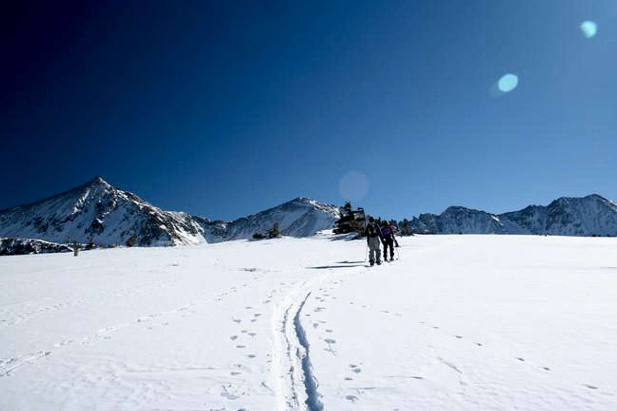
Mayflower Hill's Northwest Ridge. Note: Atlantic Peak, Pacific Peak & Fletcher Mountain.
Getting There
The Mayflower Gulch Trailhead (10,980') is on CO 91 and can be accessed from the north or south. From the north, drive 6 miles south on CO 91 from its intersection with I-70 to a parking area on the east side of the road. From the south, drive 4 miles north on CO 91 from Freemont Pass.The Mayflower Gulch Trailhead also provides access to provides access to Atlantic Peak, Pacific Peak, Crystal Peak and Drift Peak.
Northwest Ridge:
Hike up the Mayflower Gulch Trail for ~0.1 miles to another trail to the left crossing Mayflower Creek and initially heading southeast. As soon as the trail heads north towards Humbug Creek, get off of it and start heading east to gain Mayflower Hill's northwest ridge. Once on the ridge, climb to the summit.Round Trip Distance: ~3 miles
Round Trip Elevation Gain: 1,436'
Pacific Creek Drainage:
Hike up Mayflower Gulch Trail for ~0.1 miles to another trail to the left crossing Mayflower Creek and initially heading southeast. Follow the creek until it is about to intersect Pacific Creek and start heading east staying on the north side of Paciifc Creek. Follow Pacific Creek up to the saddle between Pacific Peak and Mayflower Hill. Gain the summit by heading west from the saddle.Round Trip Distance: ~4 miles
Round Trip Elevation Gain: 1,436'
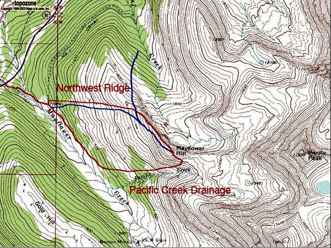
Mayflower Hill's Routes