
-
 11847 Hits
-
 88.61% Score
-
 27 Votes
|
|
Mountain/Rock |
|---|---|
|
|
48.57682°N / 113.53285°W |
|
|
Scrambling |
|
|
Summer |
|
|
8882 ft / 2707 m |
|
|
Overview

Although it's an aesthetic peak from many positions and not too far from a trail, Norris Mountain, on the Continental Divide, is seldom climbed for at least a few reasons:
* It is best accessed from the Cut Bank area of the park, which is only accessible by an unpaved road and not developed much (a primitive campground and a ranger station are the only facilities), thus making it a relatively little-known section.
* The trail hike involved is over 14 miles round-trip.
* One must climb Triple Divide Peak first to get to it, and the eastern face of that peak is imposing enough to turn away the inexperienced and those who don't have good beta on the routes up the peak.
Route
Start from the trailhead at Cut Bank and follow trail signs for Triple Divide Pass. The signs indicate that the distance is 7.2 miles, but it feels a little shorter, and my GPS device confirmed that feeling both ways. However, it is better to budget your time and supplies for the longer given distance. The trail does little climbing (about 500’) for almost 5 miles, but after the junction with the trail to Medicine Grizzly Lake, you must climb 1800’ in about 2.5 miles to reach Triple Divide Pass. Many accounts, including Edwards’s, warn that this part is hot, dry, and exhausting. In my opinion, it wasn’t that bad. Although the trail climbed steadily, it lacked the types of flat sections that mean harder sections elsewhere and the very steep grades that just burn the legs and the lungs. Plus, this long climb to the pass has outstanding scenery the entire way. A word of caution, though: in late spring and early summer, especially after winters that saw heavy snowfall totals, steep snowbanks will cross the trail in places, and it will be difficult and dangerous to negotiate them without an ice axe or at least trekking poles.
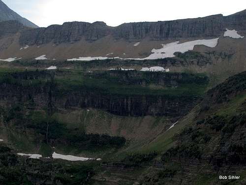
Triple Divide Pass is at almost 7400’ and is more than satisfying as a destination all on its own. Spectacular views of Razoredge Mountain, Triple Divide Peak, Norris Mountain, and Split Mountain greet you.
 Norris from Triple Divide Pass
Now it's time to make a decision about how to climb Triple Divide Peak: by the east face or by a saddle between it and Razoredge Mountain. If you've been paying attention during the hike, you've already noticed that saddle and have tried to get a sense of the conditions. Note: the Edwards guide says the saddle is 4 miles south of the peak, but that is a typo; it is really 0.4 mi south.
The saddle route is the longer but easier route and reputed to be Class 2 all the way. However, if there is snow in the steep gully below the saddle, this could be a dangerous route; I have seen it and heard of it with large cornices. Furthermore, the hike from the pass to the gully is on a sloping bench that can be snow-covered, and if it is, an uncontrolled slide could result in a fall of more than 1000' down into the basin of Medicine Grizzly Lake. In other words, this is not a good route if there is much snow present.
 The saddle option
The east face is described in ample detail here on SP, so I will not repeat all of that. It is not as complicated as the Edwards guide makes it sound and not, in my opinion, as exposed or challenging as the book makes it sound, either. It is Class 3-4 (I never felt I was on Class 4 terrain, but there is not just one way up the face, and the rock, while not a delight, is not as bad as what you have previously read might suggest. From the pass, hike up the ridge to the peak and move onto the east face when the ridge steepens significantly. Then follow ledges and short gullies to the top.
 Triple Divide Peak
From Triple Divide Peak, the rest of the route is obvious. You will use the ridge to traverse west and then, when cliffs block a direct climb of the east ridge, move left and then use ledges and gullies to make a Class 3 scramble up the southeast face to the top. You'll also discover that Triple Divide rises less than 300' from its saddle with Norris. Technically, it should not be a ranked peak, and the reason it is named and considered a separate peak is probably its hydrological significance (see peak page).
 Norris from Triple Divide Peak
The distance from the pass to the summit is about 1.5 mi, making a round-trip outing of about 17 miles. Elevation gain from trailhead to summit is around 3700', but some trail dips earlier on and the dip between Triple Divide Peak and Norris Mountain will add around 300' each way.
 Split Mountain
Getting There
The road into the Cut Bank area leaves U.S. 89 five miles north of Kiowa (junction of MT 49 and 89) and 15 miles south of St. Mary. A gravel road winds for about 5 miles past the park boundary and a ranger station to a small parking lot just before the entrance to a campground.The Cut Bank area may be little-known, but it is not unknown. The small parking area may be full by late morning on a weekend, and then you will have to add distance to your hiking as a result of parking farther away.
Red Tape
Although there is a $25 fee to enter Glacier National Park, there is no entrance station at Cut Bank.Trailhead signs cover all the wilderness regulations, so please read them carefully.
This is grizzly country. Carry pepper spray on your person (not in your pack) and know in advance how to use it. The bells some hikers wear have no proven deterrent effect; because they make a high-frequency sound and bears respond better to low frequencies, the bears may often not even hear them, but hikers seeking the natural sounds of the wilderness most certainly do. While the NPS does not officially recommend against the bells, many rangers will privately do so, and the NPS does strongly recommend having pepper spray.
Although it is now legal to carry firearms in national parks, statistics show that pepper spray is a more effective defense than a gun. Most handguns do not have the power to kill an adult grizzly unless you hit it in the eye, anyway, so firing on a charging grizzly, if you even have the time and steady nerve to do so, may just leave you facing a wounded and enraged animal that weighs several hundred pounds and has claws long and sharp enough to gut you in a single swipe.
Camping and Lodging
Backcountry camping is available at Atlantic Creek. Reserving a site is strongly advised.Backcountry camping information
If doing this as a day trip, you can camp at Cut Bank, which is small but often doesn't fill ($10). Two Medicine Campground ($20), a half-hour drive south, is larger and usually fills late or not at all. There is also a camp store there. St. Mary or Rising Sun Campground (sites can be reserved at the former) are farther away (on Going-to-the-Sun Road) but are closer to more services. Those campgrounds have a fee of $20 per night.
You could also stay at the Rising Sun Motor Inn, which is a one-hour drive from the trailhead. Historic Glacier Park Lodge is closer (in East Glacier) but more expensive.
Lodging information