
-
 74029 Hits
-
 90.47% Score
-
 32 Votes
|
|
Area/Range |
|---|---|
|
|
Hiking, Mountaineering, Sport Climbing, Skiing |
|
|
Spring, Summer, Fall, Winter |
|
|
10620 ft / 3237 m |
|
|
An Oquirrh Overview.........
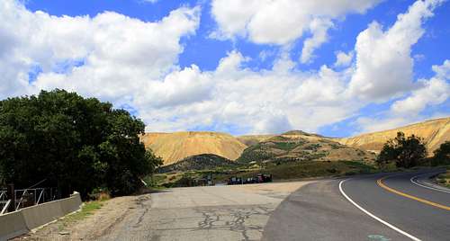
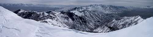
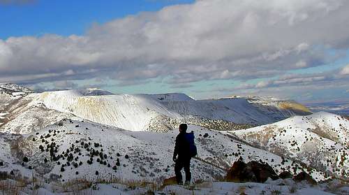
The Oquirrh (Oak-er) Mountain Range is a string of 10,000 foot peaks that divides the Salt Lake City and Tooele valleys. Better known around the world for its rich mining history rather than its mountianeering, this mountain range is often overlooked. The name "Oquirrh" is actually a Goshute Indian word that means "Wooded Mountian". Running north to south for nearly 30 or so miles, this mountain range is riddeled with private property, big peaks and expansive forests of trees/bushes. The access can be difficult and the routes can sometimes get confusing. However the views (on a clear day) of the Northern, Central and Southern Wasatch, as well as the surrounding Oquirrh Range, are so unique/beautiful that you will be glad you made the effort.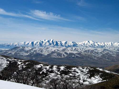
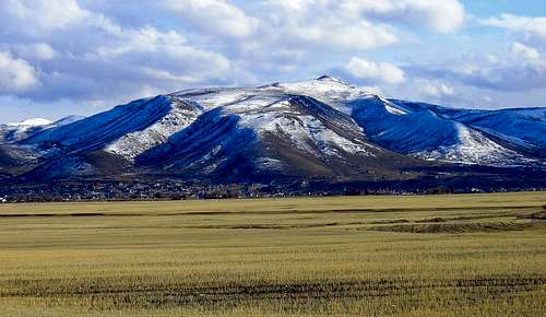
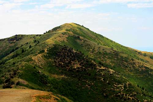
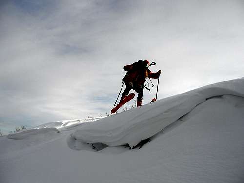
A beautiful Picture of The Day of the East side of the Oquirrh Range as seen from View Benchmark. Photo Credit Dean
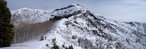
If you are a lover of the outdoors the Oquirrh Range has everything that your typical mountain range has to offer. Hiking, road biking, mountain biking, hunting, fishing, skiing, horseback riding, trail running, snowmowbiling, wildlife viewing, paragliding and even some rock climbing are all examples of activities that can be done in this range. Some of the mountains in this range worthy of checking out are Lowe Peak, Sharp Mountain and Flat Top Peak. Each are classic Oqurrih climbs that offer what I would call the "Oquirrh experience". All three of these mountains are located in the southern end of the range and are sure to please any big mountain climber. In the summer months the trailheads, trails and routes are much easier to find. However the horses and bugs will make you think that your somewhere in the Uinta Range. Due to the Oquirrh's many aspen groves, the fall months, September-November, are the most colorful months of the year. Personally the best time of year to visit this range is in the winter. The Oquirrh Range can receive anywhere from 300-500 inches of snowfall a year. This anual snowpack covers miles apon miles of what is normally the worst bushwacking imaginalbe. Also this deep snowpack turns the highest peaks of the range into some of the best skiing in the state of Utah. This page is always under construction so please attatch any trip reports, albums and/or pictures of the Oquirrh Range that you may have......
Getting There
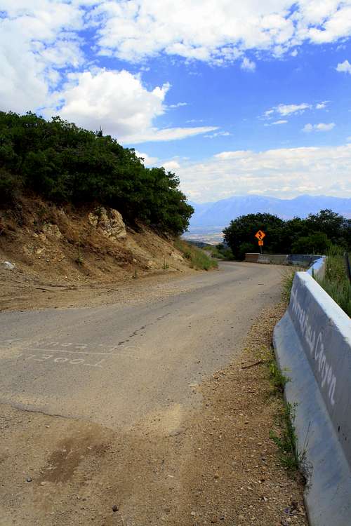
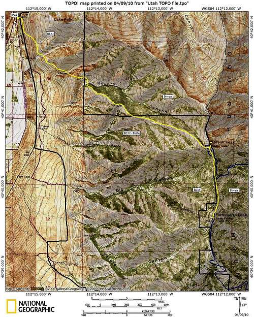
Unlike the Wasatch and Uinta mountain ranges, the access for the Oquirrh Range can prove quite difficult. Finding your way to the Oquirrhs will often send you across freeways, down highways and through neiborhoods. If you cut up the Oquirrhs into three 10 mile sections there is a major trailhead for the South, Central and Northern Oquirrhs. For the Southern Oquirrhs the major starting point is from the Ophir Canyon Trailhead located just east of the town of Ophir. The Central Oquirrhs are most easily accessed of the three and you can come from Butterfield Canyon (on the SLC side) and Middle Canyon (on the Toole side). For the Northern Oquirrhs the best approach is from the outskirts of Tooele.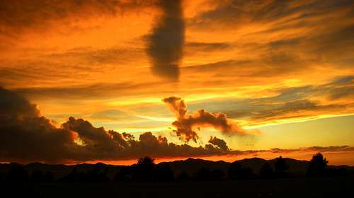
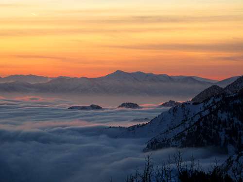
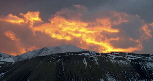
A very beautiful summer Utah sunset over the Oquirrh Mountain Range.
SOUTHERN OQUIRRHS (Ophir Canyon Trailhead)
From I-80 get off at the Tooele/Stansbury exit (Exit 99) and follow State Route 36 for approx. 20+ miles to a junction. Make a left onto State Route 73 and continue driving it for 7 miles until you see a turn off for the town of Ophir. Drive through the small town sticking to their version of a main street. Soon the speed bumps will disappear and the road will turn to dirt. After passing a public campground the trailhead will finally come into view. It should be mentioned that a small river crossing may be encountered, especially in the spring when the snowpack is melting off. One could take a 2 wheel drive car up this dirt road, however it is recommended that you have a 4 wheel drive vehical for this trailhead.
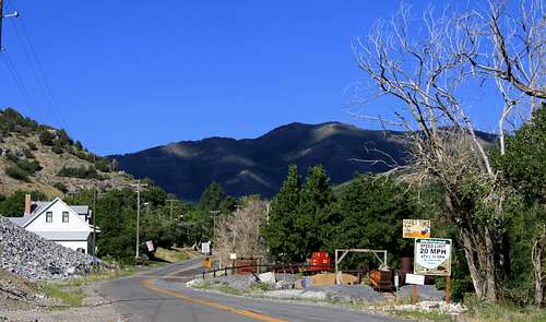
The small town of Ophir
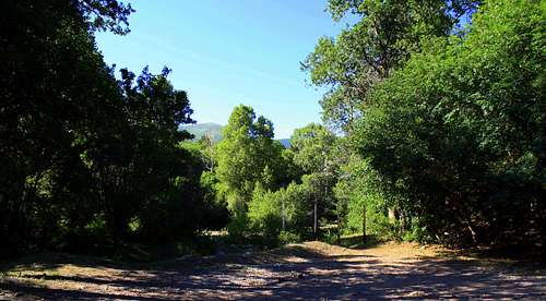
The official and very primative Trailhead
CENTRAL OQUIRRHS (Butterfield Canyon Trailhead)
From I-15 in Salt Lake City, get off at the 12300 South Exit. Turn west and follow 12300 South as it becomes 12600 South. Shortly after Bangerter Highway start looking for a street on your left named "Herriman Main Street". Make a left at this intersection. After passing some schools and Herriman's version of a main street, continue driving on the same road as it becomes 13100 South. At a 25mph curve in the road look for the unmarked entrance to Butterfeild Canyon. Much like the Scenic Aspen Grove Loop in American Fork Canyon, this road is very narrow. Although it is paved all the way to the pass, rocks from the side hills cover the road making it appear like a dirt road at times. Watch for mountain bikers, wildlife as well as other vehicals while driving this road. Once at the pass there should be parking area on your left. If you decide to continue driving west (down) from the pass this is known as Middle Canyon. In the winter the SLC side (known as Butterfield Canyon) is closed to traffic. During these months only the Middle Canyon side is open to traffic. At about 2 miles up Middle Canyon the road is closed, leaving 3 more snow covered miles to the pass.
This is the unmarked entrance to Butterfield Canyon
Make a left at this intersection on to Herriman Main Street to reach Butterfield Canyon
The Butterfield Canyon road
NORTHERN OQUIRRHS (Rogers Canyon)
One of the least official trailheads of the Oquirrhs, this route evetually crosses some private property so user beware. Take the Tooele exit off I-80(Exit 99). At the first possible left turn into the gas stations. A sign says Frontage Road. Follow Frontage Road as it parallels I-80 heading back eastward. Less than a mile beyond the gas stations, the road does a hairpin turn at the base of the mountains. The road will now head south. Follow the road for a short distance, looking for a dirt road next to some rock cliffs that have graffiti on them. Parked right there. There are no signs indicating private property, however it may be privately owned by a railway company. If you happen to be worried about getting your car towed, parking at the gas stations and biking in is an option.
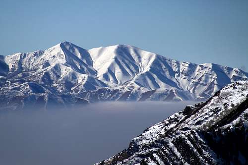
Kessler Peak as seen from the west. Photo Credit Ericwillhite
The Peaks of the Oquirrhs that you CAN climb
Flat Top Peak- Standing tall at 10,620 feet, this is the tallest peak of the range. The veiws of the Salt Lake City Valley and the surrounding Oquirrh range make this peak worthy of anyone with the Oquirrhs on their to do list. The standard route for this mountian starts at the Ophir Canyon Trailhead. After a 1/2 mile of leaving the trailhead Picnic Canyon will come up on your right. At the top of Picnic Canyon head straight south along the ridge until the summit is reached. Another option is to park just before Serviceberry Canyon and climb up the South Fork of Ophir Canyon. This route requires expirence or a photograph of the area. A more detailed description about this mountain can be found by clicking on this link Flat Top Peak  |  |  | |  |  |  |  |
 |  |  |  |  | |  |  |  |  |
 |  |  |  |  | |  |  |  |  |
| |  |  |  |  |  |  |  |  |  |
 |  |  |  |
 | |  |  |  | |  |
 |  |  |  |  |  |
 | | | |  | |
 |  |  |  |  |
A beautiful sunset over Nelson Peak. Photo Credit Ed F
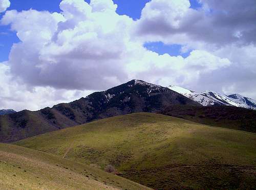
The southern peaks of the Oquirrh Range from Nelson Peak. Photo Credit Ericwillhite
Along the route to Nelson Peak. Photo Ericwillhite
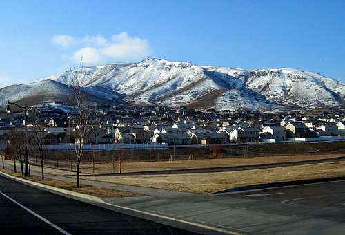
South Mountain- Looming above the city of Herriman at the southern end of the Oquirrhs is South Mountain. Considering the elevation of South Mountain is only 6,824 feet, this mountain is one of the lower elevation peaks of the Oquirrh Range. Climbing this mountain is most easily accomplished in the winter time and the views are outstanding (as long as there is no inversion going on). A more detailed description on this mountain can be found by clicking on this link South Mountain
South Mountains more impressive side. Photo Credit Dean
South Mountain. Photo Credit Dean
Tooele Peak- Located between Settlement Canyon and Middle Canyon this is not a peak that you will find on your average topo map. However because of its close location to the town of Tooele, this mountain is one of the easier peaks to find.
Tooele Peak. Photo Credit Icarreau
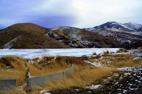
Settlement Canyon Reservoir and Tooele Peak
The R.I.P Peaks of the Oquirrh Range
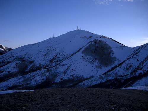
Kessler Peak- Standing tall at 8,400 feet Kessler Peak is the northern most peak in the Oquirrh Range. With outstanding views of the Salt Lake City valley, Tooele valley and the Great Salt Lake it is a real tragedy that this peak has red tape. Though there is already a page on climbing this peak, please remember that CROSSING EVEN A SLIVER OF A NO TRESPASSING AREA can have serious consequences if you are caught by a property owner. Please repect the private property areas and no trespassing signs. Dean has a great trip report on why trespassing in the Oquirrh Range is a really bad idea which can be found by clicking on this link Don't trespass in the Oquirrh range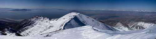
Kessler Peak from the top of Farnsworth Peak (which is PRIVATE PROPERTY). Photo Credit ericwillhite
Kessler Peak from Milluve Peak
The route to Kessler Peak and Farnsworth Peak. Note how the route crosses a sliver of Private Property. Photo Credit ericwillhite
Farnsworth Peak- The 2nd most northern peak in the Oquirrh Range is Farnsworth Peak. Farnsworth has a long approach followed by one of the best view points of the Great Salt Lake (next to Kessler Peak) that the Oquirrh Range has to offer. However there are some radio towers just short of the summit. This means that both Farnsworth Peak and it's access route, Coon Canyon, are both surrounded by red tape and private property. If you are caught trespassing by a property owner up there, they are allowed to press charges against you.
Farnsworth Peak from East Kessler. Photo Credit ericwillhite
Clipper Peak- Just above the Kennecott Copper Mines is Clipper Peak. The peaks eastern slopes are no longer ridges and hills. Insted they are now large holes in the earth that is known world wide as the Kennecott Mining operation. The closest one is allowed to the peak is West Mountain. Attempting to summit Clipper Peak from West Mountian is more than a bad idea because unlike many of the private property areas of the Oquirrhs, the Kennecott Mining areas have a full time security force.
Clipper Peak....so close yet so far, is covered in Private Property. This picture was taken from West Mountain.
A beautiful sunset over Clipper Peak and The Kennecott Mines, both of which are No Trespassing Areas. Photo Credit Rocky Alps
Silveropolis, Lion and Rover Hills- With elevations between 8,000 and 9,000 feet, it is shame that these hills are now private property for future mining prospects. All these peaks were once accessed by the 4x4 road of Silverado Canyon. Ophir Canyon (the canyon just north of Lion Hill) is still open to climbers and skiers.
Sunshine and Eagle Hill- Located at the most southern end of the Oquirrh Range are Sunshine Hill and Eagle Hill. Because these hills are just west and south of the massive Sacramento Mines they are now home to some radio facilities. This means that these hills have sections of private property and lots of red tape. These hills used to offer, according to some, an outstanding view of the southern end of the Oquirrh Range. There used to be 2 different ways access Sunshine and Eagle Hill. They were Mercur Canyon and Mitchell Canyon. Mercur Canyon is now home to a big private property access road and several large open pit mines. Mitchell Canyon is covered in "prospects" for future mining activities which = private property issues.
Skiing The Oquirrhs
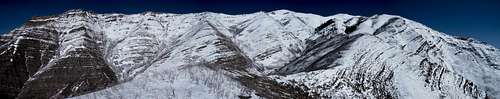
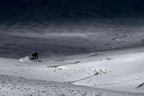
When the winter storms of Utah take a break and the Wasatch Range is all tracked out, the Oquirrhs Mountain Range is the safe haven for powder turns. The difficult/restricted access and a snow depth that constantly varies keeps this mountain range out of most backcountry tourers plans. With more than enough mountains above 10,000 feet, no Wasatch Powder Heli Birds, and too many draniges to count, the skiing possibilities are endless. Avalanches are a frequent threat anywhere there is snow and a steep enough slope. The Oquirrh Range has NO avalanche forecast so be prepared to dig snow pits, evalutate slopes and basically be your own avalanche forecaster out there. Partners, avalanche skills, beacons, probes, shovels, avalungs and common sense are all a must out here. Be prepared for self resque.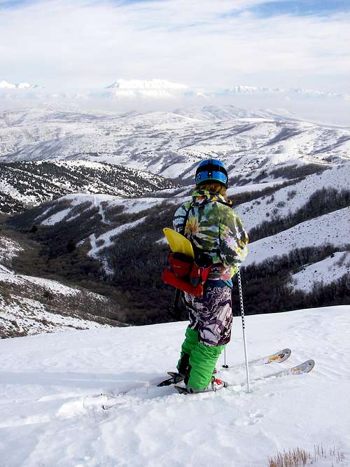
Troy about to drop into the top of Yellow Fork Canyon
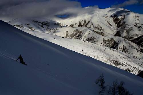
Skiing Sharp Mountain. Photo Credit Manauders
Me stomping on a soon to fall 100+ pound cornice in the Oquirrh Range.
Ron Splitboarding Sharp Mountain
Wildlife
The Oquirrh mountian range is known for a variety of wildlife species. The dominate wildlife species of this mountain range are deer and in the summer months it is all cows. Caution.....lots of deer (basically prey) means that there are many predators (cougars and bears) that roam the Oquirrh range. It is not uncommon to come up on old bones and predator scat while hiking around on the popular trails. Be sure not to travel alone at night, carry bear spray and never let your guard down out there. If you think I am joking about the Oquirrhs having predators check out this link..... Catching Oquirrh Cougars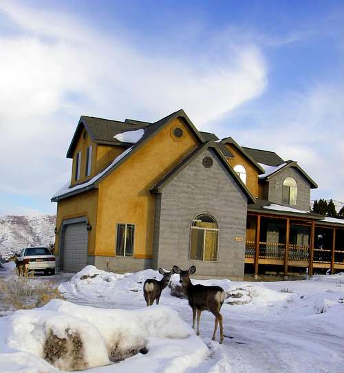
Some Oquirrh deer that seem to feel right at home
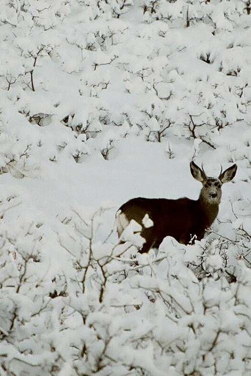
A deer in the Oquirrh Mountains. Photo Credit Pharmacist
During the higth of summer, Elk can be found grazing around the southern end of the range. These herds of elk can be up to 50 to even 100 strong. For those who wish to catch sight of these large herds the most common place they can be found is on and around Lowe Peak. Once you see them be quiet and be slow.....they are easily spooked.
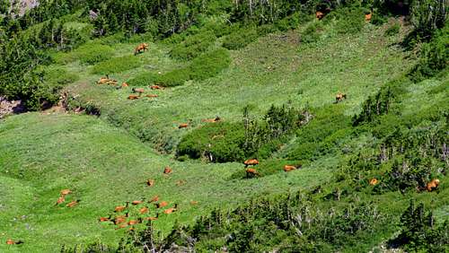
A large herd of 40+ Elk grazing in Lowe Basin
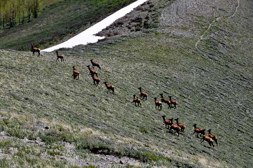
A herd of Elk on Dead Ox Pass. Photo Credit Jeremy Lott
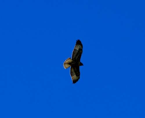
The Oquirrh Range is also surprizingly famous for bird watching. During the spring and summer months, when the flowers are out, there are humming birds and large hawks flying on and over just about every peak. The best place to go bird watching during the summer is the Butterfield Peaks. During the winter the impressive Bald Eagles take over the skies and seem to enhance the beauty of this mountain range. The best place to find Bald Eagles is at the southern end of the range in Ophir Canyon.
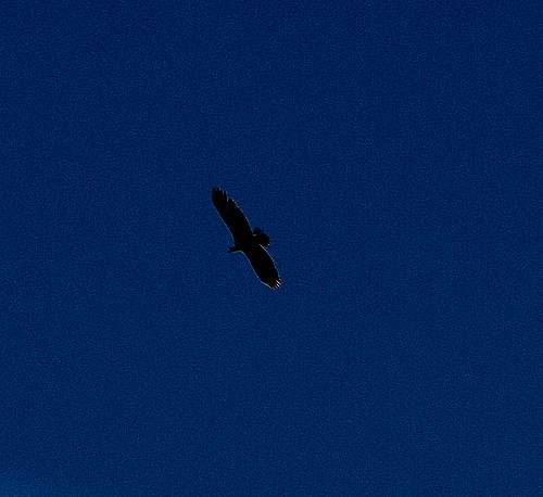
A Bald Eagle flying over Ophir Canyon. January 21st 2011
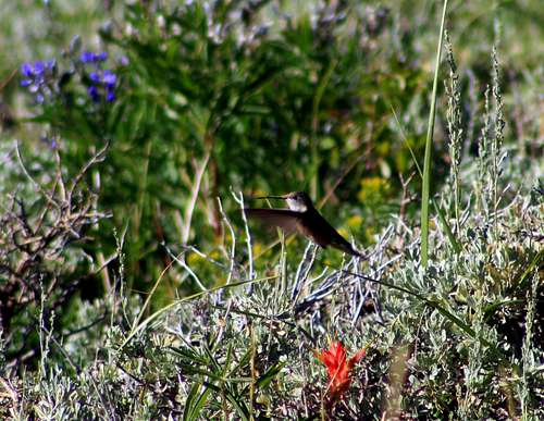
A Hummingbird on Butterfield Peak
A Hawk flying above the Butterfield Peaks
Red Tape
The Oquirrhs take first place for red tape in Utah. Many peaks are already R.I.P and several more are in danger of becoming no trespassing areas. The Kennecott Mines, Sacromento Mines and private property areas are riddeled throughout the entire range. Finding your way around these forbidden areas can prove difficult and tricky, but have faith.....for every bushwack has an end. Dean has a great trip report of why trespassing in the Oquirrhs is a bad idea which can be found by clicking on this link Don't trespass in the Oquirrh range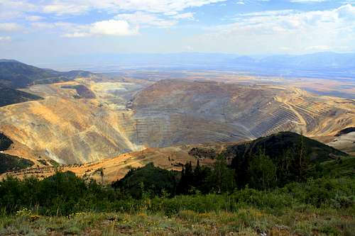
The view from the "Kennecott Overlook" at West Mountain
Brad observing where a mountain once stood
 Brad observing where a mountain once stood
Oquirrh History
The first humans to explore and mine the Oquirrhs were the local Utah Indians. By the time the Mormons arrived the Oquirrhs were already known for large forests of Pines, Redwood, Maple and Aspen Trees. The first attempts to settle the Oquirrhs were by Thomas and Sanford Bingham in 1848. Brigham Young had sent the Bingham family there to raise livestock and create the first settlement at the base of the "Bingham Canyon". At the time the Bingham Family found valuble minerals scattered amongst the range, however Brigham Young advised them to not engage in mining activities.It was not until 1863 that a logger named George B. Ogilvie, found a piece of ore that contained silver and gold. Soon after the first mining distict of Utah (nammed the West Mountain District) was set up by The Jordan Silver Mining Company. The discoveries of silver and gold in Bingham Canyon lead to the formation of the mining towns Stockton and Ophir. Within a the span of a year the recoverable ore supply was exhaused.
By 1873, the process of Lode Mining was introduced to the Oquirrhs. This revolutionary new way of extracting ore reopend mines such as the Tintic Mine, Ophir Mine, The No Ya Don't Mine, Shoo Fly Mine and The Bingham Mine. In 1896 the very first Copper was mined by Samuel Newhouse and a man by the name of Enos Wall who saw the future value of the "worthless" mineral.
Mr. Wall knew the profits that could be made with copper so he began buying all the local mines in the area. Not knowing the value of the mineral, other miners refered to the mineral copper as "Walls Rocks". Believing that open pit mining was way too "radical" the main finance backer Joseph Delamar pulled out. Daniel Jackling, one of the two engineers in charge of survaying the Bingham property for possible open pit mining thought otherwise and took over the rights to the area. He, along with Thomas Weir and Samuel Newhouse, went on to form the Utah Copper Co. which eventually became what we know today as the Kennecott Mining Co.
With the turn of the century, towns sprung up all around the copper mines. Magna, Garfield and Bingham were the largest of them. In the 1920's Kennecott begain building their own "company town" affectionatly named Copperton. This town became a showcase for copper-related products, such as strip shingles fastened with copper nails; copper valleys, hips, ridges, and downspouts; copper gutter straps, downspout stays, and chimney saddles; copper vents; bronze hardware and screens; and brass pipes, pipe fittings, and shower fixtures. By 1955 the towns of Copperton and Garfield were sold to a relastate company and were subsequently dismantaled.
During World War 2 the copper mining reached its peak. Kennecott these days still produces annually 250,000 tons of copper, 350,000 ounces of gold, 2.5 million ounces of silver, and 8 million pounds of molybdenum.
The Oquirrh Numbers
1,000,000+ is the number of people who see the Oquirrhs everyday and never even consider exploring them.10,620 feet is the elevation of Flat Top Peak (the highest peak in the range).
1,000 is the number of deer trails that will send you off route.
37+ named canyons/forks.
30 miles is the length of the Oquirrh Mountain Range.
24+ is the number of large water towers (these are private property so please do not ignore the No Trespassing signs)
17+ is the number of peaks above 8,000 feet.
8 is the number of known and named hot springs.
5 is the number of parks
2 is the number of open pit mining companies that dominate the Oquirrh Range.
1 is the number of times it takes to fall in love with the beauty of the Oquirrh Mountain Range.
magnavox44 - Jun 1, 2013 1:40 am - Voted 9/10
Kessler PeakKessler Peak can be accessed via BLM land in Tooele County.
TyeDyeTwins - Jun 13, 2013 1:34 am - Hasn't voted
Re: Kessler PeakIt can be.....but be VERY wary of the private property in the area. Eric's route did have private property slice through his route. I'll make some changes in the coming days.
lvsoule - Jul 11, 2013 2:29 am - Hasn't voted
Re: Kessler PeakYes- when you climb to Kessler from the BLM side, the BLM land crosses over to Kennecott property. That is about 3/4 of a mile and then you are back on BLM land. They would have to fly in via helicopter to ever see you on there. There are no vehicles that can access that point. It is a ridge climb and it gets a little hairy with some brush that needs to be cleared out for a good hike. There is one spot where you scale a rock area for about 10 feet(not an up climb, but across holding to the top)... not too bad, but if your tired its a pain. Once you reach the road it is BLM until you get almost to the top. Then it is private when you reach the tower area. You can go as low as the saddle and still be on BLM, but any lower you go into Kennecott. Also if you climb South from the saddle, you are back on Kennecott Property. Be very careful at the tops of these mountains in the summer. There is a combo of rock and sage brush and the Rattle Snakes are everywhere. I counted a dozen one day! Who knows how many we passed that didn't rattle too!!! The Tower operators say to always watch the ground. I've never witnessed a place so infested with snakes. So take up tall hiking boots, have a trekking pole and leather gloves. You may have to move some with your pole here and there. During the winter avalanche danger can be very high! There are also cougers and I've heard wild dogs. I have faced many fears on Kessler... When you wanna go? I've been there many times! We have a broadcast channel there.