
|
|
Mountain/Rock |
|---|---|
|
|
40.46687°N / 112.03892°W |
|
|
Salt Lake. |
|
|
Hiking |
|
|
Spring, Summer, Fall, Winter |
|
|
6824 ft / 2080 m |
|
|
Overview.
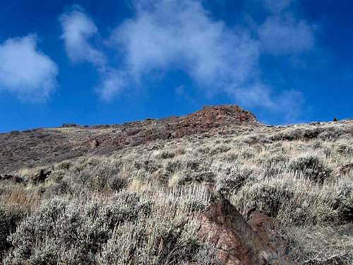
South Mountain is the high point on the western Traverse Range, above Herriman Utah. It shares it's duty with View Benchmark, the high point of the eastern Traverse Range guarding and dividing the southern portion of Salt Lake County, from the northern portion of Utah County. South Mountain has a dominating presence over Herriman, though recently homes and subdivisions have slowly been creeping up its north flanks progressively over the past decade.The mountain offers a great conditioner hike for those wanting a quick break away, and the views from the top are fantastic. The northern view gives a glimpse of the Salt Lake Valley, bordered by the Oquirrh Range to the west, and the Central Wasatch Range to the east. South views give a unique angle of Southern Wasatch Range, and the Lake Mountains.
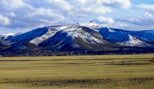
South Mountain viewed from northern Herriman.
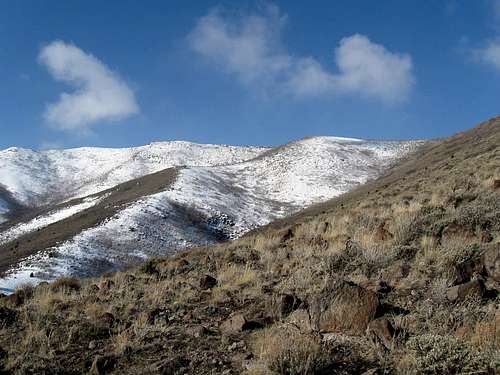
A closer view of the summit en-route.
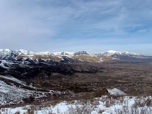
View from the summit north west at the Oquirrh Range and the Kennecot Mine area.
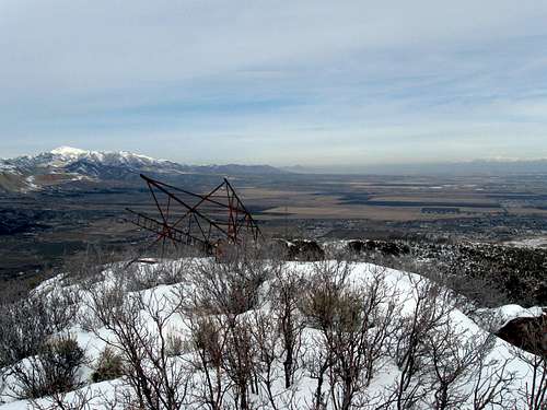
One of the more unique features near the summit area, an overturned radio tower.
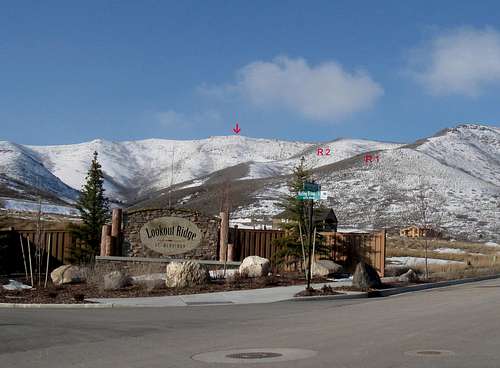
Lookout Ridge Subdivision access.
Getting There
Access to South Mountain is located at Herriman, Utah. The usual approach to Herriman is from the Bangeter Highway area. If approaching from the north or south on Bangeter, turn west onto 13400 S and continue west just over 1 mile to Monarch Meadows Parkway. This is just before the McD's. If you pass the McD's, you missed the turnoff (signal). Turn left (south) onto the parkway and continue approximately 1.25 miles. The parkway has a meandering course heading south at first, the curving south east, then south once again. After getting on a southern heading the parkway is 4800 west. The southern most portion of 4800 W forces a turn to the west onto Paradise Rose road which becomes Juniper Crest Road. It goes uphill slightly and stay on it till you come to Ambermont Drive (about a mile from the intersection). Turn right onto Ambermont Drive and follow it uphill to Rolling Brook Drive (look for the big bronze elk), and take a left into "Lookout Ridge" subdivision area. Take a right at Orchard Spring Road till you hit a T with Lookout Ridge Drive. Turn right and when it curves left, it becomes Pulley Lane. Stay on Pulley Lane a short distance and turn left on Hunt Handley Drive. This turns into Secret Sunset Circle and will lead up a a cul de sac which is the trail head. Whew...did you follow all of that?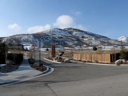
The key road to get to the cul de sac and the "trailhead" are found by going into the "Lookout Ridge" subdivision.
A great view of the two primary ridges to access South Mountain.
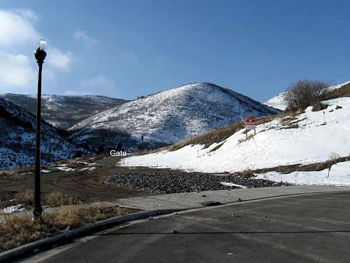
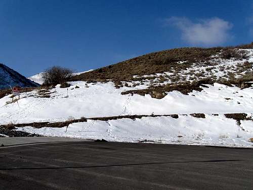
Culdesac and gate locations.
Update: If interested in coming from the north, more information will be offered on the section for geocaching when it is developed.
Red Tape
Most of the access and area to South Mountain is the ever expanding amount of residential real estate. As mentioned above access will constantly be changing due to homes being built. Also keep in mind that much of the access once off of 13400 south is through a residential area where many young families call home. Keep your eyes peeled for little ones who may be out in the road, joggers and bicyclists.If approaching the mountain from the south there will be a good chance you'll be crossing the Camp Williams Military Reservation boundary at one point or another. For this reason the primary access to the mountain is from the north side.
Camping
Camping in this area is probably best located elsewhere as most of this area is dotted with private land and homes. Butterfield Canyon further north would be a possible area, however the local Big and Little Cottonwood Canyons in the central Wasatch would be the best option, though it would mean a drive across the valley.Here is link from Utah.com, featuring camp sites near the Big and Little Cottonwood area. Check it out and take your pick.
Utah.com camping link here.
When to climb and gear.
This is an all season peak.Summer, Spring and Fall.
During these seasons the proper attire, weather pending is mainly all one will need. The summer season will get hot, plan of some sunscreen and plenty of water. Most footwear can be worn on the route up, the standard route up to the peak will not warrant anything special. A good set of trekking poles can come in handy as well. Down below the area can get muddy during the early/mid spring season or just after a fresh storm, plan on dealing with that aspect accordingly. There is minimal bushwacking involved along the ridge area, but avoid the plentiful cactus type plant that can create problems for you, those barbs hurt.
Winter.
This is the best time perhaps to hit up this peak while the higher Wasatch Peaks are rampant with avalanche danger. Virtually no avalanche danger exists on this route/peak. One thing interesting about the mountain is that not much snow accumulates at the base, however once in the vicinity of the upper ridge area the snow reaches a greater depth making snowshoes or skies needed unless you don't mind post holing for a portion of the route. Proper winter attire will be needed though nothing too advanced.
Route information.
There are several different routes up the mountain mainly by following one of the smaller sub ridges which lead to the primary ridge the summit is located on. Once following the directions to the culdesac area, there are two ridges which can be used.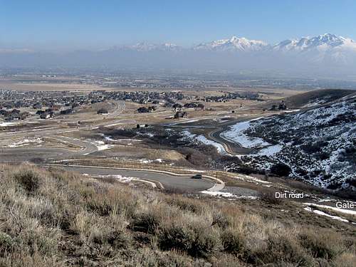
Another view of the culdesac and gate locations.
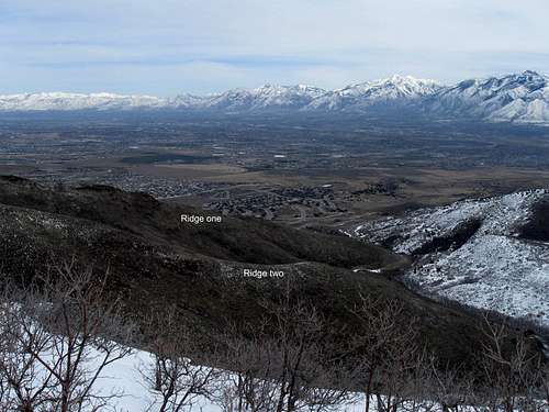
A look at the two ridges from higher on the mountain.
Ridge one access.
Ridge two access photo.
-------------------------------------------------------------
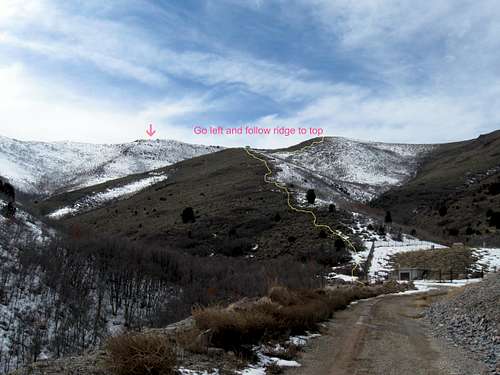
Ridge One. (Located directly above the culdesac)
One way mileage: 1.4 miles.
Elevation Gain: Approximately 1,520 feet.
Class I and II.
The last portion of ridge 2.
--------------------------------------------------------------
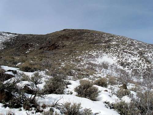
Ridge Two. (Located at the end of the dirt road beyond the culdesac)
One way mileage: 1 mile.
Elevation Gain: 1,310 feet.
Class I and II.
The reddish composition of the ridge is basalt rock.
 The last portion of ridge 2.
 ---------------------------------------------------------------
Northern route: See information that will be provided in the new geocaching section that i will be developing.
Mountain weather.
Due to this mountains lower altitude the weather will correspond most directly with that in Herriman. Check the link below for the local forecast for that area below.Weather for Herriman Utah, here.

Geology.
The main composition of South Mountain is an intrusive rock called Basalt. Basalt is an igneous intrusive rock which forms when the mantle pushes heated rock upwards through the crust, though it never quite gets to the surface. Slowly cooling over time, the rock forms what we see today.The outlying boundaries to the south and west of the mountain is the prominent Oquirrh Formation, which is a layered strata of limestone, mainly gray and light tan, with thin beds of quartzite. The age of the formation dates back to 270 to 325 million years old. This formation is huge in depth, often over 20,000 feet thick is some places. The Bingham Canyon Mine, one of the largest open pit mines in the world, capitalizes on this formation for minerals like copper, gold, lead, and others.
 The reddish composition of the ridge is basalt rock.
 Geocaching on South Mountain
As a person who enjoys both hiking/climbing and other mountain activities, I've also become an avid geocacher. I've placed a bunch of geocaches on South mountain and adopted others. Presently I'm working on a hiker's geocache trail that will take you up from the parking area on Secret Canyon Circle to the summit of South Mountain. Other geocaches have been or will be placed elsewhere on this nice local mountain. Stay tuned for more but to whet the appetite, go to geocaching dot com and become a member. Then go to PLAY and find a geocache. Insert the following: GC73Q2MThis will help to bring up one of the South Mountain geocache pages and get you started. Message me if you need more help or info. Oh, want the summit geocache? OK, use this GC2AW3Y to bring up the information on it.