
-
 3787 Hits
-
 79.78% Score
-
 11 Votes
|
|
Mountain/Rock |
|---|---|
|
|
44.65700°N / 108.8144°W |
|
|
Park |
|
|
Hiking, Scrambling |
|
|
Spring, Summer, Fall, Winter |
|
|
5138 ft / 1566 m |
|
|
Overview
 Summit view west towards the Big Horns
Peak 5138 lies at the northern edge of the McCullough Peak Badlands near Powell, Wyoming, where the hundreds of dry, desolate ridges gradually begin to descend to meet the farmlands along the Shoshone River and the surrounding canals. This hike, which is easily done in a morning, takes you from lowlands and numerous creek beds to a steep, rocky mountainside where the small rocks scattered over very hard ground make for some exciting (and sometimes nerve-wracking) scrambling.
After reaching the summit, you will be treated to a great panorama of the entire northern half of the badlands, as well as impressive views of the main McCullough Peaks, which rise up another 1,500 feet in elevation along the southern horizon. There is plentiful wildlife in this area, and deer were everywhere when I was on the mountain.
Getting There
 Deer Creek
 Peak 6442
To reach Peak 5138, travel south on Highway 295, which turns off of Highway 14A at the light across from the Subway restaurant in Powell. After about 3.5 miles, turn right on Lane 13 in Willwood and drive for 3.3 miles. Turn left on Road 12H, and follow it until just after the last house on the left, at which point you will turn left and follow the road along the canal for a short distance; do not continue on 12H to the top, as the road has been blocked off and no longer agrees with the topo map. At the fork, you will see a metal gate off to the right which provides access into the badlands area. After going through this gate, you can drive in as far as your vehicle will take you. While this is one of the nicer roads in the northern McCulloughs, there are still quite a few places where water drainage has reshaped the road; the main obstacle here is Deer Creek, which the road crosses several times. If there is water in this creek, you are asking to get hopelessly stuck in the goosh if you try to cross it, and if it rains while you are exploring the area, you may be in there for a while. It is possible to walk the entire distance from the gate, making a round trip of about 5.5 miles.
 Summit ridge
 Purple dirt
Stay on the main road for about 1.25 miles, heading generally to the right of the hills ahead and keeping right when you cross under the electric lines. At the fence, turn left and follow the road that parallels the fence until it ends on top of the steep hill, after which you will descend into the neighboring drainage. From here you will leave the road and begin the scramble up the flanks of Peak 5138, which requires some route finding, but you should generally head for the two humps at the north end of the summit ridge. Much of this route is over very hard dirt which is littered with small red stones; one false step can easily result in broken limbs or worse after the ensuing fall, so test the footholds carefully. The two humps look more difficult from below than they actually are, and after reaching the top of the second one, it is an easy walk to the summit.
This hike totals 2.75 miles one way, with 700 feet of elevation gain, though it is more if you allow for some up-and-down over the ridges. It is mostly Class 1, with a few Class 2 spots.
 Badlands hill near Deer Creek
Red Tape
There are no access fees to enter the McCullough Wilderness. The sign system marking access to roads was overhauled in 2004, and as a result, the roads are very clearly marked; there are more than 230 miles of roads marked with white arrows that are open to motorized travel, 20+ miles of roads open to ATV and non-motorized travel, 30 miles of administrative roads, and 60 miles of existing roads that are now permanently closed. Roads that enter this area from the south via Highway 14/16/20 are generally easy and don't require 4WD until you are several miles in, while the roads entering from the north from the Willwood District south of Powell need high clearance 4WD and very good judgment on the part of the driver to avoid getting into places where it is impossible to continue or turn around. The entire badlands area is prone to flash flooding which can quickly make travel impossible in places, so keep an eye on the canyon west of Cody to gauge the approach of any storms.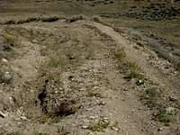 Road on the northern side of the badlands
 Deer skull
All it takes is one look at this harsh rocky environment covered in sagebrush to know that this is prime rattlesnake country! They like to sunbathe on the rocks and curl up in the brush, so it is not uncommon to have close encounters with snakes that are on or next to the trail. Be extremely careful when hiking anywhere that is off of the road or trail because of the abundance of sagebrush; a slower pace will allow you to listen for the rattle, and will also give the snake a chance to leave as it senses your approach. Make sure you know how to look for them and how to act around these animals, in addition to knowing what to do if you are bitten by one (see link below).
Be sure to bring in enough water to drink, as suitable drinking water is not found in the badlands.
Camping
Camping is allowed in the McCullough Wilderness, with a maximum stay of 14 days in any 28-day period. For more information, visit the BLM camping rules page at:http://www.blm.gov/pgdata/etc/medialib/blm/wy/information/docs.Par.1775.File.dat/wynf-0019.pdf
External Links
Information on the McCullough wild horse herd:http://www.blm.gov/wy/st/en/field_offices/Cody/wh.html
http://www.friendsofalegacy.org/mustangs.htm
Horse Tour Information:
http://www.wildmustangtours.com/index.cfm
What to do in case of a Rattlesnake bite:
http://www.whmentors.org/saf/snakes.html