
-
 5331 Hits
-
 81.84% Score
-
 14 Votes
|
|
Mountain/Rock |
|---|---|
|
|
44.86170°N / 109.2546°W |
|
|
Park |
|
|
Hiking, Scrambling |
|
|
Spring, Summer, Fall, Winter |
|
|
5429 ft / 1655 m |
|
|
Overview
 Summit ridge
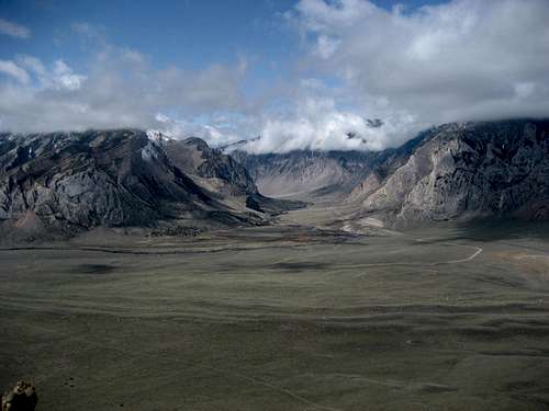
The Rock Benchmark sits southwest of the small town of Clark, Wyoming just outside of the beautiful Clarks Fork Canyon. The entire mountain is made up of conglomerate rock, which can be seen in some of the pictures of the formations and the summit. While it is dwarfed by nearby Bald Peak (8,633 feet) and the east part of the Beartooths (9500+ feet), this peak is one of only two mountains under 6,000 feet in Wyoming to have a prominence greater than 1,000 feet; its 1,009-foot rise places it at #251 on the Wyoming prominence list.
Plant life abounds on the Rock Benchmark, and you will see a large variety of sage brush, small trees, grasses, and wildflowers during a trip to this mountain. Antelope and deer roam this area, and it is always possible to run into rattlesnakes on this kind of terrain.
While the topographic maps show that there is a summit marker, I was unable to find one on or near the summit. The best explanation I can come up with is that, given the loose makeup of the summit, it was easy to vandalize and may have walked out with someone; another possibility is that I just didn't see it. Either way, don't expect to see one if you climb this peak.
 Clarks Fork Canyon
 Rock formation
Getting There
 Looking down the west face
From Cody, Wyoming, follow Highway 120 north for about 29 miles until you come to the Edelweiss area and turn left onto County Road 1AB (292). Travel for 8.1 miles, staying left at the fork which becomes Canyon Road. You will see County Road 8RA off to the right just before you pass between the two mountains; after this point, take the second dirt road that turns off to the left (not counting the one directly across from 8RA). Travel on the dirt road for 0.9 miles, staying left around to the east side of the mountain.
After parking, head on foot towards the obvious ridge that first heads left before circling back to the right leading to the summit. This is not difficult hiking, but it is steep and there is no trail, so watch your step on the loose rock. Once on top, you can revel in the views of the massive canyon to the west as well as the vast and open space of Badger Basin to the east.
If you want a crazy and steep scramble, try climbing the Rock Benchmark from one of the gullies on the west side, where you will gain over 700 feet in a quarter of a mile.
Climbing the Rock Benchmark from the east side entails a Class 2 hike of just under a mile with 1,000 feet of elevation gain.
 Bald Peak