
-
 3609 Hits
-
 75.55% Score
-
 6 Votes
|
|
Mountain/Rock |
|---|---|
|
|
41.06298°N / 111.84928°W |
|
|
Davis, Morgan |
|
|
Hiking, Mountaineering |
|
|
Spring, Summer, Fall, Winter |
|
|
9491 ft / 2893 m |
|
|
Overview
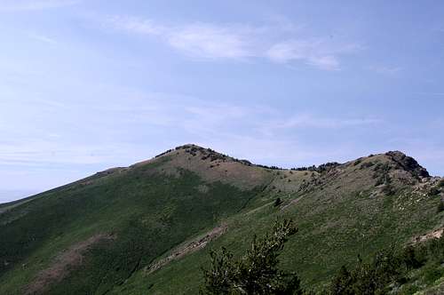
Peak 9491, to the left
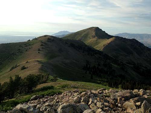
view of Thurston Peak from the summit of Peak 9491
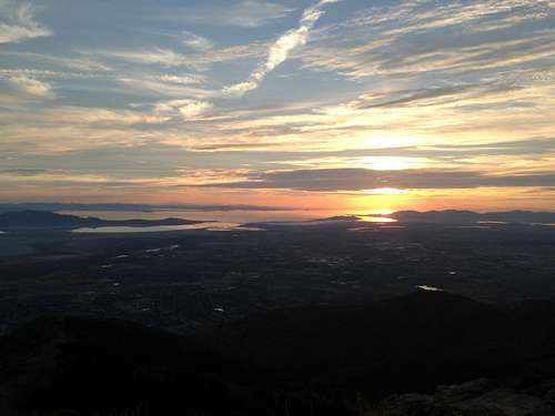
Sun setting over the Great Salt Lake from Peak 9491
Getting There
For Francis Peak, take I-15 exit 327 (Lagoon). Turn right onto U.S. Highway 106, which is Farmington's Main Street. Turn left onto 600 North and follow the signs for the scenic backway. Turn left on 100 East which leads to Farmington Canyon. At 8 miles is a junction and early in the season the gate will be closed. Continue another four miles to the summit of Francis Peak.
For Kays Creek, take I-15 exit 326 (U.S. 89 to Ogden). As you go north, look for an intersection with two gas stations (one a Sinclair, the other a Tesoro). At this intersection, turn east and the road quickly turns back north. Turn east onto Fernwood Drive. Follow the road up past a water tank and castle home. The trailhead is just beyond where the pavement ends.
Route
The route from the top of Farmington Canyon starts out continuing on the old road. Francis Peak will be the peak immediately to the north of the gate (with the balls on top). To get to Peak 9491, follow the road on the east side (where 4WD road starts); the is road will come to a bifurcation. Take the west side road traversing around a small peak and follow it until the road ends; here, you will pick up the Great Wester Trail. The route drops a bit then climbs back up to just below the summit of Peak 9491. Pick you favorite way up -- there's no trail! If you choose to continue on, the GWT will take to to just below Thurston Peak, the high point of both Davis and Morgan Counties.For late autumn, winter, or spring hikers, you will be journeying from the valley floor. Follow the Kays Creek trail up to the ridge. Just below Thurston Peak, you will connect with the Great Western Trail. Head south, leaving behind Thurston, which will be just east of the trail. The trail will go down a couple hundred feet and then start ascending again. The summit of Peak 9491 will lie to the west of the trail -- pick your desired route up to the top, as there is no official trail.
Red Tape
The road up to Francis will be gated early season (sometimes until May), so plan accordingly.When to Climb
Peak 9491 can be climbed any time of year.