

|
|
Mountain/Rock |
|---|---|
|
|
40.85200°N / 111.751°W |
|
|
9410 ft / 2868 m |
|
|
Overview
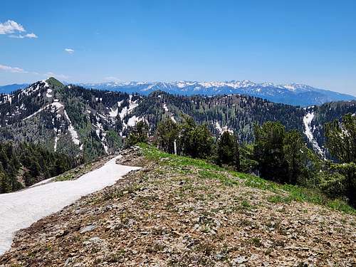
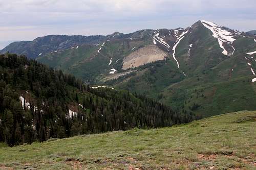
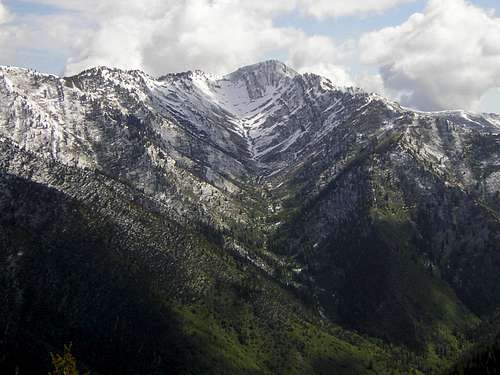
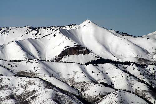
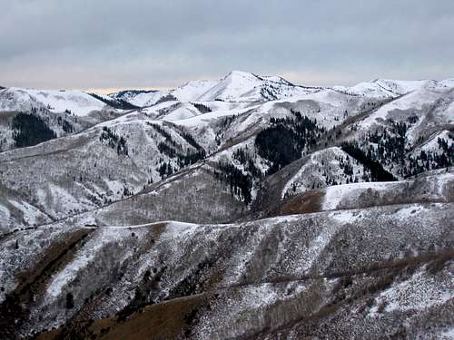
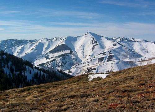
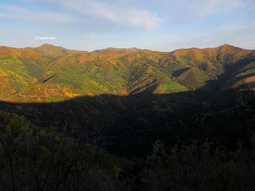
One of the more remote and seldom-visited peaks of the Wasatch. Grandview straddles the Davis and Salt Lake County line, and is visible from several places in the Salt Lake Valley. A variety of routes exist, but all are long, and there are no well defined trails though none are more difficult than class 2 off-trail hiking.
For what is a pretty seldom visited peak, especially considering it is next to a major metropolitan area, Grandview Peak offers many route choices.
Although the peak isn't as high as some of the other peaks in the Wasatch, the area gets a tremendous amount of snow in the winter due to the lake effect (from the Great Salt Lake) and is one of the wettest places in the Wasatch. In heavy snow years, I have seen snowbanks on the mountian last throughout the summer.
Getting There
Now days, Google Maps is your friend. Directions will have to be less detailed now.
Bountiful Ridge/Great Western Trail
The directions don't go all the way to the end of the road, but use this Google Map link to get you close to the trailhead.
Bountiful Ridge/Great Western Trail
From Exit 317 on I-15 you will go east along 400 North and turn left at 1300 east. Turn right at 600 north and right again at Skyline Drive. Follow Skyline Drive up to a large parking lot that is known as the Bountiful Staging area. From here follow the gravel road another 8.2 miles or so to the Sessions Mountain Road on the right. Skyline Drive is usually well maintained (except in winter and spring), but usually has some washboards.
From the Sessions Mountain Road you will turn south and follow it as far as you can. Stay on the main road all the way. Most cars can make it 2 miles or so. After than 4wd is needed. After 3.5 miles from Skyline Drive, most stock 4wds will be stopped. The most capable 4wds can make it another mile.
North Canyon
Google Maps Link:
North Canyon Trailhead
Take I-15 North to Exit 315 in North Salt Lake. Continue east on 2600 South/Orchard Drive to 1800 South. Where 1800 south intersects with the Bountiful Boulevard/1600 East) turn south for 1.5 miles to Canyon Creek Road then travel east for 1 mile to the end of the paved road. The Forest Service trailhead is 1 mile beyond the end of the Canyon Creek Road. The last part of the road beyond the main trailhead is very rough and only capable 4wds can make it. For most, it's better to walk.
Mueller Park
Google Maps Link:
Mueller Park Trailhead
Take I-15 North to Exit 315 in North Salt Lake. Continue east on 2600 South/Orchard Drive to 1800 South and follow it until it becomes Mueller Park Road. Follow the road to the trailhead.
City Creek
Google Maps Link:
Rotary Park/City Creek Trailhead
City Creek Canyon is accessed from Bountiful Blvd. not that far from the State Capitol. Follow the road up City Creek Canyon to its end near Rotary Park. See the Red Tape section for the access issues.
Big Mountain Pass
Google Maps Link:
Big Mountain Pass
Big Mountain Pass is accessed by driving up I-80 in Parleys Canyon and turning north on SH 65 at Mountain Dell. SH 65 is then followed to Big Mountain Pass.
Killyons Canyon
Google Maps Link:
Killyon Canyon Trailhead
Drive up Emigration Canyon to the big bend before the road climbs up to Little Mountain Summit. Instead of following the road around the bend, keep left and follow the main road to the trailhead. You can also get here by driving up Parleys Canyon to SH 65 at Mountain Dell and then to Little Dell and turning left on Emigration Canyon Road. Drive over Little Mountain Summit/Pass and down to the big bend mentioned.
Affleck Park
Google Maps Link:
Affleck Park Trailhead
Affleck Park is accessed by driving up I-80 in Parleys Canyon and turning north on SH 65 at Mountain Dell. SH 65 is then followed to Affleck Park.
Routes Overview
Via Bountiful Ridge/Great Western Trail
This is one of the easier routes up Grandview Peak, but it is a long day if you don’t have a 4wd.
With a modified 4wd or for a capable stock 4wd, this route can be as little as 9 miles round trip. Most stock 4wds will have to stop around Peak 8720 making the route just over 10 miles round trip. Without a 4wd, the route can be as long as 17 miles round trip, but most vehicles can make it at least part of the way along the Sessions Mountains Road.
Briefly put, from the end of the road follow the Great Western Trail (usually well marked, but some markers are starting to wear out) south up the mountain and generally along the ridge or close to it until you reach the northeast ridge of Grandview Peak. Pay close attention to your map.
From here you will leave the Great Western Trail and descend aways before following the ridge to the summit. Some parts of the ridge are steep near the end, but there is a social trail most of the way.
Via North Canyon
This route follows the North Canyon Trail to Rudys Flat and then the West Ridge of Grandview Peak to the summit. The 7.5 Minute maps show a trail all the way, but much of it has faded away. The route seems longer than it looks on paper, though there are no major difficulties. There is some bushwhacking though.
This route is about 12 miles round trip with 3600 feet elevation gain.
Via Mueller Park
This route is similar to the one from North Canyon, but follows a gentle graded trail to Rudys Flat and is longer.
The route is about 18 miles round trip with 4200 elevation gain.
Via City Creek/Cottonwood Gulch
This is the shortest route up Grandview Peak, as well as the oldest established route, but the trail shown on some old maps has long faded away. There is now bushwhacking on any variation of this route. The route is 7 miles round trip with 3400 feet elevation gain.
Follow the City Creek Meadows Trail to Cottonwood Gulch (pay attention to the map) and follow a faded trail (don’t worry if you lose it) to the Treasure Box Mine. From there Cottonwood Gulch can be followed to the summit ridge, but this is probably easier when the bottom of the gulch is filled with snow (take an ice axe) until sometime in June in most years.
Riley Ridge is the grassy ridge in the center of the left fork of Cottonwood Gulch and is an easier route to the summit ridge once the snow has melted.
Via City Creek Meadows
This is one of the easier routes up Grandview Peak, but does take some navigation skills. Follow the trail up to City Creek Meadows and climb Grandview Peak via one of the steep grassy ridges. This route is about 10 miles round trip with 3400 feet elevation gain, depending on your route variation.
Via Big Mountain Pass
Now days, this formerly seldom traveled route is probably the most popular route up Grandview Peak. This route is about 16 miles round trip with just over 2000 feet elevation gain.
From Big Mountain Pass, the Great Western Trail is followed to the northeast ridge of Grandview Peak.
From here you will leave the Great Western Trail and descend aways before following the ridge to the summit. Some parts of the ridge are steep near the end, but there is a social trail most of the way.
Via Killyons Canyon
Some hikers combine Lookout Peak and Grandview Peak using this route. From the Killyon Canyon Trailhead, follow the main trail up to a saddle and then follow the trail along the ridge to the north and towards Lookout Peak.
About a mile before the summit of Lookout Peak, a lesser used trail (pay close attention!) heads north and accesses the ridge/Great Western Trail between Swallow Rocks and Grandview Peak.
From the Great Western Trail, follow it generally west until you are near the northeast ridge of Grandview Peak.
From here you will leave the Great Western Trail and descend aways before following the ridge to the summit. Some parts of the ridge are steep near the end, but there is a social trail most of the way.
This route is about 18 miles round trip with 3700 feet elevation gain.
Via Affleck Park
This route is similar to the one from Killyon Canyon, but is shorter. You can’t park in Affleck Park without a reservation, so find a place to park along the highway.
Walk into Afleck Park and locate a trail going west to the saddle to a four-way junction. This is where the route joins the one from Killyon Canyon.
This route is about 16 miles round trip with about 3500 feet elevation gain.
Other Routes
Several other routes are available when climbing Grandview Peak. At least three trails, with various degrees of maintenance access the ridge on the north side of City Creek. Grandview Peak can be climbed from the Ensign Peak area as well or from various places in Bountiful. Stone Creek, North Holbrook, and the west ridge of the Sessions Mountains all have (unmaintained?) trails up to the ridge top. An old trail goes up Mill Creek to the vicinity of Grandview Peak, but my guess it that it is overgrown. Still, the Mill Creek valley does look beautiful from above. Climbing Grandview Peak from the east side of the Wasatch is not possible without trespassing and permission.
Red Tape
Bountiful Ridge/Great Western Trail
Hikers are requested to stay on the Great Western Trail between the Sessions Mountains and the east ridge of Grandview Peak due to private land in the area.
City Creek
The road to Rotary Park is opened Memorial Day weekend through September. Private vehicles are allowed on even calendar days during the summer period from Memorial Day in May to the last even day in September. The canyon is closed to private motorized traffic during the winter and on odd numbered calendar days. The entrance fee for cars just going for a drive or to a trailhead is $3.00 cash and correct change only.
Dogs are not allowed in the protected watershed area which is located above picnic area # 16. See also HERE.
Big Mountain Pass
Dogs are not allowed.
Camping
No camping is allowed in any part of the City Creek drainage.
Vehicle Camping
The only official campground around is at Affleck Park and reservations are recommended. See the link for information:
Affleck Park Campground
The Sessions Mountain Road has several at large campsites. Please leave them clean since the area can see heavy use.
Camping is not allowed on any other of the access roads to any of the other traiheads.
Backcountry Camping
Despite the length of most of the routes, there isn't that much camping to be found. As mentioned, camping is strictly banned anywhere in the City Creek drainge.
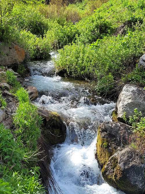
Water is a problem on most routes. The only route that makes that much sense for camping is if coming in from the north and the Great Western Trail. There are some campsites just north of the NE ridge of Grandview Peak that have a long history of use. Only when there is snow around is there water. Historically people have camped north of here in the basin at the head of Mill Creek and there are springs there that flow either year round or most of the year, but camping may or may not be allowed since there is private land in the area. Whatever you do, leave a clean campsite.
When To Climb
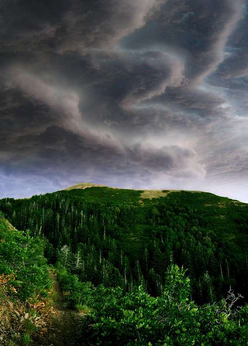
Mid summer can be hot on the lower slopes, so early summer and fall are often the best times. Most routes only have water in early summer. Fall is beautiful on all routes.
Mountain Conditions
CLICK HERE FOR WEATHER FORECAST
Below is the National Weather Service Climate Summary of the old Park City Summit House. The data is from 1969-1977. The old Park City Summit House was at 9280 feet elevation, so expect the temperatures and weather averages on Grandview Peak to be quite similar. Grandview Peak is wetter and has more snow though.
| MONTH | AVE HIGH | AVE LOW | REC HIGH | REC LOW | AVE PRECIP (in) | AVE SNOW (in) |
| JAN | 24 | 12 | 46 | -17 | 3.51 | 48.7 |
| FEB | 28 | 14 | 44 | -10 | 2.99 | 48.8 |
| MAR | 30 | 14 | 51 | -9 | 3.05 | 47.0 |
| APR | 39 | 21 | 61 | 1 | 2.81 | 39.8 |
| MAY | 50 | 32 | 67 | 10 | 1.67 | 10.3 |
| JUN | 61 | 43 | 80 | 20 | 1.13 | 3.1 |
| JUL | 69 | 51 | 79 | 36 | 1.10 | 0.0 |
| AUG | 68 | 50 | 79 | 30 | 1.10 | 0.0 |
| SEP | 57 | 39 | 75 | 13 | 1.15 | 1.5 |
| OCT | 42 | 28 | 64 | -2 | 2.83 | 24.5 |
| NOV | 32 | 20 | 54 | -14 | 2.83 | 38.1 |
| DEC | 26 | 13 | 45 | -12 | 3.49 | 54.5 |