Page Type Page Type: Mountain/Rock
Location Lat/Lon: 41.24226°N / 111.8685°W
Additional Information County: Weber
Activities Activities: Hiking
Additional Information Elevation: 7485 ft / 2281 m
Sign the Climber's Log

Overview

Sardine PeakPhoto by Mountaingazelle
Sardine Peak
Tucked away on the eastern slopes of the Northern Wasatch Mountains sits Sardine Peak. It is a little known peak, even though thousands of people pass by it traveling through Ogden Canyon to the north, and on the ski slopes of Snowbasin Ski Resort to the south. I would say that it is the Dr.Jekyl and Mr. Hyde of the peaks in the area. The south face, which is the most logical way to access the peak, is not that impressive in itself. The biggest obstacle is the scrub oak, and the final approach to the summit is not difficult. On the other hand, the northern face drops dramtically 3000 ft into rugged Ogden Canyon. It is coverd by thick brush and thick stands of pines. Limestone cliffs also spread across the north face. To summit from this side would be a long, hard bushwack. The peak can be hiked year round, and is especially a very good snow shoe hike. It is also a great peak to take children up and introduce them to hiking. The summit area is round and surrounded by scrub oak and pines.

No Name Peak
According to SP member Mountaingazelle, the peak was named after Sardine Canyon, which sits below and west. More than likely, the name "Sardine" comes from the early pioneers, who had a passion for sardines,and eaten quite often during that era. There is another, more popular Sardine Canyon futher north, extending from Brigham City to Cache Valley through the Wellsville mountains. Below the peak, to the east sits Ogden Valley and the town of Huntsville, and Pineview Reservoir. The reservoir was contructed from 1934-1937, and is fed by the Ogden River. It is a very popular recreational area year round. Views from the summit of the reservoir are excellent. To the south is Snowbasin Ski Resort, which began operating in the 1930's. It is one of the oldest ski resorts in the United States, and hosted many downhill ski events during the 2002 Winter Olympics. The are over a hundred miles of established hiking/biking trails in the Snowbasin area. Ogden Peak, Allen Peak, Demoisy and Strawberry Peaks can be accessed from the Snowbasin area.

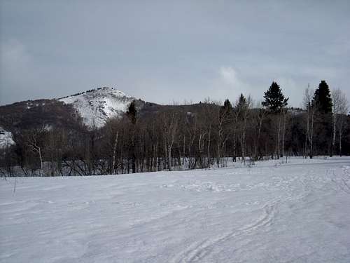
The route up to the summit starts from the Maples Campground north of Snowbasin. In the winter, you will have to park at the lower Snowbasin parking lot, then snow shoe to the campground, which is only an addtional 1/2 mile or so. From the campground you will follow the Ogden Canyon overlook trail. Once reaching the top of the ridge, the route follows the ridge northeast to the summit. It is only around a 3.2 mile round trip. They are planning on extending the trail from the summit to connect to the Wheeler Canyon Trail to the east.

Getting There

Ogden Canyon
Taking the 12th street exit from I-15, head east on 12th street, and continue up Ogden Canyon and SR 39. You will come to the intersection at the dam. Continue east another 2.75 miles, and turn left on SR 226, also called the Old Snowbasin Road. Follow the winding road up and into the Snowbasin area to the Maples Campground or lower parking area. This is approximately 7 miles. This road is closed in the winter though, from November through May.

Weber Canyon
From I-15 coming from the north, transition onto I-84, Cheyenne exit, heading east. From the south, transition onto US 89 in Framington, just north of Lagoon Amusement Park. Continue north to I-84, and head east. Continue east on I-84 through Weber Canyon. Just after the rest area on your right, take the next exit on the right for Mountain Green. After exiting, turn left under the freeway, then an immediate right onto SR 167/30. Continue 1.5 miles and take a left onto the Trappers Loop Highway, SR 167. At the summit 5.5 miles later, turn left following the signs for Snowbasin onto SR 226. Continue 3 miles to the lower Snowbasin parking lot and the turn off to Maples Campground. Follow signs to the campground entrance in the summer, or park at the lot in the winter.

Red Tape

There is private property in the area, so be mindful of postings. The only access to the area in the winter is Trappers Loop Highway as described. No fees are required for parking at the lower Snowbasin lot.

Camping

Maples Campground has the usual fees for overnight camping. For day hikes, there is plenty of parking available without having to pay.

Additions and CorrectionsPost an Addition or Correction

Viewing: 1-2 of 2
hgrapid

hgrapid - May 12, 2010 10:56 am - Hasn't voted

7 feet?

Elevation is wrong

imontop

imontop - May 12, 2010 11:10 am - Hasn't voted

Re: 7 feet?

Thanks man!. I'll get that changed.

Viewing: 1-2 of 2