|
|
Mountain/Rock |
|---|---|
|
|
49.02163°N / 19.63172°E |
|
|
Hiking |
|
|
Spring, Summer, Fall, Winter |
|
|
5082 ft / 1549 m |
|
|
Overview
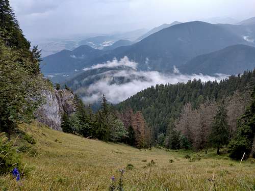
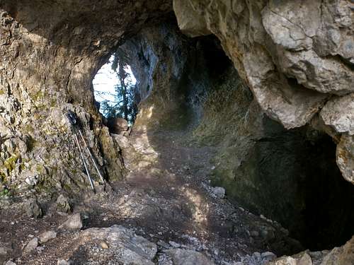
Poludnica is the northernmost peak in the Low Tatras that exceeds 1500m in elevation. With a prominence of 419m, it is the third most prominent summit in this mountain range. It rises about 900m above the Liptov Basin a few kilometres south of the town of Liptovský Mikuláš. Belonging in the limestone and dolomite belt of the Low Tatras, Poludnica stands at the end of the lateral ridge whose highest limestone massif is Krakova hoľa. Although the mountain is close to human settlements, most of its slopes lies within the Low Tatras National Park. The area is home to the brown bear, whose sightings are frequent here. Poludnica is usually climbed for the superb views from its summit, but to my mind there is much more to the mountain. South of the main summit, on the ridge, are interesting karst formations: rock windows, arches, caves, overhanging cliffs. The blue trail, which sticks to the ridge there, and the green trail traversing the southeast aspect of Poludnica give you the feeling of being in wilderness, where the chances of meeting other hikers are not much bigger than those of running into bears or other wild creatures. 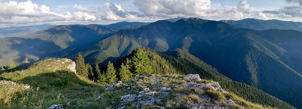
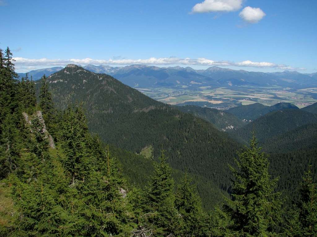
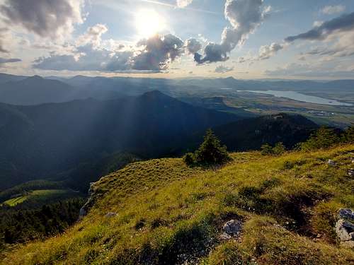
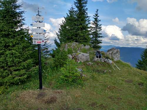
The summit of Poludnica seems to top out at 1549m (the sign on the summit reads 1540m, but that is clearly a mistake) and offers superb views except to the north. The southerly view is especially impressive: all the peaks of the Krakova hoľa massif in front and the highest peaks in the Low Tatras behind them. In fact, the whole main ridge of the mountains (and what lies north of it) can be seen. The western skyline is formed by the Veľká Fatra and Malá Fatra ranges. A little nearer, beyond the dam known as Liptovská Mara, the pyramid of Velký Choč stands out.
The Tatra Mountains can hardly be seen from the main summit, but an excellent view of the range is offered by the north end of the lower tier of Poludnica's top, known as Predná (Front) Poludnica (1491m).
|
Trails
|
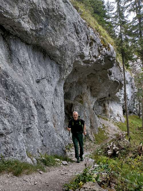
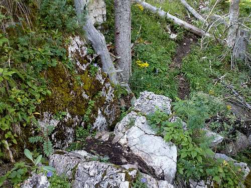
Trailheads for a Poludnica hike are in Liptovský Ján, Závažná Poruba and Iľanovo. Unless you opt for a detour via the south ridge, which connects Poludnica to Krakova hoľa, each route will be about 5km long, with about 900m of ascent. A detour hike will make the elevation gain exceed 1km and lenghten the distance to 7.5 (from Liptovský Ján) or 9 (from Iľanovo) kilometres. The ‘normal route’ to the summit has its trailhead in the resort of Liptovský Ján. It is steep, except a half mile long middle section between Javorovica and Rakytovica saddle, and does make you sweat. At the intersection at Rakytovica saddle you carry on straight (thus switching marks from green to yellow). On your way to Predná Poludnica, you will pass a cave where a few dozen Jews found refuge for several months during World War II. Before reaching the main summit area you will scramble a little up a cliffy, YDS class 2, section. 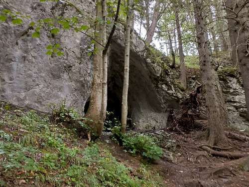
But you can make your ascent a little less steep and a lot more interesting if you do not carry on straight across Rakytovica saddle but turn left (sticking to green marks) and head south to traverse the eastern side of Poludnica. 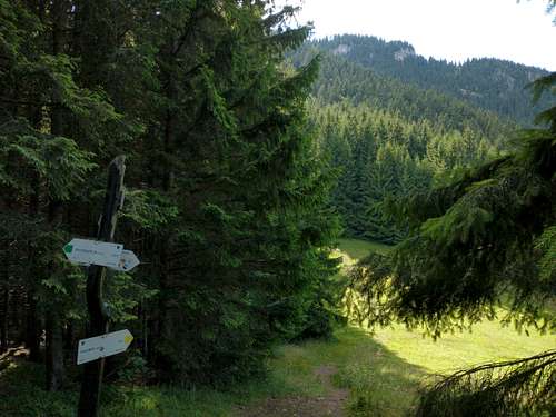
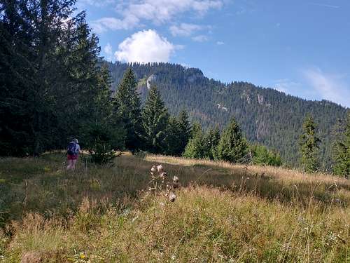
For an hour you will be walking through a wood where chances of running into bears seem to be the same as those of meeting other hikers. 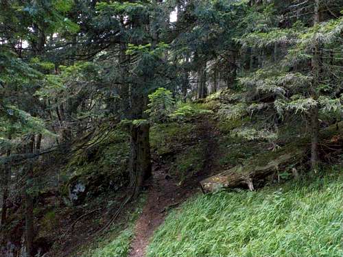
Before you get to the T-junction below the summit of Kúpeľ, you will be given just one glimpse of nearby peaks, namely the massif of Krakova hoľa, but the lack of views will be compensated for by the feeling of being in a wilderness. 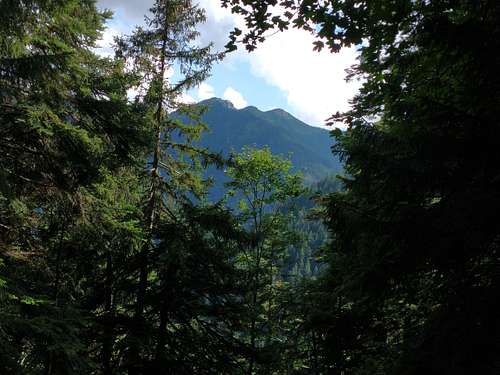
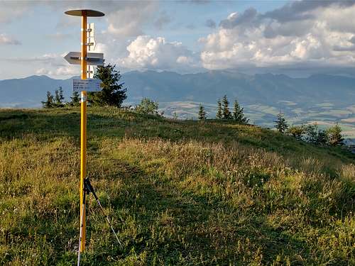
A better view of Krakova hoľa is still (year 2022) offered by a glade where the green marks connect to the ridge trail waymarked blue. 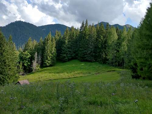
Now you turn right at the trail junction and start the last three hundred vertical metres of ascent. From here it is about two kilometres left to the summit of Poludnica. The area still looks wild, the path is rough, fallen trees lie across it, limestone starts showing below your feet. 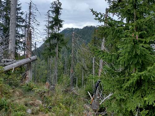
About half a kilometre from the summit interesting karst landforms appear. 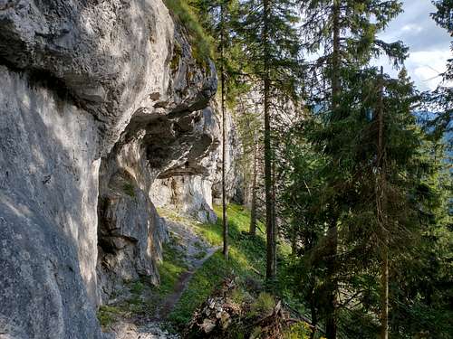
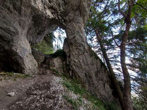
After the trail has switched from one side of the ridge to the other a couple of times, terrain flattens out and a characteristic rock shows up ahead. It is not the true summit yet but it is very near it. 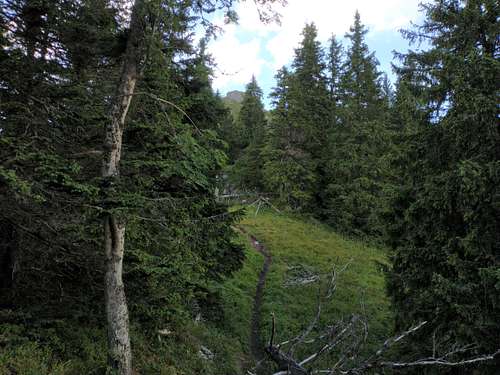
|
Maps
|
Bears (including mine)
|
Bears in Slovakia have not been depraved by man as much as in some parts of Romania, and despite fairly frequent encounters there had been few bear attacks on people until recently, most of them in springtime. However, two things have changed in recent years: the number of bears has risen significantly, and more houses and recreational facilities have been built right on the edge of or even inside the forests. No wonder the number of bear sightings and incidents has increased as well. In June 2021 a local man was killed by a bear outside the village of Liptovská Lúžna. That incident is believed to have been the first fatal bear attack recorded in Slovakia in about a hundred years. In March 2024 another fatal attack (on a couple hiking off-trail) happened near the summit of Sina. So make sure you know how to minimize the risk. First and foremost, try not to take any bear by surprise – make a reasonable amount of noise! In order to protect both people and bears the B.E.A.R.S. project has been launched by the Slovak Wildlife Society. On the project's website are pages concerned with safety advice (including this page) and encounters/attacks.    My first chance encounter with a bear took place on a sunny afternoon when I was walking up the trail waymarked green towards the saddle between the massifs of Krakova hoľa and Poludnica. Just before reaching a glade (photo on the right), I heard a noise of tree branches being snapped by a big animal. Deer, I thought, and spotted a bear foraging in the bushes about twenty meters away, a bit above the trail and ahead of me. In fact, I could only see the bear's head and back popping up from behind the dense bushes. The wind was blowing in my direction, so the bear didn't know I was coming. I hesitated a moment and gave up the option of trying to take a photo as unrealistic. The sun was blinding me, the vegetation was dense. We might have got too close to one another, was there a mother bear with her cubs by any chance? I made a few clicking sounds with my walking poles. Immediately, I heard the bear leave. The next encounter, on the same day, was kind of surreal. It was nearly 10 p.m. I had just finished my hike, but the night was wonderful, fairly warm, the sky packed with the stars of the Milky Way, so I was sitting on a bench by the road within the boundaries of the spa resort of Liptovský Ján. This road is pretty well lit by street lamps and has hotels or inns, or houses every few hundred meters, but from my bench I couldn't see any building. I had just called my daughter and told her about my bear sighting that afternoon. Out of a sudden, I heard an unearthly, overwhelming noise behind my back. As if a tank was making its way through the grove or a UFO was landing, breaking the branches of whatever grew in its way. But in fact, I didn't have time to think what it could have been, I just turned round and saw three dark shapes: a mama bear and her two cubs the size of a big dog - like a vintage motorcycle with a sidecar on either side - darting about fifteen meters to my left, across the lawn, or rather meadow and then across the road. After they had vanished in the bushes on the other side of the road, I still heard them demolishing vegetation for a minute or two. When I investigated the place a few days later, I discovered that they had run into a fence and had to bushwhack around it until they finally got to the river and the ford which made for the entrance to the other side of the valley with its vast forest. They would have had little difficulty getting there had I not stood, or rather sat, in their way. The third encounter also happened on the outskirts of Liptovský Ján just after dark. I was heading for the campsite (Borová Sihoť) where I had pitched my tent. The bear, rather young, was near the mineral spring I had just passed. As soon as the animal noticed me, it moved back into the forest, its enormous green eyes glowing in the light of my headlamp. Surely I didn’t stop speaking aloud to myself, or rather to any bears that would listen, until I reached my campsite. |
Red Tape & Warnings

- Bears have become a real problem in Liptov in recent years. Please see the above chapter.
- The Low Tatra Mountains are protected as a national park.
- Camping within the area in question is not permitted. You are supposed to stick to the waymarked trails.
- In Slovakia those who do not carry commercial insurance have to pay for any rescue services rendered by Mountain Rescue Service (HZS).
Getting There & Accommodation
 Liptovský Ján
Liptovský Mikulaš, the capital town of the region is easily accessible by both road (D1 motorway) and rail (one of the oldest railway lines in Europe; several Intercity and fast trains a day). The distance between Liptovský Mikulaš and the trailheads is less than ten kilometres.
- Timetables for Trains and Buses
- There are hundreds of guesthouses, dozens of hotels, and several campsites in the Liptov region.
Weather
- Forecast for Liptovský Ján on Slovak Hydrometeorological Institute site
- Forecast for Liptovský Ján on AccuWeather
External Links