|
|
Area/Range |
|---|---|
|
|
48.89908°N / 19.08188°E |
|
|
Hiking, Skiing |
|
|
Spring, Summer, Fall, Winter |
|
|
5236 ft / 1596 m |
|
|
LukZem Video
Overview
The Veľká Fatra mountains lie just south of the Krivánska Fatra, i.e. the highest part of the Malá Fatra mountains, which extend north of the Váh River. The adjectives 'veľká' and 'malá' translate as 'great' and 'little' respectively. The Veľká Fatra is over a hundred metres lower than the Malá Fatra, but it covers a larger area, resembling a rectangle around 40x20 km, its longer axis running SSW to NNE. The other ranges adjacent to the Veľká Fatra are the Chočské vrchy to the northeast, the Nízke Tatry (Low Tatras) to the east, the Starohorské vrchy to the southeast and the Kremnické vrchy to the south. In the west, the Veľká Fatra borders Turčianska kotlina (Turiec Basin). Thanks to being surrounded by three mountain ranges which are a little higher, the Veľká Fatra is not packed with hikers even in summer. In fact, you are more likely to run into a bear than crowds here. With their impenetrable forests, lush meadows, extensive views, varying geology and old shepherds' huts serving as shelters, the mountains - especially their southern part - are ideal for trekking. 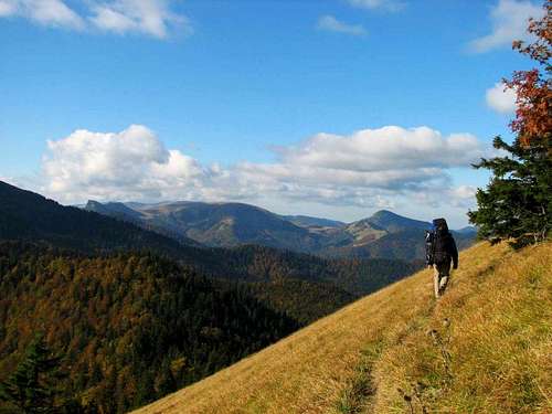 Heading south - for the Hôľna Fatra Heading south - for the Hôľna FatraLike most other mountain ranges inside the Northwestern Carpathians, the Veľká Fatra has a crystalline foundation covered by sedimentary rocks, primarily limestone and dolomite which give rise to rugged relief, but also marl, sandstone,conglomerate, flint and others. Most of these sediments belongs in either the Choč nappe or the Krížna nappe. The exposed part of the crystalline core (granite and schists) - compared to the neighbouring Carpathian ranges - is relatively small and found near Smrekovica (1530 m). Rather surprisingly, most of the highest summits, namely Ostredok at 1596 m, Frčkov at 1585 m, Krížna at 1574 m, marred by a radio mast, and Ploská (literally Flat) at 1532 m are formed of marls, which results in very gentle relief. 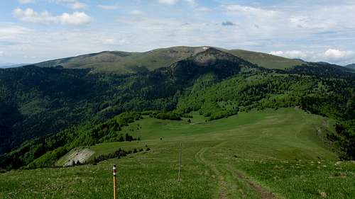 The highest chunk of the Hôľna Fatra The highest chunk of the Hôľna FatraMain RidgeIn the south of the Veľká Fatra, between Krížna and Ploská, its main ridge trends at first south-north, then northeast, for about 7 km. This is the highest swath of the mountains, known as the Hôľna Fatra. The Slovak adjective ‘holý’ has nothing to do with the English ‘holy’ but translates as bald/bare, ‘hoľa’ means an alpine meadow and ‘hôľna’ means ‘made up of alpine meadows’. The Hôľna Fatra used to be extensively grazed, which caused the treeline to drop to less than 1300 m. The range was not glaciated in the Ice Age, only large nival niches are to be found at valley heads near the highest summits. Since the upper zone of trees made way for grassland a few centuries ago, the Holná Fatra has been infamous for avalanches.
At the summit of Ploská, the main ridge of the Veľká Fatra forks, divided by the valley of the Ľubochnianka (Ľubochnianska dolina), which is the longest mountain valley in Slovakia, extending almost straight north for around 25 km. The higher branch of the main ridge, still bearing the name of Holná Fatra, is also referred to as the Liptov Ridge (Liptovský hrebeň). It runs northeast and sports pretty summits such as Čierny kameň at 1479 m (formed of limestone and dolomite, with a swath of extant upper montane and dwarf pine zones) and conical Rakytov at 1579 m.
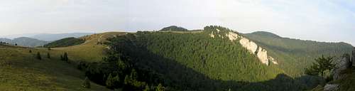
The lower, western branch of the main ridge, called the Turiec Ridge (Turčiansky hrebeň) does not exceed 1400 m in elevation, except for the short spur just west of Ploská which makes for one more high summit of the Holná Fatra, namely Borišov at 1509 m. On the Turiec Ridge proper (i.e. excluding Borišov), the highest and the most interesting summit is limestone Kľak, which falls six meters short of the 1400 m mark. 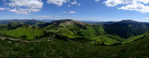 Turiec and Liptov ridges (left), Ploská (center), Suchý & Ostredok (right) Turiec and Liptov ridges (left), Ploská (center), Suchý & Ostredok (right)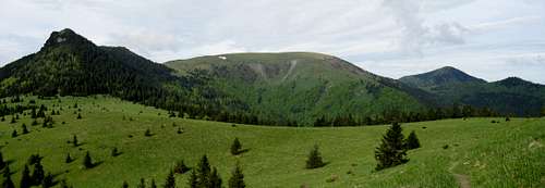 Čierny kameň (left), Ploská (center) and Borišov (right) seen from Liptov Ridge Čierny kameň (left), Ploská (center) and Borišov (right) seen from Liptov Ridge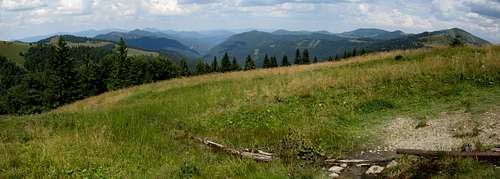 Turiec (left) and Liptov (right) ridges divided by Ľubochnianka Valley Turiec (left) and Liptov (right) ridges divided by Ľubochnianka ValleyBralná Fatra
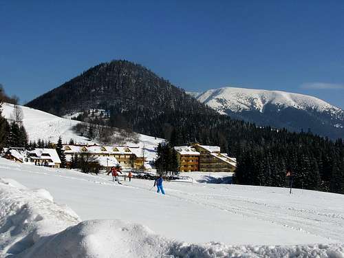
West of the highest summits of the Veľká Fatra spreads a vast, forested mountainous country composed of limestone and dolomite, which is aptly named the Bralná (Cliffy) Fatra. This wild area is home to the elusive lynx, but has a good network of waymarked trails. The trails run along the major valleys and lead to the three highest and most interesting summits: Ostrá at 1247 m, Tlstá at 1373 m and Drieňok at 1268 m. Zvolen Massif Malý Zvolen (1372 m) Malý Zvolen (1372 m)The massif of Zvolen was officially included in the Veľká Fatra in the late 1970s; before it was thought to be part of the Nízke Tatry. The massif lies several kilometers east of the highest summits of the Veľká Fatra, between the Revúca River and its right-bank tributary Korytnica, beyond which rise the Nízke Tatry. At the south foot of the summit of Zvolen (1402 m) sits the ski resort of Donovaly, one of the most popular in Slovakia. The summit of Zvolen may be worth visiting for the breathtaking panoramas of the main ridge of the Veľká Fatra, Nízke Tatry and other nearby mountain ranges.

Šípska Fatra Zadný Šíp at 1143 m Zadný Šíp at 1143 m Sidorovo at 1099 m Sidorovo at 1099 mJust like the massif of Zvolen, the Šípska Fatra was officially included in the Veľká Fatra in the late 1970s; before it was believed to be part of the Chočské vrchy. Besides, according to the Slovak geologists of today, the Šípska Fatra extends on both sides of the Váh River west of the town of Ružomberok. Still, most hikers as well as some geographers are used to calling the Šípska Fatra only what rises just north of the river. Consequently, to the geologist the highpoint of the Šípska Fatra will be Vtáčnik at 1236 m whereas the hiker will point to Šíp at 1169 m, towering impressively over the valley of the Váh. 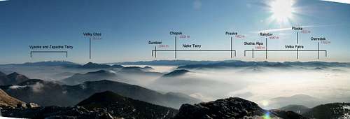 Fatra-Tatra area Fatra-Tatra area |

 seen from the east")


Interesting Summits
The table below lists the highest and some other conspicuous summits.
| Brief description | |||
 |
"Ostredok" is a complete misnomer since "ostry" translates as "sharp". Ostredok is composed of marls, therefore it is smoothly shaped and has avalanche prone slopes. It sits in the central part of the Hôľna Fatra and can be reached via trails marked with red or green stripes. The height of the mountain has recently been corrected. | ||
 |
The second highest peak about one kilometer south of Ostredok. Red stripes. | ||
 |
At the south end of the main ridge, at its intersection with a massive ridge trending west to east. Alpine meadows with patches of dwarf pine on the NE side; nicknamed the "mother of avalanches" with huge nival niches. A radio mast, military objects and a memorial of a plane crash from 1961 on its top. The trails that run north (towards Ostredok), west (towards Kráľova skala and Drieňok) and east (towards the sedlo of Veľký Šturec and the massif of Zvolen beyond it) from Krížna are all waymarked with red stripes. A blue-striped trail approaches the summit from the south. | ||
 |
The highest peak of the Liptov ridge, in its central part, shaped like a pyramid. A superb vantage point with a wooden cross on its top. It can be climbed via a green trail. There is an interesting formation named "Skalná brána" (Rocky gate) at its south base. The summit is bypassed by a yellow trail that contours its west side. | ||
 |
A patch of limestone designed a nature reserve between Ostredok and Ploská, strongly contrasting with the smoothly shaped relief of its surroundings. In the central part of the main ridge, about 1 km NE of Ostredok. Red stripes. | ||
 |
This aptly named summit ("ploská" literally means "flat"), at which the main ridge splits into two, stands over 4 km northeast of Ostredok. Its west side is prone to avalanches. On the top is the grave of Ondrej Kisso which dates back to the times of the Slovak national uprising. Red/yellow stripes to the summit; a green striped traverse of its north side and a blue striped traverse of its west side. | ||
 |
An extensively wooded massif, formed of crystalline schists, halfway down the Liptov Ridge. The massif has been designated a nature reserve. The main summit, only accessible by unmarked paths, stands on a lateral ridge over 2 km east of the main ridge, where sits a namesake mountain resort. | ||
 |
A conical peak around 2 km west of Ploská, a nature reserve. The north side of the mountain is covered by spruce woodland, the south side is notorious for avalanches, just east of the peak sits a mountain hut known as Chata pod Borišovom, from where you can get to the summit via a yellow trail. | ||
 |
One of the landmarks of the Veľká Fatra - an isolated, distinctive piece of the Choč nappe at the south end of the Liptov Ridge, formed of resistant limestone and dolomite. It is a spectacular formation with almost vertical walls trending southeast and a continuous dwarf pine cover. Its gentler, western side is protected as a nature reserve, across which runs a green trail, which keeps a few hundred meters away from the summit. | ||
 |
A sharp ridge with steep west and east sides, between Rakytov and Smrekovica, named by Austrian cartographers in the 19th century. Alternating layers of limestone and dolomite on a granite bedrock, a nature reserve. The east side of the peak is traversed by a green stripe trail. | ||
 |
A twin-peaked wooded summit formed of limestone and dolomite. At the north end of the Liptov Ridge. Red stripes. | ||
 |
A rounded mountain with gentle slopes which makes for a superb vantage point. In the east part of the namesake ridge, 2 km north of the winter resort of Donovaly, very popular with skiers and tourists. Red/yellow stripes. | ||
 |
The highpoint of the Turiec Ridge, located in its central part, formed of limestone. A great vantage point and a significant junction of red/yellow/blue/green trails. | ||
 |
Situated between the Belianska and Hornojasenska valleys, about 3 km west of the Turiec Ridge, with a cliffy northeast face. Lysec is mostly formed of limestones of the Krížna nappe. It is a nature reserve accessible by blue and yellow stripes. | ||
 |
A distinctive cliff over 2 km west of Krížna, formed of limestones and dolomites with calciphilous vegetation, towering a stone's throw from an important trail junction at a spring called Kráľova studňa, about 1 km north of the namesake mountain hut and 1 km east of an old-fashioned chalet used as a shelter. Yellow stripes. | ||
 |
A huge limestone and dolomite massif in the heart of the Bralná Fatra, resembling a table mountain with a vast summit plateau and steep sides made up of vertical cliff bands and ledges that separate them, endowed with multiple caves. A nature reserve. Blue/green stripes. | ||
 |
This impressive limestone crag on the southern outskirts of the Hôľna Fatra, 2 km southeast of Krížna, gives a fine view of the Starohorské hills. The hill is a monument of nature, its cavities and hollows being favourable winter dens of the brown bear. Blue stripes. | ||
 |
A wooded cone in the Bralná Fatra, rising above the Blatnica valley. Blue stripes. | ||
 |
One of the most spectacular massifs in the Bralná Fatra, between the valleys of Blatnica and Konský dol: a twin-peaked summit, limestone towers, narrow rocky window, nature reserve. Yellow stripes. |
Attractive Sites
The table below lists the most attractive natural and cultural sites of the Velká Fatra that sit away from its summits.
| Name | Photo | Status | Brief description |
 |
|||
 |
|||
 |
|||
 |
|||
 |
|||
 |
|||
 |
|||
 |
|||
 |
|||
 |
|||
 |
|||
| Skalná brána |  |
A rock gate on the main ridge, at the south foot of Rakytov. | |
| Hrad Sklabiňa |  |
Cultural Monument | The first mention of the place dates back to 1242. Between 1540 and 1947 it used to be a property of the Révay clan who built a renaissance palace here in 1610. In 1944 the castle was burned by the German Army. Nowadays it is being reconstructed by Donjon company. Located 8 km east of the town of Martin, accessible via an unmarked path from Sklabinský Podzámok. |
| Katova skala |  |
Nature Reserve | An impressive crag at 927 m, formed of limestone, which guards the Kantorská valley. The name of this superb vantage point, which used to witness executions, translates as the Hangman's Cliff. The namesake nature reserve with an area of 46 ha was designated in 1982. Red stripes from Sklabinský Podzámok or Podhradie villages. |
 Ťavia skala seen from Králova skala
Maps & Books
Online maps Paper maps- 1 : 40 000 by SHOCART
- 1 : 50 000 by TATRAPLAN
- 1 : 50 000 by VKU HARMANEC
- 1 : 50 000 by SHOCART
- Guidebook by Otakar Brandos
- S batohem po Slovensku by Peter Podolák
- Skryté krásy by Jana Stehlíková a kol.
Red Tape, Bivouacking & Huts
- Memorial of Slovak National Uprising by Kráľova studňa (1380m)
- Pod Suchým vrchom (1380m)
- Chyžky saddle (1310m)
- Smrekovica-Močidlo (1305m)
- Šiprúň( 1277m) - former chalet
- Rakytovy Grúň near Kľak aka Svrčnícke sedlo (1175m)
There are several mountain huts and hotels in the mountains. Those listed below sit above 1200 m.
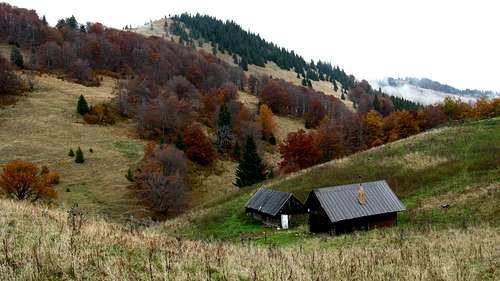
The following shepherds' huts remained unlocked in 2016, but most of them were occupied by shepherds in the summer. (Livestock grazing is allowed in some areas of the national park.)
Avalanche risk Mountain rescue teams (emergency phone number: 18 300) are based in Donovaly and Malinô Brdo. Warning: In Slovakia those who do not carry commercial insurance have to pay for any rescue services rendered by Mountain Rescue Service (HZS). Membership of the Austrian Alpine Club (Österreichischer Alpenverein) sorts the problem out.
- Chata pod Borišovom at 1300 m, just half a kilometer east of the summit of Borišov: great atmosphere, little comfort, no electricity (kerosene lamps), food and drinks relatively expensive. If you have your sleeping bag, you pay much less for a bed - in 2016 it was €9 instead of €17. If all beds sell out, a place on the floor cost €8 (in 2016)
- Útulňa Limba at 1210m, southeast of Rakytov, about half an hour's walk from the main ridge. The facilities are rudimentary (water at a nearby spring), but it is cheap (€5 in 2016)
- Kráľova Studňa Mountain Hotel at 1277 m. The hotel/hut - named after a powerful nearby spring - has been recently renovated, so it is not as bad as it used to be
- Smrekovica Mountain Hotel at 1339 m, on the main ridge, not to be mistaken for Smrekovica cabin (last photo below)
- Granit Smrekovica Hotel at 1428 m - a three-star hotel on the main ridge, not to be mistaken for Smrekovica Mountain Hotel, which sits 1 km to the SSW
 Chata pod Borišovom Chata pod Borišovom |
 By Kráľova skala By Kráľova skala |
 Unfortunately, most shepherds' huts near Borišov are locked Unfortunately, most shepherds' huts near Borišov are locked |
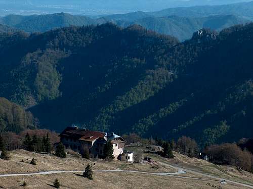 Horský hotel Kráľova studňa Horský hotel Kráľova studňa |
 Shelter known as 'Koliba nad Kráľovou Studňou' Shelter known as 'Koliba nad Kráľovou Studňou' |
 Smrekovica cabin west of Kráľova studňa Smrekovica cabin west of Kráľova studňa |
- Salaš pod Čiernym kameňom
- Salaš na Krátkej
- Koliba Kýšky
- Salaš pod Ploskou
- Salaš pod Suchým vrchom
- Salaš Košariská
Mountain Conditions
 |
 |
 |
 |
 |
 |
Getting There
 Tlstá seen from Blatnica Tlstá seen from Blatnica |
 Ľubochnianka Valley Ľubochnianka Valley |
 Teplô (TH for Rakytov) Teplô (TH for Rakytov) |
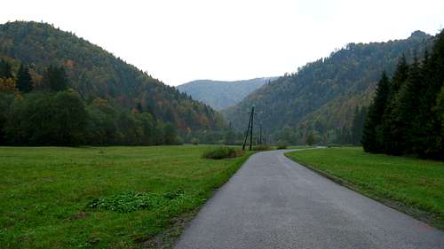
The Veľká Fatra is readily accessible from all sides. In the north, along the valley of the Váh run the main E50 road and a major rail line, which connect the city of Žilina to the towns of Martin (ten kilometers away from the western boundary of the mountains; NB you may have to get off the train at Vrútky, a few kilometers away from Martin) and Ružomberok (at the northeast corner of the mountains). The southern fringe of the mountains lies around 15 km from the city of Banská Bystrica. The city has good rail and road (road 14, then 65) links with Turčianske Teplice and Martin. The route skirts the Veľká Fatra from the south and west, leading through Harmanec. Road E77, connecting Banská Bystrica to Ružomberok, provides access to Staré Hory and the ski resort of Donovaly, then runs along the Revúca River, whose middle and lower reaches form the eastern boundary of the Veľká Fatra. Along the upper reaches of the Revúca runs a third-class road no. 2223, which - after leaving the valley - starts its countless switchbacks to cross the pass of Veľký Šturec and finally join road E77 between Staré Hory and Donovaly. Last but not least, you can drive into the heart of the Veľká Fatra up the Ľubochnianka Valley.
Train and bus timetables Bratislava Airport
Trailheads for particular hiking destinations are tabulated below.
| Access route | Trailhead at | Times of walk up (hr:min) | Destinations |
| Turčianske Teplice - Rakša | Rakša | 3:15 | Drieňok |
| Ružomberok - Liptovské Revúce | Teplô | 3 | Rakytov |