|
|
Mountain/Rock |
|---|---|
|
|
38.07923°N / 112.7601°W |
|
|
Iron |
|
|
Hiking |
|
|
8674 ft / 2644 m |
|
|

Overview
This is a peak that would appeal to just about anybody as they view it from the south looking northwest from I-15. However, that is about it as far as appeal can go since the property below the peak is all private and I don't know how anyone could legally access it from there. Access is possible from the north side as the land there is BLM land although extensively ranched.Unless you are into chasing the prominence peaks of Utah, you can skip this one as it will be a peak that would probably not be worth it to you. It is number 73 on List of Johns top 100 prominence peaks in Utah and is known as the Black Mountains HP..
If you have traveled the I-15 route between Salt Lake City and Las Vegas you will know this peak as the one that catches your eye as you near the rest areas that are just south of Beaver Utah. In the winter it has a nice dressing of snow and that means that the route in from the north is to be avoided until the snow is gone up on that plateau (think muddy roads). For map purposes, it is found on the Jack Henry Knoll quad. On top you will find a benchmark marked Poorman and a small register jar with a sprinkling of some of the prominence peakbagging diehards. There isn't much information on this mountain range and it is a bit confusing with the name "Black Mountains" since there are more than one mountain range in Utah with that name. Hence the need to call it Poorman Peak or Poorman BM.
Getting There
Here's where the pain begins on this one, the getting there part. You can come in from the north or the west but you have to figure out the dirt road system. I came in from the west so that is the route I'll do my best to describe. You need to do your mapwork on this one and using waypoints although I nailed it the first time into that area, I can't promise you will be so lucky. I've got 4 maps to show the way (my way, posted in the map section below).From Las Vegas, take I-15 to just north of Cedar City and take highway 130 and head north. How many miles? Maybe twenty-five or so. (I didn't record it) but this GPS waypoint will get you to the dirt road turn off. (lat/long nad 27) The junction with highway 130 is at 38.0785 -112.9572. Turn off onto this dirt road (Noted as Chapman road on National Geographic topo) but I don't remember it being signed. Really what you need to do is stay on the obvious main road. Refer to map 1 for the first part of the road. Maps 2, 3 and 4 will get you close to the HP.
From highway 130 it was about 17-18 miles to where we parked and then walked up a modest slope to get to the highpoint. HOWEVER, it was a good test of my high clearance 4WD vehicle to get as far as I did and my recommendation would be to stop at the first place where you feel uncomfortable and park it there. The distance and elevation gain isn't severe and its not worth the risk of damaging your vehicle to push it further than you should.
From Salt Lake City, you can turn off at Beaver, onto highway 21 and head for Minersville. Pick up highway 130 at Minersville and to get to that same turnoff mentioned above is also about 25 miles of effort.
I would imagine you could come in from the north as well or even another way but I can only relay what worked for me. In looking at my Benchmark map book for Utah, page 73, several possibilities are shown. If anyone else has done this by a different road system, I'd appreciate your input.
Maps & route & summit visitors
Depending on where you end up parking, the distance and elevation gain will vary from party to party. For us it was two miles round trip with about 700feet of elevation gain. Certainly the peak is not one that is dramatic but it
is still one sought out by a few peakbaggers who chase after prominence.
 Map one
 Map two
 Map three
 Map four
Many others have now done this one and now many have posted their routes and GPS tracks at peakbagger.com. Ken Jones found good access from the north and I'd recommend reading his peakbagger trip report. Also check out Eric Kassan's and Kay Komuro's trip reports.
Red Tape
This is BLM land so the usual rules apply but it is extensively ranched and we were stopped by two ranchers who wanted to know what our "intentions" were since they weren't used to seeing "strangers" driving on the roads out of the hunting season. I had a map of the Peak area and my GPS and pointed towards the peak which was almost in view at the point of meeting the ranchers (on their ATV). They kinda wondered about our sanity (as does my wife) and then became very helpful. They even suggested what road we should take to get close to the peak (or HP). The road was a rough 4WD high clearence track andI wouldn't have taken a regular vehicle on it beyond the first rough spot.
BLM Information
Cedar City Field Office
176 East D.L. Sargent Drive
Cedar City, UT 84721
Field Manager: vacant
Phone: (435) 586-2401
Fax (435) 865-3058
utccmail@blm.gov
Camping
Minersville State Park has good camping and that would be my choice if you want a developed camping area. Otherwise you could probably car camp butyou'd want to pick your spot carefully. BLM leave no trace rules apply as always.
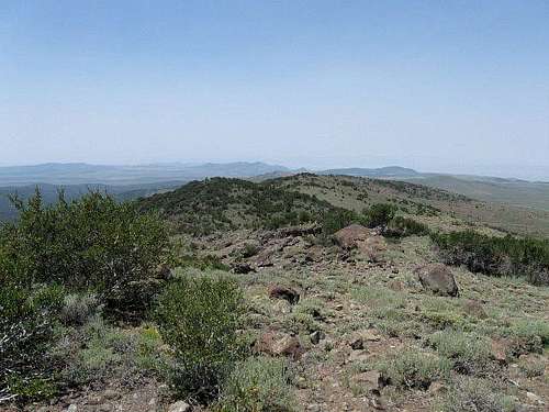
The summit
A benchmark is found atop the peak and a commanding view east and southward.I-15 is very obvious and a register was found by Andrew and I. We signed in and put the register back in its place of honor in the cairn in which we found it.


Weather (Minersville)

Odds and ends
Ticks? Yes, I picked one off of me in mid July so be aware that they are present. Check yourself for them little bloodsuckers during and at the end of your hike. Cattle were present when we were there but they gave us a wide berth as we approached them at a watering tank (our path went right by it).Rattlesnakes? This would make good rattlesnake country so again, don't take
them for granted (they might be there where you least expect them).
Pictures. I somehow had my camera set on 640 by 480 so not much resolution from the majority of the pics.
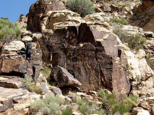
Nearby Parowan Gap. An area with petroglyphs.