
-
 5264 Hits
-
 76.66% Score
-
 7 Votes
|
|
Mountain/Rock |
|---|---|
|
|
37.96910°N / 107.7845°W |
|
|
Ouray&San Miguel |
|
|
Hiking, Mountaineering, Trad Climbing, Mixed, Skiing |
|
|
Spring, Summer |
|
|
13060 ft / 3981 m |
|
|
Overview
 Saint Sophia Ridge
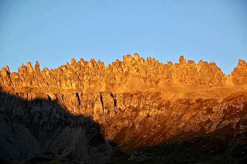 Saint Sophia Ridge
Why is this peak unranked? There is less than 300 feet raise from the saddle between Mount Emma and Saint Sophia Ridge. The saddle is at 12,900 feet, and the rise is only 160 feet. Technically, one of the more demanding summits in the area.
Parent Lineage: Mount Emma
 Saint Sophia Ridge
Nearby Peaks:
- Mount Emma 0.55 miles
- Mendota Peak 0.59 miles
- "T 5" 1.29 miles
- Gilpin Peak 1.35 miles
- "Kismet" 2.21 miles
- "Tomboy Peak" 2.31 miles
- Potosi Peak 2.42 miles
- "Coffeepot" 2.45 miles
- Mount Sneffels 2.48 miles
- Cirque Mountain 2.54 miles
- Teakettle Mountain 2.56 miles
- Dallas Peak 2.56 miles
- United States Mnt. 2.59 miles
- Chicago Peak 2.81 miles
Getting There
 Road to Yankee Boy
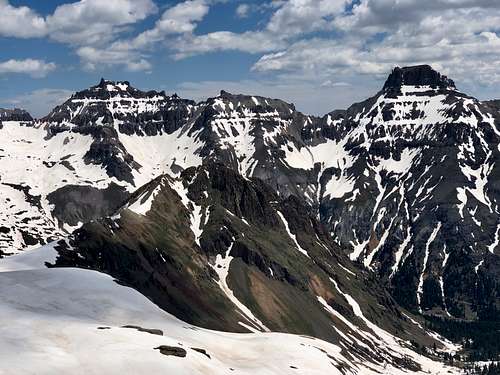 Yankee Boy Trio
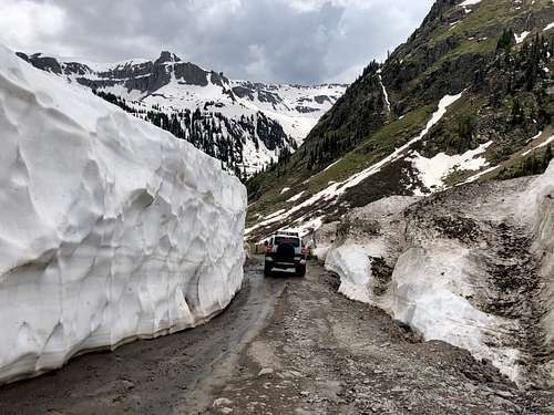
The turn off for Government Basin is below the "Toilet Trailhead" and is well marked. The road there becomes soon rough and I would recommend 4WD high clearance vehicles only.
The road is accessible from June to October. It closes about 4 miles in in the winter.
Route
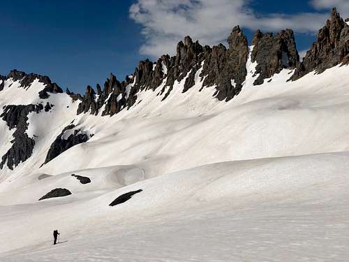
There are different options for approach. The shortest one is from Governor Basin, which I have explored a couple of years ago. Our decision was to approach on skis and starting from "Toilet Trailhead" along the rough 4 WD road up to Yankee Boy Basin. "Toilet Trailhead" is typically snow plowed by the end of May and provides great access to other peaks in the area. The road up Governor Basin was covered in snow.
 Saint Sophia Ridge
Summer approach via Governor Basin is much shorter, but you have to deal with loose scree.
Winter approach is longer, but skiing is amazing. The area on the map between Stony Mountain, Mount Emma and Gilpin is a popular early summer backcountry ski destination.
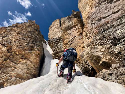
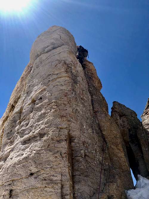
The climbing route: identify the highest pinnacle. That is relatively easy since there is a large vertical crack on this pinnacle facing east - your approach. Ascend the gully towards the crack and then traverse to the north side of the pinnacle. You do not climb the crack you see, but much smaller and easier crack on the north side of the formation. There will be an obvious crack leading to a small belay ledge with some old slings. The hand crack is maybe 10 meters long. It is only a few moves to the actual summit from this belay ledge. We found a summit register with illegible summit log, no pen and is was slightly wet. The climbing is not very enjoyable, extremely loose rock. The crack protects well with larger pieces of gear. Our gear included: 1 Camelot from 1-4. Bring extra webbing since the rappel webbing was in a poor conditions. One 60 meter rope is sufficient. We rappelled the east side and got almost to the end of snow gully, down climbing in snow the rest of it.
The views from the summit are spectacular!
Red Tape
There is no red tape. Driving the 4 WD scenic road to Yankee Boy Basin or Governor Basin are free. Hiking and climbing are free as well. The road up to Yankee Boy is open seasonally during the summer. The winter approach is long and there is high avalanche danger!
When to Climb
Summer is obviously the easiest time to climb this peak. Check out the weather before and start early. Don't get caught in the afternoon thunderstorm high up there. We chose an approach during a snow rich year, and skied in. The advantage was avoiding the infamous San Juan scree.
Camping
There are 2 developed campground along Yankee Boy Basin: Angel Creek Campground and Thistledown Campground. There are some pull out along the 4 WD road high up in Governor Basin. Town of Ouray offers plentiful opportunity for lodging and also hot springs.