
-
 6518 Hits
-
 81.84% Score
-
 14 Votes
|
|
Mountain/Rock |
|---|---|
|
|
37.95661°N / 107.73928°W |
|
|
Ouray |
|
|
Hiking, Mountaineering, Scrambling |
|
|
Spring, Summer, Fall, Winter |
|
|
13036 ft / 3973 m |
|
|
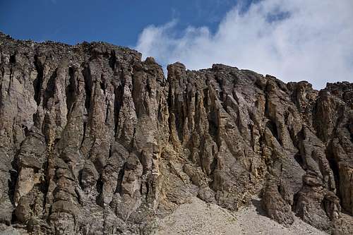
Overview
 United States Mountain
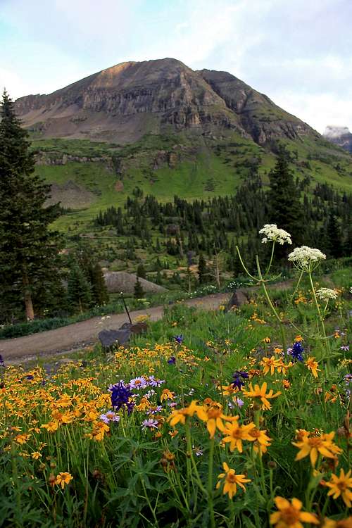
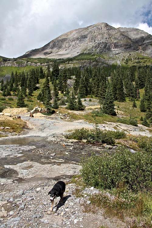 Imogene Pass Rd crosses Imogene creek many times. United States Mountain in the background.
The mountain is nicely seen when one drives or runs up Imogene Pass road. It is not often climbed and I could not find any guide book describing this mountain. Guide to the Colorado Mountains (sort of a bible of Colorado mountains) with Robert Ormes does not mention it. The summit register had one entry from 2 years ago!
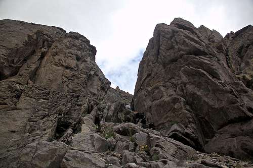
The mountain is steep and even the easiest route is class 3 climbing on a loose terrain. I have not found an easier route and attempted 2 different routes up, and descended on the opposite side of the mountain.
United States Mountain does not combine well with the surrounding peaks - the ridge connecting United States Mountain with Point 13,242 feet and further to Chicago Peak does not go easy. Expect 5th class exposed climbing on a loose terrain.
Not many climbers are interested in summiting one unranked peak when the area is filled with famous and more desirable mountains (see nearby peaks below).
However, the mountain looks pretty from the Imogene Road. It has a powerful name - United States! and the views from its summit are one of the best of the Mount Sneffels and its whole range.
Elevation: 13,036 feet
Parent Lineage: Chicago Peak
Class: 3
Nearby Peaks:
- "Tomboy Peak" 0.93 miles
- Chicago Peak 13,385 feet 0.99 miles
- "T 5" 1.34 miles
- "T 8" 1.62 miles
- "T 7" 1.78 miles
- Hayden Mountain South 13,206 feet 2.01 miles
- Mendota Peak 13,275 feet 2.16 miles
- Telluride Peak 13,509 feet 2.21 miles
- Potosi Peak 13,786 feet 2.35 miles
- Saint Sophia Ridge 2. 59 miles
- Unnamed 13510 B 2.7 miles
- "Coffeepot" 13,568 feet 2.89 miles
- Mt. Emma 13,581 feet 3.04 miles
- Teakettle Mountain 13,819 feet 3.26 miles
- Mt. Sneffels 14,150 feet 4.34 miles
Getting There
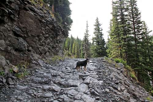 Duchess (now in heaven) on Imogene Pass Rd.
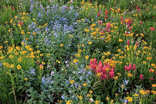 Wildflowers along Imogene Pass Rd.
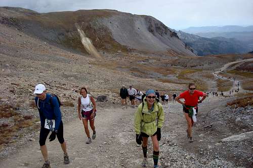 Imogene Pass Run - United States Mountain in the background
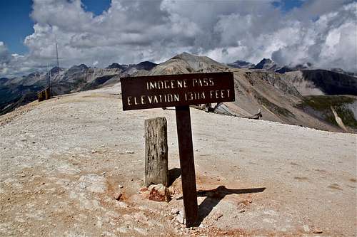 Imogene Pass
For accessing United States Mountain the easiest approach is via Imogene Pass Rd.
United States Mountain is located on the east side = Ouray side of the road. It is easier to drive from Ouray. If driving from Telluride you have to cross over the summit of Imogene Pass. Ironically, the altitude of Imogene Pass 13,114 feet is higher than the summit of United States Mountain 13,036 feet.
History of the road: The Imogene Pass road was built in 1880 for access to Ouray from Tomboy Mine. It was named for Imogene Richardson, the wife of one of Thomas Walsh's partners in the Camp Bird Mine. Wires carrying the first commercial transmission of alternating current electricity were strung across this pass in the 1890s. The power was generated in Ames and transmitted to Ouray.
The Tomboy Mine, located in 1880 by Otis Thomas, was situated high above Telluride. Tomboy was Thoma's nickname. For several years there was little activity in Tomboy because it was hard to reach. But after the silver crash in 1893, prospectors struck gold at the Tomboy, and the mine was very productive. The Tomboy Mine was sold for $2 million to the Rothschilds of London in 1897 and continued to operated until 1927.
Imogene Pass Road Description: Imogene Pass is the second highest pass road in the United States and provides a wonderful scenic route though the San Juan Mountains. The route passes through two major mining camps: Camp Bird and Tomboy. I usually come from Ouray side since it is closer to me. The Imogene Pass run always runs from Ouray to Telluride. I have actually never driven the road, but hiked it and ran it many times.
From the Yankee Boy turnoff, the road deteriorates and high clearance 4WD is needed. The track travels through the forest and Imogene Creek Valley. There are number of shallow creek crossings, the roads narrows for the final ascent to the pass. The summit is well marked and a great place to stop. There is parking for several cars.
About two miles from the pass, the track enters the ghost town of Tomboy. The town site has several historic remains. Another couple of miles past Tomboy, the road passes through Social Tunnel, a short passage through a rocky outcrop. Near this tunnel is a good place to spot and view Ingram and Bridal Veil Falls.
Route
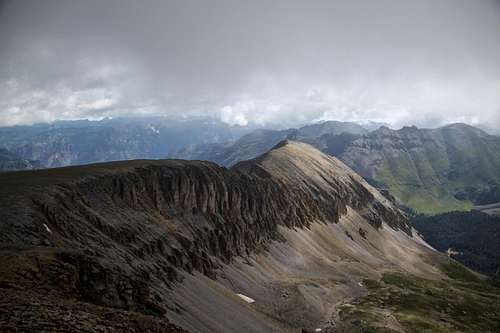
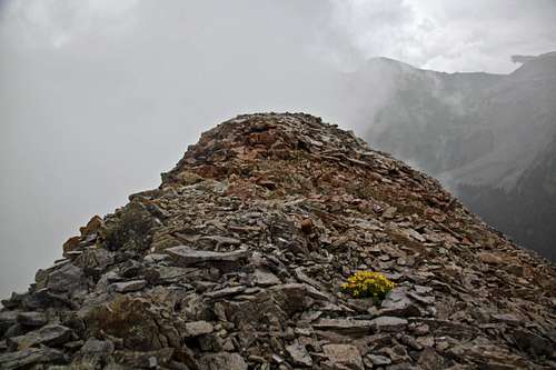
As any mountain there are many route possibilities. I explored a few, and did not find any to be exactly easy. I felt rushed by the weather - it was cloudy and rainy. I was lucky to find a good way down while descending in a thick rain and fog. I ventured out there with no information regarding routes, just a map, and scouting the mountain on my previous hikes and runs up Imogene Pass Rd.Attempt on West Ridge - After a nice hike in a fog on Chicago and "Little Chicago" = Point 13,242 I wanted to try to continue on the ridge eastwards towards United States Mountain. My map was showing a really narrow ridge. The ridge started really wide and offered excellent views - Mount Sneffels looked truly magnificent. I continued on the ridge, which started to get more narrow, and eventually became very exposed loose scramble. I reached a point where I had to drop several meters and climb over a couple of steep 5th class towers. I got spooked and turned around. It was a little depressing for me, I could see the summit cairn not too far away. But I was alone, did not mention to anyone where I was going (I do carry SPOT with me), and as mentioned this mountain is not frequented often (summit log had the last signature from 2 years ago!). The terrain was very exposed and loose. Any mistake would most likely end in a fatality. The weather was also unpredictable, clouds and light rain. I turned around and returned back to the wide saddle between Point 13,242 and United States Mountain. The descent into Imogene Basin (and below Rock Lake) was on a scree and not too hard - class 2+.
South gullies - I kept looking onto United States Mountain while skirting along its southern slopes until I found a gully, which seemed like it would get me higher and a traverse eastwards appeared relatively easy. I took it and it was not too bad, class 3. It was slightly raining at this point and the loose rock was also wet, but I am stubborn. I basically ascended through a gully, traversed east, and took class 2 loose talus/scree to the summit. There are many gullies to choose from, and most look steep. I chose to get closer and see how it felt. I took a gully which was right at the end of the ridge and lead to a little traversing ridge.
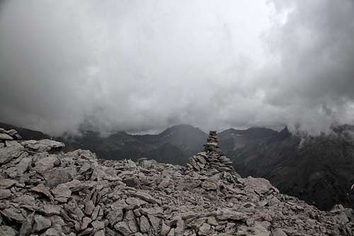
The summit has a pretty large cairn. It was raining relatively hard by this time and I spent less then 5 min there. I did sign a summit register (glass container), and took a few photos, put a rain jacket on and rushed down. I knew I did not want to go the same way I came up: #1 it was long and steep, and #2 I was hoping to explore more and find something easier.
East Ridge and Orange Gully - I continued first on an easy ridge going East (it would be going towards Potosi Peak, but I had clouds and Potosi has disappeared). The ridge seemed long, I reached a steepness and it was ending in a notch which separates United States Mountain's south face. The notch and deep orange gully are seen on photos above in Overview section, and I could see it also on my map. I also noticed a horn below me on the southern slopes of United States Mountain. I zig zagged towards it finding the easiest path - class 2+. It was raining and my visibility was not great. It appeared hard to bypass this notch, so I dropped inside the orange gully, which was running with water. I was hoping for my best. The orange gully was mostly class 2+ with occasional class 3 moves here and there. It took me all the way down. I intercepted Imogene Pass road and hiked back to my car which was parked at Camp Bird Rd.
 Ridge from Point 13,242 "Little Chicago" to United States Mnt. Ridge from Point 13,242 "Little Chicago" to United States Mnt. | 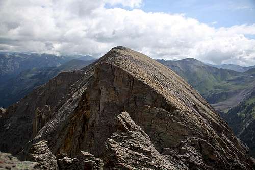 West Ridge from Point 13,242 to United States Mountain West Ridge from Point 13,242 to United States Mountain |
 West Ridge of United States Mountain with deep notches of exposed loose 5th class West Ridge of United States Mountain with deep notches of exposed loose 5th class | 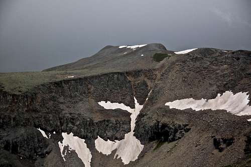 Chicago Peak as seen from West Ridge of United States Mnt. Chicago Peak as seen from West Ridge of United States Mnt. |
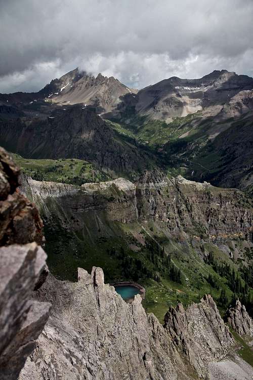 Mount Sneffels as seen from West Ridge Mount Sneffels as seen from West Ridge | 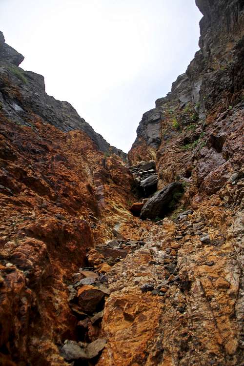 Deep orange gully I used on my descent filled with loose rocks Deep orange gully I used on my descent filled with loose rocks |
 3rd class gully south face 3rd class gully south face | 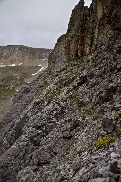 Traversing around cliffs Traversing around cliffs |
 Nice summit cairn - Mount Sneffels would be to the left of the cairn Nice summit cairn - Mount Sneffels would be to the left of the cairn | 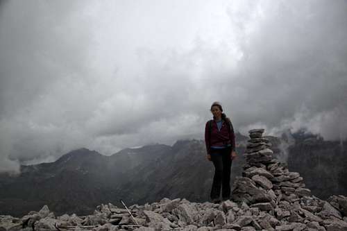 Summit photo - photo with camera timer Summit photo - photo with camera timer |
 Long East Ridge Long East Ridge | 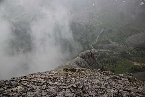 Descent east ridge Descent east ridge |
Red Tape
Hiking, driving Imogene Pass Road and driving are free. Just keep in mind that Imogene Pass road is a rough 4WD road and high clearance is needed (otherwise you will hit rocks and big steps on the bottom of your car).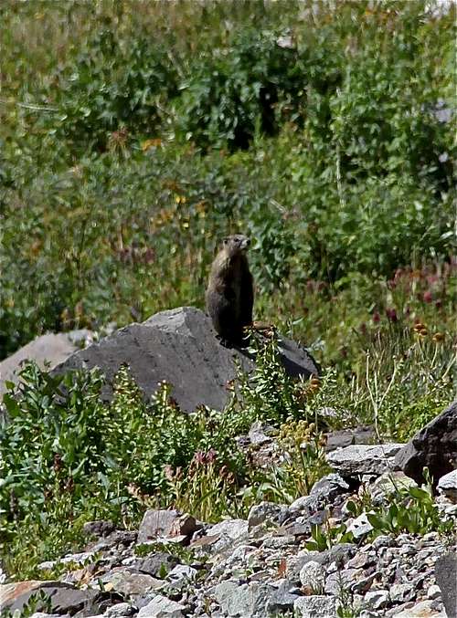 Standing marmot Standing marmot | 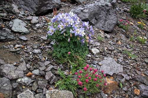 Wildflowers Wildflowers | 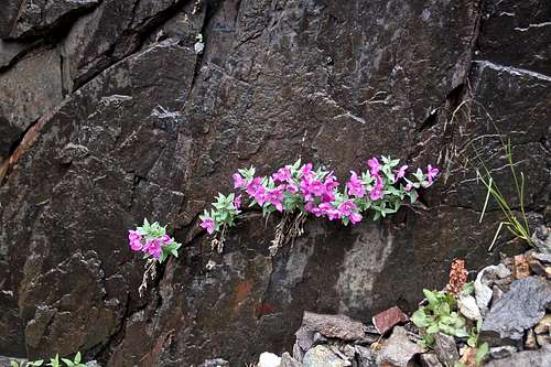 Rock garden Rock garden |
When to Climb
Summer is the easiest since the access to Imogene Pass road is in great condition. The road get snow plowed typically by June based on snow conditions. Winter is possible as well, expect a lot of snow and travel through an avalanche country. Check Northern San Juan avalanche forecast prior venturing out in the winter.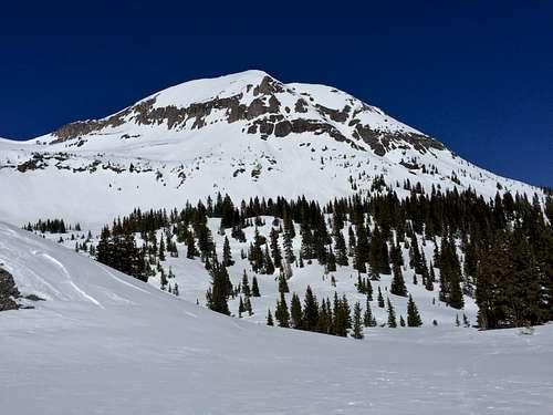 United States Mountain United States Mountain | 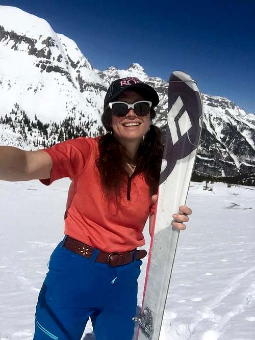 Skiing below US Mountain Skiing below US Mountain |