
|
|
Mountain/Rock |
|---|---|
|
|
36.47816°N / 50.92533°E |
|
|
Mountaineering |
|
|
12969 ft / 3953 m |
|
|
Overview
Click for Introduction to Central Alborz Mountains.Click to see the Map of the Takhte Soleyman Massif.
 Northeastern Face, Photo by FereidounForghani/Amirkhani
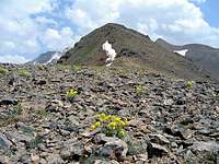 North Face
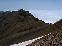 South Face
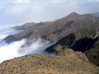
Shoor Gardan rises on the crest of the ridgeline that forms the northern arm of the Takhte Soleyman Massif. To the south, Shoor Gardan is connected to the 4140 m Mazi Gardan Peak. The northern slopes of Shoor Gardan are broad and descend slowly to a 3520 m saddle which connects Shoor Gardan to the 3640 m Reka Poshteh Peak to the north.
 Northeastern Face, Photo by FereidounForghani/Amirkhani
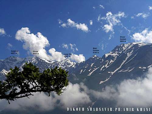
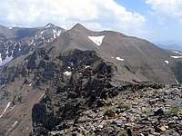
 Kalahoo & Ghobi
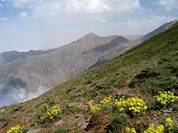 Korma Kooh
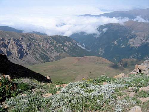
The western slopes of Shoor Gardan are very steep and drop 2300 vertical meters to the bottom of the Sehezar River Valley. Its eastern slopes are also steep and drop 2000 vertical meters to reach the Eza Rood River Valley. Both of these valleys head north and drain into the Caspian Sea which is only 31 Km away from the summit of Shoor Gardan. Caspian Forests cover the valleys up to an elevation of 2300 m and clouds generated by Caspian Sea moisture often fill the valleys.
 Momentary break in the clouds reveals the forested Eza Rood Valley
Shoor Gardan is a long way from any trailhead and reaching its summit requires a multi-day program. It is usually climbed by those who want to explore the northern arm of the Takhte Soleyman Massif. The usual route is to first climb the 4430 m Ghobi Peak and then follow the ridgeline north past the 4340 m Looy Na and the 4140 m Mazi Gardan Peaks (See Route below). From the summit of Shoor Gardan, you can continue north on the crest of the ridgeline past the 3640 m Reka Poshteh & the 3590 m Dakooh Peaks to reach the seasonal village of Kia Neshinan (2400 m). You will then hike through the dense forest to reach a road that can take you to the Caspian Sea coast.
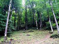 Caspian Forests Caspian Forests |  Village of Kia Neshinan Village of Kia Neshinan |  Caspian Forests Caspian Forests |
Views From the Summit of Shoor Gardan:
 Korma Kooh Korma Kooh |  Siyalan Peak & Sehezar Valley Siyalan Peak & Sehezar Valley | 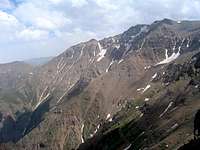 Kalahoo & Ghobi Kalahoo & Ghobi |
 Looy Na & Mazi Gardan Looy Na & Mazi Gardan | 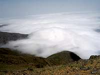 Eza Rood Valley Eza Rood Valley |  Reka Poshteh Reka Poshteh |
Route
The starting point for this route is the summit of Mazi Gardan Peak. Click here to see the Route Page for Mazi Gardan.From the summit of Mazi Gardan go down its western slopes and then gain the top of the ridgeline and head north toward Shoor Gardan. You will actually see a faint trail just below the top of the ridgeline on the west side. The southern slopes of Shoor Gardan are rocky. It will be much easier to traverse below the summit of Shoor Gardan on its western slopes until you reach the easy northern slopes. You can then turn south and follow the easy north slopes to reach the summit. Distance from the summit of Mazi Gardan is 2.3 Km.
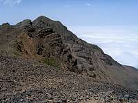 South Face South Face |  Eza Rood Valley Eza Rood Valley | 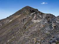 Southwestern Face Southwestern Face | 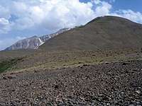 North Face North Face |