|
|
Mountain/Rock |
|---|---|
|
|
36.51105°N / 50.91008°E |
|
|
Mountaineering |
|
|
Summer |
|
|
11942 ft / 3640 m |
|
|
Overview
Click for Introduction to Central Alborz Mountains.Click to see the Map of the Takhte Soleyman Massif.
 East Face, Photo by FereidounForghani
 South Face
 On the Southern Slopes
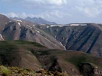
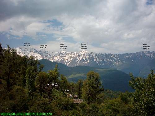
Reka Poshteh Rises on the northern fringes of the Takhte Soleyman Massif. It sits in an area that marks the boundary between the high 4000 m peaks of the massif to the south and the lower forested peaks to the north that are close to the Caspian Sea.
To the north, Reka Poshteh is connected to the 3590 m Dakooh Peak, To the south, a long and broad-top ridgeline connects Reka Poshteh to the 3953 m Shoor Gardan Peak.
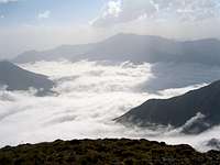
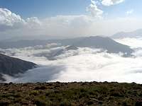
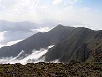
The western slopes of Reka Poshteh are very steep and drop 2200 vertical meters to the bottom of the Sehezar River Valley. Its eastern slopes are gentler but also drop 2200 vertical meters to reach the Eza Rood River Valley. Both of these valleys head north and drain into the Caspian Sea which is only 28.5 Km away from the summit of Reka Poshteh. Caspian Forests cover the valleys up to an elevation of 2300 m and clouds generated by Caspian Sea moisture often fill the valleys.
 Ghobi
GhobiReka Poshteh is often climbed by those who like to explore the peaks of the northern arm of the Takhte Soleyman Massif. This ridgeline starts at the summit of the 4430 m Ghobi Peak, heads north, slowly descending and giving rise to several major peaks as below:
1) Ghobi 4430 m
2) Looy Na 4340 m
3) Mazi Gardan 4140 m
4) Shoor Gardan 3953 m
5) Reka Poshteh 3640 m
6) Dakooh 3590 m
7) Peak 3483 m
8) Shah Rashid 3221 m
Reka Poshteh is most readily accessed via the summit of Shoor Gardan Peak (and ultimately Ghobi Peak) to the south (see “Route” below). The starting point for the hike is the village of Roodbarak to the southeast. From the summit of Reka Poshteh, you can continue north to the seasonal village of Kia Neshinan (2400 m). You will then descend into the Caspian Forests until you reach some of the remote nameless logging roads and find your way to the coastal plain.
 Pelleh Kooh Pelleh Kooh |  Eza Rood Valley Eza Rood Valley |  South Face South Face |
Route:
The starting point for this route is the summit of Shoor Gardan Peak. Click here to see the page for Shoor Gardan Peak.
From the summit of Shoor Gardan, head north and descend a broad and easy to hike ridge-top down to a 3520 m saddle and then up to a high point, down a little again and finally up to the summit of Reka Poshteh.
Distance from the summit of Shoor Gardan is 4.5 Km (Total hiking distance from the village of Roodbarak is 23.1 Km)
 North Face
Below the Clouds:
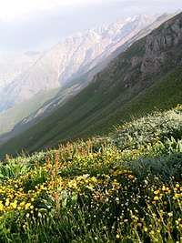
Caspian Forests cover the slopes up to an elevation of 2300 m.
 Caspian Forests Caspian Forests |  Caspian Forests Caspian Forests | 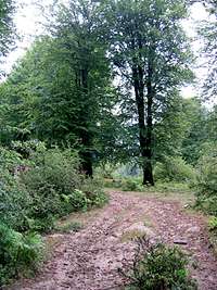 Caspian Forests Caspian Forests |  Village of Kia Neshinan Village of Kia Neshinan |
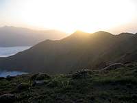
Views From the Summit of Reka Poshteh: