
|
|
Area/Range |
|---|---|
|
|
47.49950°N / 13.22560°E |
|
|
7976 ft / 2431 m |
|
|
Overview
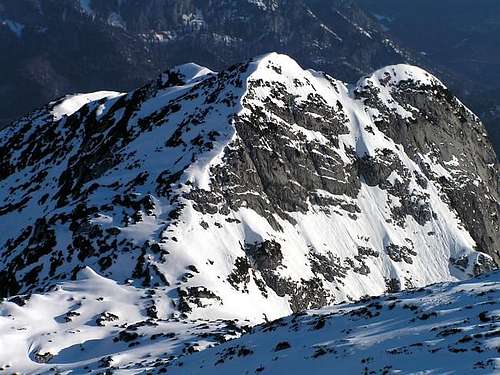
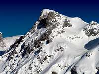
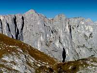
Tennengebirge is not a single mountain but - like Hagengebirge and Dachstein - a huge block of limestone with steep slopes to all sides and a vast plateau that covers approximately 45km² while the total mountain range extends over 240km². At the western and southern rim of this plateau the highest peaks of Tennengebirge arise. Several marked paths connect the huts which are mostly situated at the margins of the mountain range. Especially in the higher areas the paths are often hard to find. In case of bad weather orientation is extremely difficult. Although Tennengebirge is only 2400 meters high the vertical distance between the surrounding valleys and the highest peaks frequently exceeds 1800m.Tennengebirge also offers great climbing possibilities. Especially its sunny south- and west side with its high and compact limestone walls exhibits hundreds of routes from easy to extremely difficult.
The Tennengebirge is confined by the valleys of river Salzach in the west, river Lammer in the north and the east and river Fritzbach in the south.
Although it is one of the wettest places of Austria (with unbelieveable snow heights in winter) its plateau region resembles a desert during summer. Due to an extreme degree of karstification all water immediately disappears into open joints, shafts and caves. Up today more than 700 caves have been explored and every year national and international speleological expeditions are discovering new cave systems.
At the north-east side of the Tennengebirge some of the largest springs of Austria and Central Europe emerge with the largest discharging more than 20.000 litres per second. Interesting and beautiful hydrologic phenomena can be observed during snow melt or after heavy rains. The water table within the mountain rises and higher elevated springs start to discharge resulting in wonderful waterfalls.
Till now Tennengebirge has remained - apart from the famous ice caves near Werfen and some small skiing resorts at the southern and eastern margin - relatively quiet and unspoiled by tourism and roads. This is rather remarquable as it is only 25km south of Salzburg city.
 Hochkarfelderkopf | 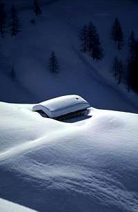 Laubichlalm | 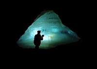 Platteneckeishöhle |  Winnerfall |
More Overview Photos
 Wieselstein in Spring |  Wieselstein in Summer |  Wieselstein in Winter |  South Side |
Getting There
Tennengebirge is situated about 25km south of Salzburg City. Salzburg has an international airport and is connected to the transnational railway and motorway net.The villages around the Tennengebirge can be reached by public transports like busses (Scheffau, Abtenau, Annaberg-Lungötz, St. Martin) or by bus and train (Golling, Tenneck, Werfen, Hüttau).
A cable car starts high above Werfen and leads to the ice caves (Eisriesenwelt, open from 1st of May to October). Some ski lifts can be found at the Bischlinghoehe (1834m) near Werfenweng with one cable car operating also during summer (many paragliders) and at the Karkogel near Abtenau with one chairlift also operating during summer .
For climbers these lifts (except the cable car to the Eisriesenwelt) are of little advantage as they are in some distance (for god´s sake) to the plateau region.
An online train timetable can be found at: http://www.oebb.at/en/index.html
Overview Over The Most Important Summits
One of the most remarquable features of Tennengebirge is its large karstic plateau. From this plateau, mostly at the margins, several peaks arise. The relative height of these peaks measured from the plateau area is only a few hundred meters. But as these summits in general are situated at the rims of the plateau the vertical distance to the surrounding valleys often exceeds 1800m!Summits of Tennengebirge Overview

The most important summits in the northern part are:
 Platteneck 1946m | 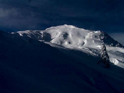 Schafgebirgspitz 1771m | 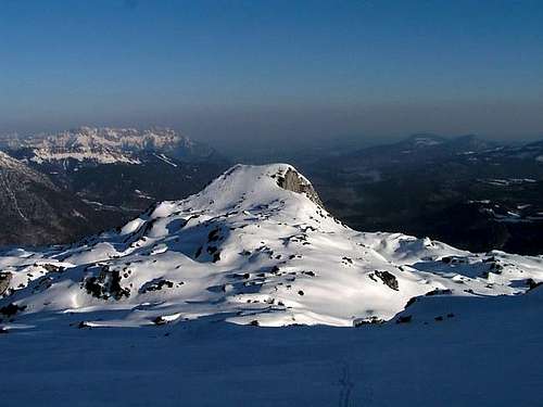 Hochtörl 1919m | 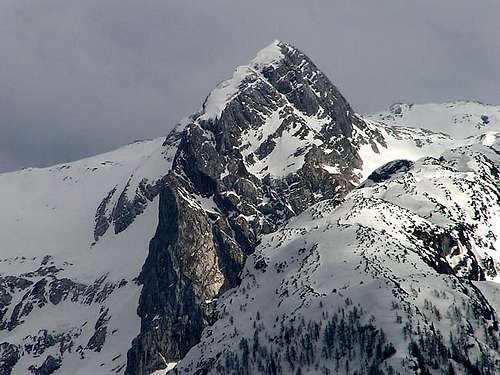 Knallstein 2233m |
 Schwerwand 2212m | 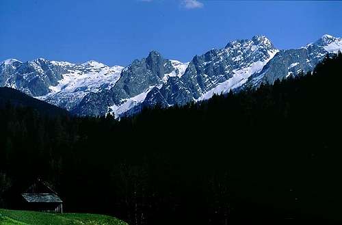 Wieswand 2020m |
The most important summits in the western and south-western part are:
Bäreck 2066m

Tiroler Kogel 2322m

Hochkogel 2281m

Hühnerkrallkopf 2403m
Raucheck 2430m (highest peak of Tennengebirge)
The most important summits in the southern part are:
Großes Fieberhorn 2276m
Kleines Fieberhorn 2152m
|
|
|---|


Werfener Hochthron 2362m
|
|
|---|


Streitmandl 2360m
Wermutschneid 2304m

Kemetstein 2209m
|
|
|---|


Eiskogel 2321m
|
|
|---|
Tauernkogel 2247m

Brietkogel 2316m

Schubbühel 2334m

The most important summits in the eastern part are:
Bleikogel 2412m

Breitstein 2161m

Grieskogel 1999m
Fritzerkogel 2360m
|
|
|---|


Kleiner Fritzerkogel 2287m
Edelweisskogel 2030m
Hochkarfelderkopf 2219m

Sonntagskogel 2046m
Tagweide 2128m
Großer Traunstein 1943m

Schober 1810m

Red Tape
The Tennengebirge can be accessed all year round. No permits are required (as long as you do not enter caves) and no fees have to be paid.When To Climb
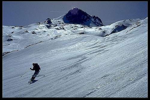
The Tennengebirge can be climbed all around the year. The best months are September and October. During summer violent thunderstorms frequently occur. Also it might be rather hot and there is almost no water up there. In June many of the higher peaks are covered with snow and snow bridges over vertical caves get thin so that it can be really dangerous.For skiing the best conditions are from the end of February to April. Of course some skiing routes can be done as soon as November but the karstic areas require loads of snow.
|
|
|
|
|---|
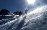


Skiing
Although the Tennengebirge is confined to almost all sides by steep and rocky slopes a variety of ski routes lead from the summits to the surrounding valleys. The most beautiful ski routes are on the north and the east side. The south side is in general to steep for skiing.Great routes are from
Wieselstein to the villages of Scheffau or Golling
Scheiblingkogel to the village of Scheffau
Bleikogel and Fritzerkogel to the village of Abtenau
Sonntagskogel to the village of Annaberg / Gwechenberg
Hochkarfelderkopf to the village of Lungötz
Eiskogel, Streitmandl and Wermutschneid to the village of Werfenweng
Korein and Frommerkogel to the village of St. Martin
Most of these routes have very steep and rocky parts demanding secure snow conditions and experienced skiers.
|
|
|
|
|---|


Camping
Camping on the mountain is not forbidden but not advisable as there is almost no water up there.Several huts can be found at the Tennengebirge. Most of them are situated in relatively low areas.
1. Leopold Happisch Hut (1925m); Tel.: +43-(0)664-4566470
email: salzburg@naturfreunde.at
accessable from Golling via Schildkar (4h), from Tenneck via Grünwaldrinne (4h), from Werfen/Eisriesenelt via Hochkogelnieder (3h)
mountains to be climbed:
Raucheck (2430m) 2,5h; Tiroler Kogel (2322m) 1h; Hochkogel (2281m) 1,5h; Wieselstein (2315m) 1h
2. Friedrich Oedel Hut (1582m); Tel.: +43-(0)6468/5248-0
accessable via cable car
mountains to be climbed:
Raucheck (2430m) 3h; Hochkogel (2281m) 2h
3. Werfener Hut (1967m) Tel.: +43-(0)664-9864828
email: werfenerhuette@yahoo.com; hompage: http://www.werfenerhuette.com
no. of mattresses: 40
accessable from Werfen via Mahdegg (3h) and from Werfenweng / Wengerau via Elmaualm (1,5h)
summits to be climbed: Hochthron (2360m) II-III; Kleines Fieberhorn (2157m) -IV; Raucheck (2430m) 2,5h
4. Elmaualm (1513m) accessable from from Werfenweng / Wengerau
(1h)
5. Proksch Hut (1586m) accessable from from Werfenweng by mountain bike or cable car and from St. Martin via Korein (3,5h)
mountains to be climbed:
Tauernkogel (2247m) 1,5h; Eiskogel (2327m) 2,5h; Frommerkogel (1883m) 1,5h; Korein (1850m) 1,5h
6. Heinrich Hackel Hut (1526m); Tel.: +43-(0)664-3429114
no. of beds: 7 no. of mattresses: 20
accessable from from Werfenweng / Wengerau (1h)
mountains to be climbed:
Tauernkogel (2247m) 1h; Eiskogel (2327m) 2h; Bleikogel (2412m) 3,5h
7. Edelweiß Hut (2360m) accessable from from Werfenweng / Wengerau via Werfener Hut (2,5h), from Oedl Hut via Raucheck (4h)
8. Gwechenbergalm (1372m); Tel.: +43-(0)6272-5147
no. of mattresses: 22
accessable from Annaberg / Quehenberg (1h)
mountains to be climbed:
Traunstein (1943m) 2,5h; Schober (1810m) 1h; Sonntagskogel (2046m) 1,5h; Hochkarfelderkopf (2219m) 2h, Tagweide (2128m) 2h
9. Gsengalm (1447m) Tel.: +43-(0)664-3575153 or +43-(0)6243-41030accessable from Abtenau via Karkogel chair lift (1h)
no. of beds: 16 no. of mattresses: 30
mountains to be climbed:
Traunstein (1943m) 1,5h; Schober (1810m) 1h; Tagweide (2128m) 2h; climbing possibilities near the hut from grade IV+ to IX+
10. Laufener Hut (1721m)accessable from Abtenau / Karalm (2h)
no. of beds: 19; no. of mattresses: 45; winter room: 8 sleeping places (you have to ask for the key)
mountains to be climbed:
Bleikogel (2412m) 3h; Edelweisskogel (2030m) 1h; Tagweide (2128m) 1,5h; Fritzerkogel (2363m) 2h; Grieskogel (1999m) 1h, Hochkarfelderkopf (2219m) 2h
11. Rossberg Hut (985m), Tel.: +43-(0)664-6527570 accessable from Oberscheffau (1h); you have to ask for the key
mountains to be climbed:
Scheiblingkogel(2289m) 3h; Wieswand (2017m) 3h; Schwerwand (2212m) 3h;
12. Stefan Schatzl Hut (1336m) accessable from Oberscheffau via Schönalm (2,5h) from Unterscheffau via Infangalm (3h)
mountains to be climbed:
Knallstein(2230m) 2h; Mittlerer Wieselstein (2300m) 2,5h; Hochtörl (1913m) 2h;
 Schildkarwandhütte |  Edelweißhütte |
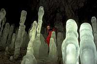
Caves

During the last decades Salzburg and especially the Tennengebirge has come into the focus of national and international spelological research activities. In the last years vast cave systems have been explored that extend from the high plateau down to the valleys. Some of the world´s largest ice caves can be found in the Tennengebirge.
From the genetical aspect several cave building stages can be distinguished:
At the plateau regions "cave ruins" which are partly collapsed and eroded caves, are visible. They represent the oldest cave generation. Their formation took place in a time when the Northern Calcareous Alps ( and the Tennengebirge) were lovely hills comparable to the classical karst in Slovenia and north-eastern Italy (around Trieste). The rivers coming from the Central Alps went over and through the nowadays highly elevated plateau regions forming large tunnels. Gravel deposits of Central Alpine origin in these tunnels give a testimony of that time. One of the most impressive example of these "cave ruins" is the Eiskogel Eishoehle high above Werfenweng containig a hughe cave chamber, the Titanenhalle (hall of the Titans) extending over a length of 400m and a width and hight of 60m.
Genetically younger and at deeper elevations (1500 - 1800m)are the caves of the "giant cave niveau" with its most famous example, the Eisriesenwelt which is the largest known ice cave in the world. Till now 42km of galleries have been explored. Every year more than 100.000 people visit these caves.
At an elevation between 1000m and 1400m large labyrinthic cave systems containig masses of fine sediments developed forming the so called Bergerhoehlen level, named after its largest member the Bergerhoehle, being about 35km long.
Very little is known about the deepest cave level which is situated near the valleys. The caves there are characterized by many water-filled galleries and deep lakes and syphons. The exploration of this part is very difficult and also rather dangerous. Divers could reach depths of up to 80 meters in the caves of the Winnerfall but did not reach horizontal tunnels.
The above described cave horizons are connected by vertical shafts or pitches, indicating tectonic uplift while the spaciously tunnels of the horizontal systems were formed in times of geologic calmness.
In total more than 700 caves have been discovered and partly explored in the Tennengebirge but much more are still hiding.
Below some examples of the magnificent caves of the Tennengebirge are shown.
A very good report (in English) of an Polish caving team can be found at this Polish caving journal
 |  |  |  |
 |  |  | |
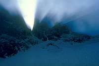
Giant Springs And Waterfalls
As mentioned above the Tennengebirge is an outstanding example for limestone karst. Some of the deepest caves in the world with a vertical extension of more than 1000m and some of the longest caves of Austria (more than 40km) - far from beeing completely explored - transsect this mountain range.Through caves and shafts all of the precipitation is transported downwards. In stratigraphically deeper units dolomite which is not that affected by corrosion occurs. These dolomite layers which are much less permeable for water are generally inclined to the north(-east) so that the boundary between the karstic limestones and the dolomites can be found in a height of up to 1500m in the south while it is below the level of the valley in the north.
As a consequence all major springs can be found at the northern side of the Tennengebirge.
The largest one is the origin of the Schwarzbach ("Black River") near Oberscheffau. Other large springs are the Infang Wasserloch ("Infang Waterhole") near Unterscheffau / Kuchlbach and the springs of Dachser and Tricklfall near Abtenau. Much of the karstic waters directly discharge into the aquifer of the Lammer valley. At the northern tip of the Tennengebirge the river that is flowing through the Brunnecker cave directly discharges into the Salzach river (somewhere below the water surface).
Most of the year these springs show only a small amount of water (except Schwarzbach) or are even dry but still a substantial amount of water discharges into the highly permeable gravels of the Lammer valley.
During snow melt or after longer raining periods the water table within the mountain rises and the giant springs are becoming active. In total an area of about 120km² is being dewaterd underground re-appearing in a few springs. Within one year about 200.000.000.000 litres of water are taking this way (this is about 30 litres for each human being on earth!). Most of this water comes out in May forming powerful waterfalls. The more astonishing is that these waterfalls have not been discovered by tourism yet (fortunately).
A few examples are shown below.
 Karstic spring of Winnerfall |  Winnerfall |  Winnerfall |  Winnerfall in dry season |
More Giant Springs And Waterfalls
 Aubachfall |  Schwarzbach |  Schwarzbach |  Schwarzbach |
 Aubachfall |  Aubach lower fall |  Aubach lower fall |  Aubachfall |
Rivers
Not only Tennengebirge itself but also the rivers confining this mountain range exhibit a large variety of natural wonders.River Lammer almost surrounds Tennengebirge. It starts its course at the south side of Tennenegbirge and further on forms the eastern and northern border of the massif. Due to its karstic springs the water is crystal clean. Between Abtenau and Scheffau River Lammer hides in a spectacular gorge called Lammeröfen. The gorge is accessable from spring to autumn and well worth a visit. During spring and summer kayaking is quite popular.
River Salzach, the largest river of the federal state of Salzburg, confines the Tennengebirge to the west. In an up to 1700m deep canyon it separates the large karstic plateau of Hagengebirge from Tennengebirge. Most impressive is a very narrow and for a short distance subterranean part of this canyon, the Salzachöfen. It is the only place in Austria where a powerful river as Salzach flows through such a narrow gorge. Some parts of the Salzachöfen including the subterranean course can be visited.
 Lammer |  Lammeröfen, lower part of canyon |  Salzachöfen |  Salzachöfen |
More River Photos
 Lammer, almost subterranean |  Lammeröfen in winter |  Lammeröfen in winter |  Lammeröfen |
The High Plateau
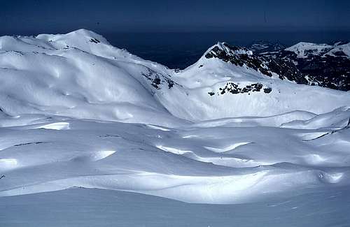
The high plateau of the Tennengebirge extends over approximately 45km² at an average height of about 2000m. The lack of vegetation and water makes it look like a desert or a place on another planet. It is a fantastic rocky wilderness transected by tectonic faults and large dolines. The largest of these karstic depressions, the Sandkar measures more then 2km in length. To cross the plateau in summer is an exhausting hike. But in springtime when loads of snow cover most of the cliffs, karren, dolines and holes it is even possible to cross the mountain range from east to west in one (long) day. Tiefe Gruben |  View to Scheiblingkogel |  View from Raucheck |
Tennengebirge As Seen From Apart
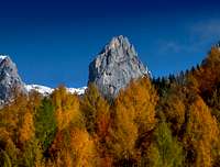
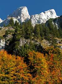
The surrounding mountains offer great views on the Tennengebirge but it is also a beautiful background for some of the lovely villages around. Tennengebirge as seen from Schlenken |  Tennengebirge as seen from Kuchl |  Tennengebirge as seen from Roßfeld |  Tennengebirge as seen from Abtenau |
Magic Places And Pure Nature
Tennengebirge offers some wonderful places where you can relax and enjoy unspoiled nature. Kuchlbach spring |  Kuchlbach near Scheffau |  Kuchlbach |  Bergeralpl |  Bergeralpl |
Flowers And Plants
The lower parts of the Tennengebirge are rich in rare flowers and other plants. Especially in spring some forests may be fully covered with rare flowers. But also in early summer many orchids, lillies and different kinds of columbines are frequent. Alpine Snowbell |  Spring Snowflake |  Snowdrop |
 Aquilegia vulgaris |  Turk´s Cap Lily |
Mountain Conditions
Till now there is no good online information about the mountain conditions.Webcams showing the Tennengebirge are:
1.
2. http://www.martinerhof.at/webcam.htm (village of St. Martin)
Maps and Books
For this region the official Austrian Map (ÖK, 1:50.000) offers the best basis for all activities. The Tennengebirge is covered by the following map sheets:No. 94 Hallein
No. 95: St. Wolfgang
No. 125: Bischofshofen
No. 126: Radstadt
Books about Tennengebirge:
1.
Albert Precht
Tennengebirge
3. Auflage 1986
320 Seiten mit 70 Schwarz-Weiß-Abbildungen
107 Anstiegsskizzen, 1 Übersichtsskizze, eine Übersichtskarte im Maßstab 1:50.000 Verfaßt nach den Richtlinien der UIAA
Format 11 x 15 cm
plastifizierter Einband
ISBN 3-7633-1246-3
34,90 sFr • 19,90 Euro

External Links
- Austrian Map online
Online digital maps of Austria (OEK 50, OEK 200 and OEK 500) by the BEV (Bundesamt für Eich- und Vermessungswesen) - in German