
-
 12187 Hits
-
 83.1% Score
-
 16 Votes
|
|
Mountain/Rock |
|---|---|
|
|
34.79125°N / 82.35901°E |
|
|
Mountaineering |
|
|
20892 ft / 6368 m |
|
|
Overview
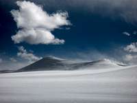
Massive mountain group in the north west of Xizang province. It's in the middle of nowhere in the desolation of the Tibetan high plateau. The massif consists of many summits. The highest are Toze Kangri NE (6388m) and Toze Kangri SW (6366m) summits. These are my measures with GPS. Officially I have seen many other figures. From north to south the main part of the range almost 25 km long. None of the peaks were climbed until 2007, when 3 where summited by an international group. None of the main summits have any technical difficulty. Easy climbs on long, flat snowfields to broad summits. Toze Kangri is a part of the Kunlun Shan mountain system, but not in the main range.
Getting There
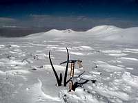
 6150m twin peaks
Go to China, then to the extreme west to the city of Kashi in the Xinjiang province. You can go here by airplane from Beijing, change aircraft in Urumqi. Also by train from Beijing or any other city in China.
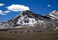
From Kashi, go by bus or private transport to the border pass of Xinjiang and Xizang provinces. Head east on small dirt tracks for 220km. Sometimes difficult to find the right way. Pass north of lake Puer. Then you see the Toze Kangri peaks.
Photos NE peak
 |
 |
 |
|---|---|---|
 |
 |
 |
Photos SW peak
 |
 |
 |
|---|---|---|
 |
 |
 |
Red Tape
Visa for China. Available at Chinese embassies all around the world. Price depends on nationality.Climbing permit. You can get this through China Mountaineering association.
Camping
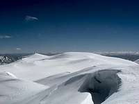
 Base camp from above
Camping is possible everywhere. Strong winds. No risk of theft.
Weather - climbing period
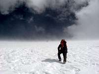
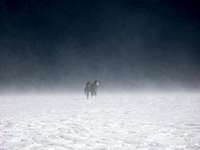
Toze Kangri is located in the north of the Tibetan high plateau. The weather here changes fast. Winter is too cold. Spring can limit access due to mud and full rivers. The summer is full of rain, snow and hard winds. This is Kunlun's "monsoon". Fall is best. Stable weather, good temperature and good access.On the mountain

Base camp can be set in many places. On the west side glaciers run all the way to river valleys which is good for a base. Flat ground, water from melt off and shelter from wind.
Avoid the glaciers initially. The moraines and long gravel ridges are better. Huge snow fields, with slight crevasse danger in some places. Both summits are easy climbs.
External Links
There is nothing of interest on the web. The peaks are unknown to most.Mentioned here
PDF map here. Not for Toze Kangri. Only general for the area.