| Uncompahgre Wilderness Area/Range |
Contribute  Loading...
Children  Loading...
Geography Parents  Loading... Areas & Ranges
| | 
| Page Type: Area/Range Location: Colorado, United States, North America Lat/Lon: 38.07891°N / 107.52045°W Activities: Hiking, Trad Climbing, Scrambling Season: Spring, Summer, Fall, Winter Elevation: 14309 ft / 4361 m | Page By: John Kirk Created/Edited: Sep 30, 2009 / Jul 7, 2010 Object ID: 558911 Hits: 5890  Loading... Page Score: 91.81% - 91 Votes  Loading... Vote: Log in to vote |
Overview

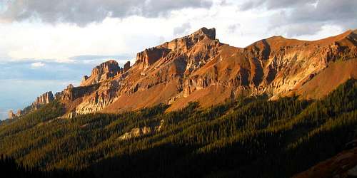
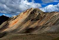
Precipice Peak (middle) and Dunsinane (left)
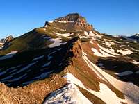
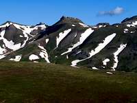
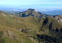
Spanning a large area northwest of Lake City and northeast of Ouray, The Uncompahgre Wilderness, formerly named the Big Blue Wilderness, was created in 1980 and expanded in 1993 with the addition of American Flats near Engineer Pass on its southern end. By designating 102,700 acres as wilderness, we are fortunate to have continued preservation of this unique area as well as public access to it. It is home to two very well-known Fourteeners: Uncompahgre Peak, the highest peak in the San Juan Range, and Wetterhorn Peak, a classic scramble by its easiest route. This wilderness boasts 30 ranked peaks (having at least 300' of rise) over 13,000'. The vast treasures one can find in this wilderness are somewhat reserved for the esoteric when comparing to the high traffic one will encounter on these two highest peaks.
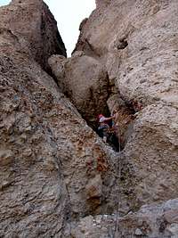
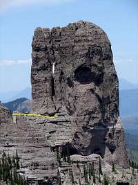
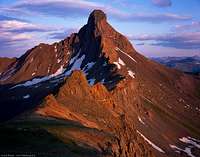
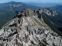
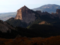
 NW ridge of Wetterhorn Peak 14,015'
Routes up the Uncompahgre Wilderness' summits range from gentle grassy slopes to classic rock climbs to precariously loose and exposed scrambles. Many of the peaks are a maze to figure out and sometimes have a only a single viable route. Volcanic tuff formations dominate the scenery in a spectacular display along the West and Middle Fork Drainages, including Precipice Peak, Dunsinane, and Turret Ridge (just north of the wilderness boundary). Often a test-piece for CMC BMS graduation, Coxcomb Peak (YDS 5.3) is perhaps the third most famous peak in the area. A much harder peak by its easiest route, and seeing far fewer ascents, Chimney Rock, requires four pitches on its South Chimney (YDS 5.6). Airy scrambles on questionable rock such as 13,222, "El Punto", and "Heisshorn" are high on the list of culprits for San Juan rock's bad reputation. It is important to be aware of rock fall hazards, keeping reasonable distance between yourself and those above, and wearing a helmet for some of these peaks is not a bad idea.
 Scrambling on "Heisshorn"
Despite the proximity to very popular trailheads, and the very busy Cinnamon and Engineer passes, one is likely to experience solitude when venturing to most summits below 14,000'. Aside from trails, evidence of other visitors is scant. There is some evidence of mining, but this pales in comparison to other nearby areas in the San Juan Range. Nevertheless, the area is getting more attention as more people are engaging in 13er bagging. There are many ways to spend many a weekend bagging these interesting peaks. Many choose to backpack and set up a base camp while any of these peaks can be done as day hikes (often combining several peaks in a day). Car camping is possible at several trailheads in the area (see the Mountains and Rocks Page for trailheads and camping info). A great resource for some of the peaks mentioned above is Colorado Scrambles.
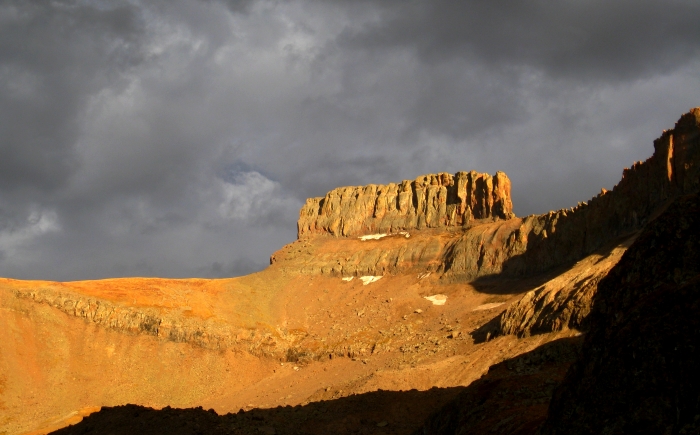
 Coxcomb Peak 13,656' from West Fork Trail
Beta Photos for Chimney Rock: |
|
From cruzit's Chimney Rock page:
"Chimney Rock has dangers that make this peak a solid grade III climb. These dangers include extreme rock fall, poor rock quality, and long unprotectable pitches (run-outs). And....all of these factors exist at the same time on almost every pitch. In addition, the approach includes a steep bushwhack through interminable downfall and loose, unprotectable class 4 and 5 which much be negotiated just to reach the base of the tower. Chimney Rock is climbable, but take heart and take care. It is not for the timid or the inexperienced. But for the ones who are looking for a true adventure climbing challenge..." Read on
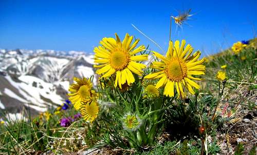
 Alpine Sunflowers near Wetterhorn Peak |
Interactive Google Map of Uncompahgre Wilderness Peaks
Peak List
| CO Rank | Name | Elevation | Quad | Rise | Latitude | Longitude | Class |
| 6 | Uncompahgre Peak | 14,309' | Uncompahgre Peak | 4,242' | 38.0716 | -107.4621 | 2 |
| 49 | Wetterhorn Peak | 14,015' | Wetterhorn Peak | 1,635' | 38.0606 | -107.5107 | 3 |
| 139 | Silver Mountain | 13,714' | Uncompahgre Peak | 1,054' | 38.1067 | -107.4496 | 2 |
| 159 | 13681 | 13,681' | Uncompahgre Peak | 501' | 38.1204 | -107.4576 | 2 |
| 171 | Coxcomb Peak | 13,656' | Wetterhorn Peak | 796' | 38.0801 | -107.5335 | 5.3 |
| 175 | Redcliff | 13,642' | Wetterhorn Peak | 502' | 38.0871 | -107.5331 | 2 |
| 193 | Matterhorn Peak | 13,590' | Uncompahgre Peak | 570' | 38.0651 | -107.4960 | 2 |
| S | "Big Blue Peak" | 13,467' | Uncompahgre Peak | 287' | 38.0946 | -107.4504 | |
| 311 | "Heisshorn" | 13,411' | Wetterhorn Peak | 471' | 38.0780 | -107.5117 | 3 |
| 338 | 13377 | 13,377' | Wetterhorn Peak | 357' | 38.0717 | -107.5149 | 2 |
| 360 | 13340 | 13,340' | Uncompahgre Peak | 745' | 38.0986 | -107.4961 | 2 |
| 400 | 13300 | 13,300' | Wetterhorn Peak | 440' | 38.0571 | -107.5223 | 2 |
| 402 | "El Punto" | 13,300' | Uncompahgre Peak | 320' | 38.0898 | -107.4993 | 3 |
| 425 | Wildhorse Peak | 13,266' | Wetterhorn Peak | 966' | 38.0133 | -107.5775 | 2 |
| 432 | Darley Mountain | 13,260' | Handies Peak | 520' | 37.9827 | -107.5881 | 2 |
| 436 | Broken Hill | 13,256' | Uncompahgre Peak | 798' | 38.0430 | -107.4718 | 2 |
| 446 | "Fortress Peak" | 13,241' | Wetterhorn Peak | 461' | 38.0978 | -107.5302 | |
| 460 | 13222 | 13,222' | Uncompahgre Peak | 322' | 38.1058 | -107.4902 | 4 |
| 480 | 13206 | 13,206' | Wetterhorn Peak | 306' | 38.0742 | -107.5248 | 2 |
| 490 | 13201 | 13,201' | Wetterhorn Peak | 661' | 38.0389 | -107.5250 | 2 |
| 507 | Sheep Mountain | 13,168' | Sheep Mountain | 592' | 38.1588 | -107.4659 | |
| 516 | 13158 | 13,158' | Uncompahgre Peak | 378' | 38.0542 | -107.4381 | 2 |
| 530 | Precipice Peak | 13,144' | Wetterhorn Peak | 484' | 38.1194 | -107.5351 | 2+ |
| 559 | Cow Benchmark | 13,111' | Wetterhorn Peak | 531' | 38.0201 | -107.6211 | |
| 564 | 13106 | 13,106' | Uncompahgre Peak | 726' | 38.0711 | -107.4209 | 2 |
| 569 | 13100 | 13,100' | Sheep Mountain | 480' | 38.1459 | -107.4674 | |
| 575 | 13091 | 13,091' | Uncompahgre Peak | 591' | 38.0726 | -107.3878 | 2 |
| 593 | Blackwall Mountain | 13,073' | Wetterhorn Peak | 453' | 38.0287 | -107.5647 | 2 |
| 608 | 13051 | 13,051' | Uncompahgre Peak | 351' | 38.1059 | -107.4298 | |
| 629 | 13016 | 13,016' | Uncompahgre Peak | 676' | 38.1244 | -107.4148 | |
| 647 | "U 4" | 12,986' | Wetterhorn Peak | 486' | 38.0870 | -107.5592 | |
| 653 | 12975 | 12,975' | Wetterhorn Peak | 315' | 38.0287 | -107.5367 | 2 |
| 656 | "Dragons Back" | 12,968' | Wetterhorn Peak | 428' | 38.0188 | -107.5634 | 4 |
| 694 | Dolly Varden Mountain | 12,932' | Handies Peak | 312' | 37.9922 | -107.5428 | |
| 705 | 12917 | 12,917' | Courthouse Mountain | 617' | 38.1338 | -107.5022 | |
| S | 12798 | 12,798' | Courthouse Mountain | 298' | 38.1442 | -107.5067 | 5.4 |
| 824 | Dunsinane Mountain | 12,742' | Courthouse Mountain | 602' | 38.1297 | -107.5390 | |
| 831 | 12739 | 12,739' | Wetterhorn Peak | 479' | 38.0346 | -107.6220 | |
| 1046 | 12441 | 12,441' | Wetterhorn Peak | 501' | 38.0543 | -107.6100 | |
| Bighorn Ridge | 12,396' | Wetterhorn Peak | 216' | 38.0407 | -107.5927 | |
| Cascade Mountain | 12,368' | Ouray | 268' | 38.0377 | -107.6340 | |
| 1169 | 12255 | 12,255' | Lake City | 475' | 38.1050 | -107.3653 | |
| 1221 | Courthouse Mountain | 12,152' | Courthouse Mountain | 1,172' | 38.1350 | -107.5739 | 2+ |
| 1223 | 12148 | 12,148' | Wetterhorn Peak | 448' | 38.0688 | -107.5669 | |
| S | 11860 | 11,860' | Courthouse Mountain | 280' | 38.1700 | -107.5021 | |
| 1418 | Chimney Rock | 11,781' | Courthouse Mountain | 401' | 38.1463 | -107.5695 | 5.6 |
| 1426 | 11773 | 11,773' | Sheep Mountain | 473' | 38.1701 | -107.4153 | |
| 1731 | 11110 | 11,110' | Alpine Plateau | 370' | 38.1327 | -107.3240 | |
| S | 10875 | 10,875' | Courthouse Mountain | 295' | 38.1900 | -107.5029 | |
| 2084 | 10393 | 10,393' | Alpine Plateau | 333' | 38.1519 | -107.3241 | |
| Sneva Mountain | 9,820' | Courthouse Mountain | 160' | 38.1299 | -107.6078 | |
|
Uncompahgre Peak - 14,309' |
Wetterhorn Peak - 14,015' |
Silver Mountain - 13,714' |
13681 - 13,681’ |
Coxcomb Peak - 13,656' |
Redcliff - 13,642' |
Matterhorn Peak - 13,590' |
"Big Blue Peak" - 13,467' |
"Heisshorn "- 13,411' |
13377 - 13,377' |
13340 - 13,340' |
13300 - 13,300' |
"El Punto" - 13,300' |
Wildhorse Peak - 13,266' |
Darley Mountain - 13,260' |
Broken Hill - 13,256' |
"Fortress Peak" - 13,241' |
13222 - 13,222' |
13206 - 13,206' |
13201 - 13,201' |
13158 - 13,158' |
Precipice Peak - 13,144' |
Cow Benchmark - 13,111' |
13106 - 13,106' |
13091 - 13,091' |
Blackwall Mountain - 13,073' |
13051 - 13,051' |
13016 - 13,016' |
"U 4" - 12,986' |
12975 - 12,975' |
"Dragons Back" - 12,968' |
Dunsinane Mountain - 12,742' |
12739 - 12,739' |
12441 - 12,441' |
Courthouse Mountain - 12,152' |
Chimney Rock - 11,781' |
Scenery and Setting
 "Fortress Peak" 13,241'
 Courthouse Mountain and Chimney Rock
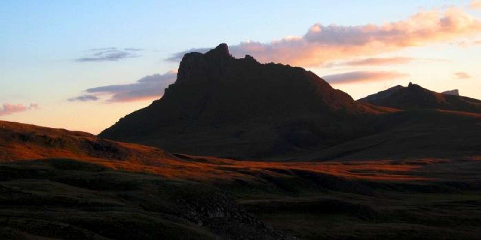
 Wildhorse Peak 13,266'
 "Dragons Back" 12,968'
 Wetterhorn Peak 14,015'
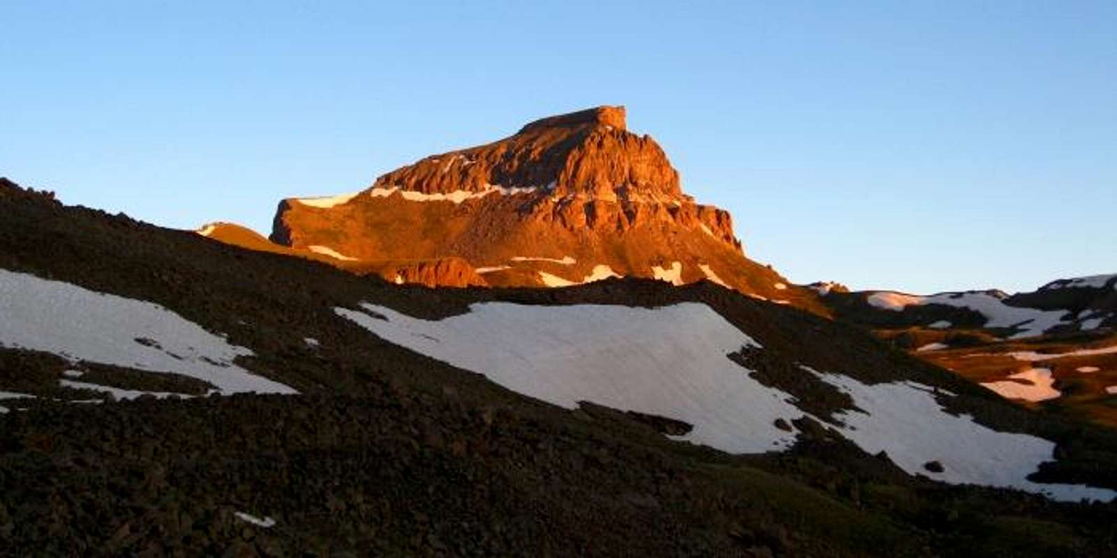
 Uncompahgre Peak 14,309'
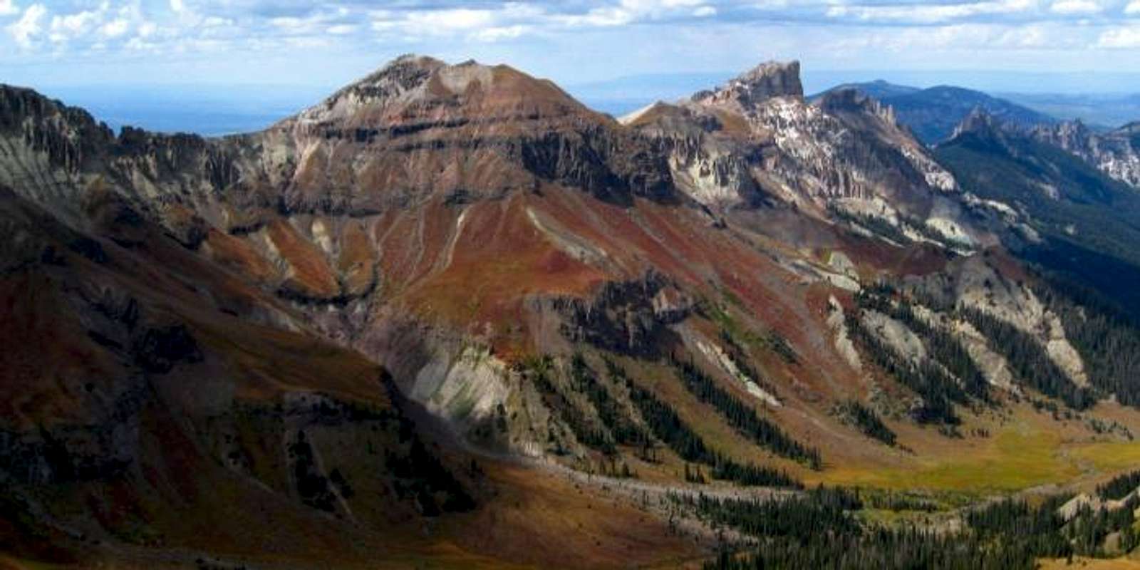
 "Fortress Peak" and Precipice Peak
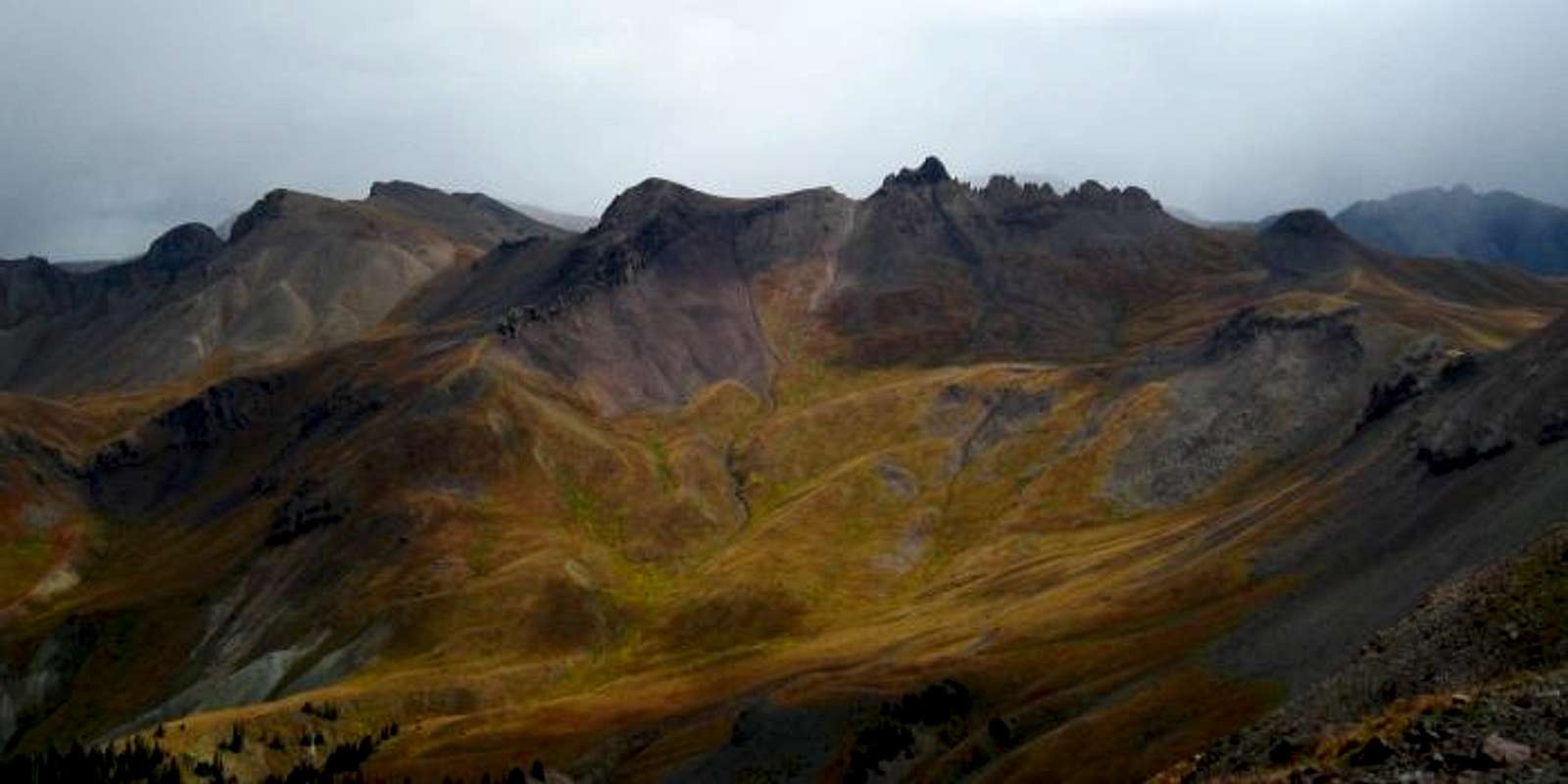
 "El Punto" and 13,340
 "Heisshorn" 13,411'
 Coxcomb and Redcliff
 Blackwall Mountain 13,073'
 Chimney Rock Sunset
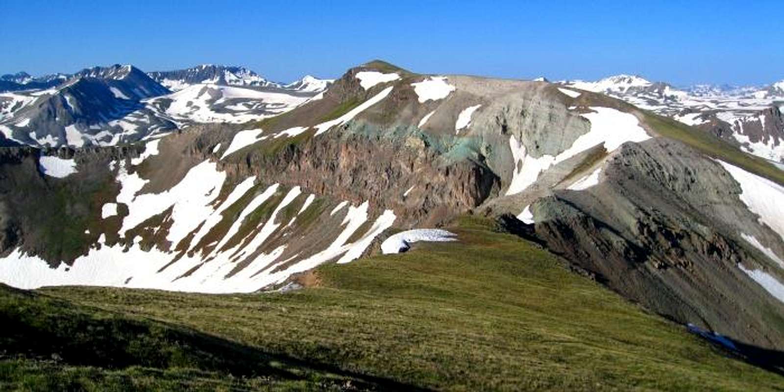
 Unnamed 12,975'
| External Links
Images
|
|