
-
 833 Hits
-
 77.48% Score
-
 8 Votes
|
|
Mountain/Rock |
|---|---|
|
|
38.13380°N / 107.5022°W |
|
|
Hinsdale |
|
|
Summer, Fall |
|
|
12917 ft / 3937 m |
|
|
Overview
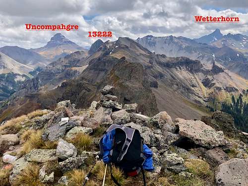
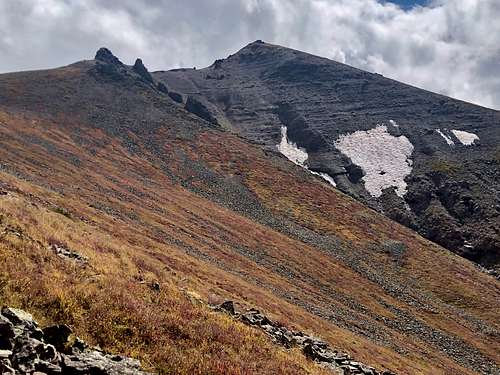 Unnamed 12917
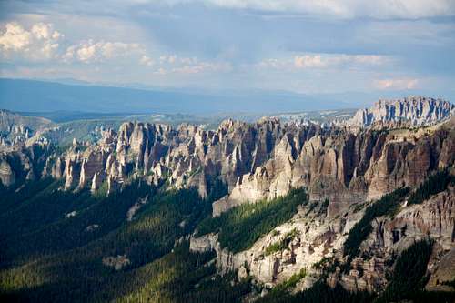 Pinnacle Ridge - northern tip
Colorado Rank: 705
Quad: Courthouse Mountain
Parent Lineage: 13222
Wilderness: Uncompahgre
Class: 2
Cimarron River Group has many weirdly shaped peaks and many offer fine scrambles and technical climbs. The area is absolutely spectacular.
Pinnacle Ridge is the six mile long ridge running north from El Punto, ending in the small forest of pinnacles the two see along the Middle Fork Road. Despite the name, the cluster of 12,000' and 13,000' points along the way aren't too difficult reach per Guide to Colorado Mountains with Robert Ormes. It depends, which point you decide to climb, e.g Unnamed 12798 (unranked) offers the easiest climb at 5.4. Unnamed 13222 (ranked summit) offers class 4 exposed scramble.
Getting There
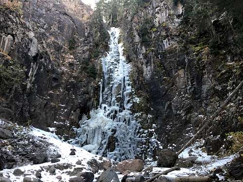 Waterfall
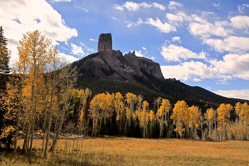 Chimney Rock
If you have time, stop for a short stroll to a beautiful waterfall about 1.5 miles from the trailhead. There is marker for the trail at the road and a small pull out parking lot.
If you have time, stop for a short stroll (5-10 min max) to a beautiful waterfall about 1.5 miles from the trailhead. There is a marker for the trail on the Middle Fork Rd., about 1 mile before the main parking. Park at a small pull out parking lot.
Route
 UN 12917
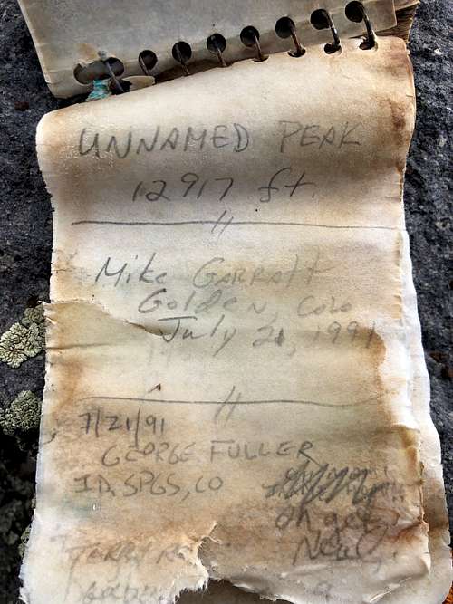 UN 12917
Red Tape
Parking, hiking, and even primitive camping are free. The peak is located in Wilderness area, so wilderness area rules apply.
Leave No Trace. Travel and Camp on Durable Surfaces. Dispose of Waste Properly. Leave What You Find. Minimize Campfire Impacts. Respect Wildlife. Be Considerable of Other Visitors.
When to Climb
Summer and early autumn are the easiest with roads being open. Winter provides a long approach and avalanche danger. Spring could be an a nice outing and the scree slopes could be still covered with snow.
Camping
There is great free camping along the Middle Fork Road. It is also possible to sleep at the trailhead.
Developed campground would be Silver Jack Campground.