
-
 103102 Hits
-
 95.47% Score
-
 53 Votes
|
|
Area/Range |
|---|---|
|
|
32.21040°N / 110.9924°W |
|
|
Hiking, Mountaineering, Trad Climbing, Sport Climbing, Toprope, Bouldering |
|
|
Overview
When the subject of popular mountaineering destinations arises, Tucson does not immediately jump to everyone's lips. Yet the Tucson area boasts an amazing variety of hiking, climbing and mountaineering. Within less than an hour's drive from town, one can find themselves clinging to 5.9 trad routes on huge granite walls, bushwhacking through saguaro-dotted arroyos in the desert, or front-pointing up steep snow and ice. Here, there's something for almost every kind of climber...
... besides, where else are you going to go if you want to climb somewhere that's sunny and 75 degrees in January?
 Pima Canyon peaks, l to r: Pusch Peak, Bighorn Mountain, and Table Mountain.
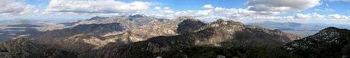
Tucson is almost completely surrounded by mountains. To the north, the Catalinas foothills begin before the city ends and rapidly rise well over a vertical mile to heights surpassing nine thousand feet. To the east are the massive, forested slopes of the Rincons, separated from the Catalinas by a few high passes. The sharp peaks of the Santa Ritas can be seen rising south of town; a short drive puts one up among them. And to the west, the barren, jagged crags of the Tucson mountains begin literally within minutes of downtown. And although these are the four major mountain ranges near Tucson, there are hundreds of other peaks in southeastern Arizona; many remain unnamed.
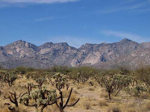
The Santa Catalinas
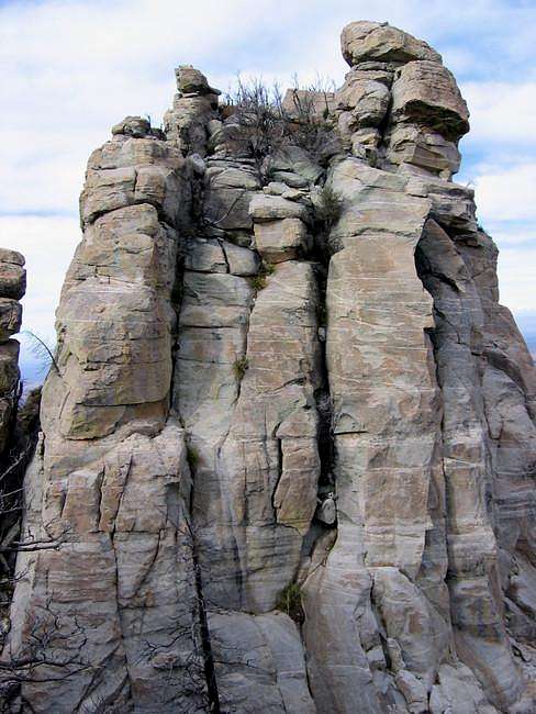
The Santa Catalinas, or Catalina Mountains tower just north of the city of Tucson and more than six thousand feet above it. Of all the mountain ranges surrounding the city, they are the largest and most complex. There are more than fifty separate peaks here, and countless crags and spires. Although a road runs up Mt. Lemmon – the range’s highest summit – most of the Catalina peaks are infrequently visited, and almost half of them aren’t even named. The higher mountains here are “sky islands,” so as you ascend, you move out of the desert and into a forest.
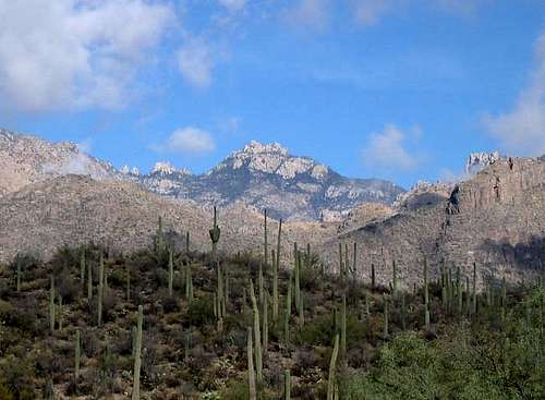
 Looking into the heart of the Catalinas from Mt. Kimball.
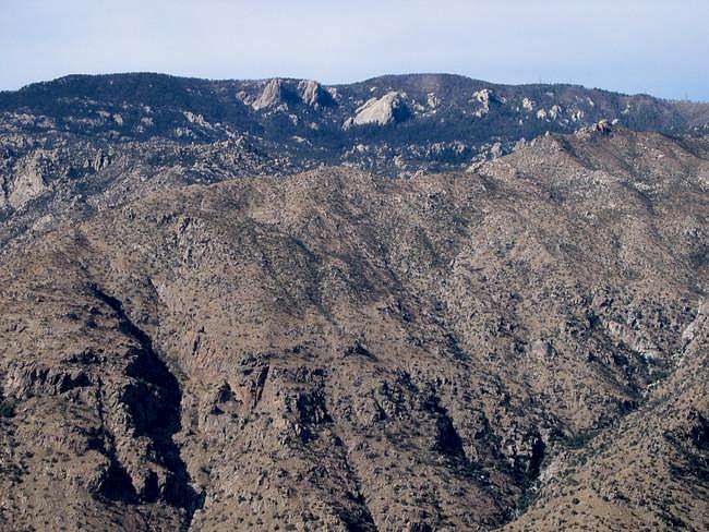 |
Mt. Lemmon (9,157) is the highest peak in the Catalinas. Although a road runs practically to the summit, Lemmon still boasts an incredible variety of hikes and climbs. |
 |
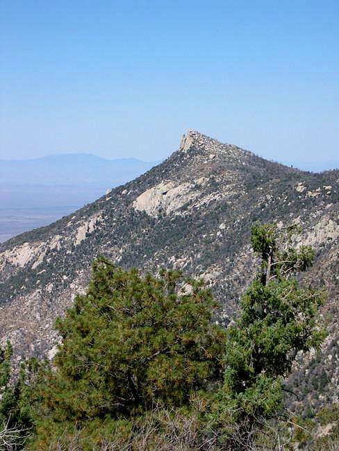
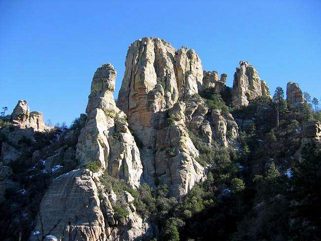
The jagged peak of Cathedral Rock (7,957) is the fourth-highest in the Catalinas, and almost certainly the most difficult to climb by its regular route, which involves a fifteen-mile hike. |
 |
Samaniego Peak (7,700) is the sixth-highest of the mountains here and despite this, is rarely visited. It presents a challenging hike whether you start from the Oro Valley or from Mt. Lemmon itself. |
 |
A huge arch of rock near its summit gives Window Peak (7,468) and Ventana Canyon their names. The hike is long, strenuous, and brings climbers right by the Window itself. |
 |
Finger Rock Canyon cuts up the south side of Mt. Kimball (7,258), one of the highest peaks along the southern front of the Catalinas. An excellent trail leads to its wooded summit. |
 |
Prominent Point (6,628) rewards climbers with a trail-less, painful scramble through desert vegetation and up crumbly cliffs. Despite the unimpressive name, the climb is a difficult one. |
 The spire of Finger Rock (6,420) juts from the mass of cliffs comprising Prominent Point, just down and east of the summit. The route to the top is technically moderate but very exposed. The spire of Finger Rock (6,420) juts from the mass of cliffs comprising Prominent Point, just down and east of the summit. The route to the top is technically moderate but very exposed. |
 |
The aptly-named Table Mountain (6,265) offers a moderate bushwhack on one side and serious multi-pitch trad routes on all others. It’s the furthest west of the major peaks. |
 |
Thimble Peak (5,323) towers over the east wall of Sabino Canyon. It’s a short, steep scramble with a 5th-class rock cap to be scaled before you can reach the summit. |
 |
UN 4910, “The Cleaver” is a jagged wedge of rotten rock that sits at the very west edge of the Catalinas, overlooking Pima Canyon to the east and the Oro Valley to the west. |
The Highest Catalina Summits
| Rank | Peak | Elevation | 7.5 minute Quadrangle | ||
| 1 | Mount Lemmon | 9,157 | Mt. Lemmon | |
|
| 2 | Mount Bigelow | 8,540 | Mount Bigelow | ||
| 3 | Marshall Peak | 8,300 | Mount Lemmon | 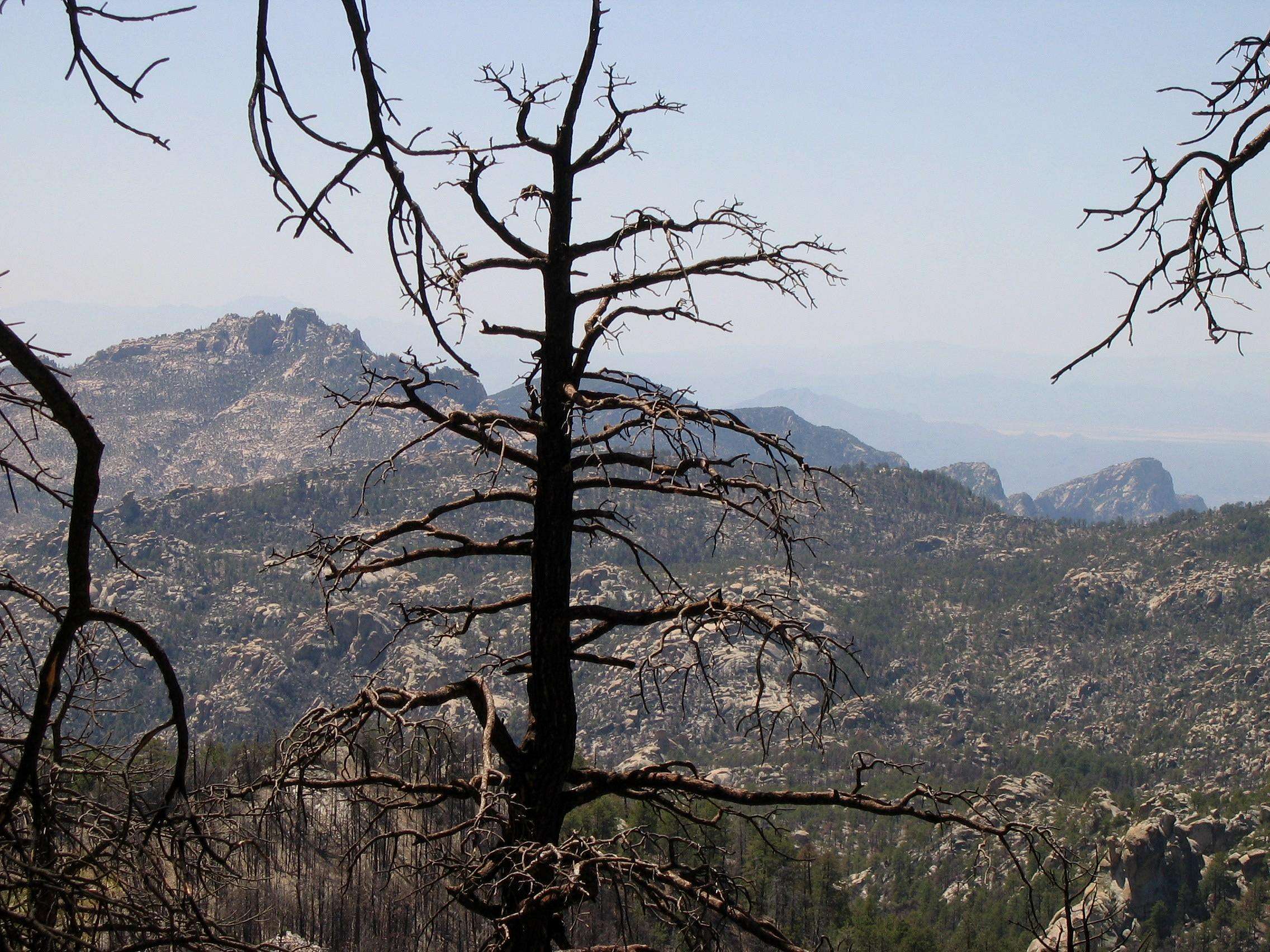 |
|
| 4 | Cathedral Rock | 7,957 | Mount Lemmon | |
|
| 5 | Green Mountain | 7,904 | Mount Bigelow | 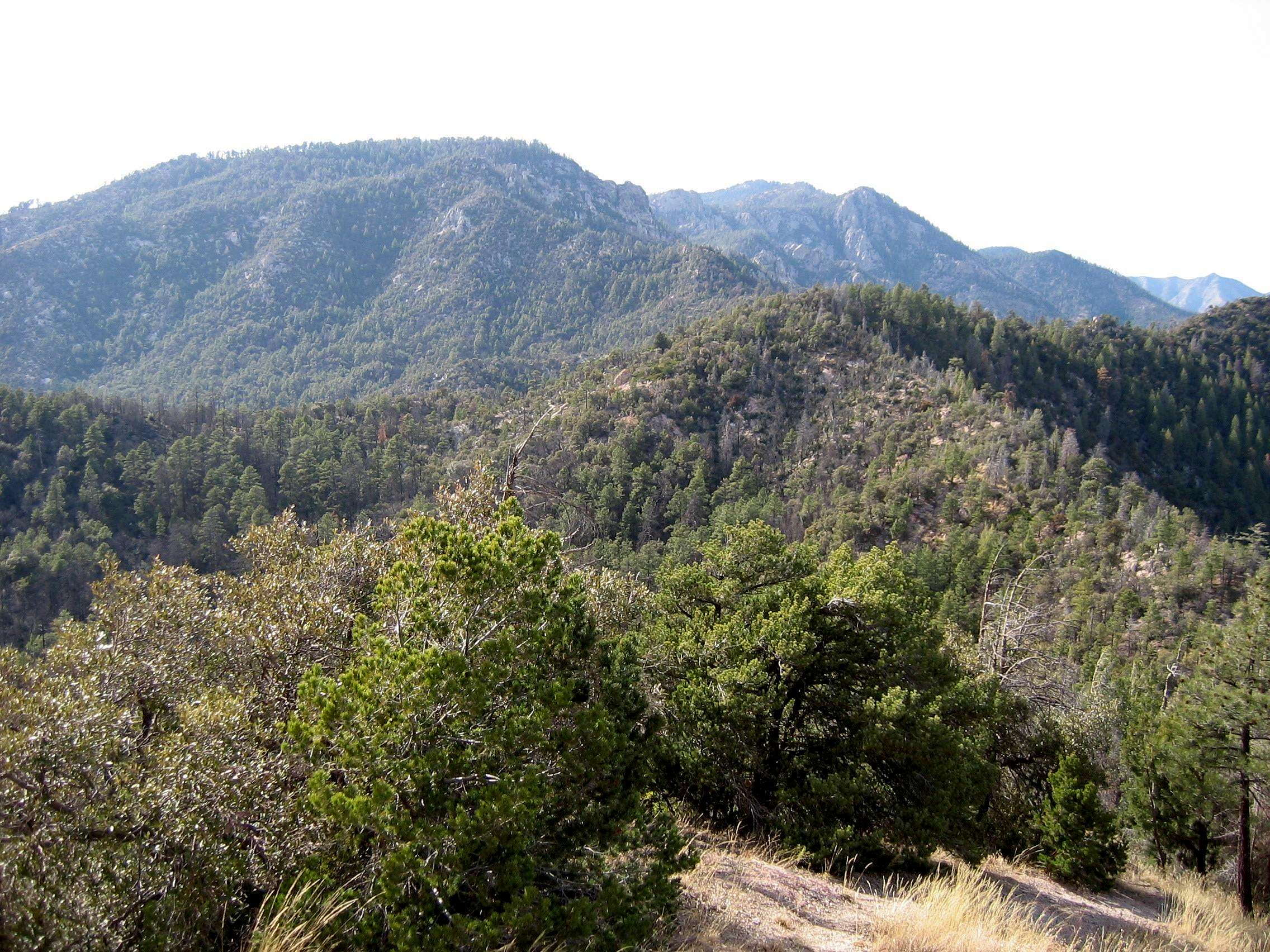 |
|
| 6 | Samaniego Peak | 7,700 | Mount Lemmon | |
|
| 7 | UN 7693 | 7,693 | Mount Bigelow | ||
| 8 | Window Peak | 7,468 | Mount Lemmon | |
|
| 9 | Rose Peak | 7,303 | Mount Bigelow | ||
| 10 | UN 7281 "Guthrie Mountain" | 7,281 | Mount Bigelow |  |
|
| 11 | Mt. Kimball | 7,258 | Oro Valley | |
|
| Mule Ears | 7,060 | Mount Lemmon | |||
| 12 | Rattlesnake Peak | 6,653 | Sabino Canyon |  |
|
| 13 | Prominent Point | 6,628 | Tucson North | 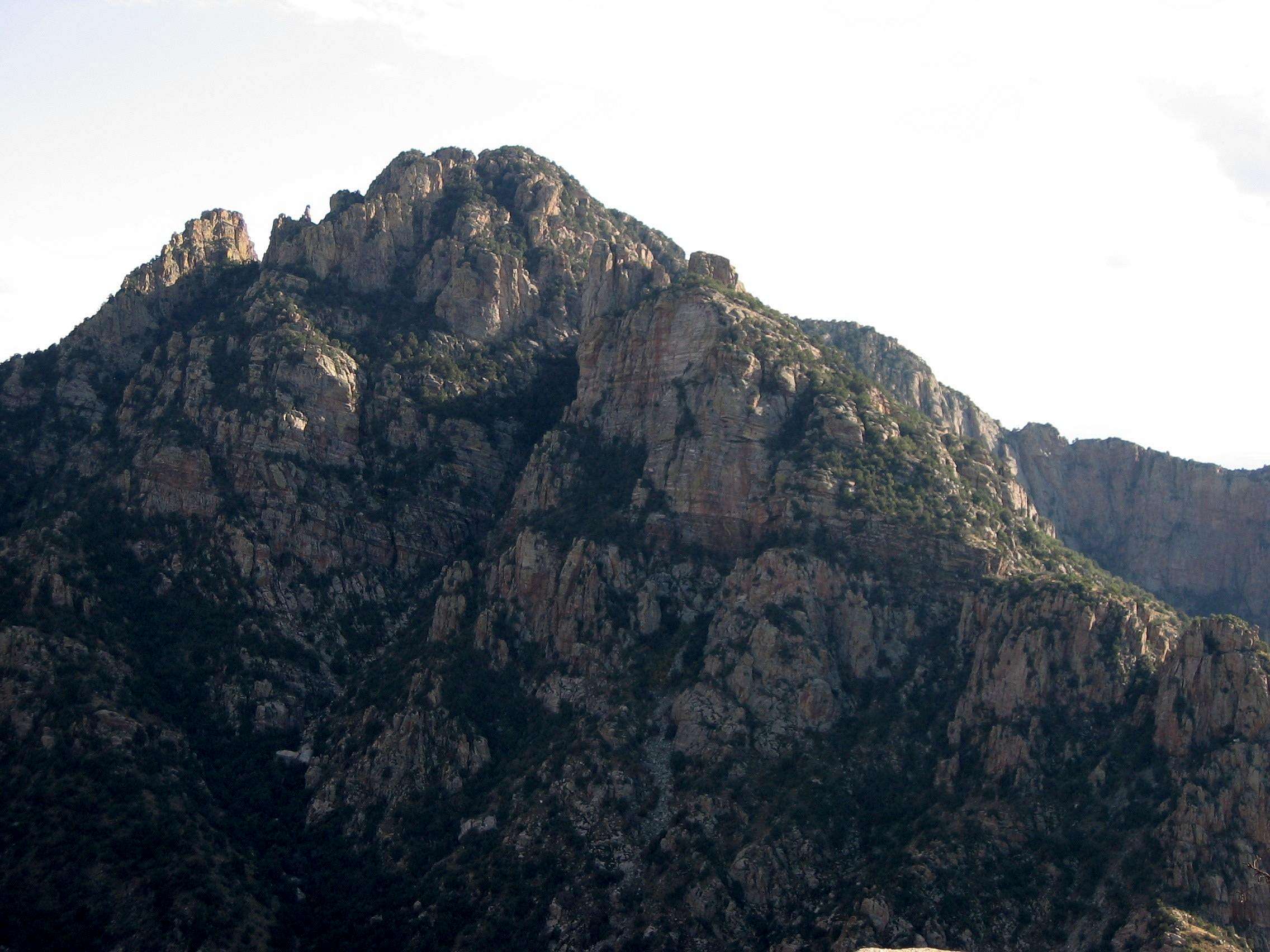 |
|
| 14 | UN 6512 | 6,512 | Agua Caliente Hill | ||
| 15 | Apache Peak | 6,441 | Oracle | ||
| Finger Rock | 6,420 | Tucson North | |
||
| 16 | Table Mountain | 6,265 | Oro Valley | |
|
| 17 | UN 6191 | 6,191 | Agua Caliente Hill | ||
| 18 | Airmen Peak | 6,100 | Agua Caliente Hill | 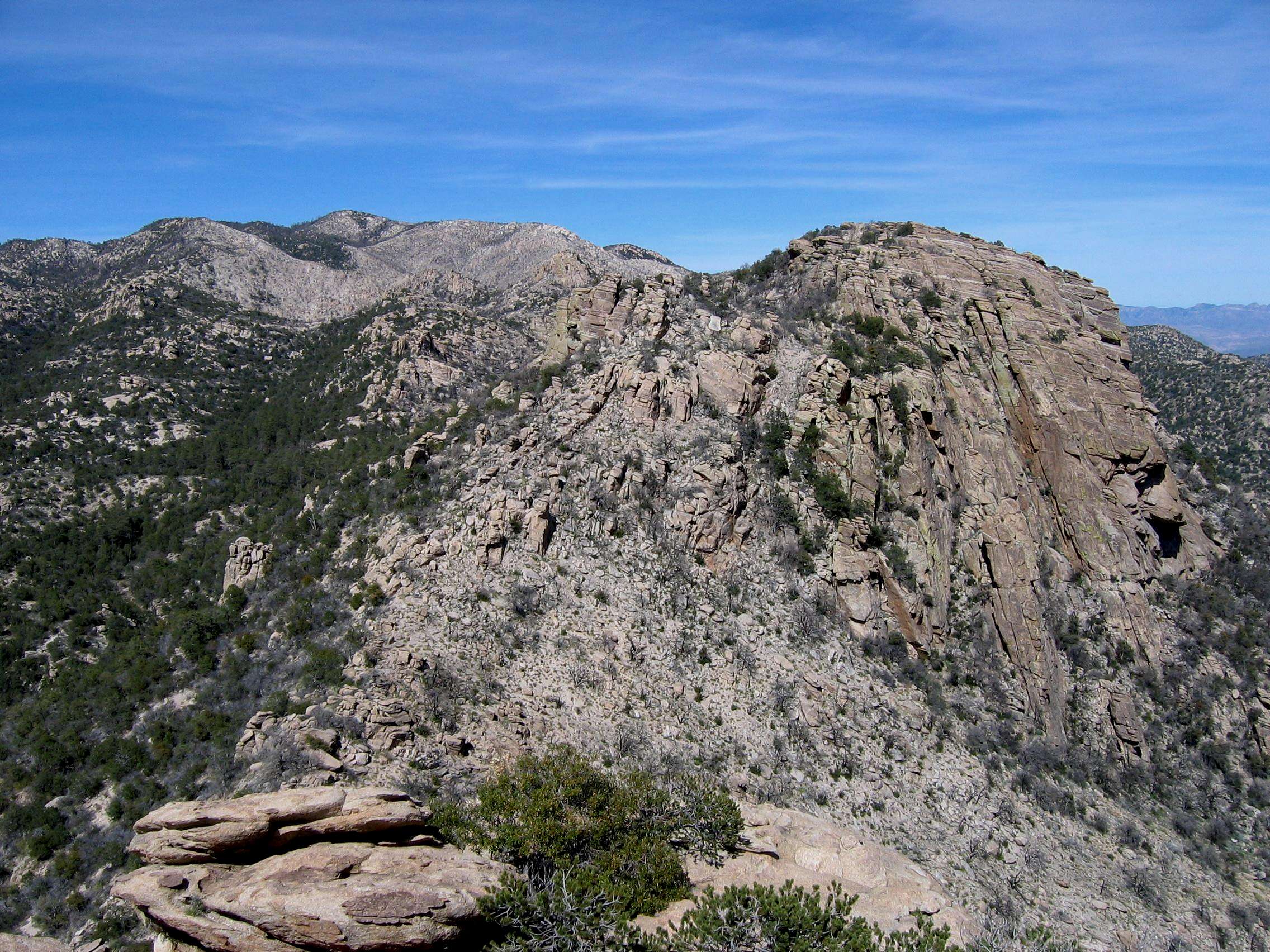 |
|
| 19 | UN 6060 | 6,060 | Mount Bigelow | ||
| 20 | UN 6053 | 6,053 | Mount Bigelow |
Clicking on the small picture by a peak will take you to a picture of that peak.
Clicking on an underlined peak will take you to that peak's page on SummitPost.
An elevation in red is interpolated.
A more expansive list of the Catalina summits can be found here.
The Santa Ritas
The Santa Rita Mountains lie some forty miles south of Tucson, in an area that’s also called – in somewhat of a misnomer – Madera Canyon. Although not as big a range as the Catalinas, the Santa Ritas boast the area’s highest peak, 9,456-foot Mt. Wrightson. The Santa Ritas are also less visited than the Catalinas; here, there is no road to the top of the mountain. The area is a favorite one among hikers, birders, and all sorts of folks looking to avoid Tucson’s summer heat.
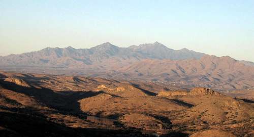 The Santa Ritas, seen from the southwest.
 |
Visible from Tucson, Mt. Wrightson (9,456) is the highest peak in the area, and a good day’s hike from the trailhead. 360-degree views can be found on the small summit. |
 |
UN 9146, Mt. Ian, is Wrightson’s slightly lower neighbor. Though the off-trail hiking necessary here is minimal, Ian is often bypassed by those intent on the peak to its south. |
 |
Josephine Peak (8,478) is the southern neighbor of Wrightson. Though a fine hike with excellent views of the southern Arizona desert, like Mt. Ian it is seldom climbed. |
 |
A jagged mass of rock, Elephant Head Peak (5,640) stands guard at the west edge of the Santa Ritas. Climbers can scramble up the east ridge to its summit or scale the 5th-class west face. |
The Tucson Mountains
Of the four ranges surrounding the city that shares their name, the Tucson mountains are by far the lowest. In the heights of the Catalinas, Rincons, and Santa Ritas you can often find forests and snow, but the summits of the Tucson mountains do not escape the desert. However, although the climbs are not as challenging, there may be more interesting things to see here; rock art, Hohokam ruins, and old copper mines dot the slopes and passes of the Tucson mountains.
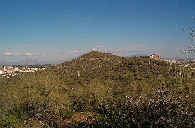
 The Tucson mountains at sunset.
 |
Wasson Peak (4,687) is the high point of the Tucson Mountains, with great views of the area. A hike to the summit takes one past old mine tunnels and ancient petroglyphs. |
 |
Golden Gate Mountain (4,288) is a rugged jumble of boulders with no trail to the top. It’s been the backdrop for scenes in a number of old Westerns; in one, acres of desert were burned. |
 |
Tumamoc Hill (3,108) lies just west of downtown Tucson. Despite the proximity to the city, this is a nice (and fairly little-known) hike with rock art at the summit. |
 |
Sentinel Peak (2,887) is also called “A” mountain in reference to the huge University of Arizona “A” standing out on its flank. Like Tumamoc, it’s just west of the city. |
The Rincons
The Rincon Mountains, east of Tucson, are a huge massif made up of a few broad peaks rather than a large, complex range of small summits. The Spanish word “rincon” means “corner,” but it is unclear how this range received its name. Unlike the Catalinas, the Rincons have no major access road, so all climbs must start low and far away from the summits. Lack of access causes a lack of traffic which continues to keep the Rincons a local hiking favorite.
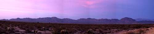
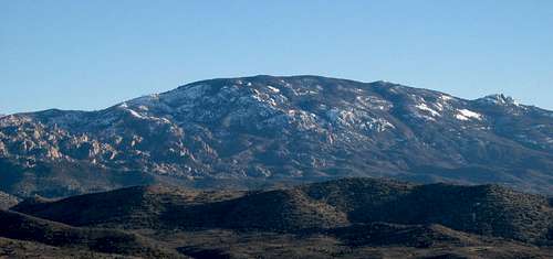 The Rincons in winter.
 |
It's over a veritcal mile to the top of Mica Mountain (8,666), tallest of the of the Rincons. A hike to the wooded summit takes you through some beautiful country and can be done as a backpacking trip. |
 |
Rincon Peak (8,482) is the second highest mountain in the range that bears its name. No matter where you start from, it’s a very long hike to the windy, rocky summit with its giant cairn. |
Other Tucson Area Peaks
There are a few mountains on this list which do not fall into any of the major Tucson ranges but are still fairly close to the city (within an hour’s drive or so). They are: Baboquivari Peak, Elephant Dome, Ragged Top, and Castle Rock (Peña Blanca).
 Mendoza Canyon
 |
Baboquivari Peak (7,730) is a climber’s mountain and has some of the biggest walls in the state. The easiest way up is fifth-class, and the mountain boasts a number of excellent multi-pitch routes as well. |
 |
Castle Rock, or Peña Blanca (4,505) lies just north of the Mexican border. It’s an impressive crag with a short access hike but a tricky scramble to the summit. |
 |
Like Baboquivari, Elephant Dome (4,660) has no easy way up. It’s located in beautiful Mendoza Canyon and its walls hold a number of interesting climbing routes from 5.4 up to 5.11. |
 |
The craggy profile of Ragged Top (3,907) is visible from many points in the Tucson and Catalina Mountains. Although it looks intimidating, there is a fairly easy way to the summit. |
Red Tape
Many of the Tucson area peaks are in recreation areas or other fee zones. The fees are usually fairly minimal; please see the individual mountain pages for conditions on any particular peak.
When to Climb
Though climbing in the Tucson area can be done year-round, spring and fall are generally the best times. Higher summits such as Mt. Wrightson and Cathedral Rock may be cooler in the summer, but the approaches through lower elevations and desert will not be. Likewise, these higher peaks often collect snow and even ice during the winter, although days with good weather and conditions are certainly possible.
 Cathedral Rock from near the trailhead.
Hazards
The many dangers common to other peaks in other areas are applicable here as well. In addition, there are a number of hazards especially particular to southeastern Arizona.
The first and most obvious is heat; here, it can be a killer. Everyone's heard the catchphrase "it's a dry heat" - in fact, this probably should be on the AZ license plate. But although the low humidity makes 100 degrees more comfortable here than it would be out East, there's a danger. The severe aridity dries perspiration to the extent that you may not even realize that you're sweating buckets until it's too late. Bring a lot of extra water when climbing here - you won't be sorry you did. I'd recommend leaving some in your vehicle or at the trailhead as well, just in case you run out during the climb.
The Tucson area - the Santa Catalina area in particular - is home to a number of mountain lions. At times, Sabino Canyon has been closed due to the aggressive behavior of these lions. I have personally had an encounter with a lion on a peak between two heavily used Catalina trails. Rattlesnakes can also be found in the Tucson area. If you choose to hike or climb here, take the necessary precautions!
It's recommended that if you see a mountain lion you try to make yourself look as big as possible so that the cat won't consider you prey. Fan out your jacket, stand up, wave your arms. Throw stuff at the lion if you can. If it attacks, don't play dead - cats kill to eat! Fight back.
With rattlesnakes the general rule is don't bother them and they won't bother you. Almost everyone who's been bitten by a rattler stepped on it or right next to it. So watch your step, especially during warm days in the lower elevations - rattlesnakes often like to bask out in the sun here.
The cacti and other sharp plants here present problems as well. If you stay on paths the damage will be minimized, but if you're climbing to an off-trail summit - like the Cleaver or Prominent Point - then prepare to bleed. While long, thick pants can help, some of the foliage here (like the broad-bladed yucca) can punch through clothing as easily as they punch through skin.
A final danger is presented by loose rock. True, you can find loose rock many places, but enough of the spires here are composed of it that the rock type has acquired the popular nickname: "Arizona desert junkoid." While there is some fine granite to be found - on Mt. Lemmon and Baboquivari Peak, for example - loose rock is a severe danger in many places. Some of the worst of it is clustered along the front of the Catalinas, on peaks such as the Cleaver, Shark's tooth, Table Mountain, and Window Peak.
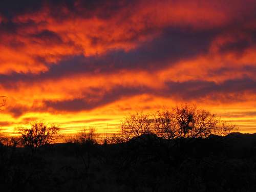 Tucson sunset.
Request for more information
If you have information about this area that doesn't pertain to any of the other sections, please add it here. Don't be shy. I'll get to it as soon as I can and include it in the page if it's pertinent.
Dean - Nov 10, 2006 1:36 pm - Voted 10/10
Prominence PeaksThis map shows the prominence peaks that Arizona has and many are in the Tucson area. There are some of us chasing these peaks. So many great things to see and do in the Tucson area.....
Andinistaloco - Nov 13, 2006 9:46 pm - Hasn't voted
Peaksinteresting stuff, thanks!