High-Altitude Experience on Cotopaxi
“Tracy! Focus on me. One foot in front of the other. We’ll take it slow, you’ll be okay, but we have to go down now.” Jason stated in a calm, but strong, manner.
“I can’t breathe. I need to lie down.” Tracy sputtered through labored breathing, as she slumped to the ground, lying parallel to the frozen surface of the summit of Cotopaxi at 19,347 feet above sea level.
Similar scenes had played their course through by mind in the months leading up to my first high-altitude climbing trip. Void of personal high-altitude experience above 14,400 feet, my role-plays developed heroically, as if altitude sickness were a demon to be crushed on the way to each summit. The real experience was sharply different—it was scary.
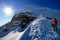
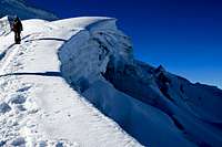
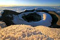
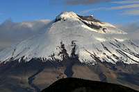
From the summit of Cotopaxi, we stared down icy, 50-degree slopes that cascade mercilessly into dark crevasses. Jason, Wynn and I felt solid and strong. We had assumed Tracy felt the same way. She had never spoken to the contrary, and she had kept pace. We reached the summit in less than 5 hours. Yet after 5 minutes of rest on the summit, we fell from our summit-induced euphoria upon seeing Tracy down on the snow, knees to her chest.
Her symptoms were difficulty breathing, excessive cold, burning lungs, confusion, lack of coordination and an overwhelming sensation to sleep. We shortened the ropes to steady her balance, and calmly talked her through our plan to descend quickly. During this descent preparation she laid down twice and stumbled over her crampons. Between us three, no words were necessary, our eyes communicated our emotions. In the eyes of Jason and Wynn I saw concern, yet calm control. I’m not sure what they saw in my eyes, but I can tell you it wasn’t calm and it wasn’t control.
With aspirations to climb big mountains outside the western United States, I had come to Ecuador to gain high-altitude experience, in a non-technical environment, with local friends who had amassed far more high-altitude mountaineering experience than I had. Now immersed in the real battle, I was forcefully reminded that you get what you ask for—high-altitude experience.
Tracy focused her energy and plodded through each step down the chiseled boot track. Boot tracks have a way of making the ascent a bit less adventurous, but on this descent I was grateful for each person who had stomped this track into the snow. After descending 500 vertical feet, Tracy’s mind was clearing and her coordination was returning. After descending 1,000 vertical feet, it was as though nothing had ever happened. Tracy’s memory of the ordeal was surprisingly limited, but ours was not. She didn’t mention the initial symptoms of altitude sickness for fear of ruining our summit; we three agreed that the summit wasn’t worth such an experience!
Quito and Sunfana (13,665 ft)
Arriving in Quito felt like coming home. My father was raised in Quito during his adolescence, so my youth was filled with bedtime stories about Ecuador. My own South America experience included two years living in Argentina. From that I learned to speak Spanish and developed a deep love for the calm pace of South American life. From the beginning of the trip I loved the country of Ecuador: the people, the culture, the smell and the landscape. It felt like coming home.
We spent a day walking Quito and visiting the Equator. The next day involved traveling to our home base, outside the city of Machachi, and hiking a 12-mile loop to the 13,665-foot summit of Sunfana. We labored to finish this summit through a stiff rainstorm and occasional lightning. Just as we reached the top, the cloud cover dissolved to reveal a spectacular sunset reflected on the flanks of Ruminahui and Cotopaxi. Our descent from Sunfana continued into the night where we stumbled upon a small herd of cattle, including a raging mother protecting her young. The cow charged us as we dived through a barbed-wire fence. Wynn snagged his Gore-Tex shell on a barb, but concluded that was a good trade to the alternative of being trampled.
Iliniza Norte (16,818 ft)
A bit of soreness lingered from the 12-mile loop and the raging cow the previous evening, but with anticipation I joined my gear in the back of the pick-up truck to drive the bumpy road to the Ilinizas.
I never asked how long the approach to the Iliniza climbing hut would be, nor did I know the elevation gain to get there. The lack of information was a blessing. If I had known the dismal distance we had to travel with bulging 50-pound packs, my mind would have defeated me. Everyone else seemed to cope well with the approach; I, on the other hand, was spent, and my left knee was awkwardly painful.
The night in the cramped, musty environment of the Iliniza climbing hut didn’t offer any solace. Our late-afternoon arrival placed us on a small, upper loft next to an unfriendly Russian couple. In addition, my knee continued to produce sharp, consistent pain. After all my preparation and training was I falling apart on the second mountain? I had all night to think about it because it was impossible to sleep. I climbed down the loft at 1:30 a.m. to chat with some friendly guys from the United States, preparing to climb Iliniza Sur. Finally, the sun rose to reveal the damage from an overnight storm. The snow totaled nearly two inches; yet, the sun was out and the strong winds had calmed. We took it as an invitation to continue!
Iliniza Norte was a blast. The scrambling was easy, although a bit more interesting with the snow cover, and the terrain was stunning as we spotted our friends on Iliniza Sur and viewed the major volcanoes on all sides. We made it up and down quickly, just as clear skies gave way to cloudy ones. I descended back to the parking lot in extremely slow fashion to save my knee further damage.
Cayambe (18,996 ft)
Back-of-the-pick-up-truck transportation was now quite common for us, but we couldn’t tolerate it on our four-hour trip to the Cayambe climbing hut. We instead found a van that took us to the city of Cayambe, and then contracted a small truck to travel the rocky, difficult road to the hut. Although our driver promised the truck could make the road to the hut, it could not, so we huffed our duffel bags over a mile to the hut. Fortunately, the Cayambe climbing hut is a resort paradise compared to the Ilinizas.
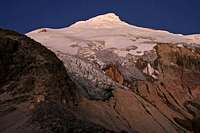
Jason left that afternoon and climbed the first 800 vertical feet of the route to scope the conditions on the glacier. After that, we rested outside as the sun faded into the horizon. Watching the colors of the sunset illuminate the rugged glaciers of Cayambe is an experience I’ll never forget.
That night, sleeplessness ensued. The weather was good, conditions looked fine, but I was anxious—too anxious. Numerous times I awoke, doubled over in pain from the anxiety eating away at my stomach. My concern was the fast-approaching unknown of Cayambe’s terrain. This mountain can require difficult route finding with a large bergshrund crossing at the top. There was also reported to be blue ice. I couldn’t sleep. We prepared at midnight and left a half hour later.
As we walked out the hut door, I felt comfortable enough with my teammates to unveil my emotions and ask Wynn if he ever felt such crippling anxiety. “Yeah.” was the answer. At least I wasn’t alone. My fears proved false as we traveled docile 25-degree ice, 30-45 degree snow, crossed over 8 narrow crevasses, and found the bergschrund to be choked full of snow with a large, stable snow bridge. I can’t imagine this mountain could be found under more favorable conditions.
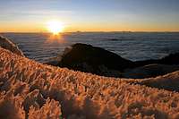
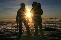
Sunrise on the summit brought a fierce, bitter wind that coated us in ice, but we were safe and happy. On the summit I felt absolute peace and satisfaction. The surrounding scene was unbelievable in its beauty. What a difference from my overnight anxiety. That experience only sweetened the euphoria of the summit. This was fun!
Otavalo
Our continuing agenda included an overnight stop in the cultural city of Otavalo. The hotel was quaint and comfortable, and the shower produced steady, hot water. What more can you ask for?
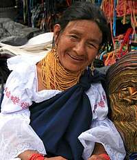
We visited the bustling Saturday market to meet some of the most colorful and beautiful people I have ever seen. The native dress for the women combines black skirts with white blouses. The edges of the clothing are embroidered in red and gold, with similar belts around their waists. Long, gold necklaces are looped ten to twenty times around their necks, with matching red bracelets on their wrists.
As charming as the clothing was, it was overpowered by the kind eyes, welcoming smiles and deep wrinkles of their faces. These were faces developed in difficulty, but blossoming in simplicity and happiness. You could see it in their eyes. I’ll never forget their eyes.
Cotopaxi (19,347 ft)
After Otavalo, we approached Cotopaxi refreshed and excited. I knew there would be a boot track on this one. Some of the adventure would be erased by the existence of a well-worn path, but so would the anxiety. I was happy to make the trade!
We traveled to Cotopaxi in the same pick-up-truck style as before, and we picked a friendly German hitchhiker/climber who was traveling solo. We were stopped at the gates to Cotopaxi, because our driver lacked the proper documentation to enter the National Park. As flashes of the Cayambe transportation difficulties returned, we found a nice man who makes a living off of helpless foreigners that lack the “Hoja de Guia” necessary to enter the park. He was all-to-happy to help and we were all-to-happy to employ. His truck did break down once, but we got to the hut with the minimal huffing required.
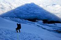
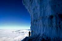
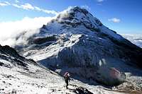
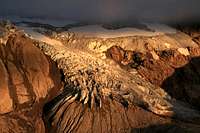
As mentioned above, Cotopaxi produced a new form of anxiety as we helped Tracy down from the summit, but in the end, we reveled in the same peaceful satisfaction of a beautiful summit and a brilliant adventure. The terrain of Cotopaxi was steeper and more rugged than Cayambe. I enjoyed the deep crevasses and overarching seracs. The mountain was stunningly wild and beautiful.
Chimborazo (20,561 ft)
Having gone four-for-four with our summit attempts thus far, we were feeling good as we made the four-hour trip to the Chimborazo climbing hut. Our only vulnerability appeared to be our narrow time frame. Our return flight was a day away, so the weather had to comply.
As we traveled the Pan American highway to Riobamba, this time in the luxury of a 4-Runner that we knew could make it to the hut, I soaked in the towering foothills covered by checkerboard patterns of agricultural fields from top to bottom. I also noticed the sunny skies over Chimborazo turn dark with clouds and an approaching storm.
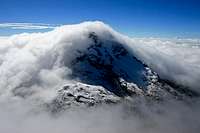
Fog enshrouded the flanks of Chimborazo as we drove up the mountain. My hopes were still high as I watched herds of wild llamas, through my car window, as they scratched at the volcanic dust for vegetation. Yet by the time we hit first hut, snow was falling and the wind began to howl. Nonetheless, we hiked to the second hut and Jason and Wynn hiked up towards El Castillo to view the conditions the best they could.
Our alarms sounded at 11:30 p.m. and we ran outside to scout the terrain. It was still snowing. We made the decision to call it quits, as did another group from Germany. The threat of avalanche and dangerous route finding was too high. A solo client coerced his guide to take him climbing anyway, but they turned around about one-third of the way up the mountain citing very dangerous conditions.
Upon returning home to Utah, my curiosity ached to know what adventure we missed by surrendering Chimborazo. The following was submitted by SPers six days, and one day, before our attempt:
“Was about 1 minute away from getting crushed in a rock/ice avalanche in the rocky section of the Castillo route. Then it was very hard ice in the two steep couloirs on the ridge. Ice axe wouldn't go in and we had to front point up two 50 foot sections. I bonked hard after the steep ice at about 18,000 feet. Unfortunately after the avalanche it was unsafe to go back down so I had to climb up to 19,000 feet so I could traverse across and go down the Whymper route. Why the hell we didn't go up the seemingly much easy Whymper route is still a mystery to me. Local guides didn't serve us well today....” –Moneal
“Chimborazo wasn't in very good condition and in my opinion wasn't that fun when compared to the other peaks I climbed in Ecuador. Lots of falling ice and falling rock on all routes due to the dry weather I guess. The "normal route" El Castillo has been plagued by rockfall. The Wymper Route has falling ice and was shooting baseball size rocks at us.
After reaching some serious avalanche danger (we also heard but did not see a huge avalanche in the dark on the way up), we had to backtrack 1000 feet/300 meters down the mountain (very tiring at almost 20,000 feet or around 6000 meters) and do an icy traverse over to the upper Castillo Route in order and reclimb the elevation lost to reach the Veintimilla summit. It made our elevation gained 1615 meters/5300 feet that day which made me very tired at that altitude. Hopefully conditions will improve. It used to be a straightforward ascent but conditions weren't good for our trip. On the other hand, the weather was great.” –Scott Patterson
Rucu Pichincha (15,728 ft) and Conclusion
As a consolation prize for surrendering Chimborazo, we woke up early to climb Rucu Pichincha for one last summit before our return flight that evening. The mountain provided a relaxing, easy hike with a bit of Class 3 scrambling at the top. The scenery overlooking Quito was spectacular. Our 2007 trip to Ecuador concluded with five summits out of six attempted.
As we waited to board our plane in Quito, we were all smiles recounting our adventures in Ecuador. We talked of our continuing goals to climb Denali in 2008, with a few trips to the Tetons and Wind Rivers in between. Even before we had returned home from this trip, we were already planning the next one. I guess that’s part of the sweet addiction that accompanies the intoxicating taste of altitude.










Comments
Post a Comment