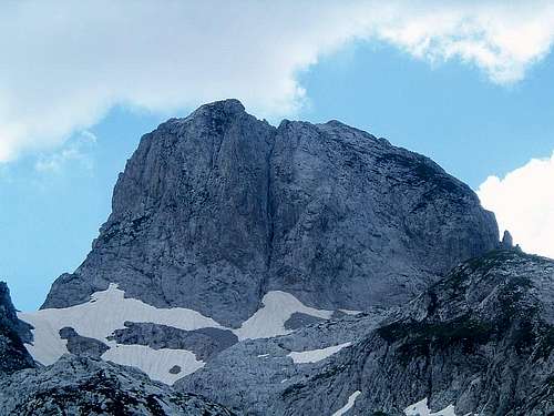
Maja Lagojvet is the highest peak in the amphitheatre of mountains that surround Grbajski Zastan - the highest terrace of Grbaja valley. I have also seen its name spelt Ladojvet, Langojve or Langojvet. Grbajski Zastan is crossed by Montenegrin-Albanian border in the NW-SE direction and Maja Lagojvet, being south of it, is all in Albania. Due to its remoteness and overall difficulty of potential climbing routes, this is perhaps one of the most inaccessible, deterring and challenging peaks of Prokletije/Bjeshkët e Nemuna. Despite its tempting view from the bottom of Grbaja, it only had its first ascent on 31 August 2009 when a route was climbed on its north face.
To the best of my limited knowledge about first ascents in this last unexplored European mountain range, until that day Maja Lagojvet might have been the highest of the unclimbed peaks of the Accursed Mountains. Highest independent unclimbed peak in Europe, outside Caucasus maybe... who knows?
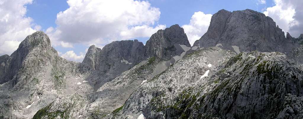
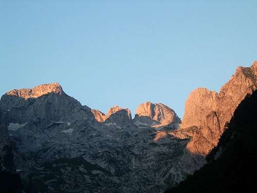
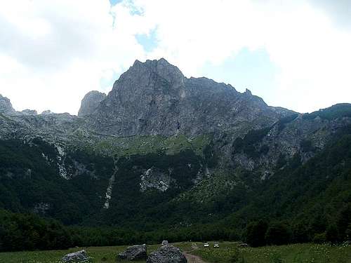
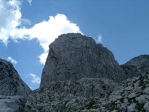
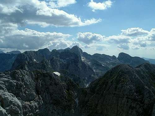
North faces of Maja Lagojvet (right) and two unnamed peaks
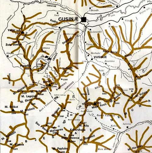
Due to the isolation policy of Albania’s Enver Hoxha’s regime, until early 90’s this was a heavily guarded border and only soldiers and local shepherds ventured into this part of Prokletije/Bjeshkët e Nemuna. Later on the situation in the region became volatile because of the nearby conflicts in former Yugoslavia. Nowadays, despite the border restrictions being lifted and the political situation getting back to normal, several of the peaks in the Zastan amphitheatre are still unclimbed or have gained their first ascents only recently(*), and some are even unnamed yet! Even when it comes to the names of the main peaks, there has been a lot of confusion among hikers and climbers who visit this area. At this page I will do my best to clear those issues, based on available maps, Internet resources and my communication with other mountaineers and local inhabitants.
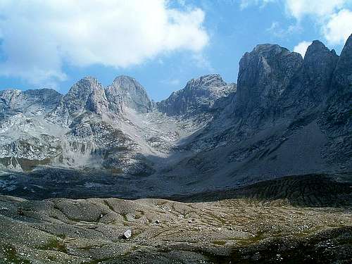
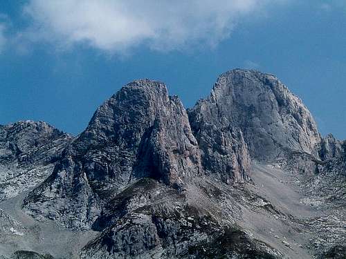
Maja Vukoces (left), some unnamed peaks (middle) and Maja Lagojvet (right).
Maja Fortit is partly hidden near the left edge of the photo.
Photo by Marija Jokanovic
(*) Maja Vukoces (Vukocki Vrh) was first climbed by a Slovenian party in August 2006, see here and here (in Slovenian). The climbers actually thought that its name was Maja Fortit or Maja Koprishtit.
First ascent of Maja Fortit (Forca) was made by Serbian climbers in July 2009. See here and here (in Serbian) and here (in English).
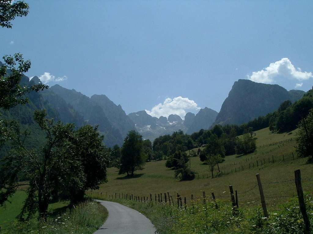
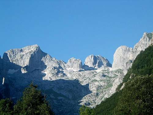
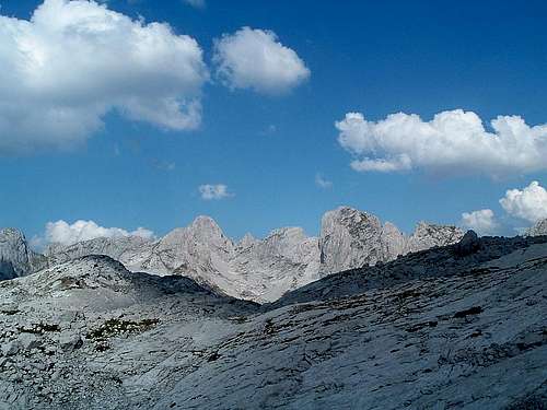
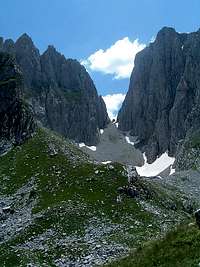
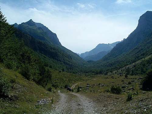
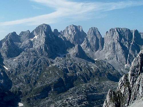
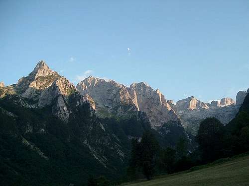
The 'Zastan amphitheatre' seen from the bottom of Grbaja valley.
Left to right: Ocnjak (sharp), Karanfili, Maja Vukoces (broad triangle),
2 unnamed peaks, Maja Lagojvet (in the middle),
unnamed peak, Maja Vojusit, Volusnica
What’s in the name?
As I only know several words in Albanian, I had to resort to online dictionaries and the opinion of my Albanian friend. Maja is ‘peak’ obviously, but neither Lagojvet nor Ladojvet mean anything in Albanian, and my friend said that the name does not sound Albanian at all. The verb largoj means something like ‘move away’, ‘remove’, ‘keep away’, ‘separate’, and the mountain is indeed very remote and it is also separated from its neighbouring peak by a very prominent col. On the other hand many Albanian local names in this area are of Slavic origin. Then the name might be derived from Serbian ledovi (‘ices’, plural of led which means ‘ice’) - something like ‘Icy Peak’ (compare Ľadový štít in the Tatras in Slovakia). There is some snow and ice below its north face even in summer so this ethymology can be justified too. Or it can be both - Remote Icy Peak - sounds cool, ain’t it? :) Later on I came across other alternative spellings Langojve and Langojvet. My friend came up with a following explanation: langua = 'hunting dog' (singular), plural langojte, and genitive i, e langojve. Another possible meaning is therefore Hunting Dogs Peak.
By the way, Maja e te fortit means 'the peak of the strongest', so Boris, Peđa and Steva (first ascenders of Maja Fortit), you are The Strongest Guys!
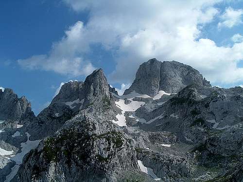
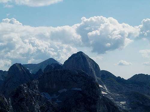
Maja Lagojvet north face (right) and three unnamed peaks:
one (sharp) to its left, 2nd behind it and 3rd far left
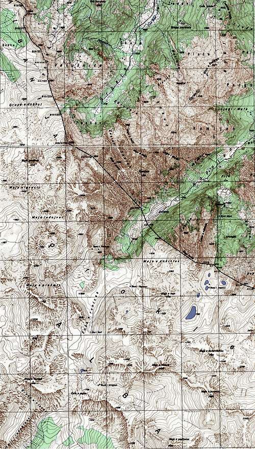
Topography
The Yugoslavian military map from the 70’s gives 2466 m as the height of Maja Lagojvet. A GPS reading during my reconnaisance trip in July 2008 at the base of its north face was 2380 m. In August 2009 during our first ascent I set my watch altimeter based on that and measured the altitude of the summit as 2540 m. This might be not an accurate value but is certainly more reliable than the values given on old maps.
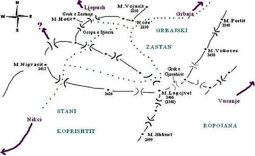
Rough sketch map (click for description)
Old ridge map
Old military map
Maja Lagojvet is well visible on the skyline from the bottom of Grbaja valley in Montenegro. Some sources, including the panoramic picture on the inside wall of Branko Kotlajić hut in Grbaja, mistakenly call it Maja Shkurt, while the name Maja Lagojvet is sometimes mistakenly given to one of the peaks with unknown names to its east.
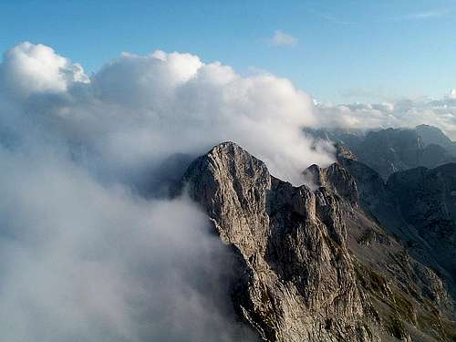
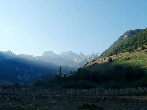
Zastan amphitheatre in sunrise alpenglow...
...and in morning sunshine
Maja Shkurt is actually another peak south of Maja Lagojvet, invisible from Grbaja. Its height is quoted as 2499 m but the view from Maja Lagojvet summit proves that M. Lagojvet is higher than M. Shkurt.
Maja Lagojvet and Maja Shkurt from SW
Maja Shkurt from Maja Lagojvet summit
Knowing the state of cartography of this area, no map can be fully trusted. In Prokletije you have to rely mainly on your own sound judgement. For off-trail hiking and mountaineering good orientation skills are necessary. In emergency you can probably rely only on yourself and your partners, as a signal from mobile phone networks can only be caught in very few places, mainly at summits.
Getting there
For instructions how to get to this part of Montenegro and Albania see the Getting There section of the Prokletije main page.
In the following section I will describe how to reach the bases of north, south-east and south-west faces of Maja Lagojvet that are situated in the valleys of Grbajski Zastan, Ropojana and Stani Koprishtit, respectively.
Getting to Grbajski Zastan from Grbaja
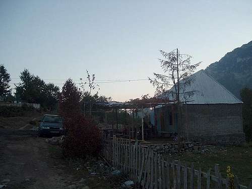
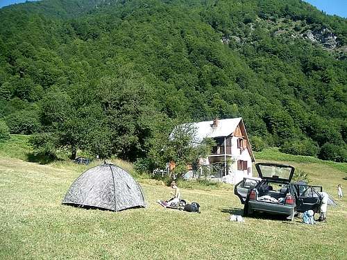
Grbaja is connected with the town Gusinje with a narrow asphalted road which turns into a bad dirt road (passable by an ordinary car with some difficulties most of the time) towards the end of the flat part of the valley that is called Treća Livada (Third Meadow). Near the end of asphalted road there is Branko Kotlajić hut (open only when inhabited by members of Radnićki mountaineering club from Belgrade) and Eko-katun (restaurant and simple accommodation in bungalows). You can take water there. Last permanent water spring is further up the road to your left.
Grbajski Zastan from Grbaja
Arrow sign
Fork in the trail
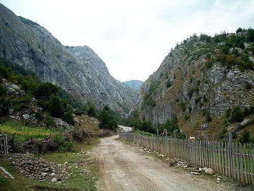
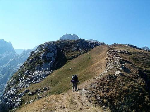
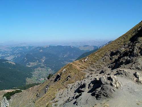
From Treća Livada there is one trail leading to the lower part of Grbajski Zastan. Find the stone with a pole with arrows. (*) Follow the arrow showing ‘V.Kotao-Snježnik’ to your left (facing south). The beginning of the trail is not marked and may be difficult to find - look for the most obvious path entering the forest. After several hundred metres you should find a fork in the path with a red mark on a stone. The path going left (to Veliki Kotao and Snježnik) may have branches lying across it, as if saying ‘do not go there’. And that’s right - take the path going right. From now on there will be some scarce red marks on trees and stones. The path is very steep, sometimes you have to use stones and trees as handholds, especially if you carry a heavy backpack. In one place there is a rope that you can use as a handrail that was left there by a Polish caving expedition.The marked path ends at the upper edge of the forest. Getting here may take from 1 to 2.5 h depending on your fitness and weight of your pack. (The above info refers to summer 2009, the state of the trail may change!) From there you have to keep the SW direction, more or less paralelly to the walls of Karanfili to your left, sometimes using a hardly visible trace of a path. Shortly above the forest there is a water spring near a big boulder (sometimes marked with two upright sticks) that is however likely to get dry at times. Further up you will see a V-shaped col to your left (Ropojanska Vrata) that separates Karanfili from Maja Fortit. Start changing your direction slightly towards the middle of the slope, towards a characteristic nose-shaped rock face, choosing the best passages. Reach the base of this face, turn left along it and then you can descent slightly, looking for a place to set a camp. From Treća Livada it took us about 6 h to get here when we carried about 35 kg each. When going light you should cut this time by half. There is no water here but even in summer there is usually some snow that can be melted.
End of marked trail
Ropojanska Vrata
Nose-shaped peak
(*) There is another arrow showing ‘Zastan (Peskovi)’. It probably shows an old trail that was still (barely) passable in 2005 and some faded red marks were still visible (see the trip report). It used to connect with patrolska staza (patrolling path) above the treeline below the north face of Maja Vojusit, where another water spring could be found. However, when I tried to find this trail in 2008, the path was nonexistent and completely grown over with lush vegetation, although I found some traces of red marks on stones (see the trip report). One more arrow showing 'Vojuša' may refer to some path leading to the right of Treća Livada towards the peak of Vojuša/Maja Vojusit and eventually connecting with patrolska staza. I tried to find it back in 2008 and there were some confusing traces of paths there that soon disappeared in the forest. I don’t know if that trail actually exists and how passable it is.
False trail
Old trail mark
Getting to Grbajski Zastan from Bordolecit/Ljepush
Border crossing at Grnčar/Bashkim
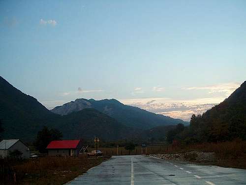
On the road from Bashkim...
...to Bordolecit
Grbajski Zastan can be reached also from Albania, from the village Bordolecit/Ljepush. To get to Bordolecit (Predelac in Serbian), at Gusinje (Montenegro) take the road to Grnčar/Bashkim (border crossing with Albania), after crossing the border follow the gravel road and after about 2 km turn left. Another 10 km of gravel road leads to Bordolecit. Or you can cross the Montenegrin/Albanian border at Hani i Hoti and follow about 50 km of gravel road via Tamara to Bordolecit. Ljepush is another 5 km from Bordolecit. All those gravel roads should be passable for ordinary cars if you drive slowly and carefully, but go at your own risk if you haven't got a 4x4.
Bar at Bordolecit
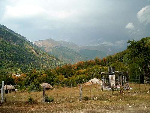
Bordolecit
Ljepush
From Ljepush take a path to the shepherds’ settlement called Paje and then towards Zastan. Orientation may be difficult but the local inhabitants will be happy to show you the way. From Ljepush it should take 3-6 h depending on your fitness and weight of your pack.
Above Ljepush...
...on the way to Zastan
Zastan and Maja Lagojvet
Getting to Ropojana from Vusanje
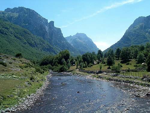
From Gusinje follow the road to Vusanje and leave your car there. Follow the dirt road to Ropojana valley, cross the border with Albania by the lake (periodically dry) and follow the path to the shepherds’ settlement Buni i Runices (2-4 h from Vusanje). Free camping is possible there and the shepherds would show you where the water is.
Ropojana at Vusanje
View towards Albania
South-east face of Maja Lagojvet has not been climbed yet and I have no information how to reach its base from Ropojana. The approach route is probably difficult and dangerous due to loose rock. If attempting it, you must find your own way!
Getting to Stani Koprishtit from Nikci
I have not been at that part of Prokletije neither by car nor on foot, so I would be grateful to fellow SP-ers for any info about the roads to Nikci and the details of passage from the village to Stani Koprishtit valley. This map can be of some help. According to the info here I understand it should also be possible to hike to Stani Koprishtit directly from Bordolecit/Predelac.
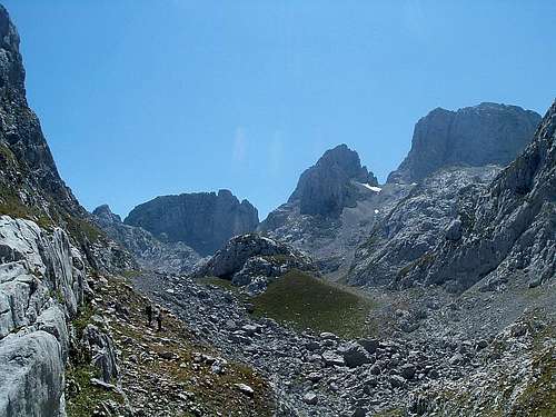
From Nikci follow shepherds’ paths to Stani Koprishtit. Free camping is possible there but probably there are no water springs and most summers there may even be a problem with finding snow. Find your way across the valley (more like a great flat-bottomed cauldron) to the bottom of well-visible south-west face of Maja Lagojvet.
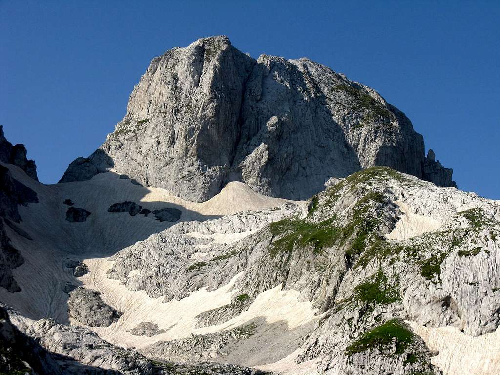
Maja Lagojvet and Maja Shkurt
from Stani Koprishtit
Stani Koprishtit can also be reached from Grbajski Zastan via two cols and a valley in the middle - see map. It is more convenient to cross the western col rather than the one just below Maja Lagojvet. The ascent of the col leading to Stani Koprishtit (below Maja Nigvacit) from the side of the ‘nameless’ valley requires a good deal of scrambling (UIAA I-II) and is difficult especially if you carry a heavy pack.
Valley between Zastan (right)
and Stani Koprishtit
'Nameless' valley
and Maja Nigvacit
It is likely that the low col at the end of the 'nameless' valley (see photos above) may be easily accessible from the valleys and villages below (see the question mark at the map) but I have no info about that route.
South-west face of Maja Lagojvet has not been climbed yet and I have no detailed information about it. If attempting it, you must find your own way!
Climbing possibilities
To the best of my knowledge, Maja Lagojvet has been climbed only once by us via its north face, and there is no non-technical access to its summit. It has three faces with a potential for many climbing routes. The mountain resembles a tower and it does not have ridges in a strict sense. We might rather speak of edges or pillars that are probably extremely chossy anyway.
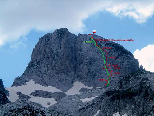
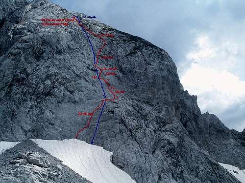
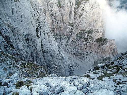
North face of Maja Lagojvet
North face towers above Grbajski Zastan and is about 160 m high. It is split in two parts by a chimney in the middle. In my solo attempt in August 2008 I tried a line just right of the chimney but had to back off from the first pitch due to lack of time and gear. On 31 August 2009 we successfully climbed a route in the middle of the right-hand half of the face that tops at the little col just left of the main (western) summit. The eastern summit, seemingly higher when looking from the bottom, is in fact lower. The ridge between them looks extremely eroded and dangerous. We only went to the main summit without climbing that ridge to the lower one. In our attempt we tried to find a compromise between accessibility and rock quality (safety). The result is a route that has one hard but relatively safe and well-protected pitch in its lower half and several pitches of choss fest from hell in the upper half. My preliminary scouting showed that the north face should be the easiest side, but it is difficult to tell whether there are any easier and/or safer lines to be climbed on this side of Maja Lagojvet. The chimney might be an option but chimneys, especially those facing north, are usually wet, rotten and nasty by nature. And any route in the middle or left-hand part of the face would involve climbing the rotten summit ridge if you’d like to climb the main summit. In good weather and with right preparation a climb and return can be made within one day if you camp at the highest part of Zastan.
See also the page of our route ‘Balkans Peace Park’ (7 pitches, UIAA VII- A0/AF) and the trip report about our climb.
Topo 1
Topo 2
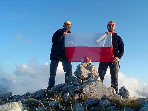
At the summit
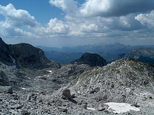
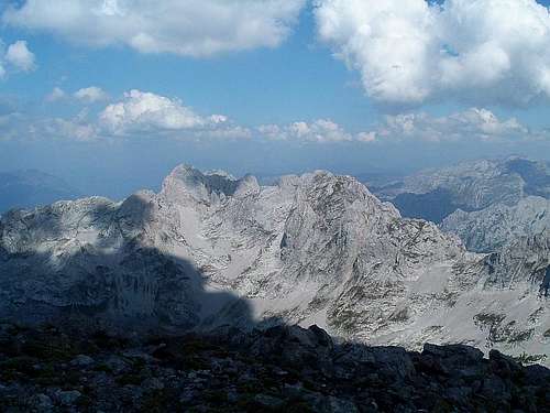
South-east face, judging from the photos taken from a distance and from the summit view, is a more complicated story. In fact, we could rather speak of separate south-east faces of the main summit and the eastern summit. Based on the summit view, the east summit face consists of good quality rock, and could even be the most interesting possibility of climbing the lower summit. The main summit face is of unknown, possibly also good quality. Between them there is a large and steep depression consisting mainly of choss rather than solid rock. An attempt to climb it would be probably very dangerous. The details of approach to the south-east face of Maja Lagojvet from the bottom of Ropojana are unknown. It probably involves dangerous scrambling and/or climbing on scree and loose rock. I presume it might be also possible to reach the base of the face from Zastan via the col Gruk e Gjavahirit (see map). We scrambled to this col from Zastan (loose rock and slippery snow/ice), looked down and saw plenty of scree and loose rock as well. We did not properly investigate the further way down or round the bottom of the face. South-east face has not been climbed yet. I estimate its height for at least 250 m, plus the massive scree fields below it.
SE faces of Maja Shkurt, Maja Lagojvet
and some unnamed peaks
Bottom part of SE face of eastern
(lower) summit of Maja Lagojvet
Top of SE face of eastern summit
and walls of unnamed peaks
South-west face looks like the one that offers some good (and difficult) climbing. It is probably about 250 m high. Any route would lead exclusively to the main summit. Also the approach is the most difficult logistically (see above). Its final part may involve dangerous scrambling on scree and loose rock. This face has not been climbed yet either.
South-west face of Maja Lagojvet (right)
Accommodation and camping
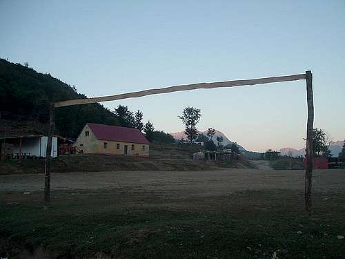
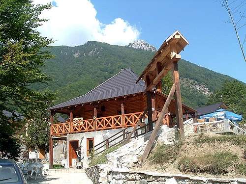
In Grbaja valley you can stay at Branko Kotlajić hut (open only when inhabited by members of Radnićki mountaineering club from Belgrade, I also heard that it may be possible to get the keys at the police station at Gusinje) or Eko-katun, which offers a restaurant, a bathroom with shower and simple accommodation in wooden bungalows (5€ per person in summer 2009). You can also camp next to those places for a small fee or higher up in the valley, possibly also for a small fee paid to local shepherds. Camping anywhere higher in the mountains is free. At the higher part of Grbajski Zastan or Stani Koprishtit it is likely that you will not meet anyone else for several days, or maybe sometimes you will only come across local shepherds. Remember to protect the wilderness of those beautiful and unspoilt mountains and leave the place in a state you would like to find it.
Branko Kotlajić hut
Eko-katun in Grbaja
Weather/when to climb
Weather forecast for Prokletije (for Gusinje in the Montenegrin part). Thanks to vvujisic for the link.
Climbing Maja Lagojvet will always be a serious expedition even in summer. Best time is late June to early September. Earlier the snow cover at the approach may be still thick and later the weather may become unstable and the days get short. But even in summer the apparently good weather can worsen literally in a matter of minutes, suddenly bringing heavy rain and thunderstorms that can last several days in a row. However, from my experience in July and August long periods of hot sunny weather are most likely.
Even with relatively good forecast for the neighbouring areas, there can be a heavy cloud and rain over Prokletije while the sun is shining e.g. at Plav or even at Gusinje.
Evening view from Grbaja: Ocnjak, Karanfili,
Maja Vukoces and Maja Lagojvet
Maja Lagojvet and Maja Shkurt
from the summit of Maja Shnikut
Red tape
Entering Albania via regular border crossings is no problem, although citizens of some countries may need to buy an entry visa (at the border) for about 10 euros. Interestingly, Polish citizens do not need it while citizens of most ex-Yugoslavian countries do.
The situation with crossing the border in the mountains is unclear. As far as I know, officially you need a permit from Montenegrin police to climb the peaks on the border. When it comes to actually crossing the border, I heard contradictory information: a) you can get a permit at Montenegrin police stations at Plav or Gusinje and then register at the watchtower at Vusanje while entering Ropojana valley before going further to Albania; b) you can get a permit via an Albanian embassy in your country; c) it is impossible to get such a permit and it is illegal in all cases to cross the border outside official border crossings.
I have heard of such permits being issued for large groups of mountaineers, although I am not sure of the way it was arranged and whether it was official or semi-official.
We tried to enquire about it in summer 2008. At the police station at Plav they said they do not deal with it and sent us to the border police watchtower at Vusanje. As it was out of our way, we went to the Grnčar/Bashkim crossing and entered Albania legally by car. The Albanian officer was not sure about permits for crossing the border on foot in the mountains.
I would be grateful to fellow SP-ers for any updates and corrections in this matter.
A peek across the border...
...at the Albanian mountains
In 2005, 2008 and 2009 I crossed the border without a permit on foot several times in the mountains. I absolutely do not recommend doing it this way as you may be arrested by Montenegrin or Albanian border police. Do it at your own risk if you wish.
The Balkans Peace Park Project
The aims of the charity organisation Balkans Peace Park Project are to establish a transborder environmental protection park in Prokletije/Bjeshkët e Nemuna (in Montenegro, Albania and Serbia/Kosovo/Kosova), help the sustainable development of local communities and allow free crossing of borders on foot for mountaineers and tourists. In Montenegro Mr Enes Drešković, chairman of Mountaineering Club ‘Hrid’ at Plav, works for this initiative. We called our first ascent route on Maja Lagojvet ‘Balkans Peace Park’ to popularise and support the idea of the Balkans Peace Park Project.
Dragan Pavlović and Enko Drešković
before the winter ascent of Maja Jezerce
in March 2008 (see trip report).
Acknowledgements
I would like to thank Rade, Vlado, Tomek, Adam and Marija for numerous and useful discussions about topography and geographical names, Edlira for her help in explaining the meaning of the mountain's name and Boris for his practical advice about climbing in this area.
Many thanks to my hiking and climbing partners and companions from Prokletije: Ivoš, David, Azra, Gord, Tomica, Tomek, Seba, Dragan, Tomica, Goca, Ljubiša, Enko, the rest of the crew from PD Radnički (Serbia) and PSK Hrid (Montenegro) and all the others from Maja Jezerce winter ascent in March 2008 and from July 2008 in Grbaja for the great time spent together on the trail, on the wall and at the campfire. Dzięki, diky, hvala, faleminderit, cheers folks!
Children refers to the set of objects that logically fall under a given object. For example, the
Aconcagua mountain page is a child of the 'Aconcagua Group' and the 'Seven Summits.' The
Aconcagua mountain itself has many routes, photos, and trip reports as children.
Parents refers to a larger category under which an object falls. For example, theAconcagua mountain page has the 'Aconcagua Group' and the 'Seven Summits' asparents and is a parent itself to many routes, photos, and Trip Reports.